
Photo: Wikipedia
Strategic Assessment of Marshall County
Workable tactical position. Some exposure to population density or targets, but generally defensible in a crisis.
What does the Strategic Assessment tell us?
Our Strategic Assessment grades tactical survivability of an area. Major population centers, military targets, fallout zones, natural disasters, and border exposure all drive risk — lower exposure means a more defensible position in a crisis.
This is heavily inspired by Joel Skousen's Strategic Relocation book. Highly recommended you checkout the book ($)What does this tell us?
Our Strategic Assessment grades tactical survivability of an area. Major population centers, military targets, fallout zones, natural disasters, and border exposure all drive risk — lower exposure means a more defensible position in a crisis.
This is heavily inspired by Joel Skousen's Strategic Relocation book. Highly recommended you checkout the book ($)Strategic Pillars

Key Distances
Strategic Assessment Analysis
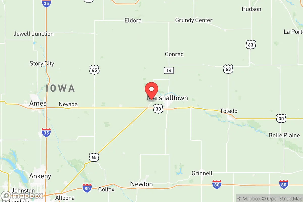
Marshall County, Iowa, sits in a sweet spot for those thinking long-term about resilience: far enough from the nation's pressure points to avoid the worst of cascading failures, yet close enough to critical infrastructure to maintain supply access. The county seat, Marshalltown, anchors a region that has historically weathered agricultural downturns and industrial shifts without collapsing, and its position along the Union Pacific mainline and U.S. Highway 30 gives it a logistical backbone that most rural counties lack. For a relocator weighing civic unrest, supply chain disruptions, or natural disasters, this area offers a defensible base with real advantages—provided you understand its specific exposures.
Geographic position and natural advantages for long-term stability
Marshall County sits in the heart of Iowa's corn and soybean belt, roughly 50 miles northeast of Des Moines and 80 miles southwest of Waterloo. The Iowa River cuts through the county, providing a reliable freshwater source that doesn't depend on distant reservoirs or interbasin transfers. The terrain is gently rolling prairie—no floodplains to speak of in most areas, though the Iowa River bottoms near Marshalltown and the town of Le Grand can see seasonal flooding. The county's elevation averages around 950 feet, which means it's not in any tornado alley bullseye, though severe weather is a fact of life here. What matters for a prepper mindset is the lack of single-point-of-failure risks: no major dams upstream that could fail catastrophically, no coastal storm surge, no earthquake zones. The area's agricultural base means local food production is a given—you're surrounded by row crops and livestock operations, and the county has a strong network of small-scale producers who sell direct to consumers. The town of State Center, for example, hosts a farmers' market that runs through the growing season, and there are dozens of u-pick operations and raw milk sellers within a 20-minute drive. For a relocator, that's not just convenience—it's a hedge against grocery store shelves going empty.
Risks, exposures, and proximity to fallout-relevant landmarks
No place is immune to risk, and Marshall County has its share of exposures that a strategic relocator needs to account for. The most obvious is the Union Pacific rail line that runs through Marshalltown—this is a major transcontinental freight corridor carrying everything from grain to hazardous materials. A derailment or intentional disruption here could cause localized chaos, but the bigger concern is that the line also serves the DuPont Pioneer seed plant in Marshalltown, a critical agricultural supply node. If that facility goes down, it ripples through the entire Midwest food system. The county also sits about 90 miles northeast of the Fort Des Moines military installation (now mostly administrative), but more relevant is the proximity to the Iowa Army Ammunition Plant in Middletown, about 100 miles southeast. That's a strategic target in any conflict scenario, and while Marshall County is far enough to avoid direct blast effects, fallout patterns depend on wind direction. The Duane Arnold Energy Center (the now-decommissioned nuclear plant near Palo) is about 60 miles west—decommissioning means spent fuel remains on-site, which is a long-term contamination risk if the site is compromised. More immediately, the county's largest industrial employer is the Marshalltown Company (a steel foundry), which means heavy industry with its own accident potential. For a conservative-leaning relocator, the key takeaway is that this area is not a zero-risk zone, but the risks are manageable with proper planning—unlike living within 20 miles of a refinery or a major port.
Practical resilience for a relocator: food, water, energy, and defensibility
Water is the first thing to sort out, and Marshall County is in good shape. The Iowa River and its tributaries (including the Timber Creek and Wolf Creek watersheds) provide surface water, and the county's groundwater is accessible through shallow wells in most areas—the Jordan Aquifer underlies the region at depths of 100-300 feet. Marshalltown's municipal water comes from the Iowa River, but for a relocator on acreage, a well is the gold standard. The county's rural areas are sparsely populated enough that a well-drilling permit is straightforward, and the water quality is generally good, though you'll want to test for nitrates from agricultural runoff. Food resilience is where this county really shines. You can buy a 40-acre parcel with good soil for under $400,000 in the eastern part of the county near Liscomb or Albion, and start producing your own vegetables, eggs, and meat within a season. The county has a strong network of 4-H and FFA programs that teach practical skills—if you have kids, they'll learn animal husbandry and gardening as a matter of course. Energy is a mixed bag: the grid is reliable but aging, and winter storms can knock out power for days (the 2020 derecho took down lines across the county). Solar is viable—you get about 4.5 peak sun hours per day—and the county has no restrictive HOA covenants that would block panels or wind turbines. Defensibility is harder to quantify, but the county's layout helps. The population is about 40,000, with Marshalltown holding roughly 27,000 of that. The rural areas are a patchwork of gravel roads and farmsteads, which makes them hard to patrol or control by any outside force. You can see a vehicle coming from a mile away on those straight section-line roads. The downside is that the county is not geographically isolated—there are multiple state highways and the U.S. 30 corridor—so a determined group could move through. But for a family or small group, the ability to lay low and produce your own essentials is strong here.
The overall strategic picture for Marshall County is one of moderate risk with high reward for those who plan ahead. It's not a remote bunker location—you're within a day's drive of Chicago, Minneapolis, and Kansas City, which means you can access urban resources when things are stable, but you're far enough out to avoid the initial chaos when things go sideways. The county's agricultural base, reliable water, and low population density make it a solid choice for a conservative relocator who wants to be prepared without going full hermit. The exposures—rail lines, industrial sites, and the decommissioned nuclear plant—are real but manageable with situational awareness and a good filtration system. If you're looking for a place where you can build a resilient life with your family, raise kids who know how to work, and sleep reasonably well at night knowing you're not in a target zone, Marshall County deserves a serious look. Just don't expect it to stay a secret forever.
* Values derived from national, state, county, city and local statistics and may differ in a specific area. Last updated: 2026-05-12T17:59:37.000Z
Narrative content on this page is AI-generated and may contain mistakes. Verify any details that matter before acting on them.
ReloMaps may earn a commission from affiliate links at no extra cost to you.