Photo: Wikipedia
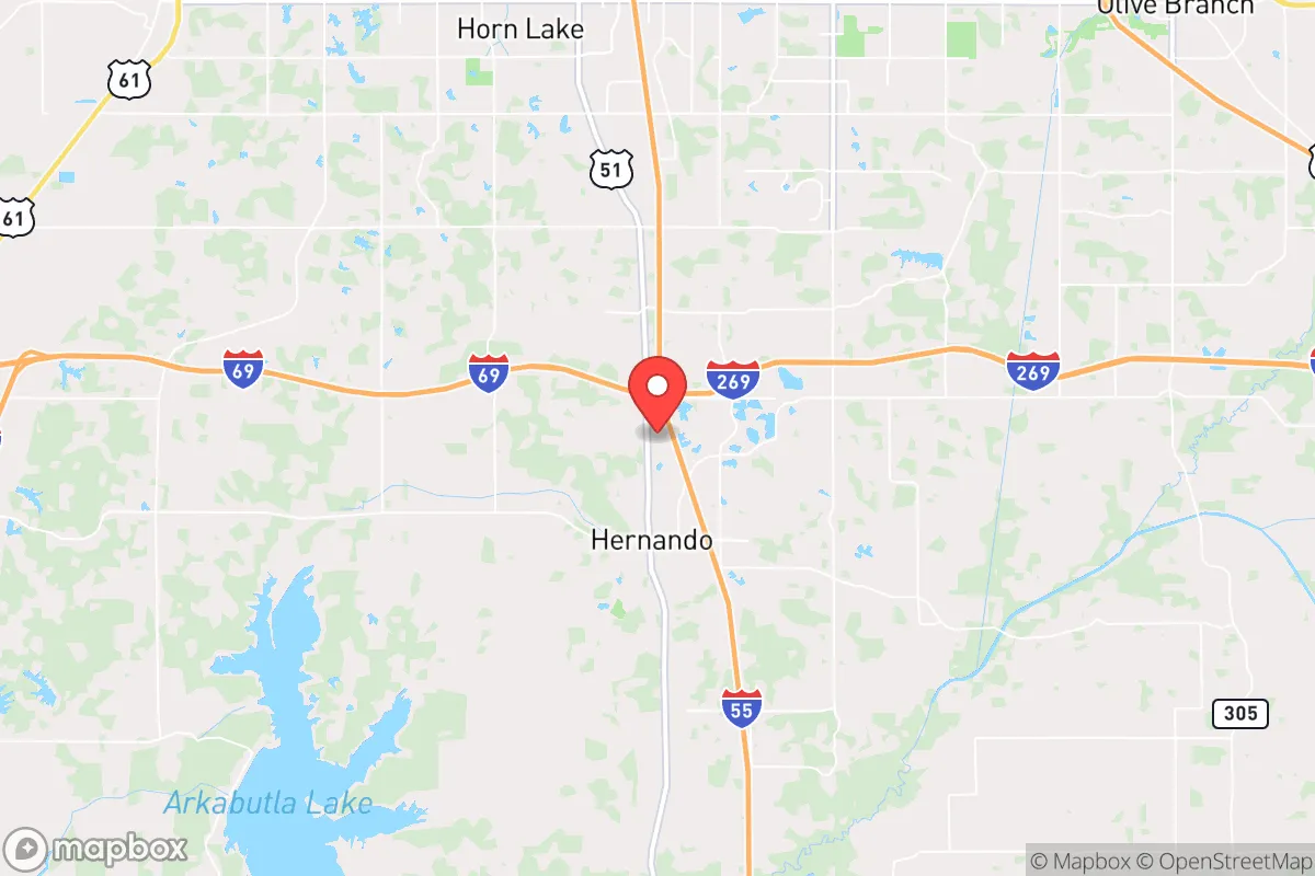
Strategic Assessment of Hernando, MS
Meaningful friction. Expect exposure to either population pressure, blast zones, or natural disaster risk. Consider buying a retreat property.
What does the Strategic Assessment tell us?
Our Strategic Assessment grades tactical survivability of an area. Major population centers, military targets, fallout zones, natural disasters, and border exposure all drive risk — lower exposure means a more defensible position in a crisis.
This is heavily inspired by Joel Skousen's Strategic Relocation book. Highly recommended you checkout the book ($)What does this tell us?
Our Strategic Assessment grades tactical survivability of an area. Major population centers, military targets, fallout zones, natural disasters, and border exposure all drive risk — lower exposure means a more defensible position in a crisis.
This is heavily inspired by Joel Skousen's Strategic Relocation book. Highly recommended you checkout the book ($)Strategic Pillars

Key Distances
Regional Safe Places
Below is our recommended "safe zones" in Mississippi and the surrounding area based on our strategic heuristics. For most people, it's unrealistic to live in a “safe zone” full-time due to work, family or other personal reasons. They tend to be more rural. However, many of these areas are perfect for second homes and retreat properties that double as a vacation home or even a short-term rental.
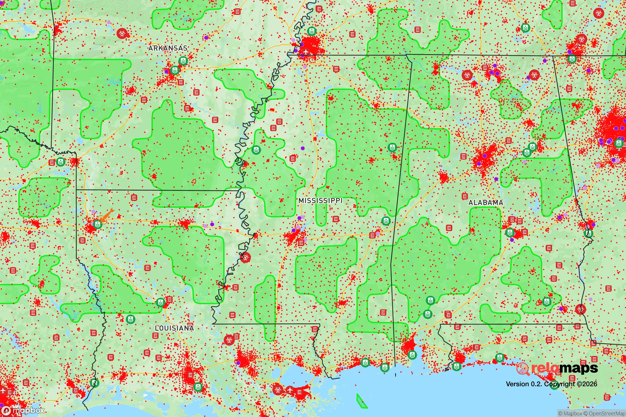
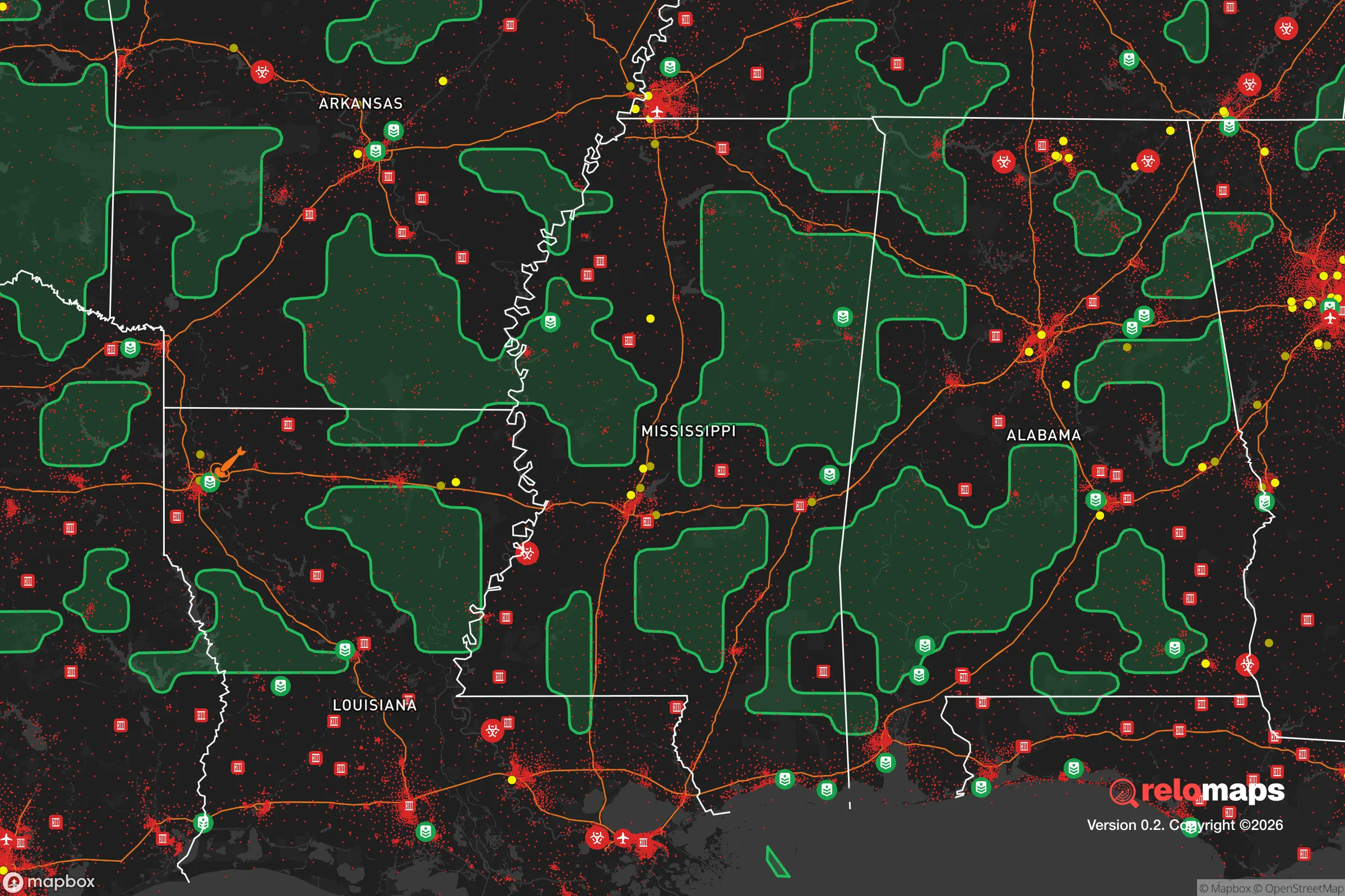
Important Note: For informational purposes only. This does not mean nothing bad ever happens in the green zones. Please use common sense. This is based on public data and modeled with AI. We tried to take a conservative approach but mistakes happen. We update this regularly as new information becomes available.
Solar Generator Recommendations
Backup power matters more here than in safer locations. We've picked three solar generators across budgets and capacity tiers — start with the budget unit if you only need a few essentials, or step up if you want to run a fridge and HVAC for days at a time.

Jackery Portable Power Station Explorer 300
Budget OptionPower on the Go: Weighing only 11 lbs, it's convenient to set up and store with book-sized foldable solar panels

BLUETTI Portable Power Station AC180
Designed for both indoor and outdoor scenarios, AC180 is highly capable as it has a robost capacity and continuous output power.

EF ECOFLOW DELTA Pro Ultra Power Station
Upgraded PickEcoFlow DELTA Pro Ultra is a whole-home energy system designed to grow with your family. Integrated with the Smart Home Panel 2, it scales to meet your evolving energy needs — keeping your home powered, intelligent, and secure through every stage of life.
We earn a commission, at no additional cost to you.
Strategic Assessment Analysis
Hernando, Mississippi, sits in a strategic sweet spot that few relocators fully appreciate: close enough to Memphis for supply runs and medical access, but far enough to avoid being caught in the blast radius of a major urban collapse. The town’s position in DeSoto County, just south of the Tennessee line, offers a buffer from the worst of a Memphis meltdown while still allowing you to monitor events from a distance. For a conservative prepper looking at long-term resilience, Hernando checks several boxes that most suburban sprawl simply cannot.
Geographic position and natural advantages for long-term security
Hernando’s location is its primary asset. The town sits on the Loess Bluffs, a ridge of wind-deposited soil that rises above the Mississippi Delta floodplain. That elevation—modest as it is—provides natural drainage and a defensible perch compared to the flat, flood-prone ground just west. The area is laced with creeks and small rivers feeding into the Coldwater River system, offering multiple water sources for off-grid scenarios. The surrounding DeSoto National Forest (actually a state-managed area) and the Holly Springs National Forest to the east give you public land for foraging, hunting, and bug-out routes. Hernando’s position on the I-69 corridor also means you can move north-south without funneling through Memphis proper, a critical detail if the interstate becomes a chokepoint during an evacuation. The local soil is fertile enough for small-scale agriculture, and the growing season runs from April to October—long enough to put up a serious garden.
Risks, exposures, and proximity to fallout-relevant landmarks
No location is immune, and Hernando has real vulnerabilities. The most obvious is Memphis, 20 miles north. Memphis is a major transportation hub with a FedEx superhub, a large inland port on the Mississippi River, and a population density that could turn chaotic fast. A civic unrest event in Memphis—whether from economic collapse, racial tensions, or supply chain disruption—would send refugees south along I-55 and Highway 51. Hernando sits directly in that path. The city also has a modest industrial base: a few chemical plants and a rail yard that could become secondary targets or accident sites. The nearby Tunica casinos, 15 miles west, are a potential flashpoint for looting and violence if the economy tanks. On the natural disaster side, Hernando is in Tornado Alley’s southern extension. The 2023 Rolling Fork tornado, while 100 miles south, showed that violent EF-4s can hit this region without warning. Flooding is less of a concern on the bluffs, but the Coldwater River can swell after heavy rain, cutting off low-lying roads. The biggest risk is proximity to a major urban center that could become a liability in a grid-down scenario.
Practical resilience for a relocator: food, water, energy, and defensibility
For a prepper moving to Hernando, the practicalities are mixed but workable. Water is the first concern. The city draws from the Memphis Sand Aquifer, a massive, high-quality groundwater source that runs under the entire region. A well is a smart investment—depths of 100-200 feet are common, and the water is clean enough that most homes don’t need a filtration system beyond basic sediment removal. If you’re on city water, a hand pump or a backup generator for the well pump is non-negotiable. Food security is better than average. DeSoto County has a strong agricultural base—soybeans, corn, and cotton are the cash crops, but local farmers’ markets and CSAs are plentiful. You can buy bulk grains, livestock feed, and seeds from local co-ops. Hunting is viable: deer, turkey, and small game are abundant in the national forests and private woodlands. Energy is a weak point. The grid here is served by Entergy Mississippi, which has a mixed reliability record. Summer storms and ice storms can knock out power for days. Solar is feasible—the area gets about 215 sunny days per year—but you’ll need battery storage to handle the cloudy stretches. Natural gas is available in town, but rural properties often rely on propane. Defensibility is where Hernando shines. The town is laid out on a grid with multiple egress routes: Highway 51, I-55, and several county roads that snake through farmland. The bluffs provide natural observation points. A rural property with a long driveway and a clear field of fire is achievable within 10 minutes of downtown. The local sheriff’s office is well-funded and conservative-leaning, and the DeSoto County Emergency Management Agency runs regular drills. That said, the town’s growth—population up 15% since 2020—means more neighbors and less privacy. If you want true isolation, you’ll need to push east into Tate County or south into Panola.
The overall strategic picture for Hernando is one of calculated risk. It’s not a remote bunker—it’s a working-class Southern town with good bones and a decent buffer from the worst of Memphis’s potential collapse. The water supply is excellent, the soil is productive, and the community is still small enough that you can build relationships with like-minded neighbors. The downsides are real: proximity to a major city that could become a source of trouble, tornado risk, and a growing population that will eventually erode the rural character. For a conservative relocator who wants to be prepared without going full off-grid, Hernando offers a middle path. You can live a normal life, send your kids to decent schools, and still have a solid plan for when things go sideways. Just don’t expect to be invisible—and make sure your bug-out bag has a route that avoids the Memphis suburbs entirely.
* Values derived from national, state, county, city and local statistics and may differ in a specific area. Last updated: 2026-04-30T15:31:29.000Z
Narrative content on this page is AI-generated and may contain mistakes. Verify any details that matter before acting on them.
ReloMaps may earn a commission from affiliate links at no extra cost to you.