
Photo: Wikipedia
Strategic Assessment of Harvey, ND
Strong survivability profile. Good buffer from population centers, with manageable environmental and tactical risks.
What does the Strategic Assessment tell us?
Our Strategic Assessment grades tactical survivability of an area. Major population centers, military targets, fallout zones, natural disasters, and border exposure all drive risk — lower exposure means a more defensible position in a crisis.
This is heavily inspired by Joel Skousen's Strategic Relocation book. Highly recommended you checkout the book ($)What does this tell us?
Our Strategic Assessment grades tactical survivability of an area. Major population centers, military targets, fallout zones, natural disasters, and border exposure all drive risk — lower exposure means a more defensible position in a crisis.
This is heavily inspired by Joel Skousen's Strategic Relocation book. Highly recommended you checkout the book ($)Strategic Pillars

Key Distances
Regional Safe Places
Below is our recommended "safe zones" in North Dakota and the surrounding area based on our strategic heuristics. For most people, it's unrealistic to live in a “safe zone” full-time due to work, family or other personal reasons. They tend to be more rural. However, many of these areas are perfect for second homes and retreat properties that double as a vacation home or even a short-term rental.
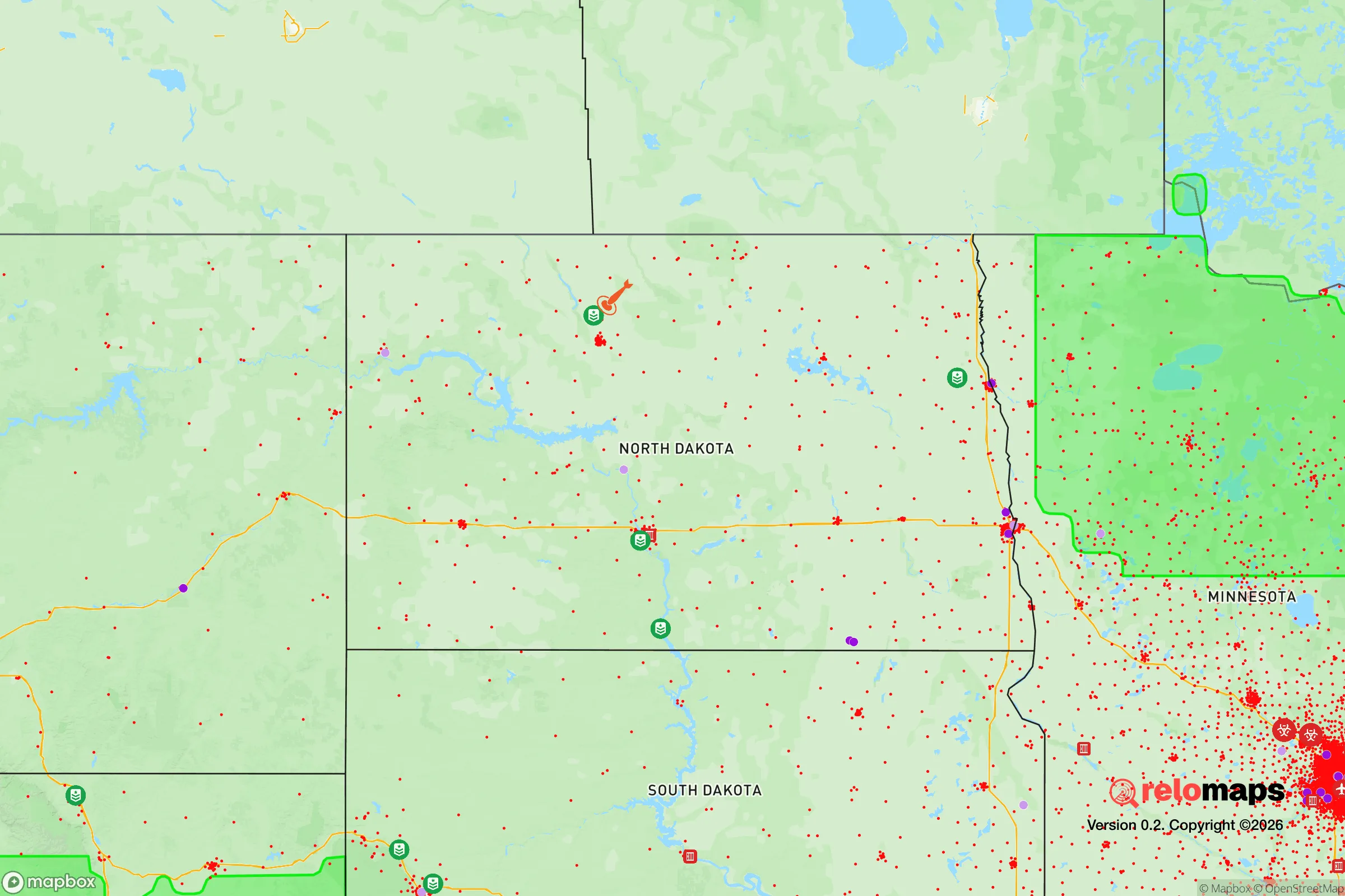
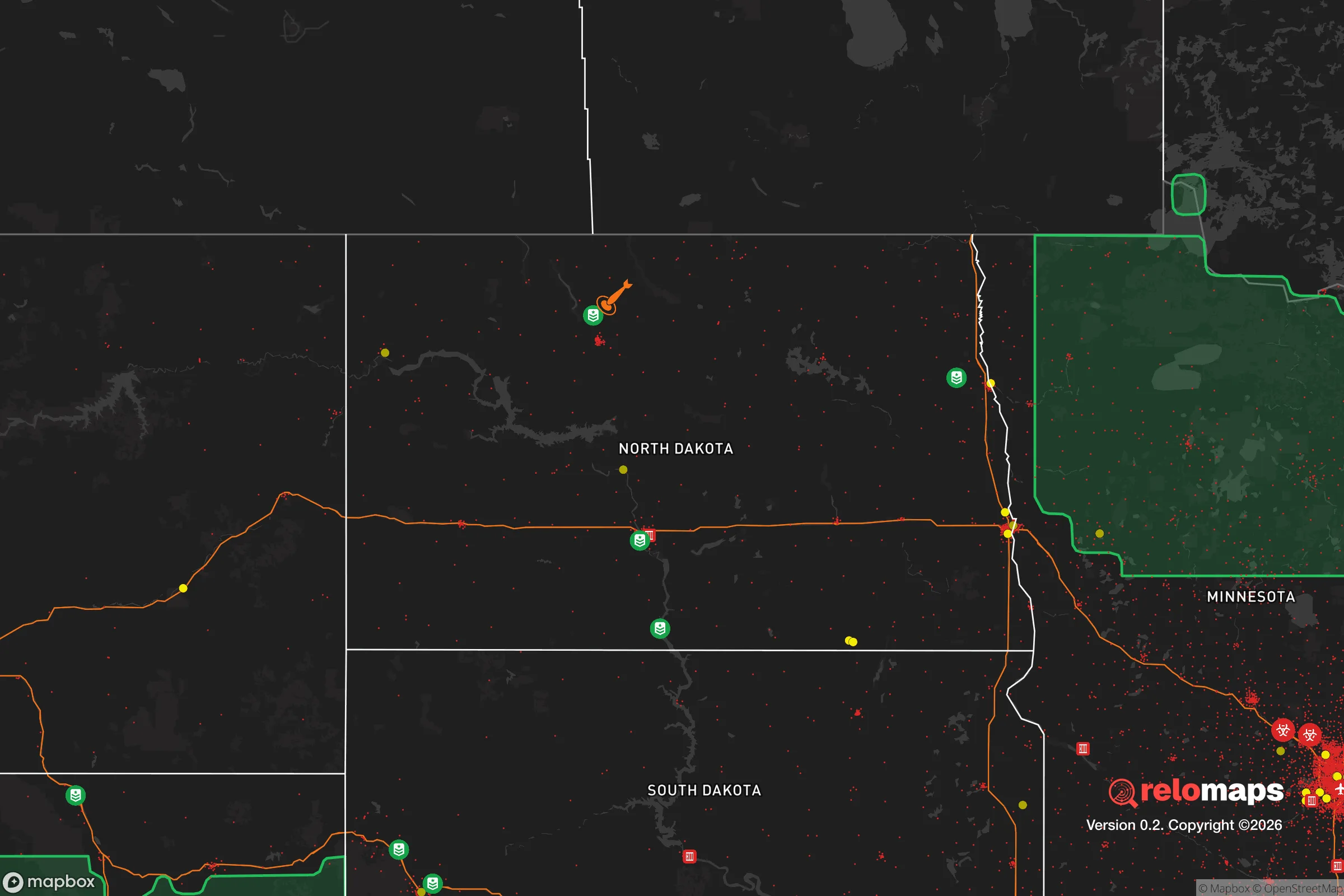
Important Note: For informational purposes only. This does not mean nothing bad ever happens in the green zones. Please use common sense. This is based on public data and modeled with AI. We tried to take a conservative approach but mistakes happen. We update this regularly as new information becomes available.
Solar Generator Recommendations
Backup power matters more here than in safer locations. We've picked three solar generators across budgets and capacity tiers — start with the budget unit if you only need a few essentials, or step up if you want to run a fridge and HVAC for days at a time.

Jackery Portable Power Station Explorer 300
Budget OptionPower on the Go: Weighing only 11 lbs, it's convenient to set up and store with book-sized foldable solar panels

BLUETTI Portable Power Station AC180
Designed for both indoor and outdoor scenarios, AC180 is highly capable as it has a robost capacity and continuous output power.

EF ECOFLOW DELTA Pro Ultra Power Station
Upgraded PickEcoFlow DELTA Pro Ultra is a whole-home energy system designed to grow with your family. Integrated with the Smart Home Panel 2, it scales to meet your evolving energy needs — keeping your home powered, intelligent, and secure through every stage of life.
We earn a commission, at no additional cost to you.
Strategic Assessment Analysis
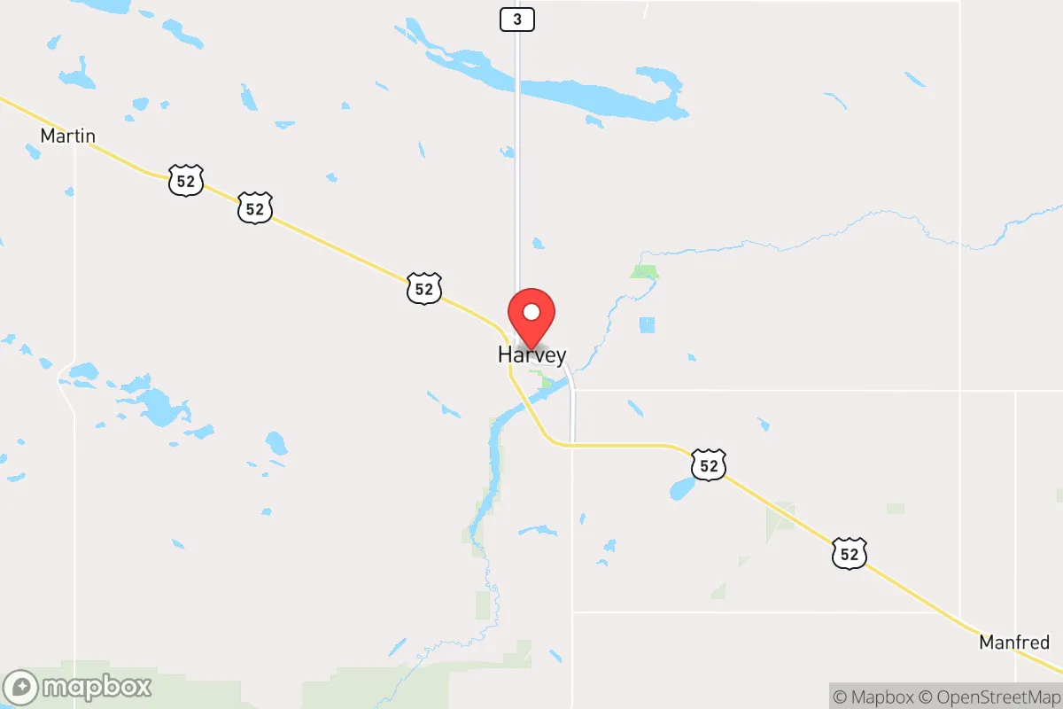
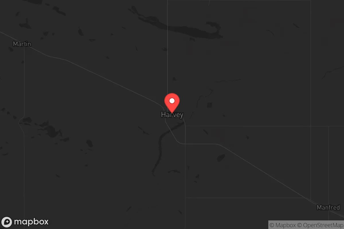
Harvey, North Dakota, sits as a low-profile but strategically sound option for those prioritizing resilience and distance from the chaos of major urban centers. Located in Wells County, roughly 90 miles north of Bismarck and 120 miles northwest of Fargo, this town of roughly 1,700 people offers a combination of geographic isolation, agricultural self-sufficiency, and a community that still values self-reliance. For a relocator with a prepper or survivalist mindset, Harvey provides a baseline of security that many other rural towns lack, particularly in its access to the Missouri River watershed and its position away from major interstate corridors that could become chokepoints during unrest.
Geographic position and natural advantages for long-term security
Harvey’s location is its primary asset. It sits on the eastern edge of the Missouri Plateau, a region of rolling plains and buttes that offers natural defensibility and limited approach vectors. The town is not on any major interstate—the closest is I-94, about 50 miles south—which means it’s off the beaten path for any large-scale evacuation or military movement. This isolation is a double-edged sword: it reduces the risk of being overrun by fleeing urban populations, but it also means that resupply routes are limited. The area’s flat-to-rolling terrain provides good visibility for miles, which is a tactical advantage for anyone concerned with perimeter awareness. The nearby James River, while not a major waterway, feeds into the Missouri River system, and the region’s aquifer is relatively shallow, making well water a viable option for those who secure property with a drilled well. The climate is harsh—winters can drop to -30°F with wind chills far lower—but that same climate acts as a natural barrier to transient populations and reduces the viability of long-term camping by unprepared individuals.
Risks, exposures, and proximity to fallout-relevant landmarks
The primary risk in Harvey is its proximity to the Minot Air Force Base, roughly 80 miles to the northwest. Minot AFB is a major strategic asset, housing the 5th Bomb Wing and the 91st Missile Wing, which operates Minuteman III ICBMs. In a full-scale conflict or a major geopolitical escalation, this base is a high-priority target. While Harvey is far enough away to avoid the immediate blast radius of a direct strike on the base—assuming a single warhead—the fallout plume from a ground burst could drift southeast depending on wind patterns. The prevailing winds in North Dakota are from the northwest, which means Harvey is downwind of Minot for a significant portion of the year. This is a non-trivial concern for anyone serious about fallout preparedness. Additionally, the town is within 150 miles of the Bakken oil fields, which are dotted with pipelines, storage tanks, and rail terminals. A major industrial accident or a coordinated attack on energy infrastructure could create localized hazards, though the sparse population reduces the likelihood of cascading failures. On the positive side, Harvey is far from any major nuclear power plants—the closest is the Monticello plant in Minnesota, over 300 miles away—and it is not near any major chemical or biological research facilities. The risk of being caught in a mass casualty event from a terrorist attack or civil unrest is extremely low, simply because there are no high-value symbolic targets within the area.
Practical resilience for a relocator: food, water, energy, and defensibility
For a relocator looking to establish a sustainable homestead, Harvey offers strong fundamentals. The surrounding farmland is primarily wheat, corn, soybeans, and sunflowers, with a significant number of cattle operations. This means that local food production is robust, and barter networks for grain, meat, and dairy are already in place. The town itself has a small grocery store, a hardware store, and a farm supply co-op, but any serious prepper should plan to stockpile non-perishables and ammunition well in advance, as supply chains here are thin and could be disrupted quickly. Water is the critical resource: the municipal water supply comes from the James River and groundwater wells, but anyone buying property should prioritize a site with a private well and a backup hand pump. The area’s water table is generally good, but drought conditions have become more common in the northern Plains, so rainwater catchment and storage should be part of any long-term plan. Energy is a mixed bag. The grid is relatively stable, but winter storms can knock out power for days. Natural gas is available in town, but rural properties rely on propane or heating oil. Solar is viable—the region gets about 200 sunny days per year—but winter production is low, so a backup generator with a fuel cache is essential. Defensibility is where Harvey shines. The town is compact, with a grid layout that makes it easy to establish checkpoints on the main roads. The surrounding countryside offers numerous farmsteads with good fields of fire and limited access points. The local sheriff’s office is small but responsive, and the community is tight-knit enough that outsiders are noticed quickly. For a single individual or a family, the ability to blend into a community that values privacy and self-sufficiency is a major advantage over more populated areas where neighbors might be nosy or hostile.
The overall strategic picture for Harvey is one of moderate risk with high reward for those willing to accept the trade-offs. The town is not a fortress, and it is not immune to the geopolitical realities of the 21st century—the Minot AFB proximity is a genuine concern that requires a fallout shelter and a radiation monitoring plan. But for a relocator who wants to be far from the riots, the supply chain collapses, and the mass casualty events that are becoming more common in major cities, Harvey offers a solid foundation. The climate is brutal, the amenities are minimal, and the nearest hospital is 30 miles away in Carrington, but that same isolation is what makes it viable. If you are serious about being prepared for civic unrest, a major disaster, or a societal breakdown, Harvey is worth a hard look—just make sure you bring a good winter coat and a Geiger counter.
* Values derived from national, state, county, city and local statistics and may differ in a specific area. Last updated: 2026-04-19T08:01:05.000Z
Narrative content on this page is AI-generated and may contain mistakes. Verify any details that matter before acting on them.
ReloMaps may earn a commission from affiliate links at no extra cost to you.