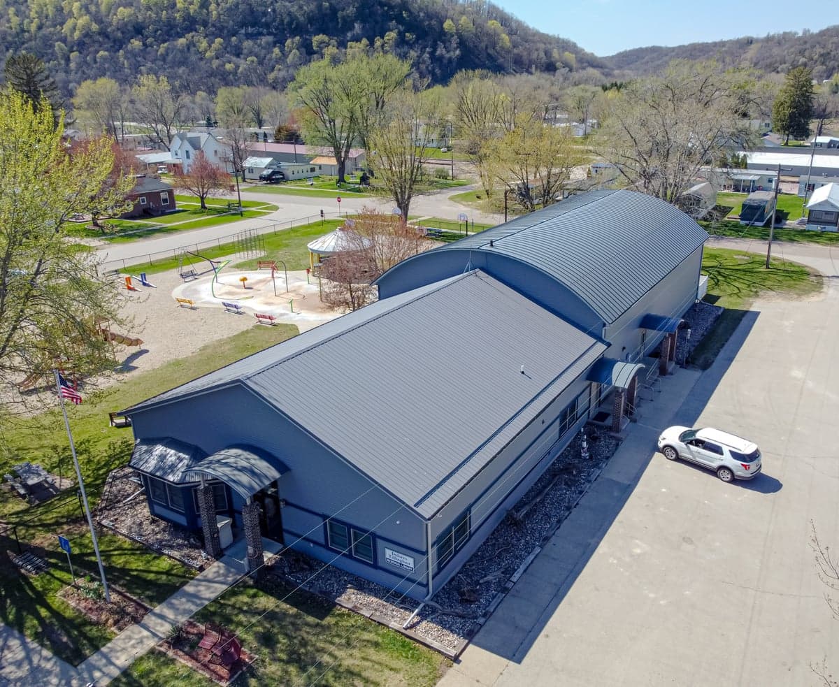
Photo: Wikipedia
Strategic Assessment of Harpers Ferry, IA
Workable tactical position. Some exposure to population density or targets, but generally defensible in a crisis.
What does the Strategic Assessment tell us?
Our Strategic Assessment grades tactical survivability of an area. Major population centers, military targets, fallout zones, natural disasters, and border exposure all drive risk — lower exposure means a more defensible position in a crisis.
This is heavily inspired by Joel Skousen's Strategic Relocation book. Highly recommended you checkout the book ($)What does this tell us?
Our Strategic Assessment grades tactical survivability of an area. Major population centers, military targets, fallout zones, natural disasters, and border exposure all drive risk — lower exposure means a more defensible position in a crisis.
This is heavily inspired by Joel Skousen's Strategic Relocation book. Highly recommended you checkout the book ($)Strategic Pillars

Key Distances
Regional Safe Places
Below is our recommended "safe zones" in Iowa and the surrounding area based on our strategic heuristics. For most people, it's unrealistic to live in a “safe zone” full-time due to work, family or other personal reasons. They tend to be more rural. However, many of these areas are perfect for second homes and retreat properties that double as a vacation home or even a short-term rental.
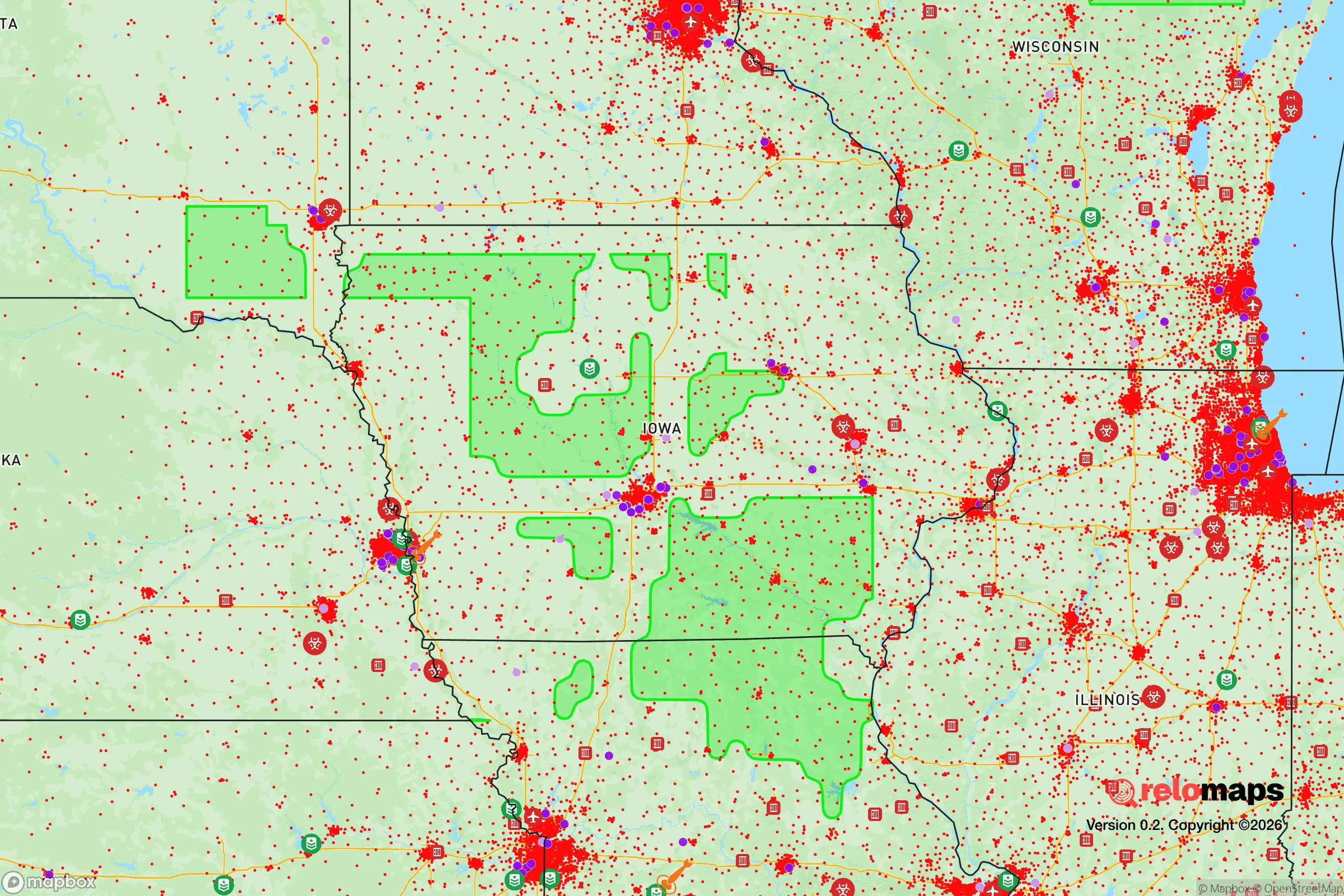
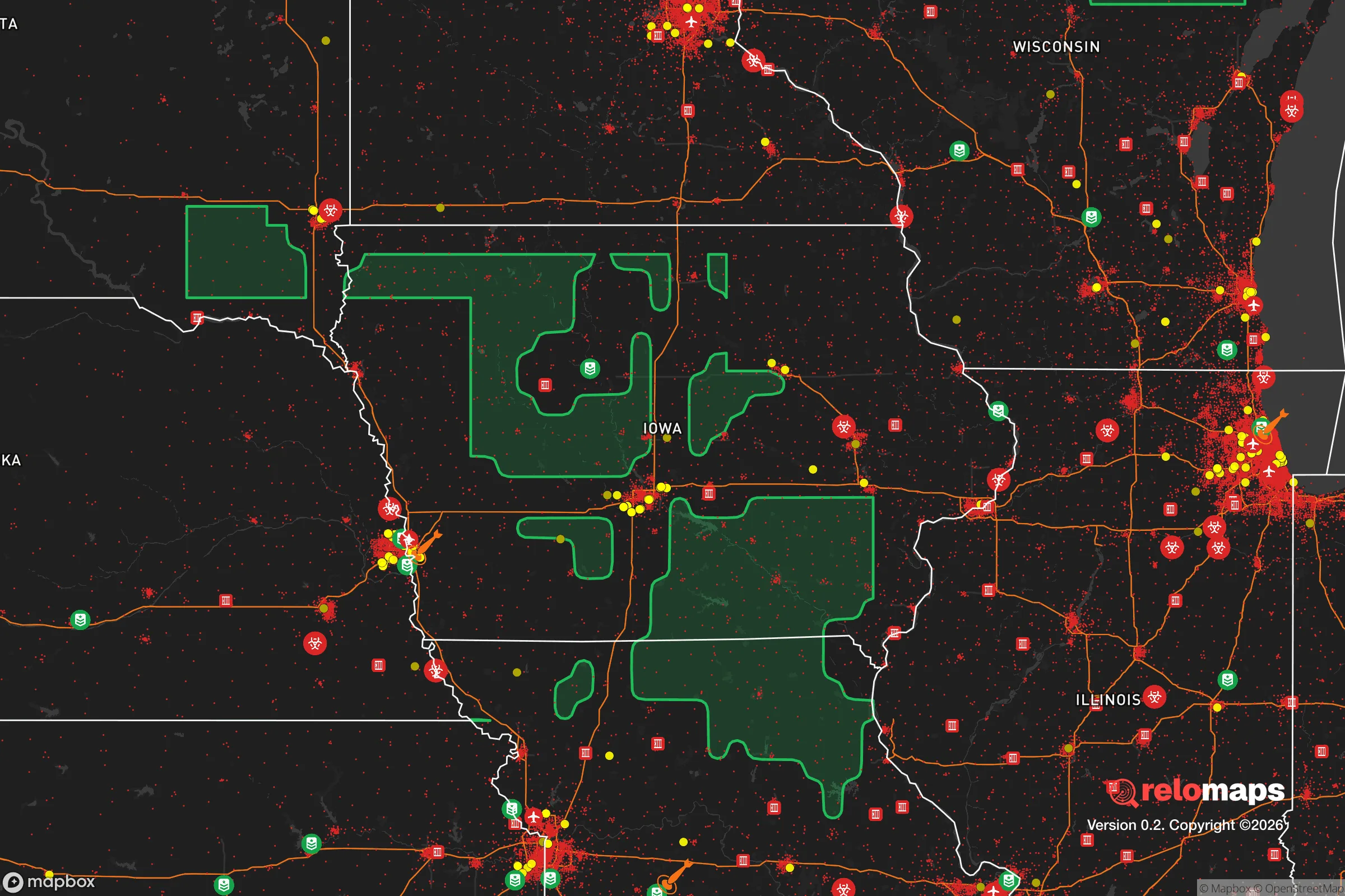


Important Note: For informational purposes only. This does not mean nothing bad ever happens in the green zones. Please use common sense. This is based on public data and modeled with AI. We tried to take a conservative approach but mistakes happen. We update this regularly as new information becomes available.
Solar Generator Recommendations
Backup power matters more here than in safer locations. We've picked three solar generators across budgets and capacity tiers — start with the budget unit if you only need a few essentials, or step up if you want to run a fridge and HVAC for days at a time.

Jackery Portable Power Station Explorer 300
Budget OptionPower on the Go: Weighing only 11 lbs, it's convenient to set up and store with book-sized foldable solar panels

BLUETTI Portable Power Station AC180
Designed for both indoor and outdoor scenarios, AC180 is highly capable as it has a robost capacity and continuous output power.

EF ECOFLOW DELTA Pro Ultra Power Station
Upgraded PickEcoFlow DELTA Pro Ultra is a whole-home energy system designed to grow with your family. Integrated with the Smart Home Panel 2, it scales to meet your evolving energy needs — keeping your home powered, intelligent, and secure through every stage of life.
We earn a commission, at no additional cost to you.
Strategic Assessment Analysis
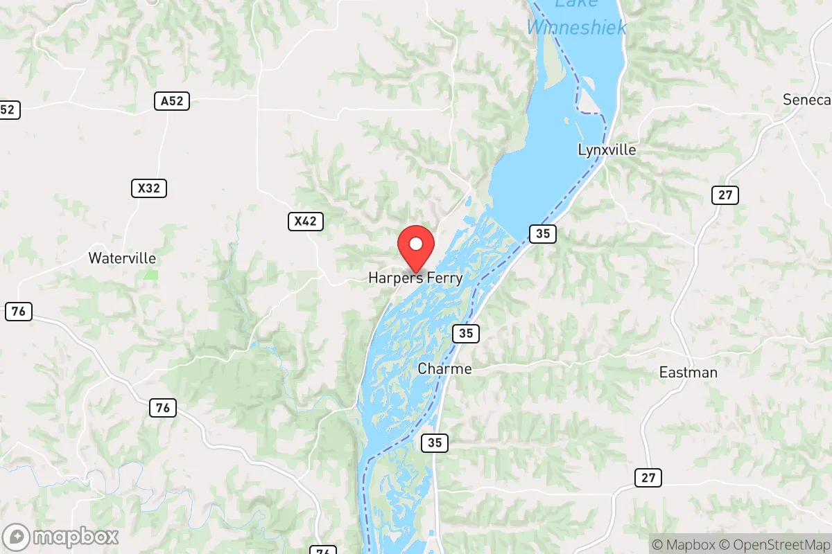
Harpers Ferry, Iowa, offers a compelling strategic profile for those prioritizing resilience and self-sufficiency, largely due to its position along the Upper Mississippi River and its distance from major metropolitan targets. This small Allamakee County community sits roughly 80 miles north of Dubuque and 100 miles southwest of La Crosse, Wisconsin, placing it well outside the likely blast and immediate fallout zones of any major city. The area’s low population density, combined with the natural barrier of the Mississippi River bluffs and the surrounding Driftless Area terrain, provides a foundation for a serious relocation assessment focused on disaster readiness and long-term sustainability.
Geographic position and natural advantages for long-term stability
The Driftless Region, which includes Harpers Ferry, escaped the flattening effects of the last glacial period, resulting in a landscape of steep hills, deep valleys, and limestone bluffs that offer natural defensibility and water security. The Mississippi River forms the eastern boundary of the area, providing a reliable surface water source, while the surrounding topography limits easy overland access from multiple directions. This terrain makes the area less vulnerable to large-scale population movement during a crisis, as the road network is constrained by the river and bluffs. The presence of the Upper Mississippi River National Wildlife and Fish Refuge immediately to the south adds a buffer of undeveloped land, reducing the likelihood of dense suburban encroachment. For a relocator, the key advantage is that Harpers Ferry sits in a region with abundant freshwater, fertile valley soils, and a climate that supports three-season agriculture, all within a day’s drive of major medical and supply hubs like Rochester, Minnesota, and Madison, Wisconsin, without being close enough to suffer direct effects from those cities’ collapse.
Risk exposure, fallout proximity, and man-made threats to consider
While Harpers Ferry avoids the primary risks of a major metropolitan target, it is not without exposure. The most significant man-made threat comes from the Prairie Island Nuclear Generating Plant, located approximately 60 miles northwest near Red Wing, Minnesota. In the event of a catastrophic release, prevailing winds from the northwest could carry fallout into the Harpers Ferry area. However, the distance and the presence of the Mississippi River valley as a potential dispersion corridor mean that the risk is moderate rather than acute. Additionally, the Lock and Dam No. 9 on the Mississippi River, just south of Harpers Ferry, is a critical infrastructure point that could become a target or a chokepoint during a conflict. The dam’s destruction would disrupt river traffic and potentially cause localized flooding, but the surrounding bluffs limit the floodplain’s reach into the town itself. Natural risks include severe thunderstorms, tornadoes (Iowa averages about 50 tornadoes per year, though Allamakee County is on the lower end of that frequency), and winter storms that can isolate the area for days. The Mississippi River flood risk is real but manageable; the town sits on higher ground above the main floodplain, though low-lying roads and farmland can be inundated during major flood events like those in 2019 and 2023.
Practical resilience for a relocator: food, water, energy, and defensibility
For someone serious about self-sufficiency, Harpers Ferry offers a strong baseline. The area’s groundwater is plentiful and generally high-quality, with the Jordan Aquifer underlying the region. Private wells are common, and the local municipal water supply draws from the Mississippi River, which is treated but could be supplemented with off-grid filtration systems. The surrounding farmland produces corn, soybeans, and hay, and the Driftless Area’s steep slopes support pasture-based livestock operations. Small-scale hunting and fishing are viable, with deer, turkey, and walleye available in the river and tributaries. Energy resilience is a mixed picture: the grid is served by Alliant Energy, and outages during storms are not uncommon, but the low population density means that restoration times can be longer than in urban areas. Solar potential is moderate, with about 200 sunny days per year, and the hilly terrain can complicate panel placement, but off-grid solar is feasible with proper siting. Wood heating is a practical option given the forested bluffs, and many existing homes already have wood stoves or fireplaces. Defensibility is a standout feature: the town’s layout along the river, with bluffs to the west and north, creates natural chokepoints on the few roads leading in and out. The population of roughly 350 people means a tight-knit community where mutual aid is realistic, but also that outside help during a crisis may be slow to arrive. The nearest hospital is in Waukon, 15 miles west, and the closest trauma center is in La Crosse, about 45 minutes north. For a relocator, the practical takeaway is that Harpers Ferry provides a defensible, water-rich location with moderate agricultural potential, but requires upfront investment in off-grid energy and food storage to achieve true resilience.
The overall strategic picture for Harpers Ferry is one of a quiet, low-profile location that balances natural advantages with manageable risks. It is not a bunker or a prepper compound, but a functioning small town with a working landscape and a community that largely keeps to itself. The distance from major cities is a double-edged sword: it reduces exposure to fallout and civil unrest, but also limits access to specialized medical care and supply chains during normal times. For a relocator who values water security, natural defensibility, and a moderate climate for subsistence agriculture, Harpers Ferry ranks well among Upper Midwest options. The key is to treat it as a base for building resilience rather than a turnkey solution—invest in well water testing, solar or wind backup, and a reliable vehicle capable of navigating winter roads. The area’s greatest strength is its obscurity; it is not on any major strategic target list, and its geography makes it a hard place to overrun quickly. That alone, in a world of increasing uncertainty, is a significant asset.

* Values derived from national, state, county, city and local statistics and may differ in a specific area. Last updated: 2026-10-17T20:11:48.000Z
Narrative content on this page is AI-generated and may contain mistakes. Verify any details that matter before acting on them.
ReloMaps may earn a commission from affiliate links at no extra cost to you.

