Photo: Wikipedia
Strategic Assessment of Eureka, MT
Workable tactical position. Some exposure to population density or targets, but generally defensible in a crisis.
What does the Strategic Assessment tell us?
Our Strategic Assessment grades tactical survivability of an area. Major population centers, military targets, fallout zones, natural disasters, and border exposure all drive risk — lower exposure means a more defensible position in a crisis.
This is heavily inspired by Joel Skousen's Strategic Relocation book. Highly recommended you checkout the book ($)What does this tell us?
Our Strategic Assessment grades tactical survivability of an area. Major population centers, military targets, fallout zones, natural disasters, and border exposure all drive risk — lower exposure means a more defensible position in a crisis.
This is heavily inspired by Joel Skousen's Strategic Relocation book. Highly recommended you checkout the book ($)Strategic Pillars

Key Distances
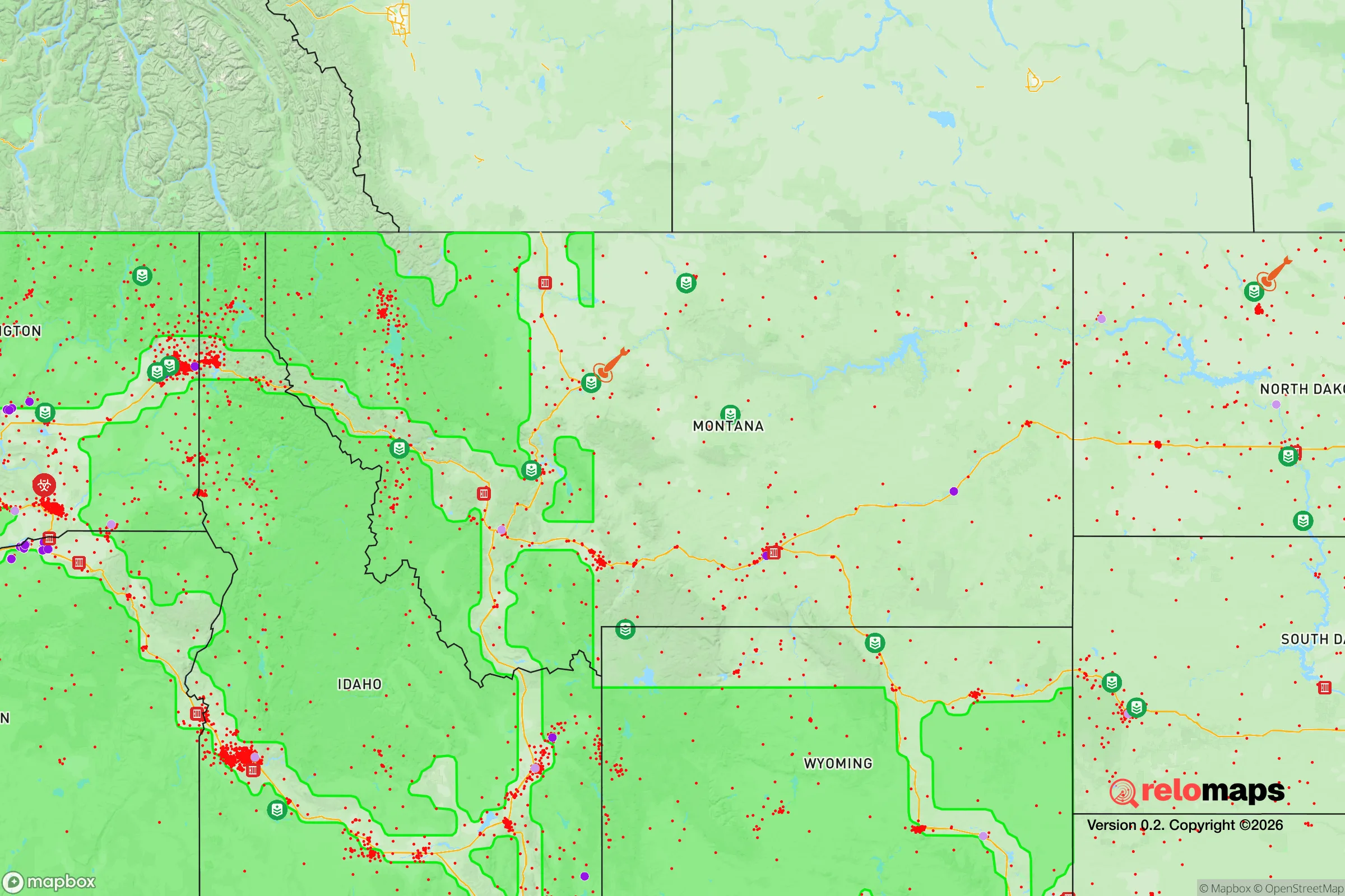
Regional Safe Places
Below is our recommended "safe zones" in Montana and the surrounding area based on our strategic heuristics. For most people, it's unrealistic to live in a “safe zone” full-time due to work, family or other personal reasons. They tend to be more rural. However, many of these areas are perfect for second homes and retreat properties that double as a vacation home or even a short-term rental.

Important Note: For informational purposes only. This does not mean nothing bad ever happens in the green zones. Please use common sense. This is based on public data and modeled with AI. We tried to take a conservative approach but mistakes happen. We update this regularly as new information becomes available.
Solar Generator Recommendations
Backup power matters more here than in safer locations. We've picked three solar generators across budgets and capacity tiers — start with the budget unit if you only need a few essentials, or step up if you want to run a fridge and HVAC for days at a time.

Jackery Portable Power Station Explorer 300
Budget OptionPower on the Go: Weighing only 11 lbs, it's convenient to set up and store with book-sized foldable solar panels

BLUETTI Portable Power Station AC180
Designed for both indoor and outdoor scenarios, AC180 is highly capable as it has a robost capacity and continuous output power.

EF ECOFLOW DELTA Pro Ultra Power Station
Upgraded PickEcoFlow DELTA Pro Ultra is a whole-home energy system designed to grow with your family. Integrated with the Smart Home Panel 2, it scales to meet your evolving energy needs — keeping your home powered, intelligent, and secure through every stage of life.
We earn a commission, at no additional cost to you.
Strategic Assessment Analysis
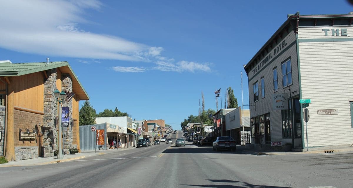
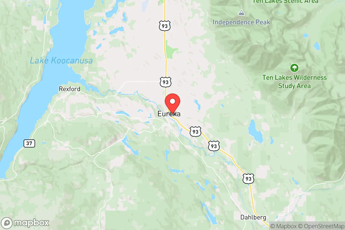
Eureka, Montana, sits in the far northwest corner of the state, just a stone's throw from the Canadian border and the Idaho panhandle, and its strategic value for a relocator with a prepper mindset is rooted in its genuine isolation. This isn't a suburb pretending to be rural; it's a genuine frontier town of roughly 1,200 people, surrounded by the Kootenai National Forest and the Cabinet Mountains. The area's resilience comes from its low population density, limited through-traffic, and distance from major population centers—Spokane is about 100 miles southwest, and Kalispell is roughly 90 miles southeast. For someone looking to put serious geographic distance between themselves and the chaos of a collapsing urban center, Eureka offers a buffer that few other towns in the Lower 48 can match. The local economy is built on timber, tourism, and a smattering of small-scale agriculture, which means the community already understands hard work and self-reliance, not the fragile service-economy dependencies of coastal cities.
Geographic position and natural advantages for long-term security
Eureka's location is its primary asset. It sits in the Tobacco Valley, a narrow, fertile strip flanked by the Purcell and Cabinet mountain ranges, which provides natural defensibility and a degree of isolation. The town is a dead-end for most traffic—Highway 93 runs north to the border crossing at Roosville (about 20 miles away) and south to Libby, but there are no major interstate highways or rail lines nearby. This means that in a crisis, Eureka is unlikely to be a destination for fleeing urban populations, as there are no major resources or infrastructure to draw them. The surrounding Kootenai National Forest offers vast tracts of public land for hunting, foraging, and timber, while the Tobacco River and Lake Koocanusa provide reliable freshwater sources. The area's elevation (around 2,500 feet) and northern latitude mean a cooler climate, which reduces the risk of heat-related crop failures and limits the spread of many vector-borne diseases. For a relocator, this is a place where you can realistically establish a semi-self-sufficient homestead with access to clean water, firewood, and game, all while being far enough from any major target to avoid the initial shockwaves of a national emergency.
Risks, exposures, and proximity to fallout-relevant landmarks
No place is a perfect fortress, and Eureka has its vulnerabilities. The most obvious risk is its proximity to the Canadian border—while this offers a potential escape route or trade corridor, it also means that any cross-border instability (civil unrest in Canada, mass migration events, or even a military conflict involving our northern neighbor) would directly impact the area. The border crossing at Roosville is lightly staffed, but in a crisis, it could become a chokepoint for refugees or a target for those seeking to flee north. Additionally, Eureka is about 100 miles from the Columbia River basin and the Hanford Site in Washington—a major nuclear waste storage facility. While that distance provides a significant buffer, prevailing winds from the west could carry fallout in a worst-case scenario. The town is also within 150 miles of the Flathead Indian Reservation and the city of Kalispell, which, while not major targets, could become staging areas for displaced populations. The local infrastructure is thin: one grocery store, one hardware store, and a small medical clinic. A major disaster would quickly overwhelm these resources, meaning any relocator must arrive with their own supplies and skills, not expecting to buy their way out of trouble. The risk of wildfire is real, especially in late summer, and the narrow valley can trap smoke and limit evacuation routes—a sobering reality for anyone planning a long-term stay.
Practical resilience for a relocator: food, water, energy, and defensibility
For the serious prepper, Eureka offers a workable foundation, but it requires significant upfront investment. Water is the strongest asset: the Tobacco River runs through town, and Lake Koocanusa (a reservoir on the Kootenai River) is a 15-minute drive east, providing a massive, reliable water source. However, surface water requires treatment, and winter freezing is a real concern for exposed pipes and pumps. Most locals rely on private wells, and drilling a new one runs $10,000–$20,000, so a relocator should factor that into their budget. Food production is feasible but limited by the short growing season (roughly 90–110 frost-free days). Cold-hardy crops like potatoes, carrots, kale, and root vegetables do well, and the valley's soil is decent for small-scale farming, but you won't be growing tomatoes or corn without a greenhouse. Local hunting for deer, elk, and black bear is excellent, and fishing in the Kootenai and Tobacco Rivers is productive. Energy is a mixed bag: grid power is available but not particularly reliable in winter storms. Solar is viable, though the area gets significant cloud cover and snow, so a hybrid system with a backup generator (propane or diesel) is wise. Wood heat is the standard here—most homes have a wood stove, and firewood permits from the national forest are cheap and plentiful. Defensibility is good: the valley is narrow, with limited entry points, and the surrounding mountains provide natural barriers. A well-chosen property on a hillside with a clear view of the approach road would be ideal. The local sheriff's office is small, and response times in the backcountry can be measured in hours, so personal security and a well-stocked armory are non-negotiable. The community itself is tight-knit and generally conservative, but it's not a prepper enclave—most folks are just regular working people, not survivalists. That means you'll need to build relationships and prove your value, not expect a ready-made militia.
The overall strategic picture for Eureka is one of high potential paired with real trade-offs. It offers genuine isolation, abundant natural resources, and a community that values self-reliance, making it a strong candidate for someone looking to ride out a long-term collapse or simply live a quieter, more prepared life. But it's not a bug-out location for the unprepared—the harsh winters, limited medical access, and thin local economy mean that anyone moving here must arrive with a solid plan, significant supplies, and the skills to thrive in a remote, cold-weather environment. If you're looking for a place that's far from the madness, with clean water, good hunting, and a population that won't panic at the first sign of trouble, Eureka deserves a serious look. Just don't expect it to be easy—that's the whole point.
* Values derived from national, state, county, city and local statistics and may differ in a specific area. Last updated: 2026-04-30T03:00:54.000Z
Narrative content on this page is AI-generated and may contain mistakes. Verify any details that matter before acting on them.
ReloMaps may earn a commission from affiliate links at no extra cost to you.