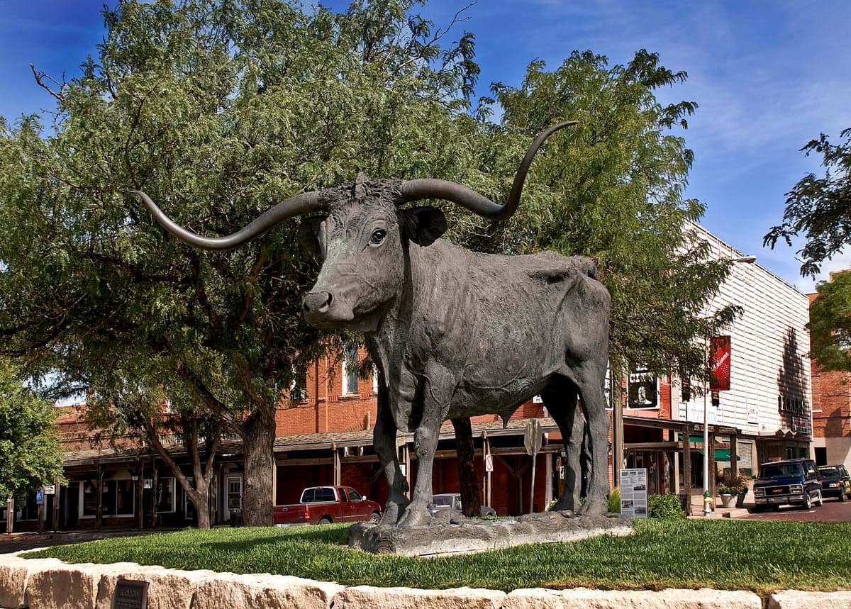
Photo: Wikipedia
Strategic Assessment of Dodge City, KS
Workable tactical position. Some exposure to population density or targets, but generally defensible in a crisis.
What does the Strategic Assessment tell us?
Our Strategic Assessment grades tactical survivability of an area. Major population centers, military targets, fallout zones, natural disasters, and border exposure all drive risk — lower exposure means a more defensible position in a crisis.
This is heavily inspired by Joel Skousen's Strategic Relocation book. Highly recommended you checkout the book ($)What does this tell us?
Our Strategic Assessment grades tactical survivability of an area. Major population centers, military targets, fallout zones, natural disasters, and border exposure all drive risk — lower exposure means a more defensible position in a crisis.
This is heavily inspired by Joel Skousen's Strategic Relocation book. Highly recommended you checkout the book ($)Strategic Pillars

Key Distances
Regional Safe Places
Below is our recommended "safe zones" in Kansas and the surrounding area based on our strategic heuristics. For most people, it's unrealistic to live in a “safe zone” full-time due to work, family or other personal reasons. They tend to be more rural. However, many of these areas are perfect for second homes and retreat properties that double as a vacation home or even a short-term rental.
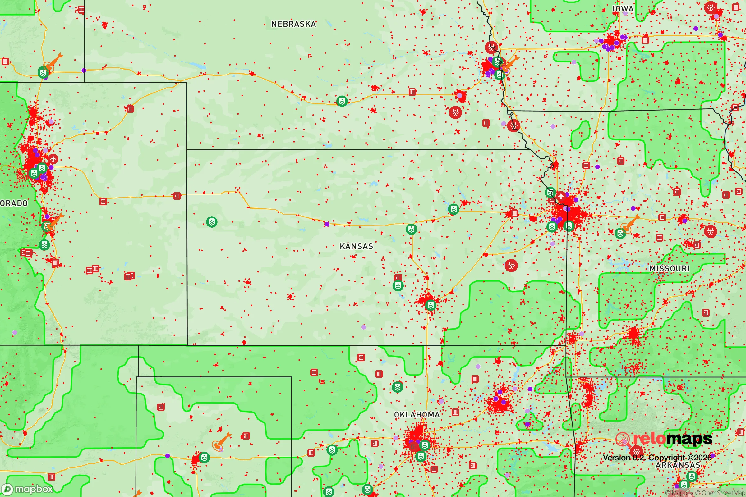
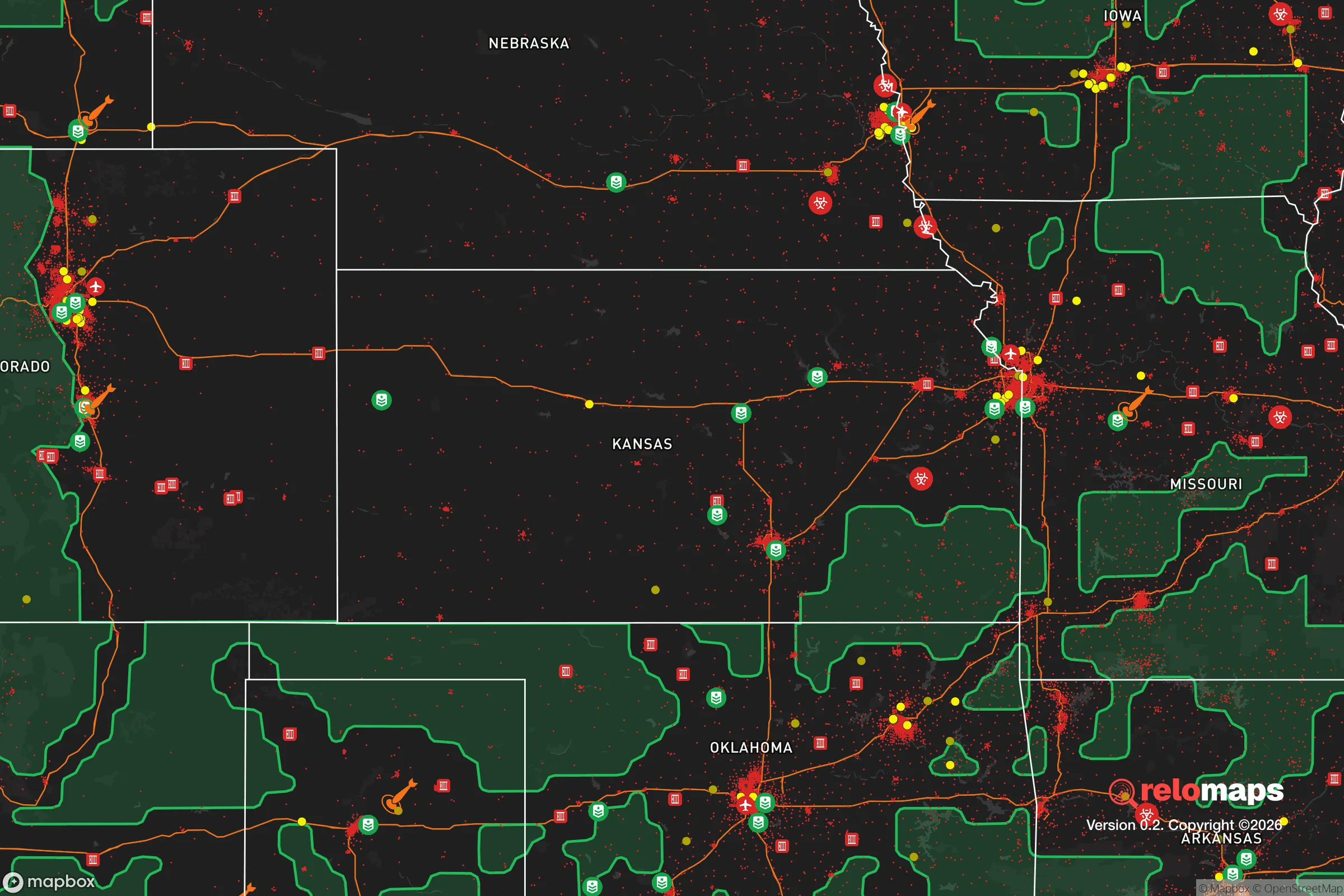


Important Note: For informational purposes only. This does not mean nothing bad ever happens in the green zones. Please use common sense. This is based on public data and modeled with AI. We tried to take a conservative approach but mistakes happen. We update this regularly as new information becomes available.
Solar Generator Recommendations
Backup power matters more here than in safer locations. We've picked three solar generators across budgets and capacity tiers — start with the budget unit if you only need a few essentials, or step up if you want to run a fridge and HVAC for days at a time.

Jackery Portable Power Station Explorer 300
Budget OptionPower on the Go: Weighing only 11 lbs, it's convenient to set up and store with book-sized foldable solar panels

BLUETTI Portable Power Station AC180
Designed for both indoor and outdoor scenarios, AC180 is highly capable as it has a robost capacity and continuous output power.

EF ECOFLOW DELTA Pro Ultra Power Station
Upgraded PickEcoFlow DELTA Pro Ultra is a whole-home energy system designed to grow with your family. Integrated with the Smart Home Panel 2, it scales to meet your evolving energy needs — keeping your home powered, intelligent, and secure through every stage of life.
We earn a commission, at no additional cost to you.
Strategic Assessment Analysis
Dodge City, Kansas, offers a compelling strategic profile for the relocation-minded reader focused on resilience and self-sufficiency, combining a remote, low-density location with robust agricultural infrastructure and a surprising degree of logistical connectivity. Its position in the High Plains, far from major population centers and their associated risks, provides a natural buffer against many cascading failure scenarios, while its role as a regional hub for food production and transportation gives it a practical edge that many isolated towns lack. For a single individual or family weighing long-term preparedness, Dodge City presents a trade-off: genuine geographic security and resource abundance against the vulnerabilities of a single-industry economy and exposure to extreme weather.
Geographic position and natural advantages for long-term security
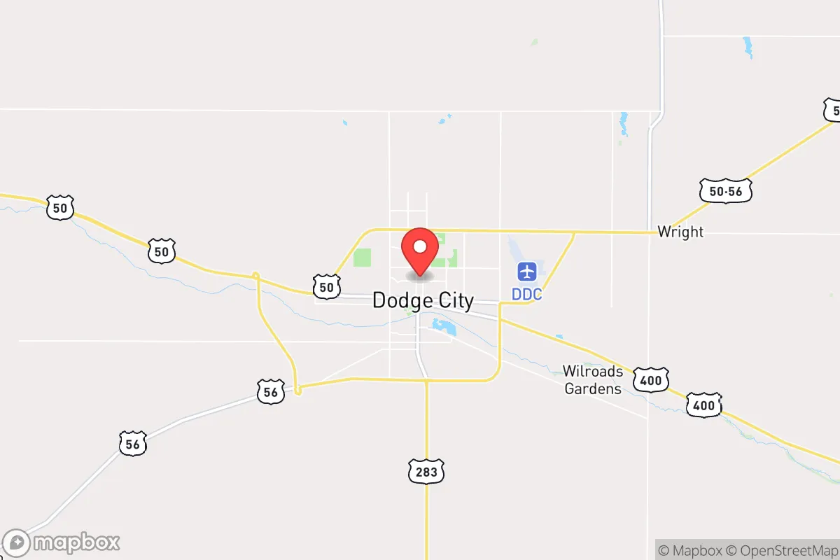
Dodge City sits in southwestern Kansas, roughly 150 miles from Wichita and over 300 miles from Denver, placing it well outside the immediate fallout and chaos zones of any major metropolitan area. This distance is a primary strategic asset: in the event of a widespread disruption—whether economic, social, or from a man-made disaster—the city is unlikely to be a primary target or to experience the rapid population influx that would overwhelm closer suburbs. The surrounding landscape is flat, open rangeland and irrigated cropland, which offers excellent visibility and few natural chokepoints for an adversary, but also provides a vast, low-population buffer. The Arkansas River runs through town, and the Ogallala Aquifer lies beneath the region, providing a deep and reliable freshwater source that is far less contested than surface water in more arid parts of the West. The local climate is semi-arid, with hot summers and cold, windy winters, but annual precipitation averages around 20 inches, enough to support dryland farming and grazing without the constant wildfire risk of the Mountain West. The area's low seismic activity and absence of hurricane or tsunami threats further reduce natural hazard exposure, making it a stable platform for long-term habitation.
Risks, exposures, and proximity to fallout-relevant landmarks
The most significant risk for Dodge City is its exposure to severe weather, particularly tornadoes and straight-line winds, which are a fact of life on the Plains. The city lies in the heart of Tornado Alley, and while modern warning systems and sturdy construction mitigate the danger, a direct hit could level a neighborhood and disrupt utilities for days or weeks. Beyond weather, the area's economic reliance on agriculture and the beef packing industry—specifically the massive Cargill and National Beef plants—creates a single-point-of-failure risk. A disease outbreak, trade disruption, or plant closure would ripple through the entire local economy, affecting jobs, tax revenue, and supply chains. From a man-made risk perspective, Dodge City is not near any major military installations, nuclear power plants, or high-value infrastructure that would make it a likely target. The nearest significant fallout-relevant landmark is the Pantex nuclear weapons plant near Amarillo, Texas, about 200 miles southwest—far enough to avoid direct blast effects but within a plausible fallout plume under certain wind conditions. More practically, the city's proximity to Interstate 40 and the BNSF rail line means it could see significant through-traffic from stressed urban areas during a crisis, potentially straining local resources. The lack of natural barriers—no mountains, rivers, or forests—makes the area difficult to defend in a security breakdown, though the low population density and wide-open spaces also make it easy to monitor and control access to the town itself.
Practical resilience for a relocator: food, water, energy, and defensibility
For a relocator focused on self-sufficiency, Dodge City's strongest card is its food production capacity. The surrounding region is one of the most productive agricultural zones in the United States, with vast fields of wheat, corn, and sorghum, and the feedlots and packing plants that turn grain into beef. A family with a few acres could easily raise vegetables, poultry, or even a small herd, and the local farmers' markets and co-ops provide direct access to fresh, locally grown food even in normal times. Water is abundant but not infinite: the Ogallala Aquifer is being depleted at an unsustainable rate, but for a single household, a well drilled to 200-300 feet will provide ample water for drinking, gardening, and livestock for decades. The city's municipal water supply comes from the Arkansas River and groundwater, and while drought can reduce surface flows, the aquifer provides a deep backup. Energy is a mixed picture: the area is windy, making small-scale wind turbines a viable option, and solar insolation is good, though winter cloud cover can reduce output. Natural gas is widely available and affordable for heating and cooking. The local electrical grid is served by Western Farmers Electric Cooperative, which is relatively stable but vulnerable to ice storms and high winds. Defensibility is the weakest link: the flat, open terrain offers no natural cover, and a determined group could approach from any direction. However, the small population (around 27,000) and tight-knit community mean that neighbors know each other, and a rural property with a good fence, a clear line of sight, and a well-stocked pantry can be made reasonably secure. The local law enforcement presence is adequate for a town this size, but in a prolonged crisis, residents would need to rely on themselves and their immediate community.
The overall strategic picture for Dodge City is one of a solid, if unglamorous, relocation option for the preparedness-minded. It offers genuine geographic isolation from the risks of coastal and urban centers, a deep agricultural base that ensures food security, and a water supply that is more reliable than in many parts of the West. The trade-offs are real: the weather is harsh, the economy is narrow, and the terrain offers little natural defense. For a family willing to invest in a well, a backup power system, and a good storm shelter, and who values community ties and a slower pace over urban amenities, Dodge City provides a defensible, sustainable base. It is not a fortress, but it is a place where a prepared individual can thrive with reasonable effort, and that is a rare and valuable combination in today's uncertain landscape.

* Values derived from national, state, county, city and local statistics and may differ in a specific area. Last updated: 2026-06-13T20:05:25.000Z
Narrative content on this page is AI-generated and may contain mistakes. Verify any details that matter before acting on them.
ReloMaps may earn a commission from affiliate links at no extra cost to you.

