Strategic Assessment of DeSoto, TX
Multiple tactical vulnerabilities. Population density, target proximity, or disaster risk are likely compounding. A retreat property and exit planning is required.
What does the Strategic Assessment tell us?
Our Strategic Assessment grades tactical survivability of an area. Major population centers, military targets, fallout zones, natural disasters, and border exposure all drive risk — lower exposure means a more defensible position in a crisis.
This is heavily inspired by Joel Skousen's Strategic Relocation book. Highly recommended you checkout the book ($)What does this tell us?
Our Strategic Assessment grades tactical survivability of an area. Major population centers, military targets, fallout zones, natural disasters, and border exposure all drive risk — lower exposure means a more defensible position in a crisis.
This is heavily inspired by Joel Skousen's Strategic Relocation book. Highly recommended you checkout the book ($)Strategic Pillars

Key Distances
Regional Safe Places
Below is our recommended "safe zones" in Texas and the surrounding area based on our strategic heuristics. For most people, it's unrealistic to live in a “safe zone” full-time due to work, family or other personal reasons. They tend to be more rural. However, many of these areas are perfect for second homes and retreat properties that double as a vacation home or even a short-term rental.

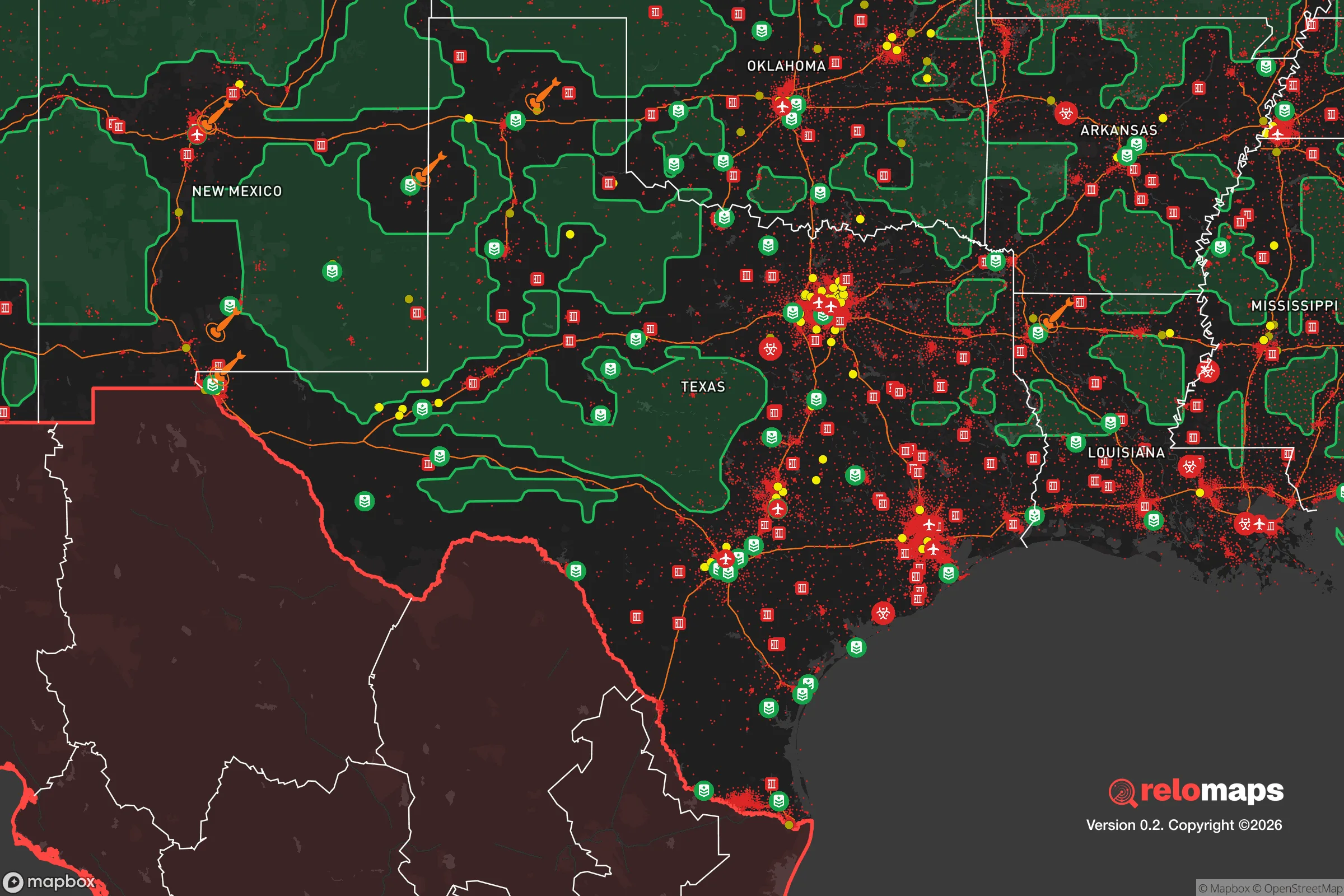


Important Note: For informational purposes only. This does not mean nothing bad ever happens in the green zones. Please use common sense. This is based on public data and modeled with AI. We tried to take a conservative approach but mistakes happen. We update this regularly as new information becomes available.
Solar Generator Recommendations
Backup power matters more here than in safer locations. We've picked three solar generators across budgets and capacity tiers — start with the budget unit if you only need a few essentials, or step up if you want to run a fridge and HVAC for days at a time.

Jackery Portable Power Station Explorer 300
Budget OptionPower on the Go: Weighing only 11 lbs, it's convenient to set up and store with book-sized foldable solar panels

BLUETTI Portable Power Station AC180
Designed for both indoor and outdoor scenarios, AC180 is highly capable as it has a robost capacity and continuous output power.

EF ECOFLOW DELTA Pro Ultra Power Station
Upgraded PickEcoFlow DELTA Pro Ultra is a whole-home energy system designed to grow with your family. Integrated with the Smart Home Panel 2, it scales to meet your evolving energy needs — keeping your home powered, intelligent, and secure through every stage of life.
We earn a commission, at no additional cost to you.
Strategic Assessment Analysis
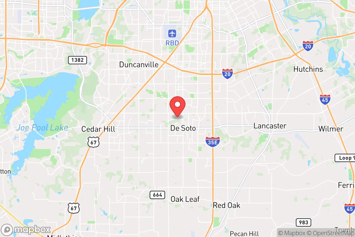
DeSoto, Texas, offers a mixed strategic picture for the relocation-minded reader focused on resilience and self-sufficiency. Located roughly 15 miles southwest of downtown Dallas, the city sits in a suburban corridor that balances proximity to major infrastructure with a degree of geographic separation from the densest urban cores. Its position within the Dallas-Fort Worth metroplex provides access to resources and supply chains, but that same proximity introduces significant vulnerabilities that a serious preparedness-minded individual must weigh carefully.
Geographic position and natural advantages for preparedness
DeSoto’s location in the Blackland Prairie region of North Texas gives it relatively flat, open terrain with good drainage and deep clay soils. The area is not prone to the flooding that plagues parts of Dallas closer to the Trinity River, though low-lying pockets near creeks like Ten Mile Creek can see localized water issues after heavy rain. The city sits at an elevation around 650 feet, which provides no meaningful topographic defensibility but also avoids the flash-flood risks of hillier terrain. The climate is humid subtropical, with hot summers averaging 95°F and mild winters that rarely drop below freezing for extended periods. This means year-round gardening is feasible with proper planning, and the growing season stretches from March to November. The area’s natural advantages are modest but real: no hurricane storm surge, no wildfire corridors, no earthquake zones, and no significant landslide risk. The primary natural hazard is severe weather, particularly tornadoes and straight-line winds, which are a recurring threat across North Texas. DeSoto lies within the traditional "Dixie Alley" tornado zone, and the May 2021 EF-2 tornado that struck nearby Ellis County serves as a reminder that shelter-in-place planning is non-negotiable here.
Risks, exposures, and proximity to fallout-relevant landmarks
The most significant strategic liability for DeSoto is its position within the Dallas-Fort Worth metroplex, a region of roughly 7.5 million people. The city is less than 20 miles from Dallas Love Field and roughly 30 miles from DFW International Airport, both of which are potential targets in a conflict scenario. Additionally, the area hosts multiple defense and aerospace contractors, including Lockheed Martin’s Fort Worth facility (home of the F-35 production line) about 40 miles west, and the Red River Army Depot near Texarkana roughly 150 miles northeast. The proximity to these assets, combined with the concentration of population and industry in the DFW corridor, makes DeSoto a secondary-risk location in a major disruption. The city itself is not a primary target, but it lies within the fallout shadow of potential strikes on Dallas or Fort Worth. Prevailing winds in North Texas blow from the south and southwest most of the year, meaning fallout from a strike on Dallas would likely drift northeast, away from DeSoto. However, a strike on Fort Worth or the Lockheed Martin facility could push contamination eastward, potentially affecting the area. The city also sits near major transportation arteries: Interstate 35E runs just west of DeSoto, and Interstate 20 passes north of the city. These highways would become chokepoints in an evacuation scenario, and the city’s population of roughly 56,000 could swell with refugees from Dallas in a crisis. The presence of the Dallas-Fort Worth National Cemetery in Dallas, about 12 miles north, is a minor landmark but not a strategic concern.
Practical resilience for a relocator: food, water, energy, and defensibility
For a relocator serious about self-sufficiency, DeSoto presents a mixed bag. The city’s water supply comes from the Dallas Water Utilities system, which draws from the Elm Fork of the Trinity River and several reservoirs, including Lake Ray Hubbard and Lewisville Lake. This centralized system is vulnerable to contamination or disruption, but the area’s groundwater is accessible via private wells in the surrounding unincorporated areas. The Trinity Aquifer lies at depths of 200-500 feet in this region, and well drilling is feasible on properties with sufficient acreage, though DeSoto’s suburban zoning limits this option for most residents. The city’s electric grid is served by Oncor, a major Texas utility, and the area is part of the ERCOT grid, which has demonstrated fragility during winter storms (notably the February 2021 blackouts). Solar generation is viable here, with the region averaging 215 sunny days per year, and net metering policies exist but are not as favorable as in some states. Battery backup is strongly recommended for anyone relying on solar, given the grid’s instability. For food production, DeSoto’s climate supports a wide range of crops, including tomatoes, peppers, okra, beans, and squash during the warm season, and leafy greens, carrots, and broccoli in the cooler months. The city’s soil is heavy clay, which requires amendment with organic matter for optimal gardening, but raised beds and container gardening are practical alternatives. The city has a municipal code that allows backyard chickens (hens only, no roosters) and beekeeping with a permit, but larger livestock is restricted to properties zoned for agricultural use. For defensibility, DeSoto’s suburban layout with cul-de-sacs and grid-like streets offers limited natural chokepoints, but the city’s relatively low crime rate (violent crime is about 30% below the national average) suggests a stable community environment. The DeSoto Police Department maintains a response time of roughly 5-7 minutes for priority calls, which is reasonable for a suburb of this size. However, in a prolonged disruption, the city’s density (about 2,100 people per square mile) would make individual property defense challenging without a coordinated neighborhood watch or community mutual-aid network.
The overall strategic picture for DeSoto is one of calculated trade-offs. The city offers a moderate level of natural hazard resilience, a workable climate for self-sufficient food production, and access to the resources of a major metroplex without being directly in the crosshairs of a primary target. The trade-offs are real: proximity to DFW’s critical infrastructure, dependence on centralized water and power systems, and the inherent vulnerabilities of suburban density. For a relocator who values community stability, a manageable commute to Dallas jobs, and a climate that supports year-round gardening, DeSoto is a defensible choice—provided they invest in backup power, water storage, and a strong local network. It is not a remote survivalist retreat, but it is a pragmatic option for someone who wants to balance modern convenience with a serious preparedness mindset. The key is to treat DeSoto as a base of operations, not a fortress, and to build resilience through redundancy in utilities and community relationships rather than isolation.

* Values derived from national, state, county, city and local statistics and may differ in a specific area. Last updated: 2026-07-20T01:36:54.000Z
Narrative content on this page is AI-generated and may contain mistakes. Verify any details that matter before acting on them.
ReloMaps may earn a commission from affiliate links at no extra cost to you.

