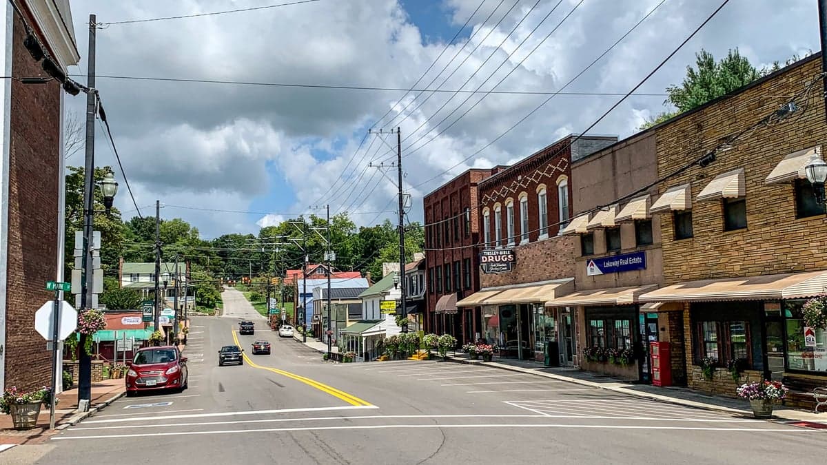
Photo: Wikipedia
Strategic Assessment of Dandridge, TN
Workable tactical position. Some exposure to population density or targets, but generally defensible in a crisis.
What does the Strategic Assessment tell us?
Our Strategic Assessment grades tactical survivability of an area. Major population centers, military targets, fallout zones, natural disasters, and border exposure all drive risk — lower exposure means a more defensible position in a crisis.
This is heavily inspired by Joel Skousen's Strategic Relocation book. Highly recommended you checkout the book ($)What does this tell us?
Our Strategic Assessment grades tactical survivability of an area. Major population centers, military targets, fallout zones, natural disasters, and border exposure all drive risk — lower exposure means a more defensible position in a crisis.
This is heavily inspired by Joel Skousen's Strategic Relocation book. Highly recommended you checkout the book ($)Strategic Pillars

Key Distances
Regional Safe Places
Below is our recommended "safe zones" in Tennessee and the surrounding area based on our strategic heuristics. For most people, it's unrealistic to live in a “safe zone” full-time due to work, family or other personal reasons. They tend to be more rural. However, many of these areas are perfect for second homes and retreat properties that double as a vacation home or even a short-term rental.
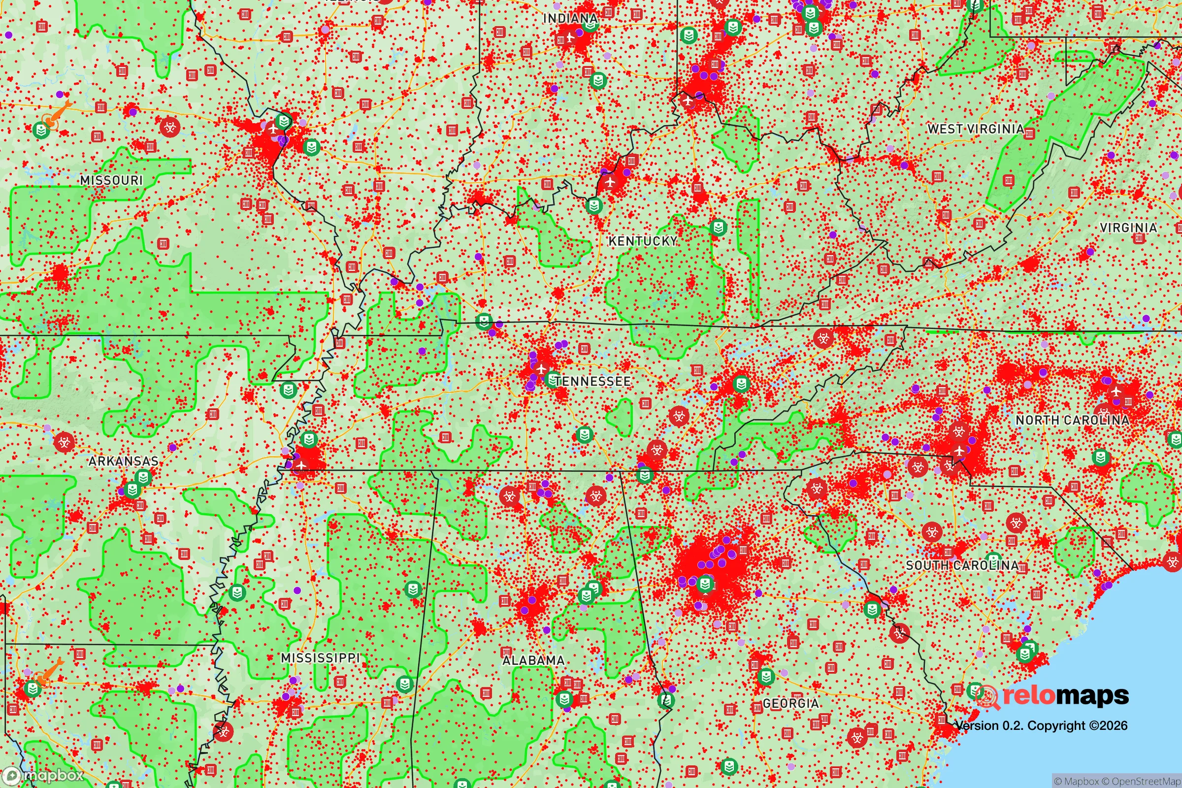
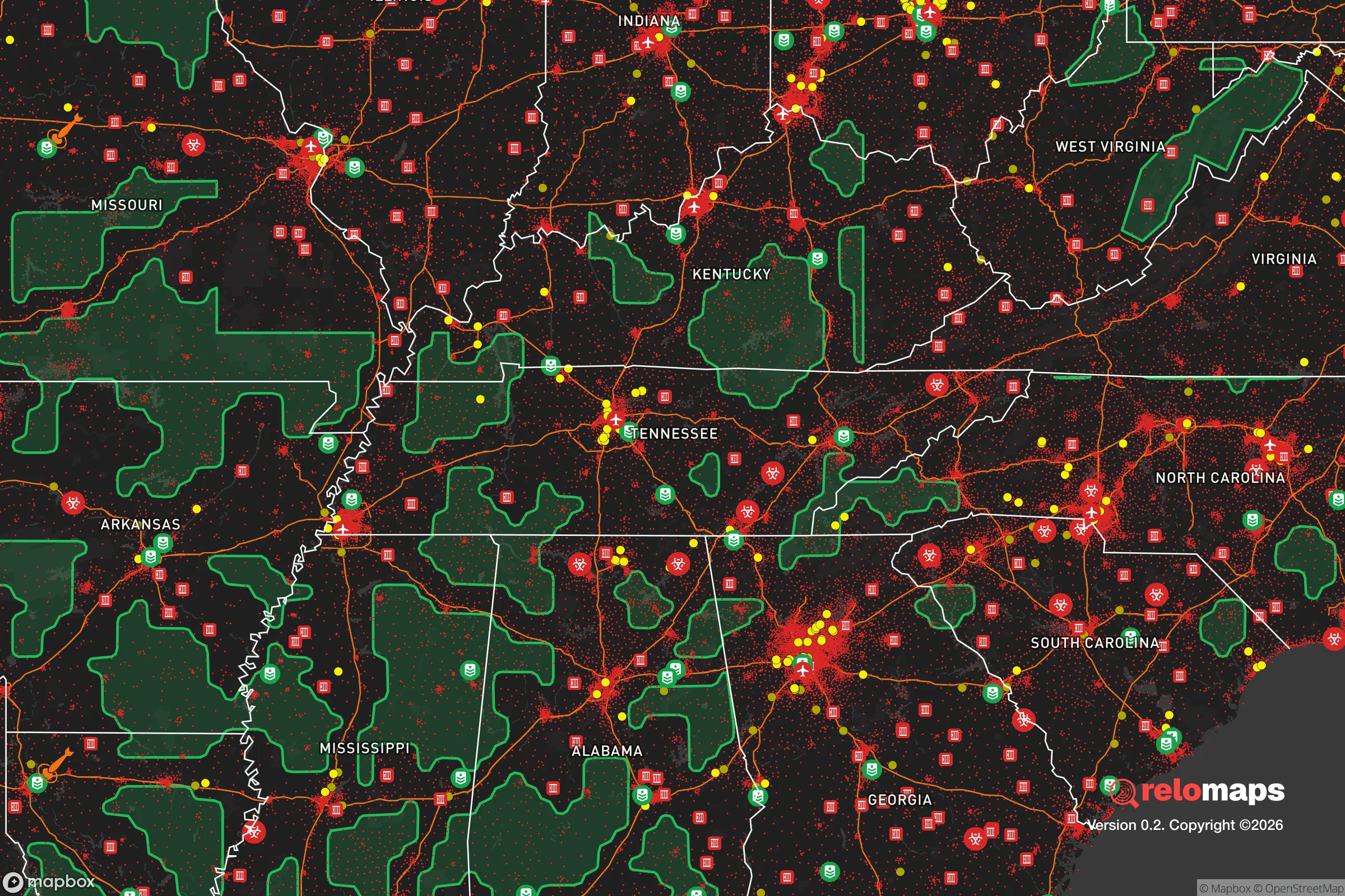


Important Note: For informational purposes only. This does not mean nothing bad ever happens in the green zones. Please use common sense. This is based on public data and modeled with AI. We tried to take a conservative approach but mistakes happen. We update this regularly as new information becomes available.
Solar Generator Recommendations
Backup power matters more here than in safer locations. We've picked three solar generators across budgets and capacity tiers — start with the budget unit if you only need a few essentials, or step up if you want to run a fridge and HVAC for days at a time.

Jackery Portable Power Station Explorer 300
Budget OptionPower on the Go: Weighing only 11 lbs, it's convenient to set up and store with book-sized foldable solar panels

BLUETTI Portable Power Station AC180
Designed for both indoor and outdoor scenarios, AC180 is highly capable as it has a robost capacity and continuous output power.

EF ECOFLOW DELTA Pro Ultra Power Station
Upgraded PickEcoFlow DELTA Pro Ultra is a whole-home energy system designed to grow with your family. Integrated with the Smart Home Panel 2, it scales to meet your evolving energy needs — keeping your home powered, intelligent, and secure through every stage of life.
We earn a commission, at no additional cost to you.
Strategic Assessment Analysis
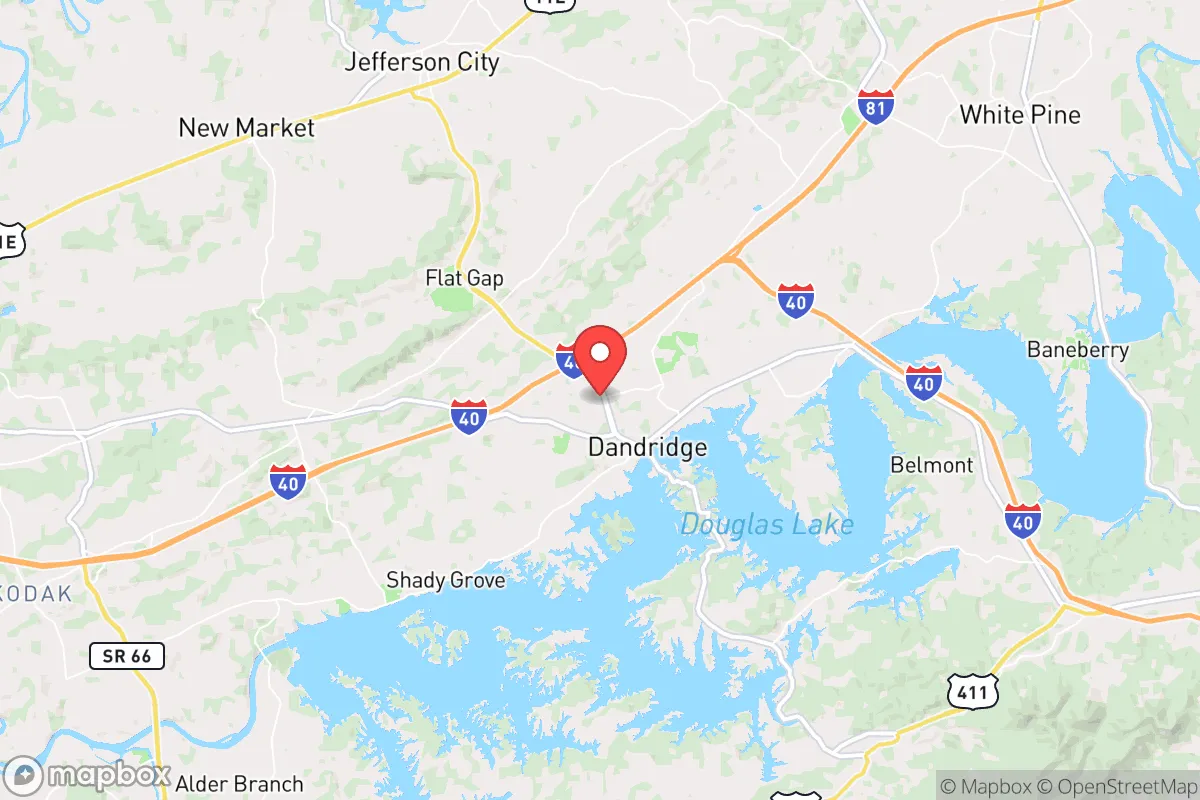
Dandridge, Tennessee, offers a strategic relocation option for those prioritizing resilience and self-sufficiency, largely due to its position in the foothills of the Great Smoky Mountains and its distance from major metropolitan targets. The town sits roughly 35 miles east of Knoxville and about 70 miles north of Asheville, North Carolina, placing it outside the immediate blast and fallout zones of those cities while still providing access to their resources. Its location along the French Broad River and near Douglas Lake provides a natural water buffer and agricultural potential, but the same geography introduces flood risks and proximity to infrastructure that could become liabilities in a crisis. For a conservative-leaning individual or family weighing disaster readiness, Dandridge presents a mixed picture: genuine natural advantages in defensibility and water access, offset by exposure to dam-related hazards and the fallout shadow of Knoxville.
Geographic position and natural advantages for self-sufficiency
Dandridge’s geography is defined by the French Broad River and the impounded Douglas Lake, which together create a water-rich environment that supports both subsistence farming and emergency water supply. The surrounding terrain is hilly and wooded, with elevations ranging from 900 to 1,200 feet, offering natural cover and multiple defensible positions for a homestead. The area sits in USDA Hardiness Zone 7a, with a growing season of roughly 190 days, allowing for diverse crops like tomatoes, beans, and squash, plus perennial fruits such as apples and blackberries. Soils are primarily sandy loam and clay, requiring amendment but capable of supporting gardens and small orchards. The nearby Cherokee National Forest and Great Smoky Mountains National Park provide vast tracts of public land for foraging, hunting, and timber, though legal access and game populations are regulated. Dandridge’s position in a river valley also means it is shielded from the worst wind events common in the Plains, and its elevation reduces the risk of tornadoes compared to flatter areas of Tennessee. The town’s distance from Interstate 40—about 5 miles north—keeps it off major evacuation routes, reducing the likelihood of refugee traffic during a regional emergency.
Risks, exposures, and proximity to fallout-relevant landmarks
The most significant risk for Dandridge is flooding, driven by its location along the French Broad River and downstream of Douglas Dam. The 2021 flooding of the Pigeon River and French Broad watershed demonstrated that heavy rain events can overwhelm the dam’s capacity, with the National Weather Service issuing flash flood emergencies for Jefferson County. The 100-year floodplain covers much of the low-lying areas near the river and lake, including parts of downtown Dandridge and residential neighborhoods along Highway 92. Any relocator should verify that a property sits above the 540-foot contour line to avoid catastrophic inundation. Beyond flooding, the area’s proximity to Knoxville—home to the University of Tennessee, Oak Ridge National Laboratory (about 45 miles west), and McGhee Tyson Air National Guard Base—makes it a secondary target in a conflict scenario. Oak Ridge is a known nuclear research and production site, and a strike there would produce a fallout plume that could reach Dandridge within hours under prevailing westerly winds. The town is also within 100 miles of the Tennessee Valley Authority’s Watts Bar and Sequoyah nuclear plants, both of which are potential targets or accident sites. While Dandridge itself has no major military or industrial targets, its location in the Tennessee River Valley corridor means it lies along potential secondary strike paths. The Douglas Dam itself, a hydroelectric facility, could be a target for sabotage or conventional attack, with downstream flooding consequences.
Practical resilience for a relocator: food, water, energy, and defensibility
Water access is Dandridge’s strongest resilience asset. The French Broad River and Douglas Lake provide year-round surface water, and the area’s average annual rainfall of 45 inches ensures reliable catchment. A household with a rainwater collection system and a simple filtration setup (e.g., Berkey or Sawyer filter) can secure potable water indefinitely. Groundwater is accessible via wells, with typical depths of 100–300 feet in the surrounding hills, though yields vary by bedrock composition. For food, the growing season and soil quality support small-scale agriculture, and local farmers’ markets in Dandridge and nearby Jefferson City provide seed stock and livestock sources. The area has a strong hunting culture, with white-tailed deer, wild turkey, and squirrel abundant in the national forest. Fishing in Douglas Lake and the river offers protein year-round, though mercury advisories exist for some species in the French Broad. Energy resilience is moderate: the grid is served by the Tennessee Valley Authority, which has a mixed record of reliability during ice storms and summer thunderstorms. Solar potential is good, with an average of 5.2 peak sun hours per day, but tree cover in the hills may require clearing for optimal panel placement. Propane and wood are common backup fuels, with several local suppliers in Jefferson County. Defensibility is aided by the terrain: the hills and winding roads create natural chokepoints, and the town’s small population (roughly 3,000) means a tight-knit community that can organize quickly. However, the lake and river also create avenues of approach for anyone with a boat, and the many vacation homes along the shoreline mean seasonal population spikes that could strain resources. The nearest hospital is Jefferson Memorial Hospital in Jefferson City, 10 miles west, but it is a small facility with limited trauma capacity; serious injuries would require evacuation to Knoxville.
The overall strategic picture for Dandridge is one of moderate resilience with clear trade-offs. Its water abundance, agricultural potential, and defensible terrain make it a strong candidate for a self-sufficient homestead, especially for those willing to invest in flood-proofing and off-grid energy. The proximity to Knoxville and Oak Ridge is a double-edged sword: it provides access to medical care and supply chains in normal times, but it also places the area in the fallout shadow of high-value targets. For a relocator who prioritizes isolation and minimal risk, deeper rural areas of East Tennessee—such as Hancock County or the Cumberland Plateau—offer fewer man-made threats. But for someone who wants a balance of natural resources, community infrastructure, and reasonable distance from urban centers, Dandridge is a viable option. The key is to choose a property above the floodplain, secure a well or rainwater system, and maintain a low profile. In a serious national emergency, the town’s location on a major river and near a dam will attract attention, but its hills and forests provide the cover and resources needed to ride out the worst.

* Values derived from national, state, county, city and local statistics and may differ in a specific area. Last updated: 2026-08-29T15:32:15.000Z
Narrative content on this page is AI-generated and may contain mistakes. Verify any details that matter before acting on them.
ReloMaps may earn a commission from affiliate links at no extra cost to you.

