 Popular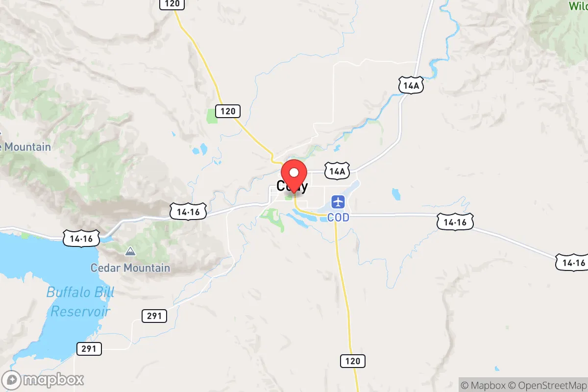
Strategic Assessment of Cody, WY
Workable tactical position. Some exposure to population density or targets, but generally defensible in a crisis.
What does the Strategic Assessment tell us?
Our Strategic Assessment grades tactical survivability of an area. Major population centers, military targets, fallout zones, natural disasters, and border exposure all drive risk — lower exposure means a more defensible position in a crisis.
This is heavily inspired by Joel Skousen's Strategic Relocation book. Highly recommended you checkout the book ($)What does this tell us?
Our Strategic Assessment grades tactical survivability of an area. Major population centers, military targets, fallout zones, natural disasters, and border exposure all drive risk — lower exposure means a more defensible position in a crisis.
This is heavily inspired by Joel Skousen's Strategic Relocation book. Highly recommended you checkout the book ($)Strategic Pillars

Key Distances
Regional Safe Places
Below is our recommended "safe zones" in Wyoming and the surrounding area based on our strategic heuristics. For most people, it's unrealistic to live in a “safe zone” full-time due to work, family or other personal reasons. They tend to be more rural. However, many of these areas are perfect for second homes and retreat properties that double as a vacation home or even a short-term rental.
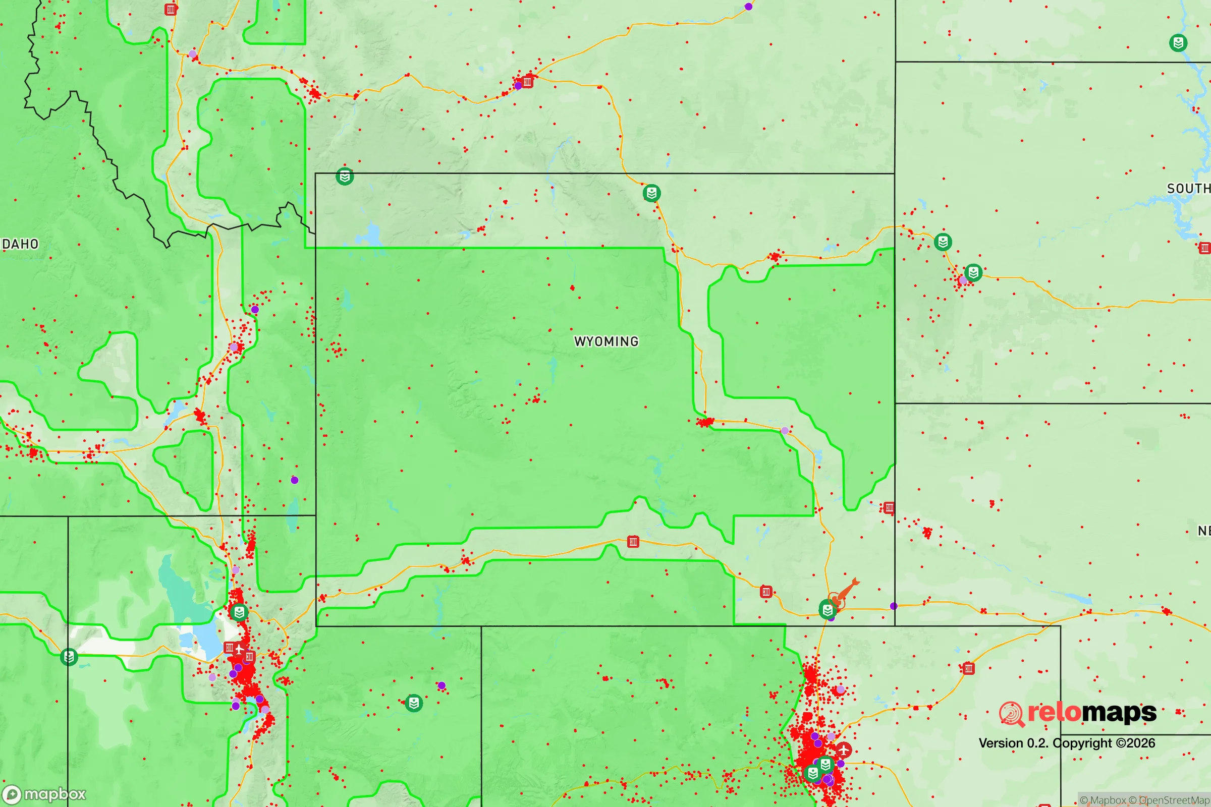
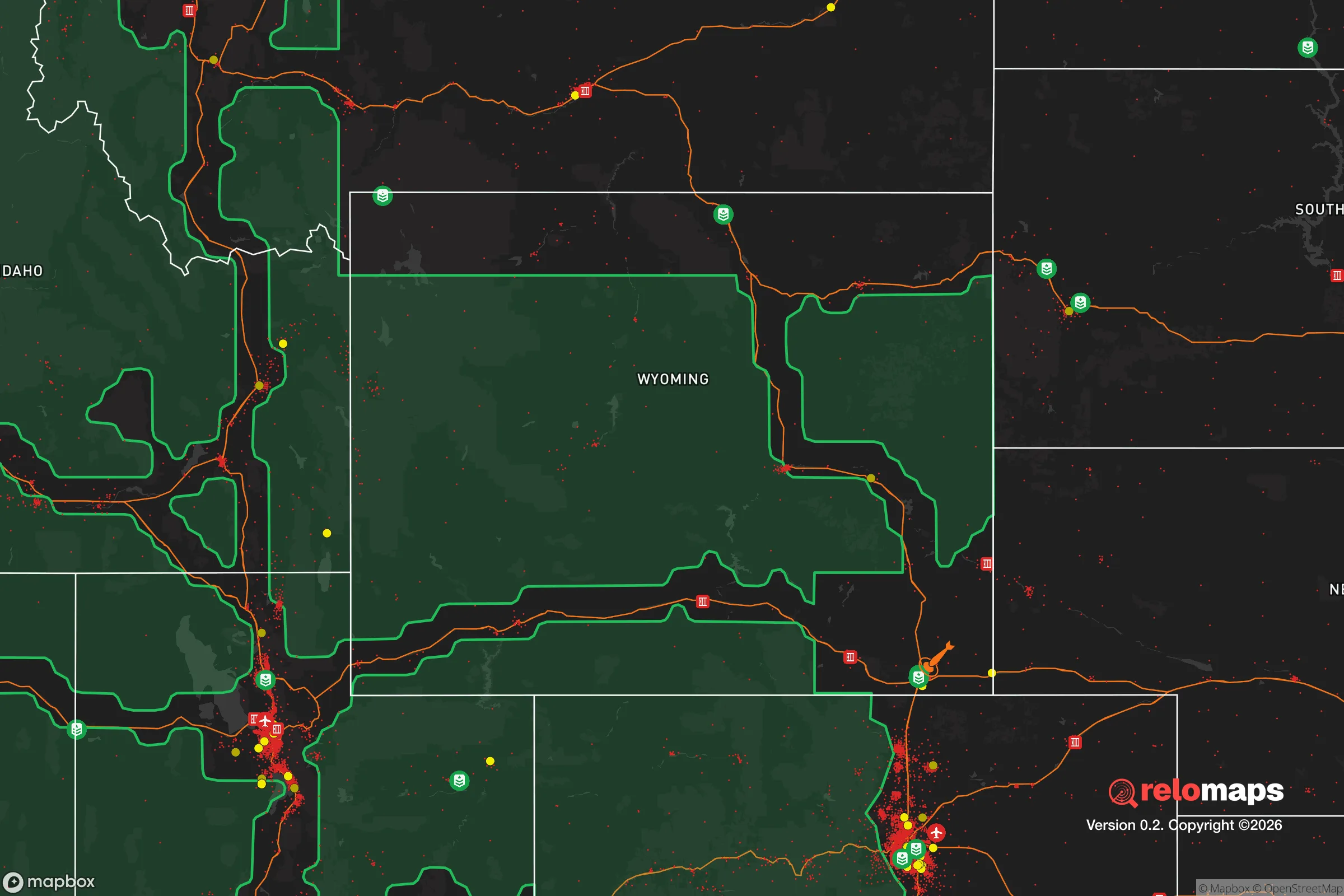


Important Note: For informational purposes only. This does not mean nothing bad ever happens in the green zones. Please use common sense. This is based on public data and modeled with AI. We tried to take a conservative approach but mistakes happen. We update this regularly as new information becomes available.
Solar Generator Recommendations
Backup power matters more here than in safer locations. We've picked three solar generators across budgets and capacity tiers — start with the budget unit if you only need a few essentials, or step up if you want to run a fridge and HVAC for days at a time.

Jackery Portable Power Station Explorer 300
Budget OptionPower on the Go: Weighing only 11 lbs, it's convenient to set up and store with book-sized foldable solar panels

BLUETTI Portable Power Station AC180
Designed for both indoor and outdoor scenarios, AC180 is highly capable as it has a robost capacity and continuous output power.

EF ECOFLOW DELTA Pro Ultra Power Station
Upgraded PickEcoFlow DELTA Pro Ultra is a whole-home energy system designed to grow with your family. Integrated with the Smart Home Panel 2, it scales to meet your evolving energy needs — keeping your home powered, intelligent, and secure through every stage of life.
We earn a commission, at no additional cost to you.
Strategic Assessment Analysis
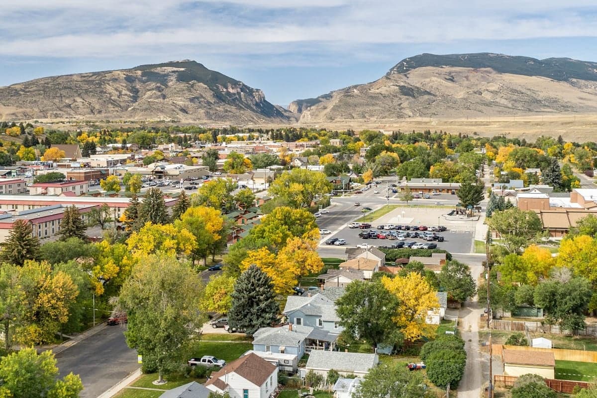
Cody, Wyoming occupies a unique position in the resilience landscape, offering a combination of geographic isolation, resource abundance, and community cohesion that is increasingly rare in the continental United States. Situated at the eastern gateway of Yellowstone National Park and the western edge of the Bighorn Basin, the town benefits from a natural buffer of rugged terrain and low population density that makes it a serious contender for anyone evaluating long-term preparedness and self-sufficiency. While no location is without risk, Cody’s strategic advantages are grounded in tangible geography and infrastructure rather than speculative promise.
Geographic position and natural advantages for long-term stability
Cody sits at roughly 5,100 feet elevation on the Shoshone River, with the Absaroka Range rising immediately to the west and the Bighorn Mountains to the east. This positioning creates a natural funnel that limits access to a few primary routes—chiefly US-14/US-16/US-20 from the east and the North Fork Highway (US-14/16/20) from Yellowstone to the west. In a disruption scenario, this constrained access is a double-edged sword: it makes the area inherently defensible and easy to monitor, but it also means that egress or supply inflow depends on a small number of chokepoints. The surrounding topography provides significant natural shielding from large-scale electromagnetic pulse (EMP) effects, as the mountain ranges block line-of-sight from high-altitude detonations over the central or western United States. The Bighorn Basin itself is a semi-arid high desert, which means flooding risk is minimal compared to river valleys in the Pacific Northwest or the Mississippi drainage. The Shoshone River, fed by snowmelt from the Absarokas, provides a reliable surface water source that flows year-round, a critical advantage over areas dependent on groundwater aquifers or seasonal precipitation alone.
Risk exposure and proximity to fallout-relevant landmarks
Cody’s primary risk exposure comes from its proximity to Yellowstone National Park, which sits roughly 50 miles to the west. While a caldera-scale supereruption is a low-probability event on human timescales, hydrothermal explosions and earthquake swarms are more frequent and could disrupt transportation corridors and infrastructure. The USGS monitors Yellowstone continuously, and the park’s seismic activity is well-documented, but relocators should understand that the primary risk is not an eruption but rather the potential for road closures and supply chain interruptions if the park’s geothermal features become unstable. On the man-made risk side, Cody is approximately 350 miles from the nearest major metropolitan area (Salt Lake City) and over 400 miles from Denver, placing it well outside the immediate fallout zones of any plausible nuclear exchange targeting major population centers or military installations. The closest significant strategic target is Malmstrom Air Force Base in Montana, roughly 250 miles north, which hosts Minuteman III ICBM silos. Prevailing westerly winds in this region mean that fallout from a strike on Malmstrom would likely be carried east-northeast, away from Cody. There are no nuclear power plants, major chemical facilities, or large-scale military depots within 150 miles, which significantly reduces the risk of secondary industrial accidents or targeted strikes. The nearest rail lines run through the Bighorn Basin to the south and east, but Cody itself is not a rail hub, which lowers its profile as a logistical target.
Practical resilience for a relocator: food, water, energy, and defensibility
Cody’s practical resilience is anchored by the Shoshone River and the area’s agricultural capacity. The Bighorn Basin is one of Wyoming’s primary agricultural regions, producing sugar beets, barley, alfalfa, and cattle. Within a 30-mile radius of Cody, there are multiple working ranches and farms that could sustain local food production even if national supply chains falter. The local irrigation infrastructure, fed by the Shoshone and its tributaries, is well-established and gravity-fed in many areas, meaning it does not depend entirely on electrical pumps. For water, the Shoshone River flows at an average of over 1,000 cubic feet per second through Cody, providing a surface water supply that is both abundant and treatable with basic filtration. The town’s municipal water system draws from the river, and many rural properties have private wells tapping into the Bighorn Basin aquifer, which has good yield and water quality. Energy resilience is a mixed picture: Cody is connected to the regional grid via Rocky Mountain Power, but the area also has significant local generation capacity from the Buffalo Bill Dam hydroelectric plant (18 MW) and several natural gas-fired peaker plants in the basin. For a relocator looking to go off-grid, the region averages over 300 days of sunshine per year, making solar viable, and the surrounding national forest provides ample biomass for wood heating. Wind is consistent but not extreme, and small-scale hydro is feasible on properties with stream access. Defensibility is arguably Cody’s strongest resilience attribute. The town’s population of roughly 10,000 is spread across a valley floor with clear sightlines, and the surrounding mountains create natural observation points. The local culture is heavily oriented toward hunting, shooting sports, and outdoor skills—the Cody Firearms Museum and multiple shooting ranges reflect a community that is both familiar with and equipped for self-defense. The Park County Sheriff’s Office and Cody Police Department maintain a visible presence, and the volunteer fire department is well-trained for wildland interface fires. However, relocators should note that the town’s medical infrastructure is limited to Cody Regional Health, a 25-bed critical access hospital. For serious trauma or specialized care, evacuation to Billings, Montana (90 miles north) is required, which could be problematic if roads are compromised.
Overall, Cody presents a strong strategic picture for a relocator prioritizing resilience and self-sufficiency, provided they are realistic about the trade-offs. The town’s isolation is its greatest asset—it is far enough from major targets and population centers to avoid the worst of a cascading collapse, yet close enough to Billings and regional supply routes to maintain access to critical goods under normal conditions. The combination of abundant surface water, local agricultural capacity, hydroelectric generation, and a culturally self-reliant population creates a foundation that few comparably sized towns in the Intermountain West can match. The primary vulnerabilities are the reliance on a few road corridors for resupply, the limited medical capacity, and the low but real geological risk from Yellowstone. For a family or individual willing to invest in off-grid power, water storage, and food production, Cody offers one of the more defensible and resource-secure positions available in the lower 48 states without requiring a complete retreat from modern amenities.

* Values derived from national, state, county, city and local statistics and may differ in a specific area. Last updated: 2026-06-21T12:31:12.000Z
Narrative content on this page is AI-generated and may contain mistakes. Verify any details that matter before acting on them.
ReloMaps may earn a commission from affiliate links at no extra cost to you.

