Photo: Wikipedia
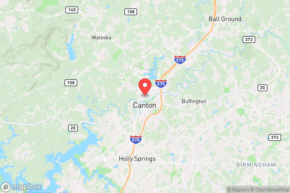
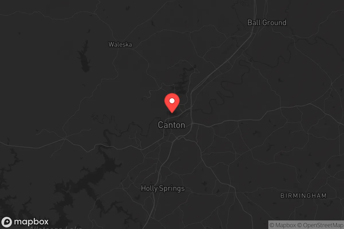
Strategic Assessment of Canton, GA
Meaningful friction. Expect exposure to either population pressure, blast zones, or natural disaster risk. Consider buying a retreat property.
What does the Strategic Assessment tell us?
Our Strategic Assessment grades tactical survivability of an area. Major population centers, military targets, fallout zones, natural disasters, and border exposure all drive risk — lower exposure means a more defensible position in a crisis.
This is heavily inspired by Joel Skousen's Strategic Relocation book. Highly recommended you checkout the book ($)What does this tell us?
Our Strategic Assessment grades tactical survivability of an area. Major population centers, military targets, fallout zones, natural disasters, and border exposure all drive risk — lower exposure means a more defensible position in a crisis.
This is heavily inspired by Joel Skousen's Strategic Relocation book. Highly recommended you checkout the book ($)Strategic Pillars

Key Distances
Regional Safe Places
Below is our recommended "safe zones" in Georgia and the surrounding area based on our strategic heuristics. For most people, it's unrealistic to live in a “safe zone” full-time due to work, family or other personal reasons. They tend to be more rural. However, many of these areas are perfect for second homes and retreat properties that double as a vacation home or even a short-term rental.


Important Note: For informational purposes only. This does not mean nothing bad ever happens in the green zones. Please use common sense. This is based on public data and modeled with AI. We tried to take a conservative approach but mistakes happen. We update this regularly as new information becomes available.
Solar Generator Recommendations
Backup power matters more here than in safer locations. We've picked three solar generators across budgets and capacity tiers — start with the budget unit if you only need a few essentials, or step up if you want to run a fridge and HVAC for days at a time.

Jackery Portable Power Station Explorer 300
Budget OptionPower on the Go: Weighing only 11 lbs, it's convenient to set up and store with book-sized foldable solar panels

BLUETTI Portable Power Station AC180
Designed for both indoor and outdoor scenarios, AC180 is highly capable as it has a robost capacity and continuous output power.

EF ECOFLOW DELTA Pro Ultra Power Station
Upgraded PickEcoFlow DELTA Pro Ultra is a whole-home energy system designed to grow with your family. Integrated with the Smart Home Panel 2, it scales to meet your evolving energy needs — keeping your home powered, intelligent, and secure through every stage of life.
We earn a commission, at no additional cost to you.
Strategic Assessment Analysis
Canton, Georgia, sits in a strategic pocket of the Appalachian foothills that offers a rare combination of geographic resilience and practical defensibility for those serious about long-term preparedness. Located roughly 40 miles north of Atlanta’s urban core, this Cherokee County seat benefits from being far enough from the immediate blast radius of a major metropolitan target—think EMP, civil unrest, or a mass casualty event—while still close enough to access critical supply chains and medical infrastructure in a non-crisis period. For a conservative-minded relocator weighing the risks of societal breakdown, Canton presents a compelling balance: it’s not a remote bunker, but it’s not a bullseye either. The area’s growth over the past decade has been steady, not explosive, meaning you’re not walking into a prepper’s paradise, but you’re also not buying into a community that will collapse under the weight of its own sprawl when things go sideways.
Geographic position and natural advantages for long-term survival
Canton’s location in the Etowah River valley gives it a natural water source that’s a genuine asset for off-grid sustainability. The Etowah runs through the heart of the county, and while you can’t just tap it without legal hurdles, its presence means groundwater tables are generally high, and well drilling is feasible on most rural parcels outside the city limits. The surrounding terrain—rolling hills, mixed hardwood forests, and scattered granite outcrops—provides natural cover and defensible positions. Unlike flat, open farmland, this topography forces any potential threat (whether a roving group or a government enforcement team) to move through chokepoints. The Blue Ridge Mountains begin just 20 miles north, offering a fallback zone of dense forest and limited road access. Canton itself sits at an elevation of roughly 1,000 feet, which is high enough to avoid the worst of Georgia’s flood risks but low enough to maintain moderate winters that won’t kill you if the grid goes down. The area’s growing season runs about 220 days, meaning you can produce a significant portion of your own food with basic gardening knowledge—a critical factor when supply chains falter.
Risks, exposures, and proximity to fallout-relevant landmarks
The primary risk for Canton is its proximity to Atlanta, which is a Tier 1 target for any adversary looking to cripple the U.S. economy and transportation network. Hartsfield-Jackson International Airport, the CDC, and multiple military installations (Dobbins Air Reserve Base, Fort Moore to the south) are all within a 50-mile radius. In a nuclear exchange or EMP event, Canton would likely experience fallout drift from a strike on Atlanta, depending on wind patterns—prevailing winds in north Georgia generally blow from west to east, meaning Canton is upwind of the city in most scenarios, which is a slight advantage. The nearby Lake Allatoona and Lake Lanier are both strategic water assets that could become contested zones during a collapse, drawing desperate populations from the south. Cherokee County’s population has grown to over 270,000, which means you’re not isolated—you’re in a suburban-rural mix where neighbors will notice your preps. The county’s law enforcement presence is solid (Cherokee County Sheriff’s Office has a reputation for professionalism), but in a mass casualty event or civil unrest scenario, they’ll be overwhelmed within 48 hours. The I-575 corridor, which runs straight through Canton, is a double-edged sword: it’s your lifeline to supplies now, but it’s also a highway for refugees fleeing Atlanta when things break down. Plan on that road becoming impassable within a day of any major event.
Practical resilience for a relocator: food, water, energy, and defensibility
For a single individual or a family looking to harden their position, Canton offers several concrete advantages. Water is the first concern: the Etowah River is perennial and flows year-round, but you’ll want a property with a well or access to a spring. Cherokee County’s groundwater is generally good quality, with average well depths around 200-300 feet. Rainwater catchment is legal and practical—the area averages 50 inches of rain annually, so a 1,000-square-foot roof can collect over 30,000 gallons per year. Food production is viable: the county has active farmers’ markets, a strong 4-H presence, and several local farms that sell heritage seeds and livestock. You can raise chickens, goats, and even a small beef herd on 5-10 acres without zoning headaches. The local soil is clay-heavy but amendable with compost; raised beds are the standard approach. Energy resilience is mixed: Georgia Power’s grid is reliable in normal times, but it’s centralized and vulnerable. Solar is a solid option—Canton gets about 210 sunny days per year, and the state has net metering policies that make grid-tied systems economical. Off-grid solar with battery storage is feasible, though you’ll need to size for winter cloud cover. Propane is widely available for backup heating and cooking. Defensibility depends on your property choice: look for parcels with a single access point, natural barriers (creeks, ridges), and good sightlines. The area’s rolling hills mean most homes have at least one neighbor within rifle range, so noise discipline and low-profile prepping are essential. Cherokee County has no zoning restrictions on firearms, and the local sheriff’s office is supportive of Second Amendment rights—a plus for those concerned about self-defense in a breakdown scenario.
The overall strategic picture for Canton is one of calculated risk. It’s not a remote survivalist retreat—you’re still within a day’s walk of 6 million people, and the fallout from Atlanta’s collapse would ripple through this community within weeks. But for a relocator who wants to be prepared without going full off-grid hermit, Canton offers a workable middle ground: good water access, defensible terrain, a conservative-leaning local government, and a community that still values self-reliance. The key is to buy property with a well, establish a garden and rainwater system before the crisis, and build relationships with like-minded neighbors. If you’re looking for a place to ride out the next decade of instability while maintaining a normal life in the meantime, Canton deserves a serious look—just don’t expect it to be a sanctuary. It’s a staging ground, and that’s exactly what you need when the world starts coming apart at the seams.
* Values derived from national, state, county, city and local statistics and may differ in a specific area. Last updated: 2026-04-30T00:36:50.000Z
Narrative content on this page is AI-generated and may contain mistakes. Verify any details that matter before acting on them.
ReloMaps may earn a commission from affiliate links at no extra cost to you.