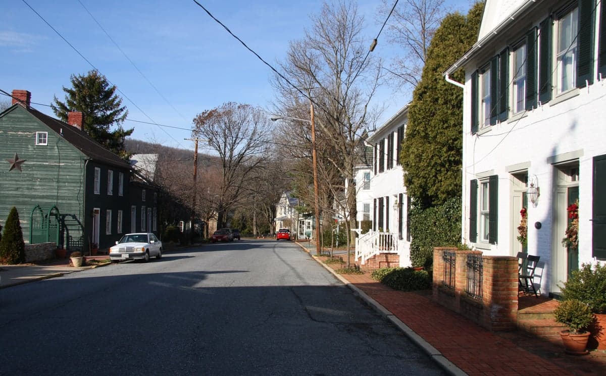
Photo: Wikipedia
Strategic Assessment of Burkittsville, MD
Meaningful friction. Expect exposure to either population pressure, blast zones, or natural disaster risk. Consider buying a retreat property.
What does the Strategic Assessment tell us?
Our Strategic Assessment grades tactical survivability of an area. Major population centers, military targets, fallout zones, natural disasters, and border exposure all drive risk — lower exposure means a more defensible position in a crisis.
This is heavily inspired by Joel Skousen's Strategic Relocation book. Highly recommended you checkout the book ($)What does this tell us?
Our Strategic Assessment grades tactical survivability of an area. Major population centers, military targets, fallout zones, natural disasters, and border exposure all drive risk — lower exposure means a more defensible position in a crisis.
This is heavily inspired by Joel Skousen's Strategic Relocation book. Highly recommended you checkout the book ($)Strategic Pillars

Key Distances
Regional Safe Places
Below is our recommended "safe zones" in Maryland and the surrounding area based on our strategic heuristics. For most people, it's unrealistic to live in a “safe zone” full-time due to work, family or other personal reasons. They tend to be more rural. However, many of these areas are perfect for second homes and retreat properties that double as a vacation home or even a short-term rental.




Important Note: For informational purposes only. This does not mean nothing bad ever happens in the green zones. Please use common sense. This is based on public data and modeled with AI. We tried to take a conservative approach but mistakes happen. We update this regularly as new information becomes available.
Solar Generator Recommendations
Backup power matters more here than in safer locations. We've picked three solar generators across budgets and capacity tiers — start with the budget unit if you only need a few essentials, or step up if you want to run a fridge and HVAC for days at a time.

Jackery Portable Power Station Explorer 300
Budget OptionPower on the Go: Weighing only 11 lbs, it's convenient to set up and store with book-sized foldable solar panels

BLUETTI Portable Power Station AC180
Designed for both indoor and outdoor scenarios, AC180 is highly capable as it has a robost capacity and continuous output power.

EF ECOFLOW DELTA Pro Ultra Power Station
Upgraded PickEcoFlow DELTA Pro Ultra is a whole-home energy system designed to grow with your family. Integrated with the Smart Home Panel 2, it scales to meet your evolving energy needs — keeping your home powered, intelligent, and secure through every stage of life.
We earn a commission, at no additional cost to you.
Strategic Assessment Analysis
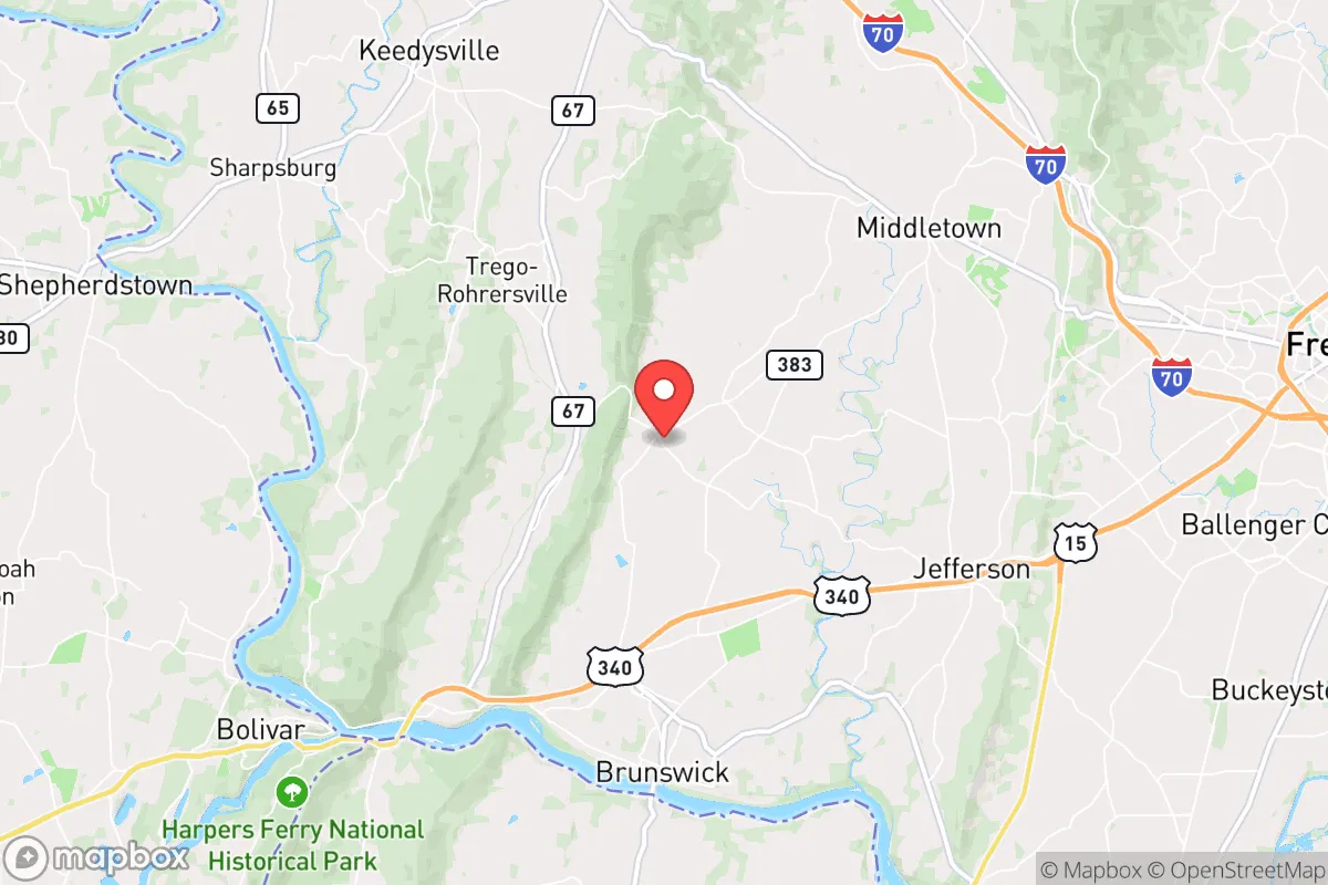
Burkittsville, Maryland, presents a nuanced strategic picture for the relocation-minded individual or family prioritizing resilience and self-sufficiency. Its primary advantage is a deceptive proximity to major metropolitan areas—roughly 50 miles from Washington, D.C., and 60 miles from Baltimore—combined with a distinctly rural, low-density character that offers genuine buffer from urban chaos. The town itself, with a population hovering around 150, sits in a narrow valley of the Catoctin Mountains, a geography that provides natural screening and a degree of isolation while still being within a reasonable drive of essential supplies and medical facilities in Frederick (about 12 miles north). For the conservative-leaning relocator, this balance of seclusion and access is a key strategic asset, but it comes with specific vulnerabilities that demand careful consideration.
Geographic position and natural defensive advantages
Burkittsville’s location within the Catoctin Mountain range offers tangible defensive benefits. The town is nestled in a valley flanked by steep, wooded ridges to the east and west, creating a natural funnel for approach routes. This topography limits the number of practical access points—primarily Maryland Route 17 and a handful of secondary roads—which could be monitored or controlled in a disruption scenario. The surrounding South Mountain and Catoctin Mountain state parks provide extensive, rugged terrain for foraging, hunting, and off-grid movement, with the Appalachian Trail running roughly 10 miles to the west. The area’s elevation, around 500-600 feet, places it above the flood-prone Potomac River floodplain, though local creeks like Catoctin Creek can swell during heavy rains. The forested ridges also offer excellent cover and reduce line-of-sight visibility from the air, a minor but real advantage for those concerned with surveillance or overflight. However, the valley floor itself is relatively narrow and open, meaning a determined observer on the ridgelines could monitor movement into and out of town. The proximity to the Potomac River (about 8 miles south) provides a reliable water source, but also a potential avenue for unwanted traffic from the Virginia side.
Risks, exposures, and proximity to fallout-relevant landmarks
The most significant strategic liability for Burkittsville is its proximity to high-value, high-risk targets within the Washington-Baltimore corridor. The town lies roughly 30 miles from Fort Detrick in Frederick, a major U.S. Army biodefense and medical research installation. While Fort Detrick itself is a potential target, the more pressing concern is the concentration of government, military, and intelligence infrastructure in the D.C. metro area—including the Pentagon, CIA headquarters at Langley, and numerous federal agencies. In a major conflict or terrorist event involving weapons of mass effect, Burkittsville would be within the fallout plume or secondary blast zone of a strike on these targets, depending on prevailing winds. The town is also about 20 miles from the Point of Rocks rail junction, a critical chokepoint for CSX and Amtrak rail lines carrying hazardous materials and military logistics. A derailment or attack there could release toxic chemicals or disrupt supply chains for weeks. Natural disaster risks are moderate: the area is in a seismically quiet zone, but severe thunderstorms, occasional tornado warnings, and winter ice storms are annual realities. The narrow valley can also trap cold air, leading to more severe frost and longer power outages than surrounding higher ground. Wildfire risk is low but not zero, given the dense forest cover and periodic droughts.
Practical resilience for a relocator: food, water, energy, and defensibility
For the self-sufficient relocator, Burkittsville offers a mixed but workable foundation. Water is the strongest asset: the town sits atop the Catoctin aquifer, and most homes in the surrounding area rely on private wells with depths of 100-300 feet, providing a reliable, off-grid water source. Surface water from Catoctin Creek and the Potomac is accessible but requires filtration and treatment due to agricultural runoff and upstream development. Food production is viable but not effortless: the valley has fertile limestone-based soils suitable for gardens, and the surrounding forests support deer, turkey, and small game. However, the growing season is relatively short (roughly 160 frost-free days), and the rocky slopes limit large-scale agriculture. Local farms in the Middletown Valley to the north and east supply produce, meat, and dairy, but these supply chains could be disrupted. Energy resilience is a weak point: the area is served by Potomac Edison, and overhead power lines are vulnerable to ice storms and falling trees. Outages of 24-72 hours are common after major storms. Solar potential is moderate—the valley receives about 4.5 peak sun hours per day—but ridge shading can reduce output on south-facing slopes. Wood heating is practical, given abundant forest cover, but requires a chainsaw, splitting equipment, and dry storage. Defensibility is situational: the narrow valley and limited road access make it easier to monitor and control entry points, but the town itself is not a natural fortress. The historic district’s dense, walkable layout offers some neighborhood security, but outlying homes on the ridges are more exposed. The local population is small and generally self-reliant, with a strong hunting and firearms culture, which can be a social asset for mutual aid. However, the town lacks a formal emergency services network beyond the Frederick County Sheriff’s Office and a volunteer fire company, so medical emergencies or security incidents would require self-response or a 20-minute drive to Frederick.
Overall, Burkittsville represents a viable but not ideal relocation choice for the resilience-minded conservative relocator. Its strongest selling points are the reliable well water, the natural screening of the Catoctin ridges, and the ability to live quietly off the grid while still having access to Frederick’s hospitals and supply chains. The critical trade-off is the proximity to high-value targets in the D.C.-Baltimore corridor, which introduces a real, if low-probability, risk of fallout or secondary effects from a major event. For a family willing to invest in solar backup, wood heat, and a deep pantry, and who accept that a true SHTF scenario might require a secondary bug-out location further west (e.g., into West Virginia or Pennsylvania), Burkittsville offers a defensible, resource-rich base. For those seeking absolute isolation from metropolitan risks, the Shenandoah Valley or western Maryland’s Garrett County would be more prudent. But for the relocator who wants to stay within striking distance of urban resources while maintaining a low profile and a high degree of self-sufficiency, Burkittsville is a solid, if not perfect, strategic choice.

* Values derived from national, state, county, city and local statistics and may differ in a specific area. Last updated: 2026-08-11T03:13:33.000Z
Narrative content on this page is AI-generated and may contain mistakes. Verify any details that matter before acting on them.
ReloMaps may earn a commission from affiliate links at no extra cost to you.

