Photo: Wikipedia
Strategic Assessment of Bothell, WA
Multiple tactical vulnerabilities. Population density, target proximity, or disaster risk are likely compounding. A retreat property and exit planning is required.
What does the Strategic Assessment tell us?
Our Strategic Assessment grades tactical survivability of an area. Major population centers, military targets, fallout zones, natural disasters, and border exposure all drive risk — lower exposure means a more defensible position in a crisis.
This is heavily inspired by Joel Skousen's Strategic Relocation book. Highly recommended you checkout the book ($)What does this tell us?
Our Strategic Assessment grades tactical survivability of an area. Major population centers, military targets, fallout zones, natural disasters, and border exposure all drive risk — lower exposure means a more defensible position in a crisis.
This is heavily inspired by Joel Skousen's Strategic Relocation book. Highly recommended you checkout the book ($)Strategic Pillars

Key Distances
Regional Safe Places
Below is our recommended "safe zones" in Washington and the surrounding area based on our strategic heuristics. For most people, it's unrealistic to live in a “safe zone” full-time due to work, family or other personal reasons. They tend to be more rural. However, many of these areas are perfect for second homes and retreat properties that double as a vacation home or even a short-term rental.


Important Note: For informational purposes only. This does not mean nothing bad ever happens in the green zones. Please use common sense. This is based on public data and modeled with AI. We tried to take a conservative approach but mistakes happen. We update this regularly as new information becomes available.
Solar Generator Recommendations
Backup power matters more here than in safer locations. We've picked three solar generators across budgets and capacity tiers — start with the budget unit if you only need a few essentials, or step up if you want to run a fridge and HVAC for days at a time.

Jackery Portable Power Station Explorer 300
Budget OptionPower on the Go: Weighing only 11 lbs, it's convenient to set up and store with book-sized foldable solar panels

BLUETTI Portable Power Station AC180
Designed for both indoor and outdoor scenarios, AC180 is highly capable as it has a robost capacity and continuous output power.

EF ECOFLOW DELTA Pro Ultra Power Station
Upgraded PickEcoFlow DELTA Pro Ultra is a whole-home energy system designed to grow with your family. Integrated with the Smart Home Panel 2, it scales to meet your evolving energy needs — keeping your home powered, intelligent, and secure through every stage of life.
We earn a commission, at no additional cost to you.
Strategic Assessment Analysis
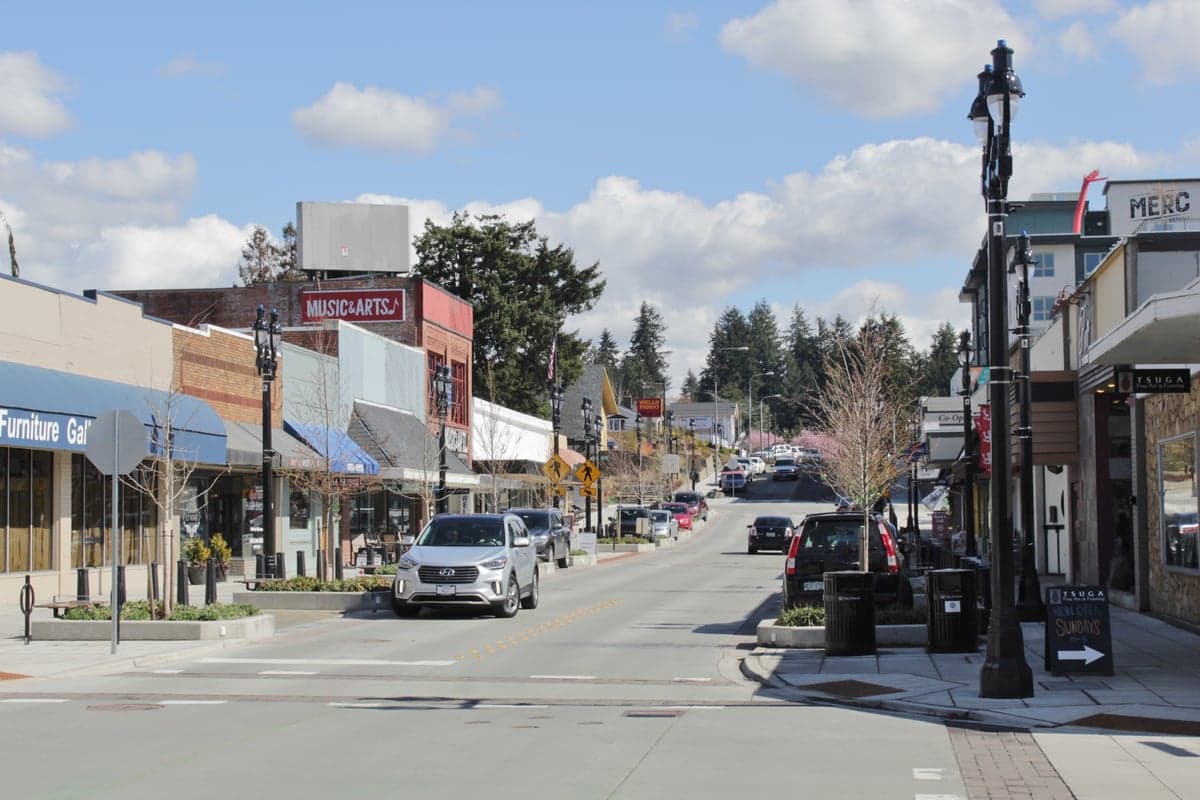
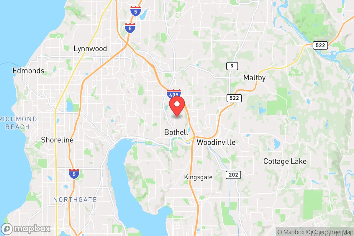
Bothell, Washington, occupies a strategic but precarious position in the Pacific Northwest, offering genuine resilience advantages for those preparing for civic unrest or large-scale disruptions, but only if its proximity to major urban and military targets is fully understood. Nestled along the Sammamish River roughly 15 miles northeast of downtown Seattle and 10 miles from the Microsoft-heavy Redmond campus, Bothell benefits from a semi-rural feel within a suburban shell—ample tree cover, a network of greenbelts, and access to the Cascade foothills for retreat. However, its location within the I-405 corridor, a primary evacuation and supply route, means it sits directly in the path of any Seattle-area crisis, from earthquake liquefaction zones to civil unrest spillover. For a conservative-leaning relocator prioritizing self-sufficiency and low-profile living, Bothell is a mixed bag: strong local resources, but dangerously close to the kind of population centers that become liabilities when the system falters.
Geographic position and natural advantages for long-term survival
Bothell’s geography is its strongest card, but it’s a card that requires careful play. The city straddles the Sammamish River Valley, with the Cascade Range rising to the east—a natural barrier and potential bug-out zone. The area’s dense coniferous forests and numerous small lakes (like Lake Washington to the west and Lake Sammamish to the south) provide abundant water sources, though surface water requires treatment. The terrain is hilly but not mountainous, offering decent defensibility without the isolation that complicates resupply. Bothell’s average annual rainfall of 37 inches ensures reliable water for catchment systems, but the mild, wet climate also means mold and rot are constant concerns for stored supplies. The city’s position along the Sammamish River Trail and Burke-Gilman Trail network gives foot or bike access to the Cascade foothills—a potential escape route if the I-405 corridor becomes impassable. For a prepper, the key advantage is the ability to blend into a suburban environment while maintaining quick access to wilderness; the key risk is that thousands of others have the same idea.
Risks, exposures, and proximity to fallout-relevant landmarks
The elephant in the room is Bothell’s proximity to Seattle, Redmond, and the Puget Sound Naval Shipyard in Bremerton—all high-value targets in any conflict scenario. Bothell lies roughly 20 miles from Naval Base Kitsap, home to Trident submarines and a major nuclear weapons depot, making it a potential secondary target or fallout zone in a nuclear exchange. The city is also within the blast radius of a conventional attack on the Boeing Everett Factory (30 miles north) or the Microsoft campus (5 miles south). For civil unrest, Bothell’s location on the I-405 corridor means it would be a chokepoint for refugees fleeing Seattle; the 2020 CHAZ protests demonstrated how quickly Seattle’s unrest can spill into the suburbs. Earthquake risk is high—the Cascadia Subduction Zone could produce a 9.0+ megathrust quake, with Bothell sitting on alluvial soils prone to liquefaction. The city’s emergency management plan assumes 72 hours of self-sufficiency, but a major event would likely require weeks. The presence of the University of Washington Bothell campus (6,000+ students) and the nearby EvergreenHealth hospital (a regional trauma center) are double-edged swords: they provide medical resources but also attract crowds and potential looting.
Practical resilience for a relocator: food, water, energy, and defensibility
For a relocator serious about self-sufficiency, Bothell offers a mixed but workable baseline. Water is the strongest asset: the Sammamish River, Lake Washington, and numerous creeks provide year-round surface water, but all require filtration or boiling due to agricultural runoff and urban pollutants. Rainwater catchment is viable, with average monthly rainfall of 3-4 inches, but local regulations may restrict large-scale collection. Food resilience is weaker—Bothell has limited agricultural land, with most soil being clay-heavy and acidic. Community gardens exist but are small; the nearest farmable land is in the Snoqualmie Valley (15 miles east). Energy independence is feasible but expensive: the area’s frequent cloud cover makes solar marginal (average 3.5 peak sun hours per day), but micro-hydro from the river or creeks is possible for properties with water rights. Wood heating is common, with firewood available from state forests (e.g., Tolt River area), but air quality regulations restrict burning during inversions. Defensibility is moderate: Bothell’s winding roads and tree cover provide natural concealment, but the suburban layout means neighbors are close—good for mutual aid, bad for operational security. The city’s police force is well-funded (about 1.5 officers per 1,000 residents), but response times would stretch thin during a crisis. For a prepper, the ideal setup is a property on the eastern edge near the Cascade foothills, with a well, solar backup, and a wood stove, plus a pre-planned bug-out route to the Mount Baker-Snoqualmie National Forest.
Overall, Bothell is a calculated risk for the conservative relocator. It offers genuine natural advantages—water, tree cover, and proximity to wilderness—but these are offset by its position in a high-risk corridor between Seattle and military targets. The city’s infrastructure is robust for daily life but brittle for long-term disruption; the 2021 heat dome and 2023 wildfire smoke events showed how quickly the grid and supply chains can falter. For a single individual or family willing to invest in off-grid systems and maintain a low profile, Bothell can work as a base of operations, but it is not a retreat. The smart play is to treat it as a staging area: build resilience here, but have a secondary location east of the Cascades (e.g., Cle Elum or Ellensburg) for when the I-405 corridor becomes a liability. In a world where Seattle’s instability is a given, Bothell is a buffer zone, not a sanctuary—and that distinction matters when the lights go out.
* Values derived from national, state, county, city and local statistics and may differ in a specific area. Last updated: 2026-04-21T11:16:35.000Z
Narrative content on this page is AI-generated and may contain mistakes. Verify any details that matter before acting on them.
ReloMaps may earn a commission from affiliate links at no extra cost to you.