
Photo: Wikipedia
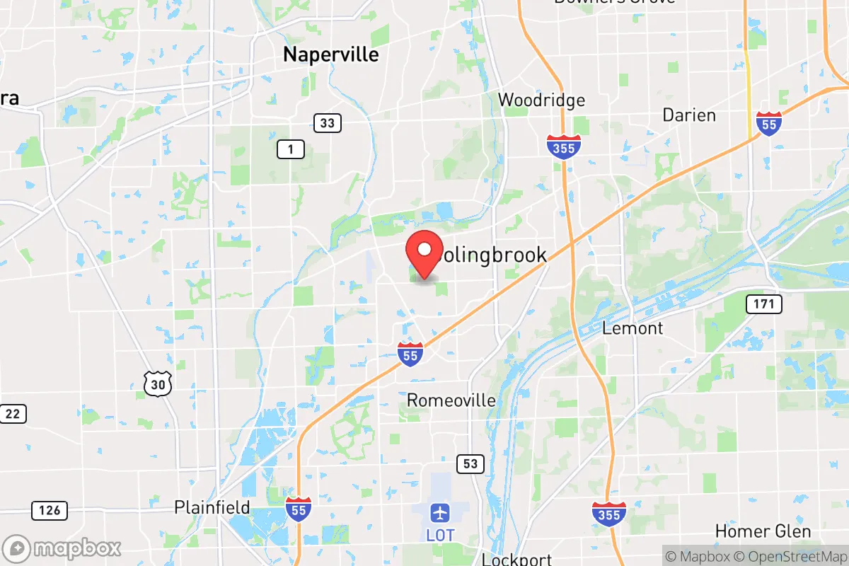
Strategic Assessment of Bolingbrook, IL
Multiple tactical vulnerabilities. Population density, target proximity, or disaster risk are likely compounding. A retreat property and exit planning is required.
What does the Strategic Assessment tell us?
Our Strategic Assessment grades tactical survivability of an area. Major population centers, military targets, fallout zones, natural disasters, and border exposure all drive risk — lower exposure means a more defensible position in a crisis.
This is heavily inspired by Joel Skousen's Strategic Relocation book. Highly recommended you checkout the book ($)What does this tell us?
Our Strategic Assessment grades tactical survivability of an area. Major population centers, military targets, fallout zones, natural disasters, and border exposure all drive risk — lower exposure means a more defensible position in a crisis.
This is heavily inspired by Joel Skousen's Strategic Relocation book. Highly recommended you checkout the book ($)Strategic Pillars

Key Distances
Regional Safe Places
Below is our recommended "safe zones" in Illinois and the surrounding area based on our strategic heuristics. For most people, it's unrealistic to live in a “safe zone” full-time due to work, family or other personal reasons. They tend to be more rural. However, many of these areas are perfect for second homes and retreat properties that double as a vacation home or even a short-term rental.
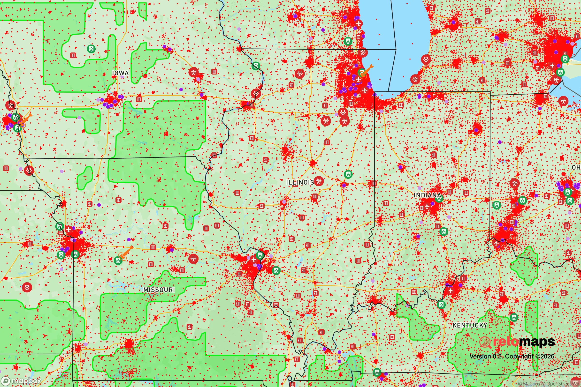
Important Note: For informational purposes only. This does not mean nothing bad ever happens in the green zones. Please use common sense. This is based on public data and modeled with AI. We tried to take a conservative approach but mistakes happen. We update this regularly as new information becomes available.
Solar Generator Recommendations
Backup power matters more here than in safer locations. We've picked three solar generators across budgets and capacity tiers — start with the budget unit if you only need a few essentials, or step up if you want to run a fridge and HVAC for days at a time.

Jackery Portable Power Station Explorer 300
Budget OptionPower on the Go: Weighing only 11 lbs, it's convenient to set up and store with book-sized foldable solar panels

BLUETTI Portable Power Station AC180
Designed for both indoor and outdoor scenarios, AC180 is highly capable as it has a robost capacity and continuous output power.

EF ECOFLOW DELTA Pro Ultra Power Station
Upgraded PickEcoFlow DELTA Pro Ultra is a whole-home energy system designed to grow with your family. Integrated with the Smart Home Panel 2, it scales to meet your evolving energy needs — keeping your home powered, intelligent, and secure through every stage of life.
We earn a commission, at no additional cost to you.
Strategic Assessment Analysis
Bolingbrook, Illinois, sits in a precarious strategic position that demands careful consideration for anyone prioritizing long-term resilience and self-sufficiency. Located roughly 30 miles southwest of Chicago, this village of roughly 74,000 residents offers a mixed bag of advantages and liabilities for a prepper or survivalist-minded relocator. Its proximity to major interstate corridors (I-55 and I-355) provides rapid egress options, but that same connectivity makes it a potential chokepoint during a crisis. The area's flat, fertile terrain and access to the Des Plaines River valley offer some natural resource advantages, but the overall picture is one of a suburban community that would face severe strain during any large-scale disruption. For a conservative-leaning individual concerned about civic unrest, mass casualty events, or societal breakdown, Bolingbrook requires a sober assessment of its strengths and glaring vulnerabilities.
Geographic position and natural advantages for long-term survival
Bolingbrook's location in the DuPage River watershed provides a modest but real water security advantage. The DuPage River runs through the village's eastern edge, and several forest preserves—like Whalon Lake and Hidden Lakes—offer potential water sources and foraging grounds. The area sits on relatively flat, fertile glacial till soil, which means backyard gardening is feasible, though the heavy clay content requires amendment for serious food production. The village's elevation is around 700 feet above sea level, offering no significant defensive high ground but also minimal flood risk outside of the immediate river floodplains. The region's four-season climate provides a reliable growing season from April to October, but winters are harsh, with average January lows around 16°F and occasional polar vortex events dropping temperatures below -20°F. This cold reality means any off-grid heating plan must be robust—wood stoves are viable given the surrounding forest preserves, but fuel supply would be a constant concern. The area's natural advantages are real but modest: adequate water access, workable soil, and a climate that supports agriculture, but no natural barriers or defensible terrain to speak of.
Risks, exposures, and proximity to fallout-relevant landmarks
The single greatest strategic liability of Bolingbrook is its proximity to Chicago and the associated target density. The village lies within 35 miles of the Chicago metropolitan area's core, which includes O'Hare International Airport, the nation's second-busiest airport and a prime target for any state-actor attack. Additionally, the Argonne National Laboratory sits just 12 miles southeast in Lemont—a facility that, while primarily research-focused, represents a potential secondary target or source of hazardous material release. The I-55 corridor, which runs directly through Bolingbrook, would become a parking lot during any evacuation scenario, trapping residents in place. The village is also within 20 miles of the Will County nuclear plants (Braidwood and Dresden), both of which are aging facilities that present a radiological risk in the event of a major earthquake or sabotage. On the civil unrest front, Bolingbrook's demographics have shifted significantly over the past decade, with the village now roughly 40% Hispanic, 35% white, and 20% Black—a diversity that, while not inherently problematic, could become a flashpoint during resource scarcity. The 2020 civil unrest saw protests in nearby Naperville and Joliet, and Bolingbrook's own police force of roughly 120 officers would be quickly overwhelmed in a widespread crisis. The village's location in a Democratic stronghold (Will County voted +15 for Biden in 2020) also means local governance may not align with the self-reliance priorities of a conservative prepper.
Practical resilience for a relocator: food, water, energy, and defensibility
For a relocator looking to establish a resilient homestead, Bolingbrook presents a mixed picture. Water security is the strongest asset: the village draws from Lake Michigan via the Chicago water system, but private wells are common in the older, unincorporated areas on the village's outskirts. A well-equipped property with a hand pump and a backup generator could provide reliable water even during grid failure. The DuPage River is a backup source, but it carries agricultural runoff and requires robust filtration. Food production is feasible but limited by lot sizes: typical suburban lots in Bolingbrook range from 0.25 to 0.5 acres, enough for a substantial garden and a few fruit trees, but not for livestock without zoning variances. The village allows chickens (up to 6 hens, no roosters) with a permit, but larger animals like goats or pigs are prohibited in most residential zones. For bulk food storage, basements are common in homes built before 2000, but many newer developments have slab foundations, limiting long-term storage options. Energy resilience is a weak point: the grid is served by ComEd, which has a mixed reliability record—outages during summer storms and winter ice events are common, but typically short (under 24 hours). Solar is viable, with the area averaging 4.2 peak sun hours per day, but homeowners' associations in many subdivisions restrict panel placement. Natural gas is the primary heating fuel, which means a gas generator is the most practical backup option, but fuel storage (propane or gasoline) requires careful planning given suburban fire codes. Defensibility is the biggest concern: Bolingbrook is a sprawling, flat suburb with no natural chokepoints or defensible terrain. The village's layout—a grid of cul-de-sacs and arterial roads—makes it easy to navigate but hard to secure. During a breakdown, the I-55 and I-355 interchanges would become contested zones, and the village's proximity to Joliet (a major prison and industrial hub) means potential refugee flows from the south. The local police are professional but under-resourced, and the Will County Sheriff's Office would be stretched thin. For a relocator, the best defensive strategy would be to secure a property on the village's rural fringe, near the DuPage River or the forest preserves, where natural cover and limited access points provide some advantage.
The overall strategic picture for Bolingbrook is one of calculated risk. It offers genuine advantages in water access, soil quality, and proximity to multiple egress routes, but these are offset by severe vulnerabilities: proximity to high-value targets, a dense and diverse population that could become unstable during crisis, and a flat, indefensible geography. For a single individual or family willing to invest in a well-equipped property on the village's outskirts—with a private well, solar panels, a wood stove, and a substantial food cache—Bolingbrook could serve as a viable base for a few years of post-disaster survival. But for anyone seeking a truly resilient long-term position, the area's fundamental exposure to Chicago's shadow makes it a second-tier choice at best. The smart play here is to treat Bolingbrook as a temporary staging point—a place to build skills and resources while scouting more defensible ground further west or south, where population density drops and natural barriers increase. In the end, Bolingbrook is a place you can survive in, but not one you can thrive in when the world goes sideways.
* Values derived from national, state, county, city and local statistics and may differ in a specific area. Last updated: 2026-04-30T01:32:34.000Z
Narrative content on this page is AI-generated and may contain mistakes. Verify any details that matter before acting on them.
ReloMaps may earn a commission from affiliate links at no extra cost to you.