Photo: Wikipedia
Strategic Assessment of Bladensburg, MD
Multiple tactical vulnerabilities. Population density, target proximity, or disaster risk are likely compounding. A retreat property and exit planning is required.
What does the Strategic Assessment tell us?
Our Strategic Assessment grades tactical survivability of an area. Major population centers, military targets, fallout zones, natural disasters, and border exposure all drive risk — lower exposure means a more defensible position in a crisis.
This is heavily inspired by Joel Skousen's Strategic Relocation book. Highly recommended you checkout the book ($)What does this tell us?
Our Strategic Assessment grades tactical survivability of an area. Major population centers, military targets, fallout zones, natural disasters, and border exposure all drive risk — lower exposure means a more defensible position in a crisis.
This is heavily inspired by Joel Skousen's Strategic Relocation book. Highly recommended you checkout the book ($)Strategic Pillars

Key Distances
Regional Safe Places
Below is our recommended "safe zones" in Maryland and the surrounding area based on our strategic heuristics. For most people, it's unrealistic to live in a “safe zone” full-time due to work, family or other personal reasons. They tend to be more rural. However, many of these areas are perfect for second homes and retreat properties that double as a vacation home or even a short-term rental.


Important Note: For informational purposes only. This does not mean nothing bad ever happens in the green zones. Please use common sense. This is based on public data and modeled with AI. We tried to take a conservative approach but mistakes happen. We update this regularly as new information becomes available.
Solar Generator Recommendations
Backup power matters more here than in safer locations. We've picked three solar generators across budgets and capacity tiers — start with the budget unit if you only need a few essentials, or step up if you want to run a fridge and HVAC for days at a time.

Jackery Portable Power Station Explorer 300
Budget OptionPower on the Go: Weighing only 11 lbs, it's convenient to set up and store with book-sized foldable solar panels

BLUETTI Portable Power Station AC180
Designed for both indoor and outdoor scenarios, AC180 is highly capable as it has a robost capacity and continuous output power.

EF ECOFLOW DELTA Pro Ultra Power Station
Upgraded PickEcoFlow DELTA Pro Ultra is a whole-home energy system designed to grow with your family. Integrated with the Smart Home Panel 2, it scales to meet your evolving energy needs — keeping your home powered, intelligent, and secure through every stage of life.
We earn a commission, at no additional cost to you.
Strategic Assessment Analysis
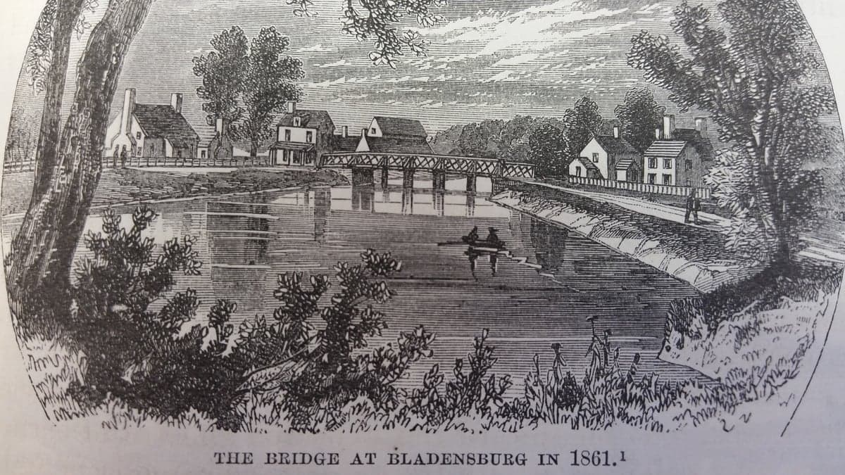
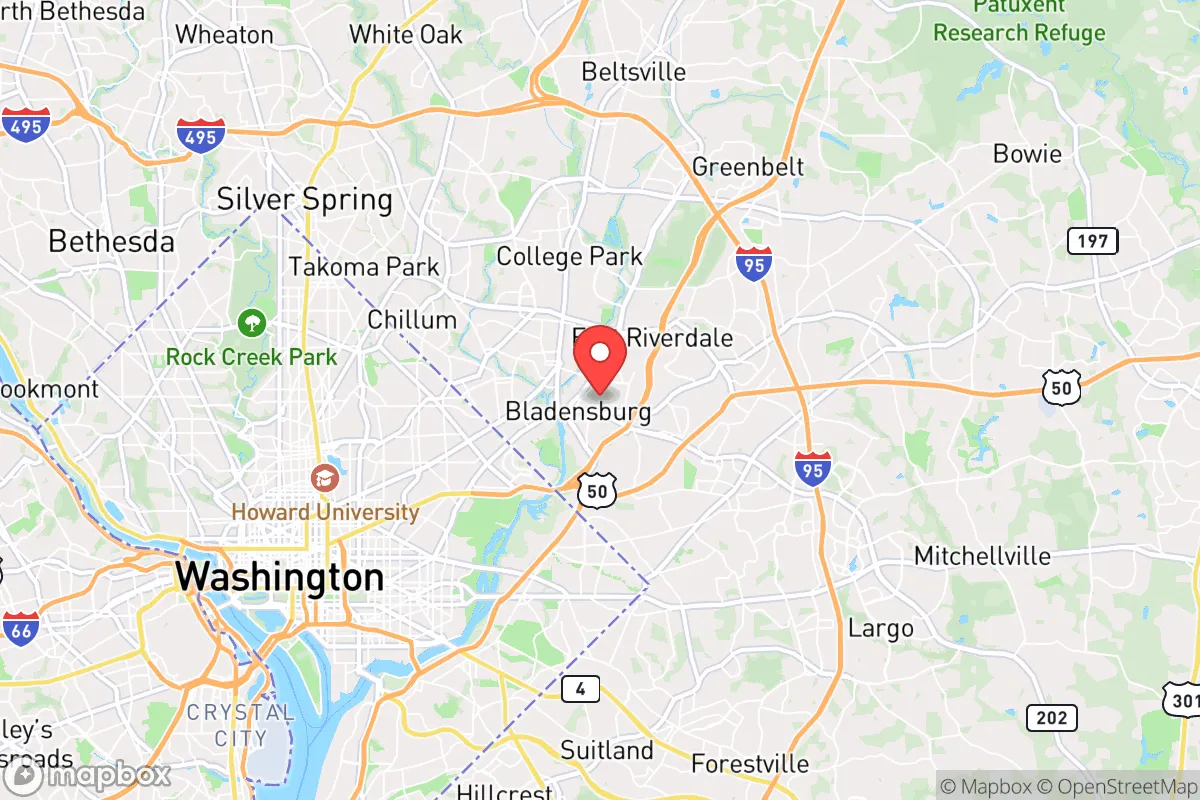
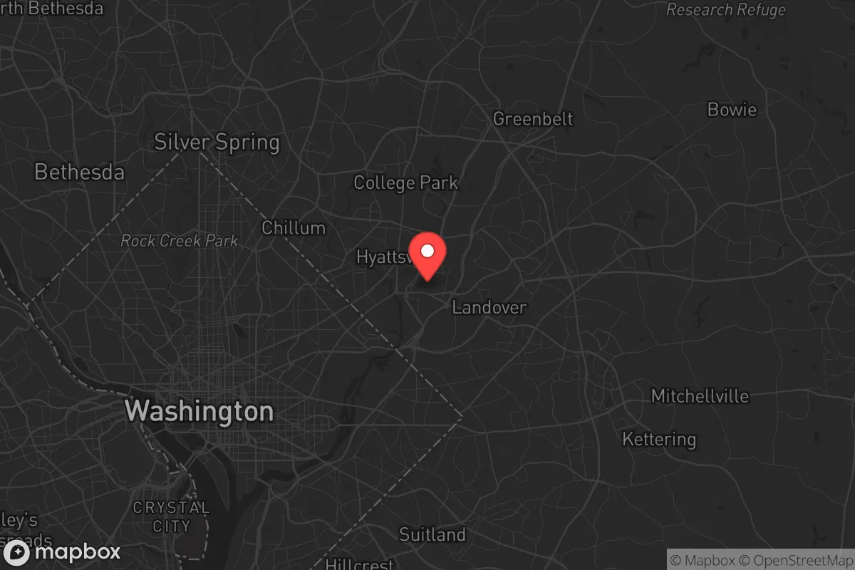
Bladensburg, Maryland, sits in a precarious strategic position that demands a clear-eyed assessment for anyone serious about long-term preparedness. While its location just inside the Capital Beltway offers immediate access to infrastructure and supply lines, that same proximity to Washington, D.C. makes it a high-risk zone for the kind of civic unrest, mass casualty events, and systemic disruptions that preppers and survivalists are actively planning for. The town’s resilience is fundamentally compromised by its geography—close to major government targets, transportation hubs, and population centers that would be primary fallout zones in any major crisis. For a conservative-leaning relocator weighing self-sufficiency and security, Bladensburg presents more liabilities than assets, though a few niche advantages exist for those who understand the terrain.
Geographic position and natural advantages for a prepper
Bladensburg’s location at the confluence of the Anacostia River and Northeast Branch provides a natural water source, which is a non-negotiable asset in any long-term survival scenario. The surrounding area includes patches of wooded terrain and the nearby Bladensburg Waterfront Park, offering limited cover and potential foraging grounds. The town sits roughly 8 miles from the U.S. Capitol, placing it within a 30-minute drive of the federal core—a double-edged sword. On one hand, this proximity means access to major supply corridors like U.S. Route 1 and the Baltimore-Washington Parkway, which could be used for resupply or evacuation if secured early. On the other hand, these same routes would be choke points during any mass evacuation, likely gridlocked within hours of a major event. The natural elevation is low—around 30 feet above sea level—offering no defensive high ground, and the river system is prone to flooding, which could compromise any below-ground storage or bug-out locations. For a prepper, the area’s natural advantages are minimal: water is available but contaminated by urban runoff, and the terrain offers little concealment from the dense suburban sprawl that surrounds it.
Risks, exposures, and proximity to fallout-relevant landmarks
The single greatest risk for Bladensburg is its position within the D.C. metropolitan area’s “kill zone” for any large-scale event. The town is less than 5 miles from Joint Base Andrews, a primary military airfield that would be a target in any conflict or a staging ground for martial law responses. It’s also within 10 miles of the Pentagon, the White House, and the National Mall—all high-value targets for any adversary or domestic disruption. In the event of a mass casualty event like a coordinated attack or civil unrest, Bladensburg would be caught in the secondary shockwave: looters fleeing the city, roadblocks set up by federal agencies, and a likely communications blackout as authorities lock down the region. The town’s population density is roughly 9,000 people per square mile, meaning any evacuation would be chaotic, with limited egress points. The nearby Washington D.C. Metro system and CSX rail lines are both potential vectors for contamination or targeted attacks. For a conservative-minded relocator concerned about federal overreach or societal collapse, being this close to the seat of power is a liability—not an advantage. The area’s history of civil unrest, including the 1968 riots that saw Bladensburg businesses burned, is a reminder that the town is not insulated from D.C.’s volatility.
Practical resilience for a relocator: food, water, energy, defensibility
When assessing day-to-day preparedness, Bladensburg falls short on nearly every metric. Food security is weak: the town has no significant agricultural land, and the nearest farmers’ markets are in Hyattsville or College Park, both of which would be overwhelmed in a crisis. The local grocery options are limited to a few chain stores that would be stripped bare within hours of any disruption. Water is available but compromised: the Anacostia River is heavily polluted with sewage and industrial runoff, requiring advanced filtration or boiling—impractical for long-term use without a reliable fuel source. The town’s water supply comes from the Washington Suburban Sanitary Commission, which is vulnerable to cyberattacks or infrastructure failure. Energy resilience is poor: Bladensburg relies on the regional grid, with no notable off-grid solar or wind installations in the immediate area. Power outages during storms are common, and any prolonged grid failure would leave residents without heating, cooling, or refrigeration. Defensibility is the weakest point: the town’s layout is a mix of older single-family homes and dense apartment complexes, with narrow streets and limited sightlines. There are no natural barriers—no hills, no forests, no rivers wide enough to serve as a moat. A determined group could easily approach from multiple directions, and the lack of a cohesive community network (Bladensburg has a population of just over 9,000, but it’s transient and diverse in ways that don’t foster mutual aid) means you’d likely be on your own. For a single individual or family, the best you could do is harden a single home with reinforced doors, window bars, and a stockpile, but that’s a temporary solution, not a sustainable one.
Overall strategic picture for the conservative prepper
Bladensburg is not a location you choose for long-term survival; it’s a location you pass through or use as a temporary staging point before moving to a more defensible position. The town’s only real strategic value is its access to the D.C. region’s resources—medical facilities like the University of Maryland Medical Center in nearby Baltimore, or the federal stockpiles that might be distributed in a crisis. But that access comes at the cost of being in the bullseye. For a conservative relocator who values self-reliance, community cohesion, and distance from government overreach, Bladensburg is a hard pass. The crime rate is above the national average, the schools are underfunded, and the local government is heavily dependent on state and federal funding—all red flags for anyone seeking independence. If you’re already in the area and can’t leave, your best bet is to build a deep network with like-minded neighbors, invest in water filtration and solar panels, and have a bug-out plan for heading west toward the Appalachian foothills. But if you’re looking to relocate with a prepper mindset, look further out—places like Garrett County or the Eastern Shore offer far better defensibility, lower population density, and a political climate more aligned with conservative values. Bladensburg is a strategic liability dressed up in suburban convenience, and the risks far outweigh the rewards.
* Values derived from national, state, county, city and local statistics and may differ in a specific area. Last updated: 2026-04-22T02:45:51.000Z
Narrative content on this page is AI-generated and may contain mistakes. Verify any details that matter before acting on them.
ReloMaps may earn a commission from affiliate links at no extra cost to you.