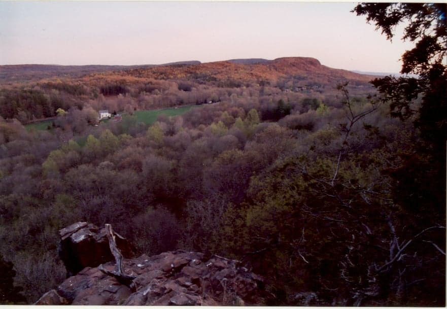
Photo: Wikipedia
Strategic Assessment of Berlin, CT
Multiple tactical vulnerabilities. Population density, target proximity, or disaster risk are likely compounding. A retreat property and exit planning is required.
What does the Strategic Assessment tell us?
Our Strategic Assessment grades tactical survivability of an area. Major population centers, military targets, fallout zones, natural disasters, and border exposure all drive risk — lower exposure means a more defensible position in a crisis.
This is heavily inspired by Joel Skousen's Strategic Relocation book. Highly recommended you checkout the book ($)What does this tell us?
Our Strategic Assessment grades tactical survivability of an area. Major population centers, military targets, fallout zones, natural disasters, and border exposure all drive risk — lower exposure means a more defensible position in a crisis.
This is heavily inspired by Joel Skousen's Strategic Relocation book. Highly recommended you checkout the book ($)Strategic Pillars

Key Distances
Regional Safe Places
Below is our recommended "safe zones" in Connecticut and the surrounding area based on our strategic heuristics. For most people, it's unrealistic to live in a “safe zone” full-time due to work, family or other personal reasons. They tend to be more rural. However, many of these areas are perfect for second homes and retreat properties that double as a vacation home or even a short-term rental.




Important Note: For informational purposes only. This does not mean nothing bad ever happens in the green zones. Please use common sense. This is based on public data and modeled with AI. We tried to take a conservative approach but mistakes happen. We update this regularly as new information becomes available.
Solar Generator Recommendations
Backup power matters more here than in safer locations. We've picked three solar generators across budgets and capacity tiers — start with the budget unit if you only need a few essentials, or step up if you want to run a fridge and HVAC for days at a time.

Jackery Portable Power Station Explorer 300
Budget OptionPower on the Go: Weighing only 11 lbs, it's convenient to set up and store with book-sized foldable solar panels

BLUETTI Portable Power Station AC180
Designed for both indoor and outdoor scenarios, AC180 is highly capable as it has a robost capacity and continuous output power.

EF ECOFLOW DELTA Pro Ultra Power Station
Upgraded PickEcoFlow DELTA Pro Ultra is a whole-home energy system designed to grow with your family. Integrated with the Smart Home Panel 2, it scales to meet your evolving energy needs — keeping your home powered, intelligent, and secure through every stage of life.
We earn a commission, at no additional cost to you.
Strategic Assessment Analysis
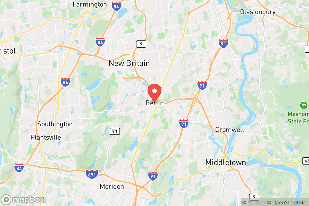
Berlin, Connecticut, occupies a strategic position in the state's central corridor that offers a meaningful blend of accessibility and buffer, making it a location worth serious consideration for those prioritizing disaster readiness and long-term self-sufficiency. Situated roughly 15 miles southwest of Hartford and 30 miles northeast of New Haven, the town sits at the intersection of major transportation arteries—Interstates 91 and 691, as well as the Berlin Turnpike—while maintaining a distinctly suburban-to-rural character that provides more physical separation from dense urban centers than many realize. For a relocator weighing resilience, Berlin's geography presents a workable balance: close enough to regional resources and employment hubs for practical daily life, yet far enough from the highest-risk zones to offer a credible defensive posture in a crisis scenario.
Geographic position and natural advantages for preparedness
Berlin's location within the Connecticut River Valley provides several inherent advantages for a resilience-minded household. The town's elevation varies significantly, with higher ground in the western sections near the Hanging Hills and lower floodplain areas along the Mattabesset River and the Connecticut River's western edge. For a relocator, this means the western half of Berlin—neighborhoods near the Meriden line and around the Berlin Turnpike's higher elevations—offers natural defensibility and reduced flood risk. The underlying geology is primarily metamorphic bedrock with glacial till soils, which supports stable building foundations and decent groundwater recharge in most areas. The town's 27 square miles include substantial forested tracts, particularly around the Ragged Mountain Memorial Preserve and the Berlin Land Trust properties, which provide both a natural buffer and potential resources for those planning for extended self-reliance. Berlin's distance from the coastline—roughly 25 miles inland—eliminates storm surge risk entirely, a significant advantage over shoreline communities that face hurricane and sea-level-rise threats. The area's climate is typical of central New England: four distinct seasons with average annual snowfall around 40 inches and summer highs rarely exceeding 90°F, meaning temperature extremes are manageable without extraordinary infrastructure.
Risks, exposures, and proximity to fallout-relevant landmarks
No honest assessment of Berlin's resilience can ignore the liabilities that come with its position in the Northeast Corridor. The most significant risk factor is Berlin's proximity to multiple high-value civilian and military infrastructure targets. The town lies approximately 15 miles from Bradley International Airport in Windsor Locks, a dual-use civilian and military airfield that hosts the Connecticut Air National Guard's 103rd Airlift Wing and is a designated alternate landing site for Air Force One. The Pratt & Whitney headquarters in East Hartford—a critical defense supply chain node for military aircraft engines—is roughly 12 miles northeast. The Electric Boat shipyard in Groton, which builds nuclear submarines for the U.S. Navy, sits about 45 miles southeast but remains within the plausible fallout dispersion radius for a major strike. Berlin itself hosts no obvious high-value targets, but its position between Hartford and New Haven places it within the secondary risk zone for any event targeting those cities' transportation hubs, insurance headquarters, or state government facilities. Natural disaster risks are more manageable: the town faces moderate earthquake risk (the Ramapo Fault system is distant but active), occasional inland flooding from nor'easters and tropical remnants, and the standard New England winter storm threats. The Connecticut River floodplain along the town's eastern edge does pose a localized hazard, but the vast majority of Berlin's residential areas sit well above the 100-year flood zone.
Practical resilience for a relocator: food, water, energy, and defensibility
For someone serious about self-sufficiency, Berlin offers a mixed but workable picture. The town's water supply is municipally managed by the Berlin Water Control Commission, drawing primarily from the Ragged Mountain Reservoir system and the Mattabesset River watershed. Private wells are common in the town's more rural sections, particularly west of the Berlin Turnpike and in the Kensington neighborhood, which gives a relocator the option of a decentralized water source independent of the municipal grid—a major resilience advantage. Well depths in the area typically range from 100 to 300 feet, with yields adequate for a household if properly maintained. For food security, Berlin's agricultural resources are limited but present: the town has several active farms including the historic Rose's Berry Farm and a handful of smaller market gardens, but the town is not a food-producing powerhouse. Serious self-sufficiency would require either a substantial home garden (the growing season runs roughly April through October) or a plan to source from the larger agricultural areas in the Connecticut River Valley to the north and south. The town's zoning allows for backyard chickens and small livestock in most residential zones, and the local agricultural commission supports community gardening initiatives. Energy resilience is a brighter spot: Berlin's electric grid is served by Eversource Energy, which has invested in tree-trimming and infrastructure hardening after the repeated storm outages of the 2010s, but a backup generator or solar-plus-battery system is still a wise investment for any preparedness-minded household. The town's defensibility is aided by its road network: the major routes (Routes 9, 72, and the Berlin Turnpike) create natural chokepoints, while the secondary road system offers multiple egress options for those familiar with the area. The western hills provide good vantage points, and the forested areas around the Hanging Hills offer cover and concealment if needed.
The overall strategic picture for Berlin, Connecticut, is one of moderate resilience with specific, manageable vulnerabilities. For a relocator who values being within striking distance of Hartford's medical and supply resources while maintaining physical separation from the highest-risk zones, Berlin offers a credible middle ground. The town's real strength lies in its geographic position—close enough to function as part of the regional economy, far enough from the most obvious targets to provide a meaningful buffer. The weaknesses are real: proximity to defense-industrial infrastructure, dependence on a regional grid that has shown fragility in severe weather, and limited local food production capacity. But for someone willing to invest in a private well, solar backup, and a serious garden operation, Berlin provides a defensible base of operations in a state that offers more natural advantages than most of the Northeast. It is not a remote survivalist retreat, nor does it pretend to be—but for the strategic relocator who wants to stay connected to professional life while maintaining a credible posture of self-reliance, Berlin deserves a serious look.

* Values derived from national, state, county, city and local statistics and may differ in a specific area. Last updated: 2026-07-22T18:23:19.000Z
Narrative content on this page is AI-generated and may contain mistakes. Verify any details that matter before acting on them.
ReloMaps may earn a commission from affiliate links at no extra cost to you.

