
Photo: Joshua J. Cotten via Unsplash
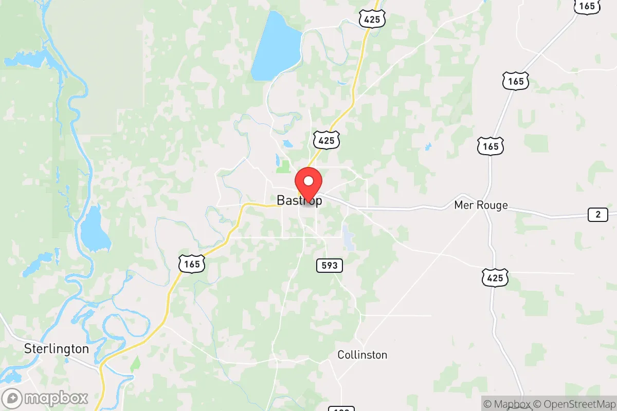
Strategic Assessment of Bastrop, LA
Workable tactical position. Some exposure to population density or targets, but generally defensible in a crisis.
What does the Strategic Assessment tell us?
Our Strategic Assessment grades tactical survivability of an area. Major population centers, military targets, fallout zones, natural disasters, and border exposure all drive risk — lower exposure means a more defensible position in a crisis.
This is heavily inspired by Joel Skousen's Strategic Relocation book. Highly recommended you checkout the book ($)What does this tell us?
Our Strategic Assessment grades tactical survivability of an area. Major population centers, military targets, fallout zones, natural disasters, and border exposure all drive risk — lower exposure means a more defensible position in a crisis.
This is heavily inspired by Joel Skousen's Strategic Relocation book. Highly recommended you checkout the book ($)Strategic Pillars

Key Distances
Regional Safe Places
Below is our recommended "safe zones" in Louisiana and the surrounding area based on our strategic heuristics. For most people, it's unrealistic to live in a “safe zone” full-time due to work, family or other personal reasons. They tend to be more rural. However, many of these areas are perfect for second homes and retreat properties that double as a vacation home or even a short-term rental.

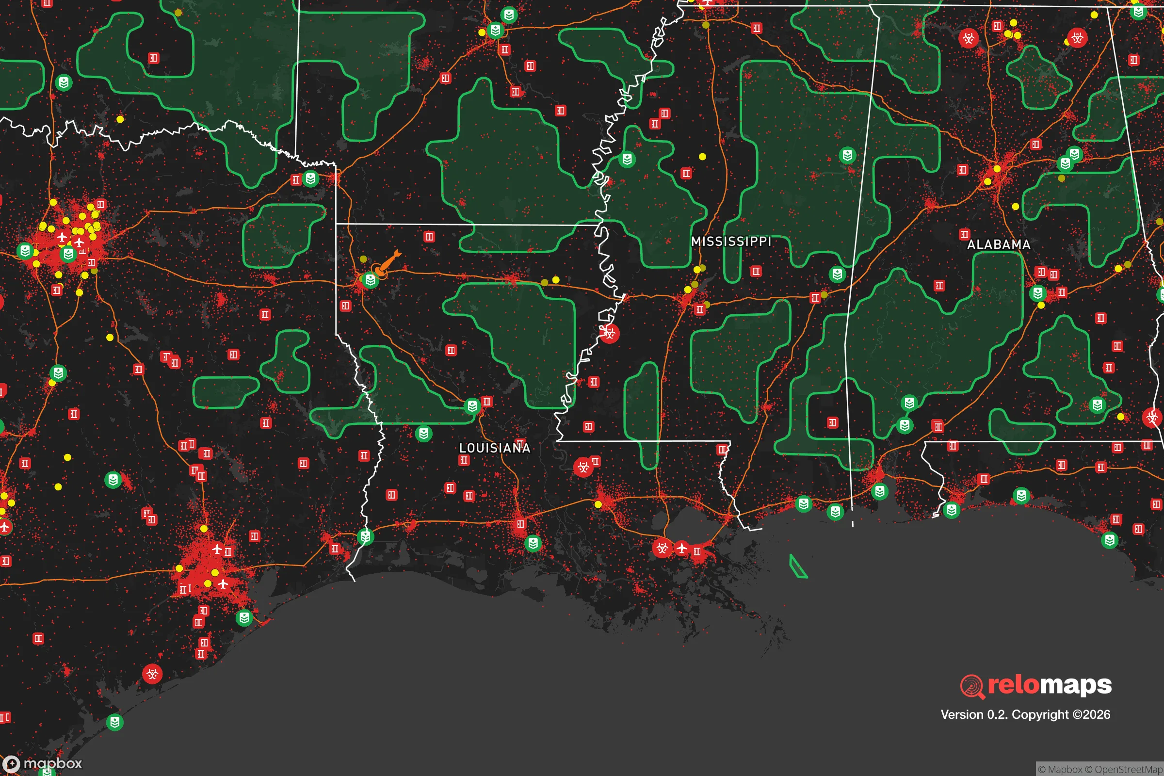
Important Note: For informational purposes only. This does not mean nothing bad ever happens in the green zones. Please use common sense. This is based on public data and modeled with AI. We tried to take a conservative approach but mistakes happen. We update this regularly as new information becomes available.
Solar Generator Recommendations
Backup power matters more here than in safer locations. We've picked three solar generators across budgets and capacity tiers — start with the budget unit if you only need a few essentials, or step up if you want to run a fridge and HVAC for days at a time.

Jackery Portable Power Station Explorer 300
Budget OptionPower on the Go: Weighing only 11 lbs, it's convenient to set up and store with book-sized foldable solar panels

BLUETTI Portable Power Station AC180
Designed for both indoor and outdoor scenarios, AC180 is highly capable as it has a robost capacity and continuous output power.

EF ECOFLOW DELTA Pro Ultra Power Station
Upgraded PickEcoFlow DELTA Pro Ultra is a whole-home energy system designed to grow with your family. Integrated with the Smart Home Panel 2, it scales to meet your evolving energy needs — keeping your home powered, intelligent, and secure through every stage of life.
We earn a commission, at no additional cost to you.
Strategic Assessment Analysis
Bastrop, Louisiana, offers a strategic paradox for the conservative prepper: it sits within striking distance of a major metropolitan area yet retains the quiet, low-profile character of a Deep South river town. Its location along the Ouachita River and its position as the seat of Morehouse Parish give it a degree of institutional stability—courthouse, hospital, local law enforcement—that many rural patches lack. For a relocator weighing resilience against proximity to risk, Bastrop is a place that demands a clear-eyed assessment of both its natural advantages and its uncomfortable nearness to potential fallout zones.
Geographic position and natural advantages for long-term security
Bastrop’s primary strategic asset is its location in the Mississippi Delta region, roughly 25 miles south of the Arkansas line and about 30 miles west of the Mississippi River. This places it in a corridor of relatively low population density compared to the I-20 or I-10 corridors. The surrounding Morehouse Parish is heavily agricultural—cotton, soybeans, corn, and timber—which means the land itself can support food production and offers ample hunting opportunities for deer, turkey, and small game. The Ouachita River, which flows past the eastern edge of town, provides a reliable surface water source and a potential transportation route if roads become compromised. The area’s flat terrain and clay-loam soils are well-suited for gardening and small-scale farming, and the long growing season (roughly 230 frost-free days) allows for multiple crop cycles. Groundwater is generally accessible via shallow wells in the alluvial plain, though water quality varies and testing is advised. The region’s low seismic risk and absence of wildfire or hurricane storm surge (Bastrop is over 100 miles inland) reduce the likelihood of natural disaster forcing a relocation. For a prepper, the land itself is a buffer—sparse enough to avoid crowds, fertile enough to sustain a household.
Risks, exposures, and proximity to fallout-relevant landmarks
The most significant vulnerability for Bastrop is its proximity to Monroe, Louisiana, roughly 20 miles to the southwest. Monroe is a regional hub with a population of about 48,000, a regional medical center, and a commercial airport. In a scenario of civil unrest or supply chain collapse, Monroe could become a source of looting, refugee flow, or resource competition. Bastrop’s own population of roughly 10,000 means it is not immune to crime or social friction, but it is small enough that community ties and local knowledge still matter. More concerning is the presence of industrial infrastructure along the Mississippi River corridor, including chemical plants and refineries near Baton Rouge and New Orleans, roughly 150–200 miles south. A major industrial accident or terrorist event on the river could send toxic plumes or disrupt barge traffic, but Bastrop’s distance and prevailing wind patterns (generally from the south) offer some mitigation. There are no nuclear power plants within 100 miles, and the nearest major military installation is Barksdale Air Force Base near Shreveport, about 90 miles west—a potential target but far enough to avoid direct blast effects. The biggest practical risk is flooding: parts of Bastrop lie in the Ouachita River floodplain, and heavy rain events can cause localized inundation. Checking FEMA flood maps before buying property is non-negotiable. For a relocator, the calculus is that Bastrop is far enough from major cities to avoid the worst of urban collapse, but close enough that a regional crisis could still wash over it.
Practical resilience for a relocator: food, water, energy, and defensibility
Bastrop’s practical resilience hinges on its agricultural base and the ability to operate off-grid without drawing attention. Local grocery options are limited to a Walmart Supercenter and a few smaller markets, so a serious prepper will want to establish a garden and secure bulk food storage immediately. The Morehouse Parish Farmers Market operates seasonally, and direct relationships with local farmers are feasible—cotton and soybean farmers often sell produce or eggs on the side. For water, a private well is the gold standard; the local water table is high enough that drilling a shallow well (50–100 feet) is common and affordable. Rainwater catchment is also viable given the region’s 50+ inches of annual rainfall. Energy resilience is straightforward: the area gets ample sun for solar panels, and many rural properties already have propane tanks for heating or cooking. Wood heat is a practical backup, as timber is abundant and firewood permits are easy to obtain from the Louisiana Department of Agriculture and Forestry. Defensibility is mixed. Bastrop’s street grid is typical of a small Southern town—wide roads, open lots, and a mix of older homes and newer subdivisions. A property on the outskirts, with a long driveway and clear sightlines, offers better security than a house near the town square. The local sheriff’s office is responsive but understaffed (roughly 30 deputies for the entire parish), so self-reliance in security is expected. The broader community is conservative, church-oriented, and generally armed—cultural factors that reduce the likelihood of organized crime but do not eliminate the risk of petty theft or trespassing. For a relocator, the key is to buy land with a water source, establish a garden, and keep a low profile. Bastrop is not a fortress, but it is a place where a prepared individual can operate without constant interference.
The overall strategic picture for Bastrop is one of moderate resilience with clear trade-offs. It offers fertile land, abundant water, low natural disaster risk, and a conservative social fabric that values self-sufficiency. Its drawbacks are its proximity to Monroe, its flood risk in low-lying areas, and the reality that no location in the Lower 48 is truly remote. For a single individual or a family willing to invest in a well, solar panels, and a garden, Bastrop provides a viable base of operations for weathering regional disruptions. It is not a bug-out location for a total collapse scenario—there are too many people and too little geographic isolation for that—but it is a solid choice for a long-term, low-drama relocation where the goal is to live quietly, grow food, and stay off the grid’s radar. The smart move is to visit during a wet season, talk to locals at the feed store, and buy high ground. Bastrop will not save you from everything, but it will give you a fighting chance.
* Values derived from national, state, county, city and local statistics and may differ in a specific area. Last updated: 2026-05-01T05:15:00.000Z
Narrative content on this page is AI-generated and may contain mistakes. Verify any details that matter before acting on them.
ReloMaps may earn a commission from affiliate links at no extra cost to you.