
Photo: Wikipedia
Strategic Assessment of Argyle, TX
Meaningful friction. Expect exposure to either population pressure, blast zones, or natural disaster risk. Consider buying a retreat property.
What does the Strategic Assessment tell us?
Our Strategic Assessment grades tactical survivability of an area. Major population centers, military targets, fallout zones, natural disasters, and border exposure all drive risk — lower exposure means a more defensible position in a crisis.
This is heavily inspired by Joel Skousen's Strategic Relocation book. Highly recommended you checkout the book ($)What does this tell us?
Our Strategic Assessment grades tactical survivability of an area. Major population centers, military targets, fallout zones, natural disasters, and border exposure all drive risk — lower exposure means a more defensible position in a crisis.
This is heavily inspired by Joel Skousen's Strategic Relocation book. Highly recommended you checkout the book ($)Strategic Pillars

Key Distances
Regional Safe Places
Below is our recommended "safe zones" in Texas and the surrounding area based on our strategic heuristics. For most people, it's unrealistic to live in a “safe zone” full-time due to work, family or other personal reasons. They tend to be more rural. However, many of these areas are perfect for second homes and retreat properties that double as a vacation home or even a short-term rental.


Important Note: For informational purposes only. This does not mean nothing bad ever happens in the green zones. Please use common sense. This is based on public data and modeled with AI. We tried to take a conservative approach but mistakes happen. We update this regularly as new information becomes available.
Solar Generator Recommendations
Backup power matters more here than in safer locations. We've picked three solar generators across budgets and capacity tiers — start with the budget unit if you only need a few essentials, or step up if you want to run a fridge and HVAC for days at a time.

Jackery Portable Power Station Explorer 300
Budget OptionPower on the Go: Weighing only 11 lbs, it's convenient to set up and store with book-sized foldable solar panels

BLUETTI Portable Power Station AC180
Designed for both indoor and outdoor scenarios, AC180 is highly capable as it has a robost capacity and continuous output power.

EF ECOFLOW DELTA Pro Ultra Power Station
Upgraded PickEcoFlow DELTA Pro Ultra is a whole-home energy system designed to grow with your family. Integrated with the Smart Home Panel 2, it scales to meet your evolving energy needs — keeping your home powered, intelligent, and secure through every stage of life.
We earn a commission, at no additional cost to you.
Strategic Assessment Analysis
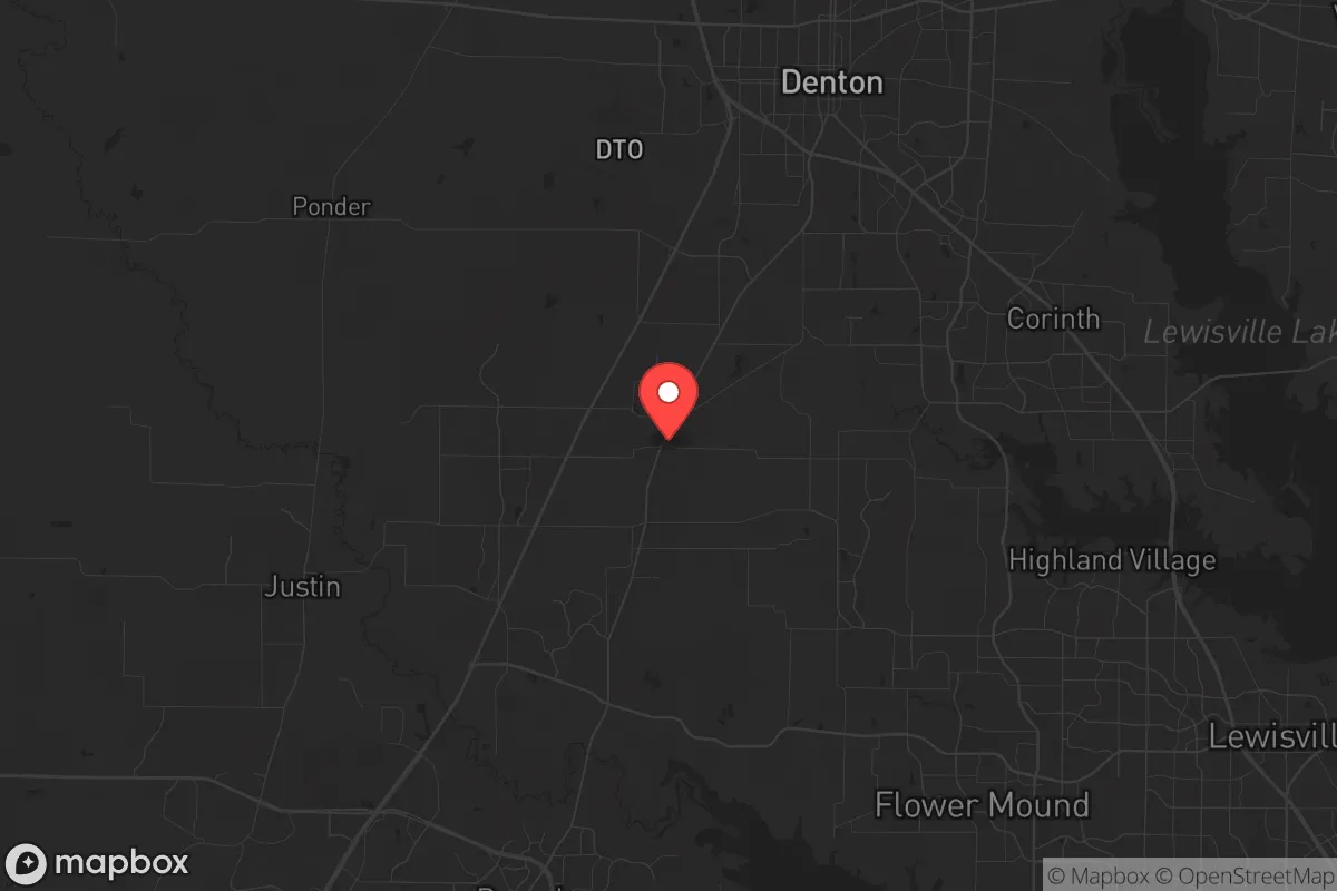
Argyle, Texas, sits in a strategic sweet spot that few relocation guides properly assess: close enough to the economic engine of the Dallas-Fort Worth metroplex to sustain a career and supply chain access, yet far enough north to avoid the worst of a major urban collapse scenario. The town’s position along the I-35W corridor, roughly 30 miles north of Fort Worth and 40 miles from downtown Dallas, places it within a 45-minute drive of DFW Airport and the region’s major medical centers, but the surrounding Denton County landscape—rolling hills, scattered lakes, and ranchland—offers a buffer that denser suburbs like Flower Mound or Highland Village simply lack. For a relocator thinking in terms of resilience, Argyle’s low population density (around 5,000 residents within the town limits, with the broader 76226 ZIP code holding roughly 20,000) means fewer choke points on the roads and a community that still knows its neighbors. The town’s recent growth has been measured, not explosive, which suggests infrastructure has kept pace better than in boomtowns like Celina or Prosper. This isn’t a fortress, but it’s a solid base camp for someone who wants access to urban resources without being trapped inside the blast radius of a major crisis.
Geographic position and natural advantages for long-term security
Argyle’s geography is its first line of defense. The town sits atop the Eastern Cross Timbers, a transitional zone of sandy loam soils and post oak savanna that historically made large-scale agriculture difficult—but for a prepper, that same terrain offers natural cover and water retention. The area is drained by the Elm Fork of the Trinity River, with several smaller creeks like Hickory Creek and Stewart Creek running through the vicinity, providing surface water sources that aren’t dependent on municipal treatment plants. The underlying geology is the Woodbine Formation, a sandstone aquifer that yields moderate groundwater—enough for a well if you’re on enough acreage, though most residential lots in Argyle are 1–5 acres, which limits private well feasibility without a permit. The rolling hills, with elevations ranging from 600 to 800 feet, provide decent line-of-sight advantages for a rural property, and the lack of major floodplains within the town limits means you’re not worrying about a 100-year flood wiping out your supplies. The climate is typical North Texas: hot summers, mild winters, and a tornado risk that’s real but manageable with a storm shelter. The area’s position on the Balcones Fault line is negligible for seismic risk—Texas hasn’t had a damaging earthquake in this region in recorded history. For a relocator, the key takeaway is that Argyle’s natural setting offers defensible terrain, accessible water, and a climate that supports year-round gardening without the extremes of the Panhandle or the humidity of East Texas.
Risks, exposures, and proximity to fallout-relevant landmarks
No strategic assessment is honest without naming the liabilities, and Argyle has several that a survivalist must weigh. The most obvious is proximity to the Dallas-Fort Worth metroplex, a population center of over 7.5 million people. In a scenario involving civil unrest, a major terrorist attack, or a grid-down event, that mass of humanity will become a liability—people will flee the cities, and I-35W and I-35E will become parking lots. Argyle is directly in the path of that exodus. The town is also within 15 miles of the Denton Municipal Airport, which is a general aviation field but could become a target in a conflict scenario, and roughly 25 miles from the Fort Worth Alliance Airport, a major cargo hub that handles FedEx and Amazon freight—both are plausible targets for a sophisticated adversary. On the energy front, Argyle is about 20 miles from the Comanche Peak Nuclear Power Plant in Glen Rose, which is a pressurized water reactor that has operated safely since 1990, but any nuclear incident—whether accident or attack—would put Argyle within the 50-mile ingestion exposure zone. The town is also within 30 miles of the DFW International Airport, a high-value target for any state actor or terrorist group. For a prepper, the calculus is this: Argyle is far enough from the urban core to avoid the immediate blast and fallout of a ground-level nuclear detonation in downtown Dallas, but close enough that secondary effects—panic, refugees, supply chain disruption—will hit within hours. The town’s lack of a major hospital (the nearest Level I trauma center is in Fort Worth, 30 minutes south) is another vulnerability. If you’re looking for a location that’s completely off the grid and out of the blast radius, Argyle isn’t it. But if you want a location that gives you a fighting chance to bug out north or west into the less populated ranchlands of Montague and Clay counties, it’s a viable staging ground.
Practical resilience for a relocator: food, water, energy, and defensibility
For a relocator serious about self-sufficiency, Argyle’s practical resilience is a mixed bag that requires active preparation. The town is served by the Upper Trinity Regional Water District, which draws from the Elm Fork of the Trinity and from Lewisville Lake—a reservoir that holds roughly 600,000 acre-feet of water. In a drought or contamination event, that supply is vulnerable, but the lake is large enough to provide a buffer for months. The smarter play is to drill a private well: the Woodbine aquifer is productive at depths of 200–400 feet, and yields of 10–20 gallons per minute are common. Rainwater catchment is also viable, given the area’s average 36 inches of annual rainfall, though you’ll need a metal roof and a filtration system. On the food front, the growing season runs from March to November, and the sandy loam soil is workable for vegetables, though it’s nutrient-poor and requires amendment. The local farmers’ market in nearby Denton is seasonal, and the Argyle area has a handful of small farms selling eggs, meat, and produce, but you won’t find the deep agricultural infrastructure of the Texas Panhandle. For energy, the grid is served by the Electric Reliability Council of Texas (ERCOT), which has a track record of failures—the 2021 winter storm being the most notorious. Solar is viable: the area averages 220 sunny days per year, and a 10 kW rooftop system with battery storage can cover a typical home’s needs for 8–12 hours of grid outage. Natural gas is available in most subdivisions, but a propane tank is a better bet for off-grid cooking and heating. Defensibility is where Argyle shines relative to denser suburbs: the town’s layout is a mix of large-lot subdivisions and ranch properties, with winding roads and limited through-traffic. The Argyle Police Department is small (roughly 15 officers), but the Denton County Sheriff’s Office has a substation nearby, and the community’s rural character means most residents own firearms. For a relocator, the practical takeaway is that Argyle requires investment—a well, solar panels, a storm shelter, and a stockpile of supplies—but the baseline conditions are favorable enough that those investments pay off.
The overall strategic picture for Argyle is that of a buffer zone, not a redoubt. It’s a place where a prepared individual or family can maintain a normal suburban life while building the infrastructure for a crisis scenario. The town’s location offers the best of both worlds—access to the economic and medical resources of the metroplex during stable times, and a defensible position with natural water sources and escape routes to the sparsely populated north and west during collapse. The risks are real: proximity to major airports, a nuclear power plant, and a massive urban population that will become a liability in any widespread disaster. But for a conservative-leaning relocator who values community, self-reliance, and a slower pace of life, Argyle provides a foundation that can be hardened over time. It’s not a bug-out location—it’s a live-in location that gives you options. If you’re willing to drill a well, install solar, and build relationships with your neighbors, Argyle can be a tenable long-term base. If you’re looking for total isolation and zero risk, keep driving north until you hit the Red River. But for most people serious about resilience, this town is a solid B+—and in a world that’s trending toward chaos, that’s worth a hard look.
* Values derived from national, state, county, city and local statistics and may differ in a specific area. Last updated: 2026-04-19T07:11:34.000Z
Narrative content on this page is AI-generated and may contain mistakes. Verify any details that matter before acting on them.
ReloMaps may earn a commission from affiliate links at no extra cost to you.