Photo: Wikipedia
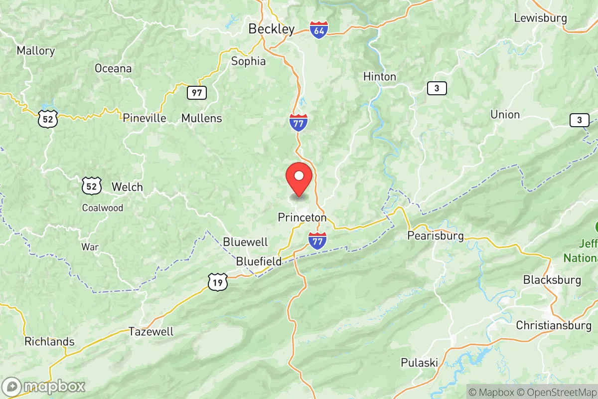
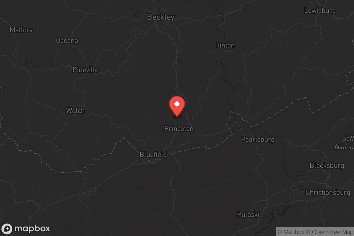
Strategic Assessment of Mercer County
Workable tactical position. Some exposure to population density or targets, but generally defensible in a crisis.
What does the Strategic Assessment tell us?
Our Strategic Assessment grades tactical survivability of an area. Major population centers, military targets, fallout zones, natural disasters, and border exposure all drive risk — lower exposure means a more defensible position in a crisis.
This is heavily inspired by Joel Skousen's Strategic Relocation book. Highly recommended you checkout the book ($)What does this tell us?
Our Strategic Assessment grades tactical survivability of an area. Major population centers, military targets, fallout zones, natural disasters, and border exposure all drive risk — lower exposure means a more defensible position in a crisis.
This is heavily inspired by Joel Skousen's Strategic Relocation book. Highly recommended you checkout the book ($)Strategic Pillars

Key Distances
Strategic Assessment Analysis
Mercer County, West Virginia, offers a strategic relocation option for those prioritizing resilience and distance from major population centers, combining the rugged terrain of the Appalachian Plateau with a surprisingly central position along the I-77 corridor. Its location roughly 90 miles from Roanoke, Virginia, and 120 miles from Charleston, West Virginia, places it outside the immediate blast and fallout zones of major metropolitan targets, while still providing access to regional supply chains and medical infrastructure. The county seat of Princeton and the city of Bluefield serve as practical hubs for daily life, but the surrounding rural areas—think communities like Athens, Matoaka, and Oakvale—offer the kind of low-density, defensible geography that appeals to those planning for long-term self-sufficiency.
Geographic position and natural advantages for long-term security
Mercer County sits in the southernmost tip of West Virginia, bordered by Virginia to the south and Tazewell County to the west, giving it a natural buffer from the denser corridors of the Northeast and Midwest. The area is defined by the Appalachian Mountains, with elevations ranging from roughly 2,000 to 3,500 feet, which provides cooler summers, reliable water sources from numerous creeks and springs, and terrain that naturally limits vehicle-based movement—a key defensive advantage. The New River and Bluestone River systems, along with Bluestone Lake and its associated state park, offer both recreational water access and potential emergency water supplies. Unlike flatter, more exposed regions, the hills and hollows of Mercer County create microclimates and natural chokepoints that can be leveraged for perimeter security. The presence of the East River Mountain and the surrounding national forest land (Jefferson National Forest is just across the Virginia line) adds a layer of resource availability for those with backcountry skills. For a relocator, this geography means you're not just buying a house—you're buying a position that's inherently harder to overrun or disrupt than a suburban subdivision in the Piedmont.
Risks, exposures, and proximity to fallout-relevant landmarks
While Mercer County avoids the worst-case scenarios of being near a major city, it's not without its own risk profile. The closest significant infrastructure target is the Mountain Valley Pipeline corridor, which runs through parts of southern West Virginia and could be a symbolic target for civil unrest or sabotage, though the actual risk of catastrophic failure is low. More concerning is the proximity to the Radford Army Ammunition Plant in Radford, Virginia, roughly 50 miles southeast—a major conventional munitions facility that could be a target in a conflict scenario. The Bluefield Regional Airport and the nearby Princeton–Mercer County Airport are small general aviation fields, not strategic targets, but the I-77 bridge over the East River Mountain is a critical chokepoint that could be disrupted by civil unrest or natural disaster. On the natural disaster front, the area faces moderate risks from flash flooding in narrow valleys (particularly around the Bluestone River) and occasional ice storms that can knock out power for days. The Clinch River and New River watersheds are not prone to the catastrophic flooding seen in eastern Kentucky, but localized events are a real concern. The biggest exposure for a prepper is the lack of a major trauma center—the closest Level 1 trauma center is in Roanoke, 90 minutes away, which means a serious injury during a grid-down event could be a death sentence. That said, the low population density (roughly 60,000 people in the county) means you're not competing with millions for resources during a crisis.
Practical resilience for a relocator: food, water, energy, and defensibility
For those serious about self-sufficiency, Mercer County offers a mix of advantages and trade-offs. Water is generally abundant—most rural properties have access to wells or springs, and the county's average annual rainfall of around 40 inches means rainwater catchment is viable. The Bluestone Lake and Claytor Lake (just across the Virginia line) provide large surface water reserves, though you'll want to filter and treat anything from these sources due to agricultural runoff. Food production is feasible but limited by the short growing season (roughly 150 frost-free days) and acidic mountain soil; raised beds and greenhouses are almost mandatory for serious gardening. Local agriculture is modest—hay, cattle, and some corn—so you'll need to establish relationships with farmers in nearby Tazewell County or Bland County for bulk grains and livestock. Energy resilience is a bright spot: the area has good solar potential despite the cloud cover, and the hilly terrain allows for micro-hydro setups on year-round streams. Wood heating is the standard here, with abundant hardwood forests on both public and private land. Defensibility is the county's strongest card—the narrow valleys and single-road access to many hollows mean a small group can effectively control movement into their area. The East River Mountain and Flat Top Mountain ridges offer natural observation points, and the lack of major interstate interchanges within the county (I-77 runs through, but exits are spaced far apart) reduces the risk of refugee flows from urban centers. The biggest practical gap is medical infrastructure: Princeton Community Hospital is a solid rural facility, but it's not equipped for trauma or prolonged grid-down operations. Stockpiling antibiotics, trauma supplies, and having a telemedicine plan is non-negotiable.
The overall strategic picture for Mercer County is one of a solid, if unglamorous, fallback position. It's not a prepper paradise with year-round growing seasons and isolated bunkers—it's a working-class Appalachian county with real infrastructure, real communities, and a geography that naturally filters out the unprepared. The proximity to the New River Gorge and the Jefferson National Forest provides recreational buffer zones and resource extraction opportunities, while the distance from major targets like Washington D.C. (roughly 300 miles) and the Norfolk naval complex (roughly 350 miles) means you're unlikely to see fallout or refugee waves in a limited conflict. The conservative culture of the area—strong church presence, hunting tradition, and a general distrust of federal overreach—aligns well with a prepper mindset, and the local economy is resilient enough that you can find work in healthcare, logistics, or remote tech without being dependent on a single industry. The trade-off is that you're trading convenience for security: you'll drive 30 minutes for a Home Depot, you'll deal with spotty internet in the hollows, and you'll need to be comfortable with a slower pace of life. For a single individual or family looking to plant roots in a place that won't be on the front page of the news when things go sideways, Mercer County is a legitimate contender—just make sure you bring your own water filtration and a good chainsaw.
* Values derived from national, state, county, city and local statistics and may differ in a specific area. Last updated: 2026-05-12T12:12:40.000Z
Narrative content on this page is AI-generated and may contain mistakes. Verify any details that matter before acting on them.
ReloMaps may earn a commission from affiliate links at no extra cost to you.