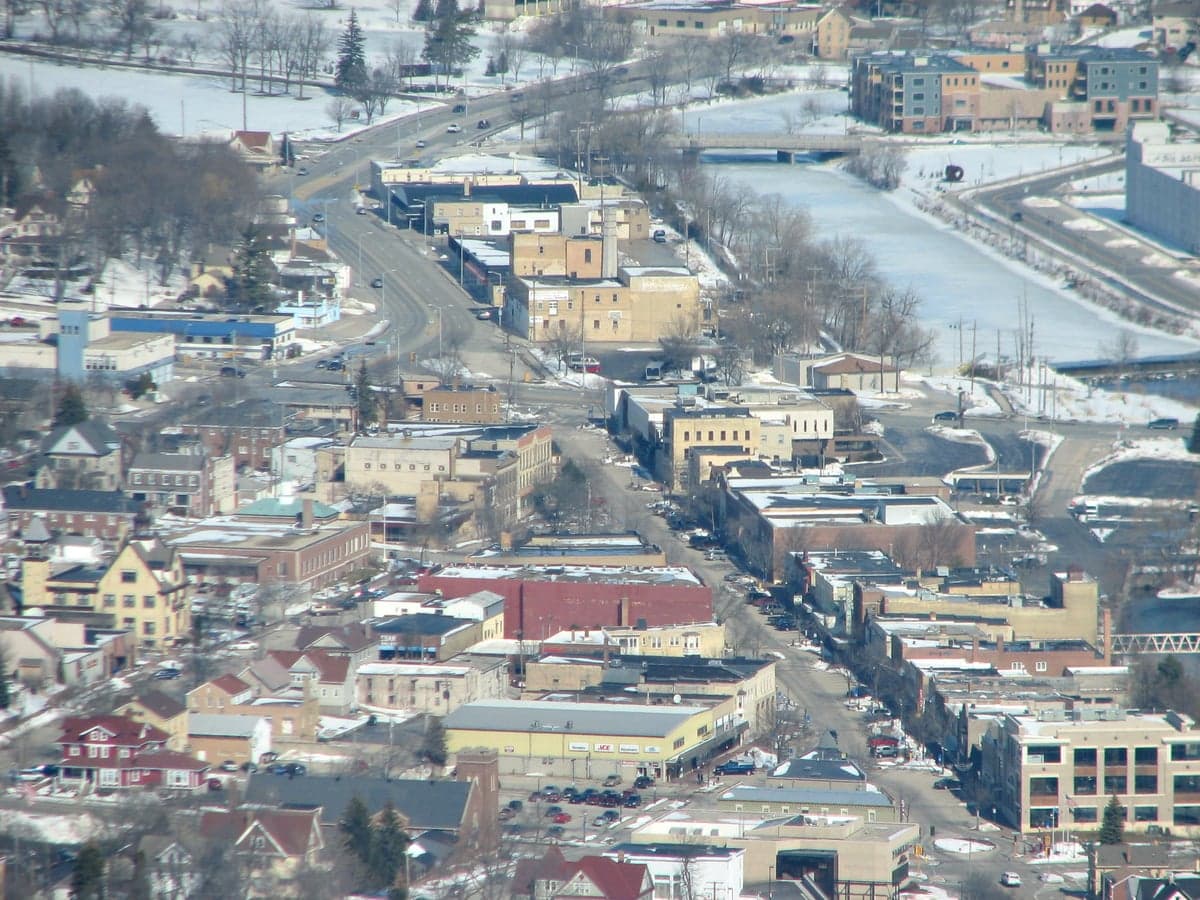
Photo: Wikipedia
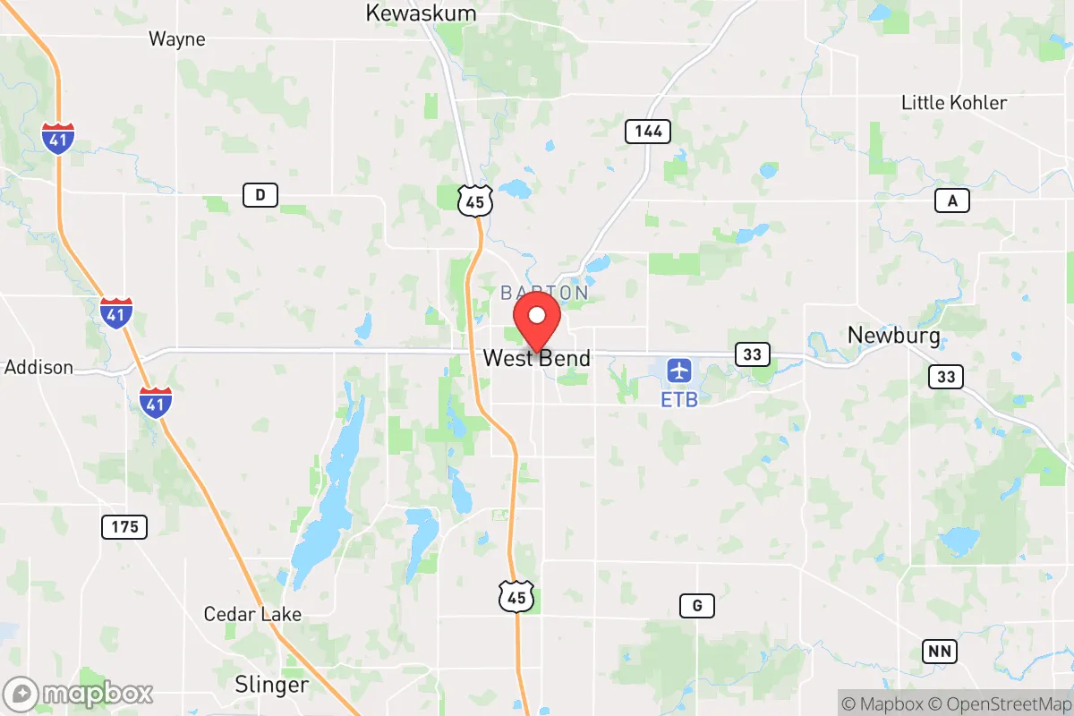
Strategic Assessment of West Bend, WI
Meaningful friction. Expect exposure to either population pressure, blast zones, or natural disaster risk. Consider buying a retreat property.
What does the Strategic Assessment tell us?
Our Strategic Assessment grades tactical survivability of an area. Major population centers, military targets, fallout zones, natural disasters, and border exposure all drive risk — lower exposure means a more defensible position in a crisis.
This is heavily inspired by Joel Skousen's Strategic Relocation book. Highly recommended you checkout the book ($)What does this tell us?
Our Strategic Assessment grades tactical survivability of an area. Major population centers, military targets, fallout zones, natural disasters, and border exposure all drive risk — lower exposure means a more defensible position in a crisis.
This is heavily inspired by Joel Skousen's Strategic Relocation book. Highly recommended you checkout the book ($)Strategic Pillars

Key Distances
Regional Safe Places
Below is our recommended "safe zones" in Wisconsin and the surrounding area based on our strategic heuristics. For most people, it's unrealistic to live in a “safe zone” full-time due to work, family or other personal reasons. They tend to be more rural. However, many of these areas are perfect for second homes and retreat properties that double as a vacation home or even a short-term rental.
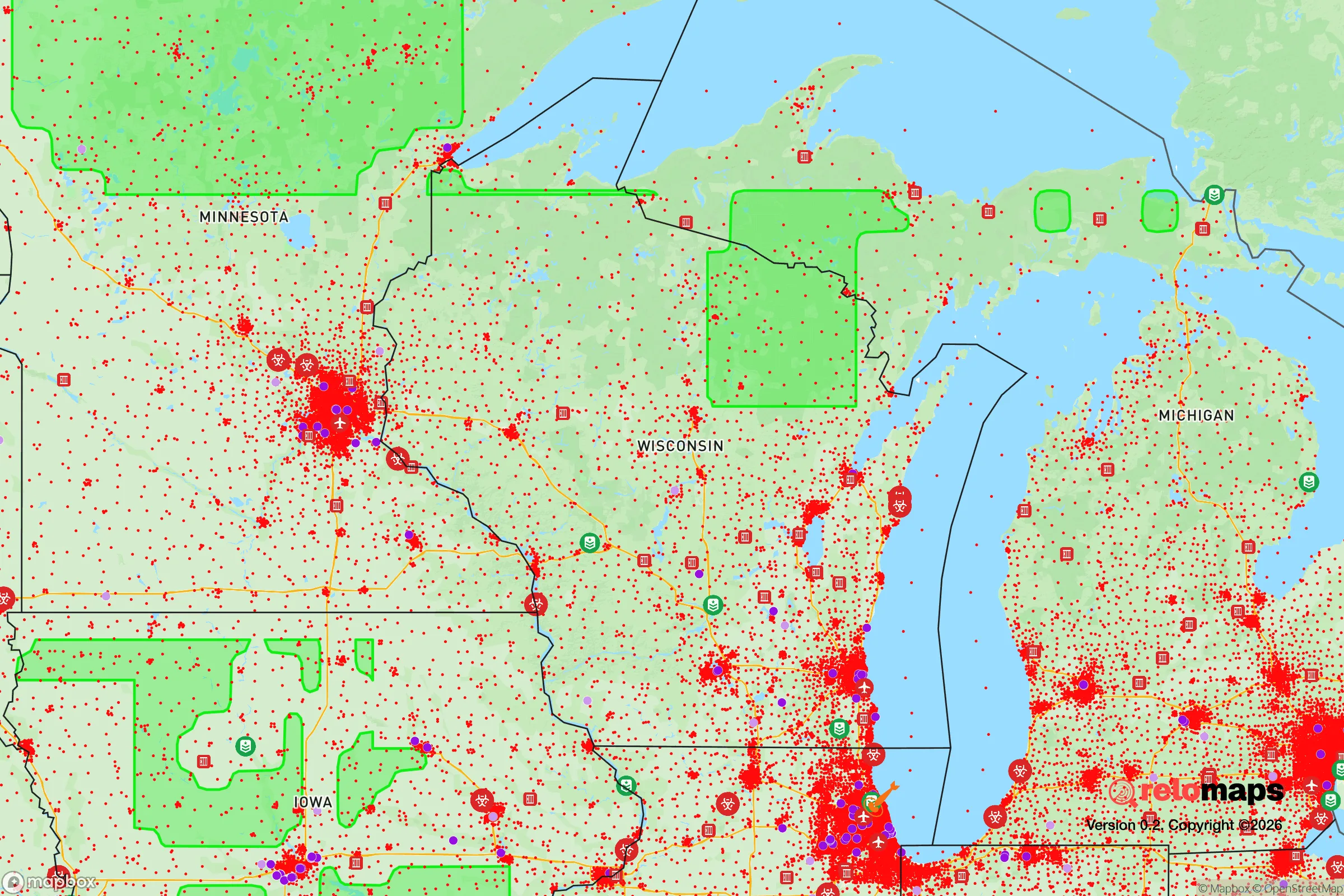
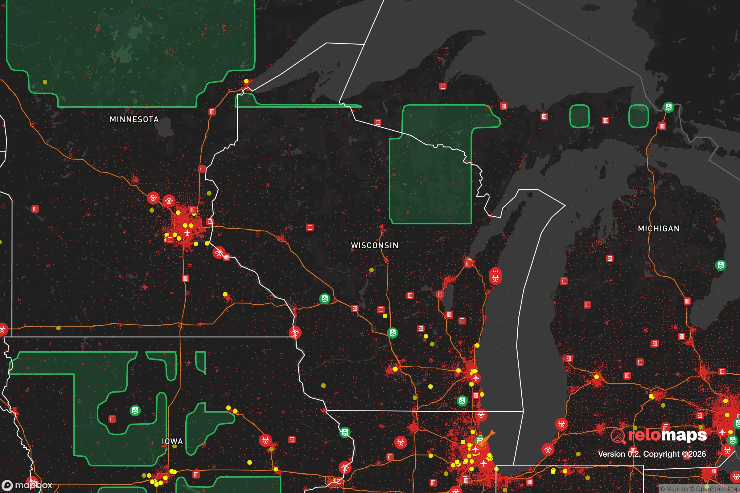
Important Note: For informational purposes only. This does not mean nothing bad ever happens in the green zones. Please use common sense. This is based on public data and modeled with AI. We tried to take a conservative approach but mistakes happen. We update this regularly as new information becomes available.
Solar Generator Recommendations
Backup power matters more here than in safer locations. We've picked three solar generators across budgets and capacity tiers — start with the budget unit if you only need a few essentials, or step up if you want to run a fridge and HVAC for days at a time.

Jackery Portable Power Station Explorer 300
Budget OptionPower on the Go: Weighing only 11 lbs, it's convenient to set up and store with book-sized foldable solar panels

BLUETTI Portable Power Station AC180
Designed for both indoor and outdoor scenarios, AC180 is highly capable as it has a robost capacity and continuous output power.

EF ECOFLOW DELTA Pro Ultra Power Station
Upgraded PickEcoFlow DELTA Pro Ultra is a whole-home energy system designed to grow with your family. Integrated with the Smart Home Panel 2, it scales to meet your evolving energy needs — keeping your home powered, intelligent, and secure through every stage of life.
We earn a commission, at no additional cost to you.
Strategic Assessment Analysis
West Bend, Wisconsin, offers a compelling strategic position for those prioritizing resilience and self-reliance, sitting roughly 30 miles north of Milwaukee but maintaining a distinct small-city character that buffers it from the worst of urban collapse scenarios. Its location along the Milwaukee River and at the junction of US-45 and WI-33 provides both a natural water source and multiple egress routes, while the surrounding Washington County farmland and Kettle Moraine State Forest create a buffer of open space and resources. For a relocator assessing long-term stability, West Bend presents a balanced mix of industrial capacity, agricultural access, and community cohesion that is increasingly rare in the upper Midwest.
Geographic position and natural advantages for long-term stability
West Bend sits in the Kettle Moraine region, a glacially sculpted landscape of rolling hills, hardwood forests, and numerous small lakes that offer natural defensibility and resource diversity. The area is not prone to major natural disasters—no hurricanes, no earthquakes, and only occasional tornado warnings that rarely produce direct hits. The Milwaukee River runs through the city, providing a reliable surface water source, and the underlying aquifer is generally good quality, though well depth varies. The surrounding Washington County is roughly 60% agricultural and forested, meaning a relocator has access to local food production and timber for fuel or construction. The proximity to the Northern Highland and Chequamegon-Nicolet National Forests, about two hours north, offers a potential retreat zone if conditions deteriorate further. Critically, West Bend is far enough from Lake Michigan's shoreline to avoid the lake-effect snow belts that bury communities like Sheboygan or Manitowoc, but close enough to tap into Great Lakes water if regional infrastructure holds.
Risks, exposures, and proximity to fallout-relevant landmarks
The primary strategic concern with West Bend is its proximity to Milwaukee, a major population center with significant industrial, port, and transportation infrastructure that could become a target during civil unrest or a mass casualty event. Milwaukee is roughly 30 miles south, and its metropolitan area contains a major international airport (MKE), a Great Lakes port, and multiple rail yards and chemical facilities. In a worst-case scenario involving a nuclear detonation or large-scale industrial accident, West Bend sits outside the immediate blast and heavy fallout zones for most plausible targets, but prevailing winds from the south could carry fallout or airborne contaminants northward. The city itself has a modest industrial base—including a large Amerex fire extinguisher plant, a Quad/Graphics printing facility, and several metal fabrication shops—that could become secondary targets or sources of hazardous material release. The nearby Slinger Superfund site (a former landfill) and the Milwaukee River's industrial history mean water contamination is a real concern if treatment plants fail. On the plus side, West Bend's distance from Chicago (about 120 miles) and Madison (about 70 miles) places it outside the immediate chaos radius of those larger cities, and the Kettle Moraine's forested hills provide some natural shielding and dispersion for airborne threats.
Practical resilience for a relocator: food, water, energy, and defensibility
For a relocator focused on self-sufficiency, West Bend offers a workable baseline. The city's water supply comes from the Milwaukee River and groundwater wells, but a prepper should plan for private well installation or rainwater catchment—the average annual precipitation is about 32 inches, enough for basic cistern systems. The surrounding farmland produces corn, soybeans, dairy, and livestock, and the West Bend Farmers Market (one of the oldest in Wisconsin) provides direct access to local growers. For energy, the area is served by We Energies, which relies on a mix of coal, natural gas, and renewables, but grid failure is a real risk in extended winter storms. Solar panels are viable here—the region gets about 4.5 peak sun hours per day in summer—and wood heat is practical given the forest cover. Defensibility is moderate: West Bend is a compact city of about 32,000 people, with a downtown grid layout but suburban sprawl that creates chokepoints on the main roads. The Kettle Moraine State Forest's Southern Unit, just west of town, offers thousands of acres of rugged terrain for retreat or caching supplies. The local population skews older and more conservative than Milwaukee's, which can mean stronger community bonds and a higher likelihood of mutual aid networks, but also a potential for conflict if resources become scarce. The Washington County Sheriff's Office is well-regarded and maintains a visible presence, but in a prolonged crisis, law enforcement will be stretched thin.
The overall strategic picture for West Bend is one of cautious optimism for the prepared relocator. It is not a hardened bunker location—it lacks the isolation of the Upper Peninsula or the deep rural security of northern Wisconsin—but it offers a realistic middle ground: close enough to urban resources (medical centers, hardware stores, fuel depots) to stock up and maintain a modern lifestyle, yet far enough to avoid being overrun in the first wave of a crisis. The key vulnerabilities are the Milwaukee proximity and the reliance on a single major highway (US-45) for north-south travel, which could become a chokepoint. For a single individual or family willing to invest in a well, solar panels, a wood stove, and a solid network of local contacts, West Bend provides a defensible, resource-rich base that can sustain a household through most disruptions short of a full societal collapse. The area's conservative culture and strong hunting/fishing traditions mean you won't be the only one thinking this way—and that shared mindset can be the difference between isolation and survival.
* Values derived from national, state, county, city and local statistics and may differ in a specific area. Last updated: 2026-04-19T07:43:23.000Z
Narrative content on this page is AI-generated and may contain mistakes. Verify any details that matter before acting on them.
ReloMaps may earn a commission from affiliate links at no extra cost to you.