
Photo by Christian Alvarez on Unsplash
Strategic Assessment of Williamsburg City County
Meaningful friction. Expect exposure to either population pressure, blast zones, or natural disaster risk. Consider buying a retreat property.
What does the Strategic Assessment tell us?
Our Strategic Assessment grades tactical survivability of an area. Major population centers, military targets, fallout zones, natural disasters, and border exposure all drive risk — lower exposure means a more defensible position in a crisis.
This is heavily inspired by Joel Skousen's Strategic Relocation book. Highly recommended you checkout the book ($)What does this tell us?
Our Strategic Assessment grades tactical survivability of an area. Major population centers, military targets, fallout zones, natural disasters, and border exposure all drive risk — lower exposure means a more defensible position in a crisis.
This is heavily inspired by Joel Skousen's Strategic Relocation book. Highly recommended you checkout the book ($)Strategic Pillars

Key Distances
Strategic Assessment Analysis
Williamsburg City County, Virginia, occupies a unique strategic position in the Mid-Atlantic that balances historical significance with modern resilience challenges. Its location roughly 50 miles southeast of Richmond and 45 miles northwest of Norfolk places it within a corridor of military, industrial, and logistical activity that offers both advantages and vulnerabilities for a relocator prioritizing disaster readiness and self-sufficiency. The area’s resilience profile is shaped by its proximity to major defense installations, its position relative to coastal storm risks, and the practical realities of living in a region that blends suburban comfort with rural-adjacent access.
Geographic position and natural advantages for disaster readiness
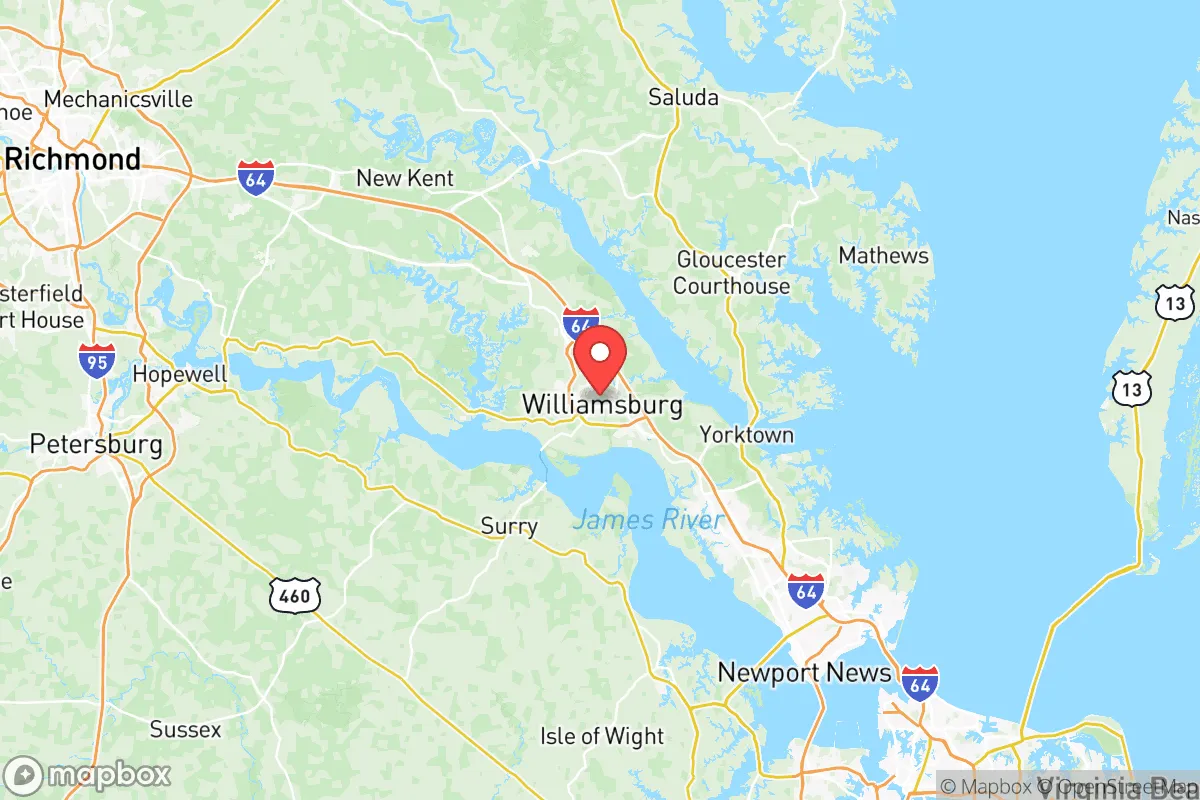
Williamsburg sits on the Virginia Peninsula, bounded by the James River to the south and the York River to the north, with the Chesapeake Bay roughly 20 miles east. This geography provides natural barriers that can slow the spread of certain threats—wildfires, for example, are rare here due to the region’s humid subtropical climate and extensive hardwood forests. The area’s elevation averages around 80 feet above sea level, which offers some protection against storm surge from hurricanes, though the city is not immune to flooding from heavy rainfall or tidal surges during major events like Hurricane Isabel in 2003, which caused significant damage in nearby Hampton Roads. The presence of Fort Eustis (Army base, 10 miles east) and Naval Weapons Station Yorktown (15 miles east) means the region has a heavy military footprint, which can be a double-edged sword: these installations bring robust infrastructure, emergency response capabilities, and a population accustomed to readiness, but they also represent potential targets in a conflict scenario. The Colonial National Historical Park and surrounding state forests provide green space that could serve as buffer zones or resource areas for foraging and water collection, though they are not wilderness in the survivalist sense.
Risks, exposures, and proximity to fallout-relevant landmarks
The most significant risk for Williamsburg relocators is its position within the Hampton Roads metropolitan area, a region of roughly 1.8 million people that includes Norfolk, Newport News, and Hampton. This density means that in a major disaster—whether natural or man-made—Williamsburg could face secondary effects from population displacement, supply chain disruptions, and infrastructure strain. The city is located about 30 miles northwest of the Port of Virginia in Norfolk, one of the largest and busiest ports on the East Coast, which handles massive volumes of container traffic and military cargo. A disruption at this port would ripple through the entire region’s food and fuel supply chains. Additionally, the Yorktown Refinery (operated by Plains All American) sits roughly 15 miles east, processing crude oil and storing refined products. While not on the scale of Houston’s refinery corridor, a major accident or attack at this facility could create a hazardous plume affecting downwind areas, including parts of Williamsburg. The presence of Langley Air Force Base (20 miles southeast) and Naval Station Norfolk (35 miles southeast) elevates the area’s profile as a potential target for long-range strikes or sabotage, though the likelihood of such events remains low for most relocators. For those concerned about fallout from a nuclear event, Williamsburg’s distance from major urban centers like Washington, D.C. (150 miles north) and Richmond (50 miles northwest) offers some buffer, but the military bases and port remain high-value assets that could attract attention in a broader conflict.
Practical resilience for a relocator: food, water, energy, and defensibility
For a family or individual serious about self-sufficiency, Williamsburg presents a mixed picture. The city itself is suburban, with most residents dependent on municipal water from the Newport News Waterworks, which draws from the Chickahominy River and Lee Hall Reservoir. In a prolonged grid-down scenario, this system would be vulnerable to contamination or pressure loss, making private well access a key consideration for relocators. Properties in the surrounding James City County and York County areas often have wells, but within Williamsburg city limits, well access is rare. Food resilience is moderate: the region has a growing local food scene, with farmers’ markets like the Williamsburg Farmers Market operating seasonally, and there are several community gardens. However, the area’s agricultural output is limited compared to the Shenandoah Valley or Piedmont regions—most staple crops are imported from elsewhere in Virginia or beyond. For long-term food storage, relocators would need to rely on their own stockpiling or develop relationships with local farms in outlying counties like New Kent or Charles City. Energy resilience is a bright spot: the region is served by Dominion Energy, and solar adoption is increasing, though grid reliability is generally good. For defensibility, Williamsburg’s layout—a mix of historic district, suburban neighborhoods, and rural-adjacent pockets—offers options. The College of William & Mary campus and surrounding areas are densely populated, which could be a liability in a crisis, but properties on the outskirts near Toano or Lightfoot provide more seclusion and easier access to rural routes. The area’s road network, anchored by I-64 and US-60, offers multiple evacuation routes north toward Richmond or south toward the Peninsula, though these could become congested quickly.
The overall strategic picture for Williamsburg City County is one of moderate resilience with notable trade-offs. Its location near military bases and a major port provides infrastructure and emergency response advantages but also introduces risks that a relocator must weigh carefully. For a family seeking a balance between access to urban amenities and a lower-risk profile than living directly in Norfolk or Richmond, Williamsburg offers a defensible middle ground—provided they secure a property with independent water, invest in food storage, and maintain situational awareness of the region’s industrial and military assets. The area’s historical character and stable community fabric are genuine assets for long-term stability, but the relocator should not mistake its charm for isolation. In a major crisis, Williamsburg would likely experience secondary effects from the broader Hampton Roads region, making personal preparedness and a clear evacuation plan essential. For those willing to invest in those measures, it remains a viable option for a strategic relocation in the Mid-Atlantic.

* Values derived from national, state, county, city and local statistics and may differ in a specific area. Last updated: 2026-10-15T09:32:56.000Z
Narrative content on this page is AI-generated and may contain mistakes. Verify any details that matter before acting on them.
ReloMaps may earn a commission from affiliate links at no extra cost to you.

