
Strategic Assessment of Hopewell City County
Meaningful friction. Expect exposure to either population pressure, blast zones, or natural disaster risk. Consider buying a retreat property.
What does the Strategic Assessment tell us?
Our Strategic Assessment grades tactical survivability of an area. Major population centers, military targets, fallout zones, natural disasters, and border exposure all drive risk — lower exposure means a more defensible position in a crisis.
This is heavily inspired by Joel Skousen's Strategic Relocation book. Highly recommended you checkout the book ($)What does this tell us?
Our Strategic Assessment grades tactical survivability of an area. Major population centers, military targets, fallout zones, natural disasters, and border exposure all drive risk — lower exposure means a more defensible position in a crisis.
This is heavily inspired by Joel Skousen's Strategic Relocation book. Highly recommended you checkout the book ($)Strategic Pillars

Key Distances
Strategic Assessment Analysis
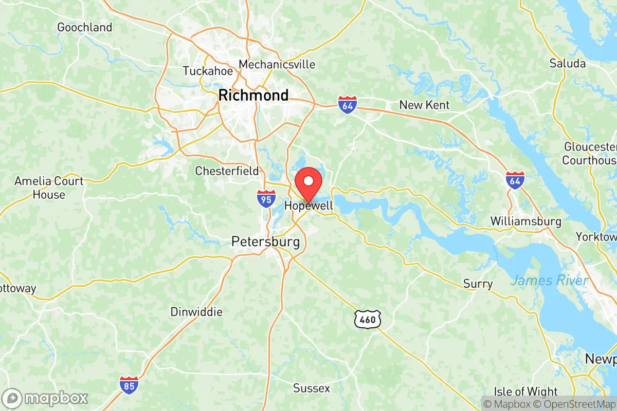
Hopewell City County, Virginia, occupies a unique strategic position at the confluence of the James and Appomattox Rivers, roughly 25 miles southeast of Richmond. For a relocator prioritizing resilience and self-sufficiency, this small independent city of about 23,000 residents offers a mixed picture: significant industrial infrastructure and river access provide local resources, but proximity to major petrochemical and military targets introduces serious risk considerations. The area's historical identity as a manufacturing and logistics hub, dating back to World War I-era munitions production, means the local economy and infrastructure are built around industries that are both an asset and a liability in a disaster scenario.
Geographic position and natural advantages for self-sufficiency
Hopewell sits at the fall line of the James River, where the Piedmont meets the Coastal Plain, giving it access to both tidal navigation and freshwater upstream. The James River at this point is wide and deep enough for commercial barge traffic, which could serve as an alternative transportation corridor if road networks are compromised. The surrounding landscape is a mix of agricultural land, forest, and wetlands, with the Appomattox River forming the city's southern boundary. This riverine setting provides ample surface water for irrigation or household use, though treatment would be necessary. The city's position roughly 30 miles from the Chesapeake Bay means it is not coastal, reducing direct hurricane surge risk, but it remains vulnerable to inland flooding from heavy rain events, as demonstrated by Hurricane Michael in 2018 and the remnants of Hurricane Florence. The terrain is generally flat to gently rolling, with elevations between 10 and 80 feet, offering no significant natural defensive high ground but also no major barriers to movement or construction.
Risks, exposures, and proximity to high-value targets
The most significant strategic liability for Hopewell is its concentration of industrial infrastructure. The city hosts the Honeywell Hopewell Plant, a major chemical manufacturing facility producing nylon intermediates and other industrial chemicals, and the Dominion Energy Chesterfield Power Station is just across the James River in Chester. These facilities, along with the Fort Lee (now part of the Army's Combined Arms Support Command) military installation about 20 miles south in Prince George County, and the Port of Richmond roughly 25 miles upstream, make the broader Richmond-Hopewell-Petersburg corridor a plausible target set in a conflict scenario. The I-295 and I-95 corridors that connect these assets run within a few miles of Hopewell, meaning any disruption to those highways would severely impact the city's ability to receive supplies or evacuate. Natural hazards include riverine flooding from the James and Appomattox, with the National Flood Insurance Program mapping significant portions of the city's low-lying areas as Special Flood Hazard Areas. The city's industrial legacy also means soil and groundwater contamination in some areas, particularly near the former Allied Chemical site, which could complicate post-disaster recovery or gardening efforts.
Practical resilience for a relocator: food, water, energy, and defensibility
For a relocator focused on self-sufficiency, Hopewell offers several practical advantages and notable gaps. The city's water supply comes from the James River, treated by the Hopewell Water Treatment Plant, which has a capacity of about 12 million gallons per day. In a grid-down scenario, the river provides an abundant raw water source, but residents would need personal filtration or purification systems. The local power grid is served by Dominion Energy, with transmission lines running along the I-295 corridor; these are vulnerable to both weather events and targeted disruption. Natural gas is available in much of the city, but propane and heating oil are alternatives for those seeking off-grid capability. Agricultural land is present in the surrounding counties of Prince George, Charles City, and Surry, but within the city limits, residential lots are typically small (0.25 to 0.5 acres), limiting space for substantial food production. The city's zoning allows for backyard chickens and small gardens, but larger livestock or extensive farming would require moving to the unincorporated areas. Defensibility is poor: the city's flat terrain, grid street pattern, and multiple river crossings make it difficult to secure a perimeter. The nearest significant population center, Richmond, is close enough that a crisis could trigger an influx of evacuees, straining local resources. The city's police force is small (about 50 sworn officers), and mutual aid agreements with surrounding counties would be stretched in a regional emergency.
Overall, Hopewell City County presents a calculated trade-off for the resilience-minded relocator. Its river access, industrial base, and proximity to agricultural land offer tangible resources for post-disaster survival, but its location within a dense web of high-value targets—chemical plants, power stations, military bases, and major transportation corridors—introduces risks that are difficult to mitigate. For someone willing to invest in water filtration, alternative energy, and a well-stocked pantry, and who accepts the elevated risk profile of living near critical infrastructure, Hopewell could function as a base of operations with access to both riverine and road networks. However, for those seeking a lower-risk, more defensible location with greater space for self-sufficiency, the rural counties further west, such as Buckingham or Cumberland, or south of the James in Surry County, would offer fewer industrial targets and more land at comparable prices. The key takeaway is that Hopewell's strategic value is tied directly to its industrial assets—which are precisely what make it a target—so a relocator must decide whether the local resources are worth the associated exposure.

* Values derived from national, state, county, city and local statistics and may differ in a specific area. Last updated: 2026-08-14T22:26:53.000Z
Narrative content on this page is AI-generated and may contain mistakes. Verify any details that matter before acting on them.
ReloMaps may earn a commission from affiliate links at no extra cost to you.

