Photo: Wikipedia
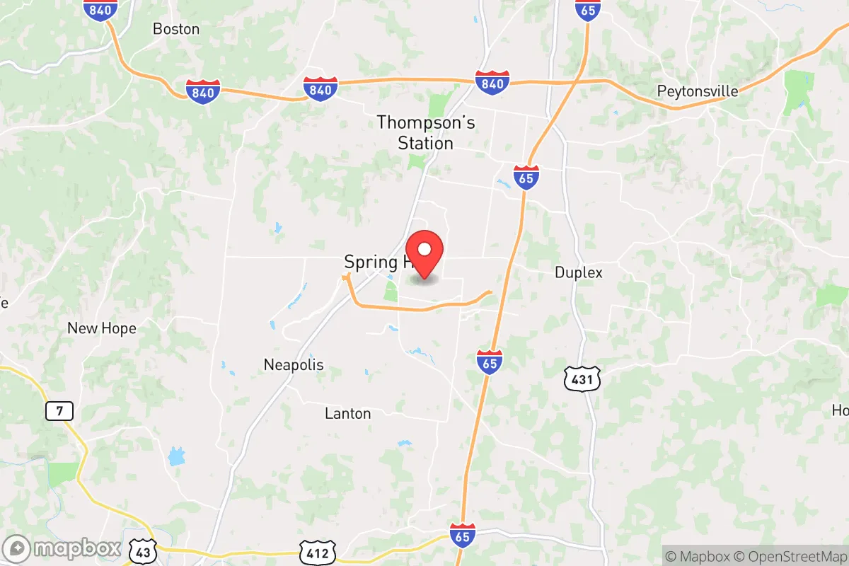
Strategic Assessment of Spring Hill, TN
Meaningful friction. Expect exposure to either population pressure, blast zones, or natural disaster risk. Consider buying a retreat property.
What does the Strategic Assessment tell us?
Our Strategic Assessment grades tactical survivability of an area. Major population centers, military targets, fallout zones, natural disasters, and border exposure all drive risk — lower exposure means a more defensible position in a crisis.
This is heavily inspired by Joel Skousen's Strategic Relocation book. Highly recommended you checkout the book ($)What does this tell us?
Our Strategic Assessment grades tactical survivability of an area. Major population centers, military targets, fallout zones, natural disasters, and border exposure all drive risk — lower exposure means a more defensible position in a crisis.
This is heavily inspired by Joel Skousen's Strategic Relocation book. Highly recommended you checkout the book ($)Strategic Pillars

Key Distances
Regional Safe Places
Below is our recommended "safe zones" in Tennessee and the surrounding area based on our strategic heuristics. For most people, it's unrealistic to live in a “safe zone” full-time due to work, family or other personal reasons. They tend to be more rural. However, many of these areas are perfect for second homes and retreat properties that double as a vacation home or even a short-term rental.
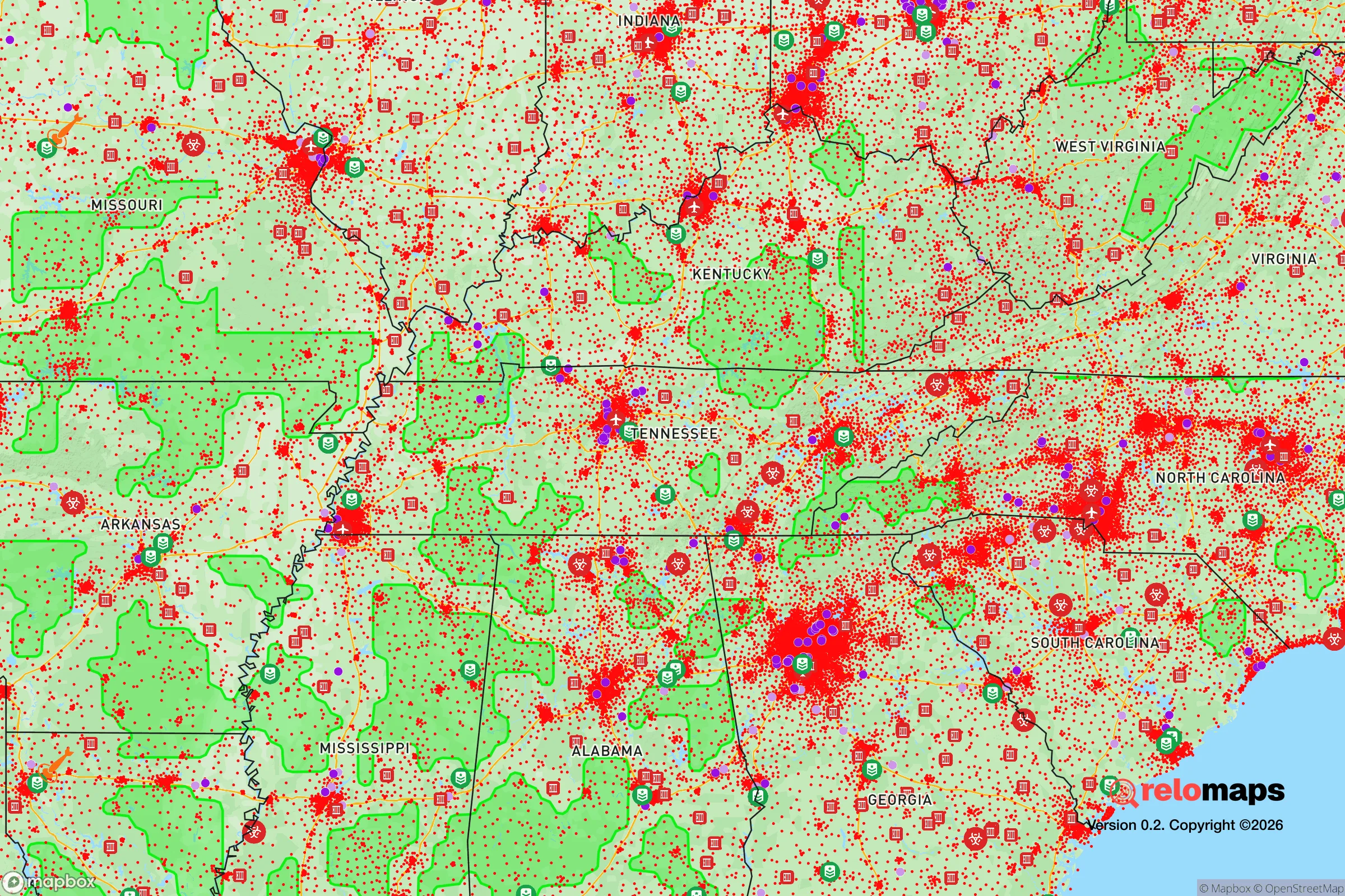
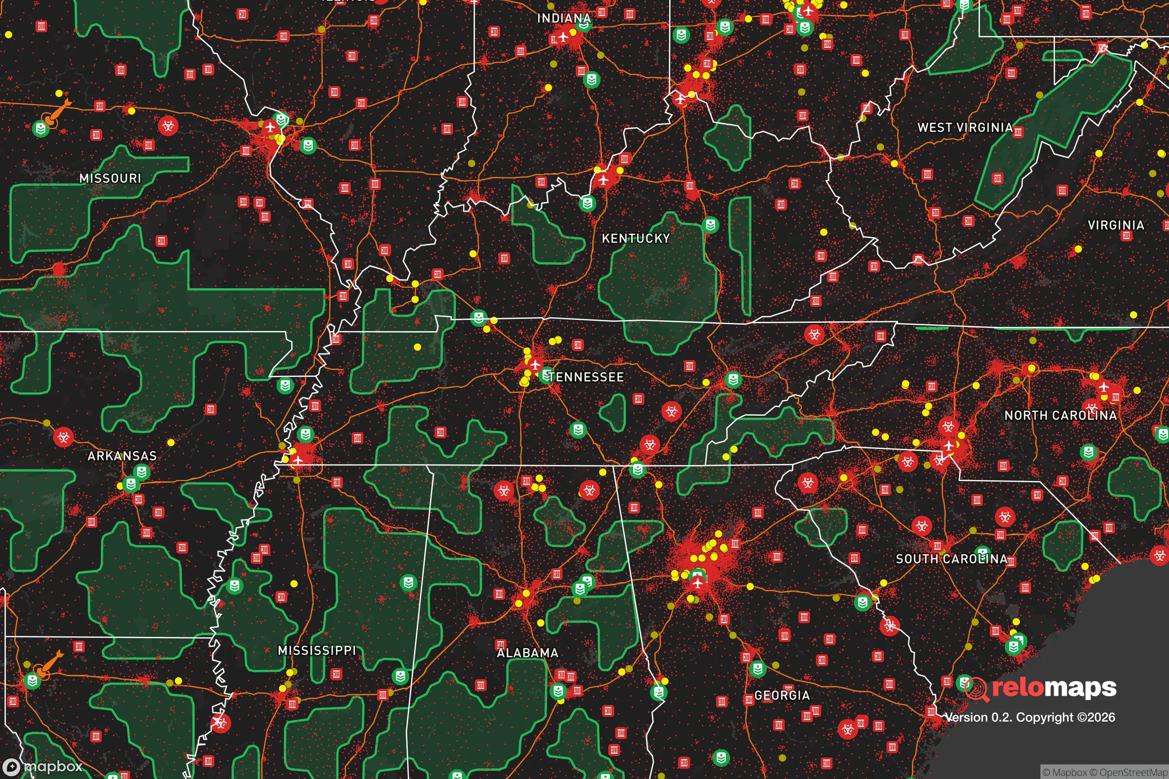
Important Note: For informational purposes only. This does not mean nothing bad ever happens in the green zones. Please use common sense. This is based on public data and modeled with AI. We tried to take a conservative approach but mistakes happen. We update this regularly as new information becomes available.
Solar Generator Recommendations
Backup power matters more here than in safer locations. We've picked three solar generators across budgets and capacity tiers — start with the budget unit if you only need a few essentials, or step up if you want to run a fridge and HVAC for days at a time.

Jackery Portable Power Station Explorer 300
Budget OptionPower on the Go: Weighing only 11 lbs, it's convenient to set up and store with book-sized foldable solar panels

BLUETTI Portable Power Station AC180
Designed for both indoor and outdoor scenarios, AC180 is highly capable as it has a robost capacity and continuous output power.

EF ECOFLOW DELTA Pro Ultra Power Station
Upgraded PickEcoFlow DELTA Pro Ultra is a whole-home energy system designed to grow with your family. Integrated with the Smart Home Panel 2, it scales to meet your evolving energy needs — keeping your home powered, intelligent, and secure through every stage of life.
We earn a commission, at no additional cost to you.
Strategic Assessment Analysis
Spring Hill, Tennessee, sits in a sweet spot that few relocation analysts fully appreciate: close enough to Nashville’s economic engine to sustain jobs and infrastructure, yet far enough from the urban core to offer genuine strategic depth in a crisis. The city’s post-2000 population boom—from roughly 7,000 to over 50,000 residents—has been driven by families and professionals seeking lower taxes, better schools, and a slower pace. But for the prepper or survivalist, the real draw is the area’s natural resilience: rolling hills, abundant water, and a position that puts major fallout risks at a comfortable distance while keeping supply lines open. This isn’t a remote bunker location—it’s a place where you can live a normal life while maintaining a credible posture for when things go sideways.
Geographic position and natural advantages for long-term security
Spring Hill’s geography is its strongest card. The city straddles the boundary between Williamson and Maury counties, placing it on the edge of the Nashville Basin where the terrain rises into the Highland Rim. This means elevation changes of 200–400 feet within a few miles, offering natural defensibility and good drainage—critical for avoiding flood zones that plague flatter parts of Middle Tennessee. The area sits atop the Nashville Dome aquifer system, which provides reliable groundwater access for private wells, a key advantage if municipal water treatment is disrupted. Creeks like Rutherford Creek and the Duck River tributaries run through the region, giving multiple surface water sources that can be filtered or boiled. The local climate is temperate, with an average of 210 growing days per year, meaning a determined homesteader can produce a significant portion of their own food. Unlike the arid West or the hurricane-prone Gulf Coast, Spring Hill faces no single catastrophic natural threat—tornadoes are possible but rarely violent, and the region’s seismic risk is negligible. For a relocator thinking in decades, not just election cycles, this is a place where the land itself works with you, not against you.
Risks, exposures, and proximity to fallout-relevant landmarks
No location is perfect, and Spring Hill has its vulnerabilities. The most obvious is proximity to Interstate 65, which runs right through town. In a mass evacuation scenario—whether from a Nashville terror event, a chemical spill, or a coordinated attack—I-65 becomes a choke point. The highway is the primary north-south artery for the region, and a single truck bomb or bridge failure could trap thousands. Spring Hill is also roughly 35 miles south of Nashville’s urban core, which includes the Tennessee Valley Authority’s electrical grid nodes, the Nashville International Airport (a likely target in a conflict), and the city’s major hospitals and government buildings. A ground-level nuclear detonation at Nashville’s center would put Spring Hill outside the lethal blast radius but within the zone of significant fallout—depending on wind direction, you’d have 12–24 hours to shelter or evacuate. More concerning is the Bellefonte Nuclear Plant, about 90 miles northeast near Scottsboro, Alabama. While not an immediate threat, a catastrophic failure there could contaminate the Tennessee River watershed, which feeds into the Cumberland River system that supplies Middle Tennessee’s water. Spring Hill’s water comes from the Harpeth River and local wells, so the risk is moderate but not zero. The city’s rapid growth also means increased dependence on just-in-time logistics—grocery stores typically hold only 3–5 days of inventory. In a prolonged disruption, Spring Hill’s suburban layout could become a liability, with long distances between residential areas and food sources.
Practical resilience for a relocator: food, water, energy, and defensibility
For the individual or family serious about preparedness, Spring Hill offers a workable baseline that can be hardened with modest investment. Water is the easiest win: the water table sits at 20–40 feet in most of Maury County, and a hand-pump well can be installed for $3,000–$5,000. The Duck River, which flows just west of town, is one of the most biodiverse rivers in North America and provides a reliable secondary source—though you’ll want a good filtration system given agricultural runoff. Food production is viable on as little as a quarter-acre. The soil is clay-heavy but amendable, and local extension services offer free soil testing. Spring Hill’s zoning allows for backyard chickens and small livestock in most residential areas, and the city’s farmers’ market operates year-round, giving you a local network for seeds, tools, and knowledge. Energy resilience is more challenging. The grid is served by Duck River Electric Membership Corporation, a cooperative that has been reliable but is vulnerable to cascading failures from Nashville’s load. Solar is feasible—the region gets about 200 sunny days per year—but you’ll need battery storage to handle winter cloud cover. A 5kW system with 10kWh of storage will run $12,000–$15,000 installed and cover essential loads (lights, fridge, well pump, communications). Defensibility is mixed. Spring Hill’s newer subdivisions are cul-de-sac nightmares for security—single points of entry, no sight lines, and neighbors packed in. Older homes along Main Street and the rural parcels on the Maury County side offer better options: set back from the road, with tree cover and multiple access routes. If you’re buying, prioritize a property with a long driveway, a basement or storm shelter, and at least one neighbor within sight who shares your mindset. The local sheriff’s office is well-funded and responsive, but in a prolonged crisis, you cannot rely on them—response times will stretch to hours or days.
The overall strategic picture for Spring Hill is cautiously optimistic. It is not a hardened retreat—it is a viable base of operations for someone who wants to maintain a normal career and family life while building genuine resilience. The city’s growth has brought infrastructure, medical facilities, and a tax base that will weather most short-term disruptions. The conservative lean of the local population—Maury County voted +31 R in 2024—means a cultural alignment that reduces friction with neighbors and local law enforcement. The risks are real but manageable: the I-65 corridor is a vulnerability, the Nashville proximity is a double-edged sword, and the suburban sprawl requires deliberate hardening. But for the relocator who buys on the rural fringe, drills a well, installs solar, and builds a local network of like-minded families, Spring Hill offers a rare combination of opportunity and security. It’s not a place to hide—it’s a place to stand your ground, with good water, good soil, and good people. That’s more than most locations can claim in 2026.
* Values derived from national, state, county, city and local statistics and may differ in a specific area. Last updated: 2026-05-01T08:11:38.000Z
Narrative content on this page is AI-generated and may contain mistakes. Verify any details that matter before acting on them.
ReloMaps may earn a commission from affiliate links at no extra cost to you.