Photo: Wikipedia
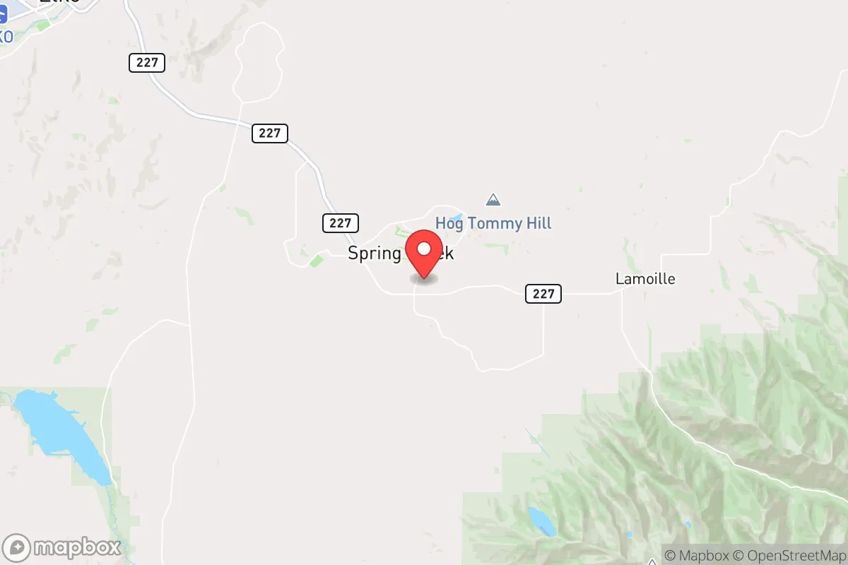
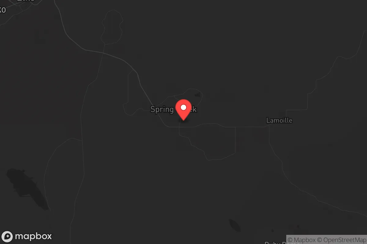
Strategic Assessment of Spring Creek, NV
Strong survivability profile. Good buffer from population centers, with manageable environmental and tactical risks.
What does the Strategic Assessment tell us?
Our Strategic Assessment grades tactical survivability of an area. Major population centers, military targets, fallout zones, natural disasters, and border exposure all drive risk — lower exposure means a more defensible position in a crisis.
This is heavily inspired by Joel Skousen's Strategic Relocation book. Highly recommended you checkout the book ($)What does this tell us?
Our Strategic Assessment grades tactical survivability of an area. Major population centers, military targets, fallout zones, natural disasters, and border exposure all drive risk — lower exposure means a more defensible position in a crisis.
This is heavily inspired by Joel Skousen's Strategic Relocation book. Highly recommended you checkout the book ($)Strategic Pillars

Key Distances
Regional Safe Places
Below is our recommended "safe zones" in Nevada and the surrounding area based on our strategic heuristics. For most people, it's unrealistic to live in a “safe zone” full-time due to work, family or other personal reasons. They tend to be more rural. However, many of these areas are perfect for second homes and retreat properties that double as a vacation home or even a short-term rental.
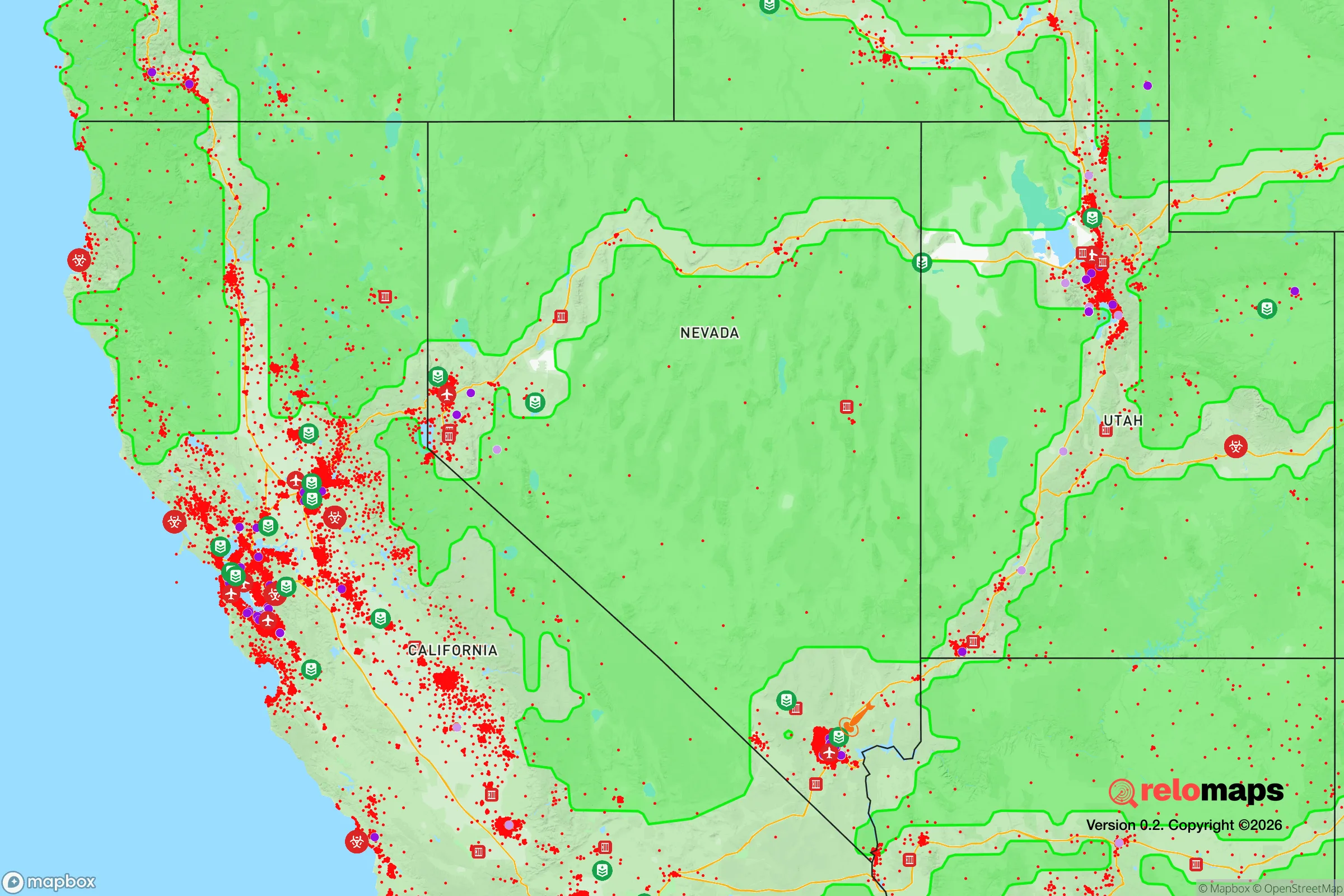
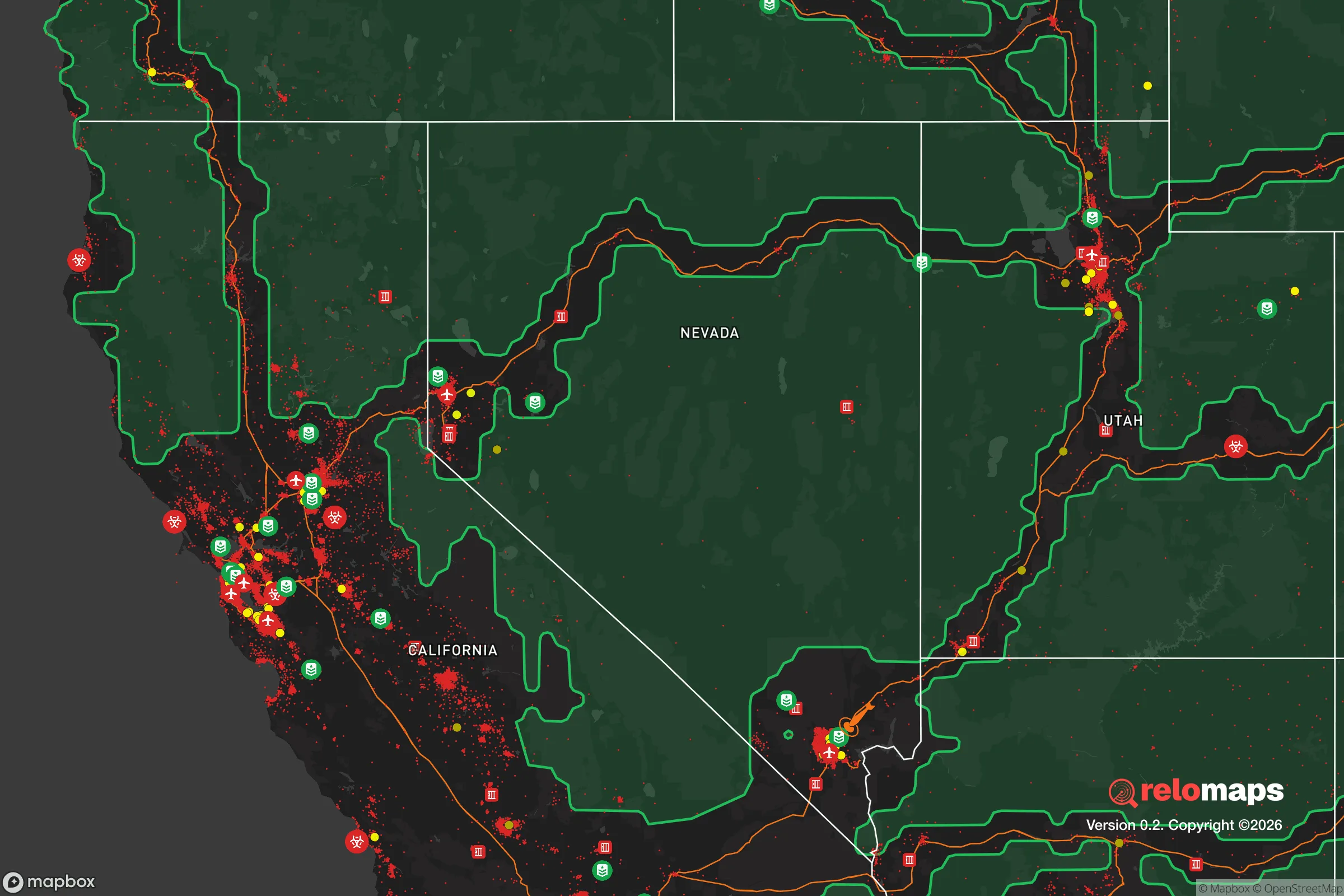
Important Note: For informational purposes only. This does not mean nothing bad ever happens in the green zones. Please use common sense. This is based on public data and modeled with AI. We tried to take a conservative approach but mistakes happen. We update this regularly as new information becomes available.
Solar Generator Recommendations
Backup power matters more here than in safer locations. We've picked three solar generators across budgets and capacity tiers — start with the budget unit if you only need a few essentials, or step up if you want to run a fridge and HVAC for days at a time.

Jackery Portable Power Station Explorer 300
Budget OptionPower on the Go: Weighing only 11 lbs, it's convenient to set up and store with book-sized foldable solar panels

BLUETTI Portable Power Station AC180
Designed for both indoor and outdoor scenarios, AC180 is highly capable as it has a robost capacity and continuous output power.

EF ECOFLOW DELTA Pro Ultra Power Station
Upgraded PickEcoFlow DELTA Pro Ultra is a whole-home energy system designed to grow with your family. Integrated with the Smart Home Panel 2, it scales to meet your evolving energy needs — keeping your home powered, intelligent, and secure through every stage of life.
We earn a commission, at no additional cost to you.
Strategic Assessment Analysis
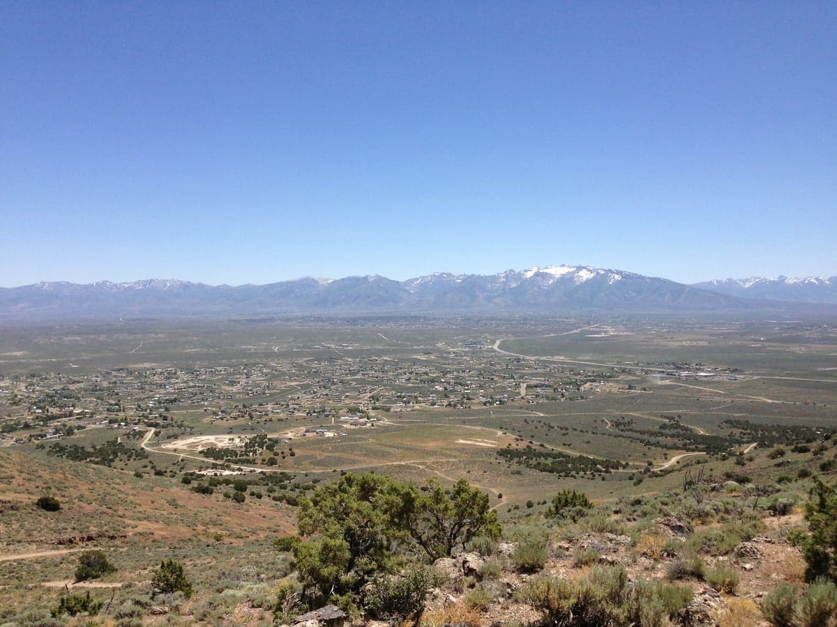
Spring Creek, Nevada, sits in a unique strategic pocket that balances genuine resilience with real trade-offs. Located in Elko County, roughly 20 miles southeast of Elko itself, this unincorporated community of about 14,000 people offers a combination of high desert isolation, access to the Ruby Mountains, and proximity to Interstate 80 that makes it a serious candidate for anyone thinking long-term about security, self-sufficiency, and distance from the chaos of the West Coast. The area's elevation (around 5,700 feet), cold winters, and dry climate mean it's not for everyone, but for those who can handle the extremes, the location provides a buffer that many other "remote" towns simply don't have.
Geographic position and natural advantages for long-term security
Spring Creek's primary strategic asset is its position in the northeastern Nevada basin and range country, far from the major population corridors of the I-5 and I-15. The community sits at the base of the Ruby Mountains, which provide a natural barrier to the west and a reliable water source from snowmelt. The Humboldt River runs through the region, and while Spring Creek itself relies on groundwater and the South Fork of the Humboldt, the overall watershed is a significant advantage in a state where water rights are everything. The area is roughly 300 miles from Salt Lake City and 400 miles from Reno, putting it outside the immediate fallout zone of any major metropolitan target. The nearest city of any size is Elko, which at 20,000 people is small enough that it wouldn't be a primary target in a major conflict, but large enough to have a hospital, airport, and supply chain infrastructure. The Ruby Mountains offer hunting, fishing, and timber resources that could support a small population in a grid-down scenario, and the high desert terrain provides excellent line-of-sight for security and limited avenues of approach for any potential threat. The climate is arid, with annual precipitation around 10 inches, so water storage and management are non-negotiable, but the snowpack in the Rubies provides a renewable source that many other dry western locations lack.
Risks, exposures, and proximity to fallout-relevant landmarks
No location is perfect, and Spring Creek has its share of vulnerabilities. The most obvious is Interstate 80, which runs just north of the community. In a collapse scenario, I-80 would become a major evacuation route from the West Coast, potentially bringing millions of people through the area. Elko sits at the junction of I-80 and US 93, making it a natural choke point. If things go bad, Spring Creek could see significant refugee traffic, and the community's location on the south side of the interstate means it's not directly on the main line, but it's close enough to be affected. The area is also within 150 miles of the Nevada Test Site (now the Nevada National Security Site), where historical nuclear testing occurred. While the site is currently used for subcritical experiments and training, any major conflict could see it reactivated or targeted. The Toano Range and the Goshute Valley to the east contain military training areas and the Utah Test and Training Range, which could become relevant in a conflict scenario. The area is also seismically active, with the Ruby Mountains fault zone capable of producing magnitude 6.5+ earthquakes. The 2008 Wells earthquake (magnitude 6.0) demonstrated that even moderate events can cause significant damage in this region. Wildfire risk is moderate, but the dry conditions and high winds can turn a small fire into a major threat quickly. The community's water supply is groundwater-dependent, and any contamination event (natural or man-made) would require immediate alternative sources.
Practical resilience for a relocator: food, water, energy, and defensibility
For someone serious about preparedness, Spring Creek offers a mixed bag. Water is the critical issue. The area gets about 10 inches of rain annually, and while the Ruby Mountains provide snowmelt, capturing and storing that water requires infrastructure. Most homes in Spring Creek are on well water, which means you control your own supply, but wells can fail, and the water table can drop. A minimum of 1,000 gallons of stored water per person is recommended, and that's just for short-term events. For long-term sustainability, you'd need a combination of well, rainwater catchment, and possibly a spring development on the mountain. Food production is possible but challenging. The growing season is short (about 100 days), and the soil is alkaline and rocky. Raised beds with imported soil, greenhouses, and cold frames are essential for any serious gardening. The area does support livestock, and there are several ranches in the valley, so access to meat and dairy is possible if you have the land and the skills. Energy is relatively straightforward. The area gets over 300 days of sunshine per year, making solar a viable option. Wind is also consistent, especially in the spring and fall, so a hybrid system is ideal. The grid is reliable for now, but any major event would likely knock it out, and the rural nature of the area means restoration could take weeks. Defensibility is one of Spring Creek's strongest points. The community is laid out in a series of subdivisions on the bench above the valley, with limited road access. The main routes are Spring Creek Parkway and Lamoille Highway, both of which can be monitored and controlled. The terrain to the west is the Ruby Mountains, which are impassable to vehicles, and to the east is the open desert, which provides excellent visibility. The community itself is spread out, with lots typically 1-5 acres, giving you space and privacy. The nearest hospital is in Elko, about 20 minutes away, and the Elko Regional Airport can handle small jets and cargo planes, which could be critical for resupply or evacuation.
The overall strategic picture for Spring Creek is one of calculated trade-offs. It's not a bug-out location in the sense of being completely off the grid—it's a community with infrastructure, neighbors, and a connection to the outside world. That's both a strength and a weakness. The isolation from major population centers is real, but the proximity to I-80 and Elko means you're not completely cut off from the chaos. For someone who wants to be prepared for civic unrest, mass casualty events, and disasters, Spring Creek offers a solid foundation: water from the mountains, defensible terrain, a conservative and self-reliant local culture, and enough distance from the coasts to avoid the immediate fallout. The downsides are the dry climate, the short growing season, and the risk of refugee traffic on the interstate. If you're willing to invest in water storage, food production infrastructure, and a good solar setup, this area can work. If you're looking for a place where you can ride out the storm without being in the middle of it, Spring Creek deserves a serious look. Just don't expect it to be easy—nothing worth doing ever is.
* Values derived from national, state, county, city and local statistics and may differ in a specific area. Last updated: 2026-05-02T04:19:49.000Z
Narrative content on this page is AI-generated and may contain mistakes. Verify any details that matter before acting on them.
ReloMaps may earn a commission from affiliate links at no extra cost to you.