Photo: Wikipedia
Strategic Assessment of Newberry County
Workable tactical position. Some exposure to population density or targets, but generally defensible in a crisis.
What does the Strategic Assessment tell us?
Our Strategic Assessment grades tactical survivability of an area. Major population centers, military targets, fallout zones, natural disasters, and border exposure all drive risk — lower exposure means a more defensible position in a crisis.
This is heavily inspired by Joel Skousen's Strategic Relocation book. Highly recommended you checkout the book ($)What does this tell us?
Our Strategic Assessment grades tactical survivability of an area. Major population centers, military targets, fallout zones, natural disasters, and border exposure all drive risk — lower exposure means a more defensible position in a crisis.
This is heavily inspired by Joel Skousen's Strategic Relocation book. Highly recommended you checkout the book ($)Strategic Pillars

Key Distances
Strategic Assessment Analysis
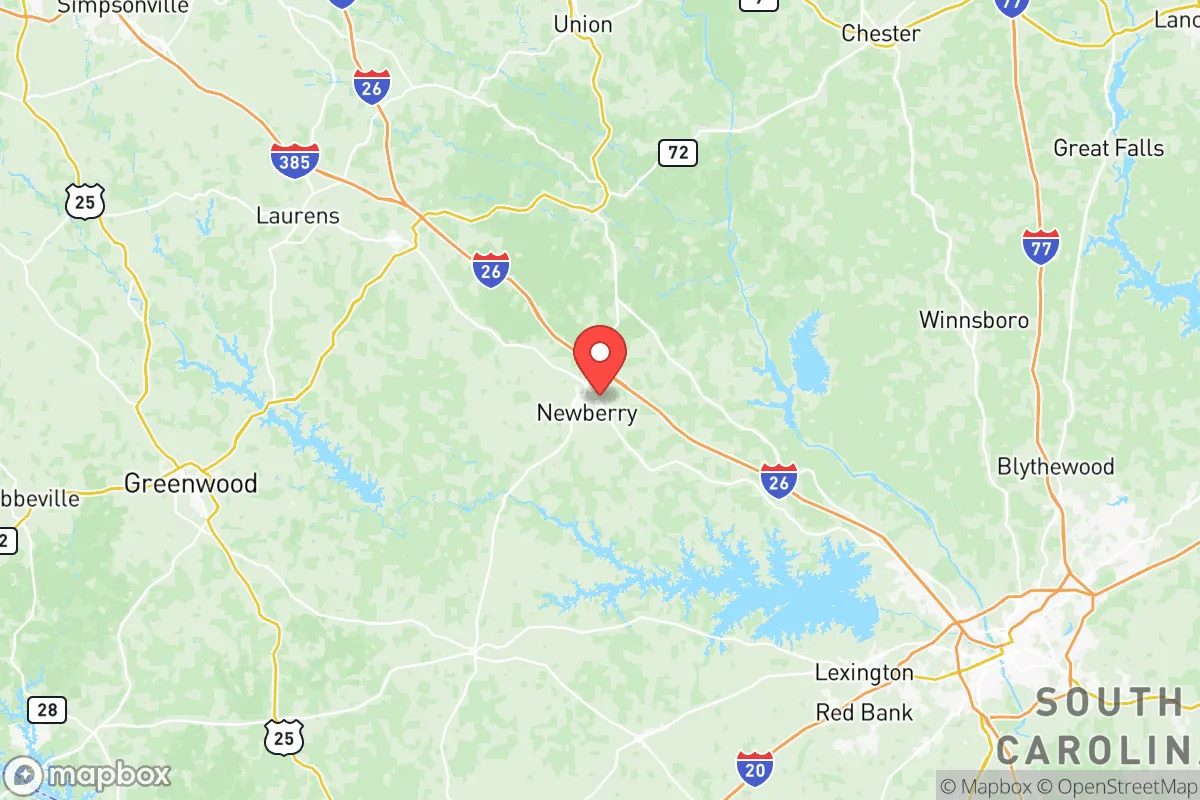
Newberry County, South Carolina, occupies a strategic position in the Piedmont region that offers a compelling mix of geographic insulation and practical self-sufficiency for those prioritizing disaster readiness. Located roughly 45 minutes northwest of Columbia and an hour southeast of Greenville, the county sits outside the immediate blast and fallout zones of major metropolitan targets while still providing access to regional supply chains. The county seat, Newberry, anchors a rural landscape of rolling hills, working farms, and dense pine forests that create natural buffers against both man-made and natural disruptions, making it a location worth serious consideration for relocators focused on long-term resilience.
Geographic position and natural advantages for disaster preparedness
Newberry County's location in the South Carolina Piedmont places it on a geologic transition zone between the coastal plain and the Blue Ridge foothills, offering several inherent resilience advantages. The area sits at elevations ranging from 300 to 600 feet above sea level, well above the flood-prone coastal zones that threaten Charleston and the Lowcountry. The county is drained by the Saluda River and the Broad River, both of which provide reliable freshwater sources without the catastrophic flooding risk associated with coastal storm surge. The terrain is characterized by gently rolling hills and mixed hardwood-pine forests, which provide natural cover and defensible positions compared to flat, open farmland. The county's position along Interstate 26 gives residents a direct evacuation route toward the mountains, while U.S. Highway 76 and State Road 34 offer secondary corridors that avoid the congestion of major metropolitan arteries. The nearby Sumter National Forest, which extends into the county's western edge, provides a vast public land buffer and potential resource zone for those practicing self-sufficiency. The climate is humid subtropical with four distinct seasons, supporting year-round food production without the extreme weather events that plague other regions—tornadoes are rare, and the area lies outside the highest-risk hurricane zones.
Risks, exposures, and proximity to fallout-relevant landmarks
While Newberry County offers strong geographic insulation, it is not without exposure to risks that a strategic relocator must weigh. The most significant man-made risk comes from the county's proximity to the Savannah River Site, a nuclear materials processing facility located about 60 miles southwest in Aiken County. In the event of a major incident at this Department of Energy site, prevailing winds could carry fallout across the region, though Newberry's distance and intervening terrain provide meaningful attenuation. The county is also roughly 90 miles from Fort Jackson, the Army's largest initial training base near Columbia, which could become a secondary target in a conflict scenario. The Lake Murray Dam, located about 30 miles southeast near Irmo, represents a critical infrastructure vulnerability—a breach could send floodwaters down the Saluda River corridor, though Newberry sits upstream of the dam's primary flood zone. Natural risks are comparatively mild: the area experiences occasional ice storms and severe thunderstorms, with the most recent significant event being the 2014 ice storm that knocked out power for several days across the region. The county lies in Seismic Zone 1, the lowest earthquake risk category in the eastern U.S., and the 1886 Charleston earthquake caused only minor shaking here. Wildfire risk is moderate, concentrated in the forested western portions of the county near the Sumter National Forest boundary.
Practical resilience for a relocator: food, water, energy, and defensibility
For the relocator focused on practical self-sufficiency, Newberry County offers strong fundamentals. The county's agricultural heritage means local food production is well-established, with working farms producing poultry, cattle, soybeans, corn, and timber. The Newberry Farmers Market operates seasonally, and the surrounding rural areas have numerous small farms selling directly to consumers. Water availability is a major advantage: the county sits atop the Cretaceous aquifer system, which provides abundant groundwater at moderate depths—most rural properties can access potable water through private wells at 100-200 feet. Surface water is also plentiful via the Saluda and Broad Rivers, as well as numerous creeks and ponds. For energy resilience, the county is served by Newberry Electric Cooperative, a member-owned utility that has demonstrated better outage recovery times than investor-owned utilities in the region. Solar potential is good, with the area receiving an average of 5.2 peak sun hours per day, and the county's zoning codes are generally favorable for off-grid installations. The rural character of the county provides natural defensibility: properties are spread out, with many homes set back from main roads and screened by tree lines. The county's population density is just 57 people per square mile, compared to South Carolina's average of 170, meaning fewer neighbors to compete with for resources during a disruption. The Newberry County Sheriff's Office maintains a visible presence in rural areas, and the county has a strong tradition of community mutual aid, particularly among farming families and church networks.
The overall strategic picture for Newberry County is one of balanced resilience with manageable trade-offs. It offers the geographic insulation and natural resources that support long-term self-sufficiency, while remaining close enough to Columbia and Greenville for access to medical centers, supply chains, and employment opportunities. The primary risks—proximity to the Savannah River Site and the Lake Murray Dam—are real but distant enough that they don't dominate the risk calculus for most relocators. For the conservative-leaning individual or family seeking a location that combines rural independence with practical preparedness, Newberry County represents a solid choice in the Southeast. The county's mix of working farmland, abundant water, low population density, and moderate climate creates a foundation that can be built upon with personal preparation. As with any relocation decision, a site visit to assess specific property locations, well depths, and neighbor proximity is recommended before committing, but the county's fundamentals are strong enough to warrant serious consideration.
* Values derived from national, state, county, city and local statistics and may differ in a specific area. Last updated: 2026-06-11T19:11:05.000Z
Narrative content on this page is AI-generated and may contain mistakes. Verify any details that matter before acting on them.
ReloMaps may earn a commission from affiliate links at no extra cost to you.