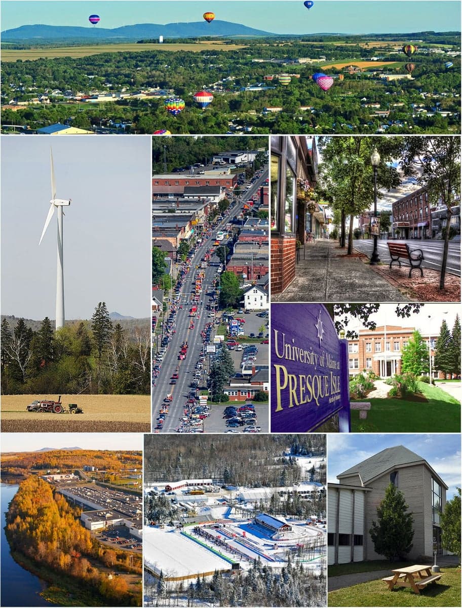
Photo: Wikipedia
Strategic Assessment of Presque Isle, ME
Meaningful friction. Expect exposure to either population pressure, blast zones, or natural disaster risk. Consider buying a retreat property.
What does the Strategic Assessment tell us?
Our Strategic Assessment grades tactical survivability of an area. Major population centers, military targets, fallout zones, natural disasters, and border exposure all drive risk — lower exposure means a more defensible position in a crisis.
This is heavily inspired by Joel Skousen's Strategic Relocation book. Highly recommended you checkout the book ($)What does this tell us?
Our Strategic Assessment grades tactical survivability of an area. Major population centers, military targets, fallout zones, natural disasters, and border exposure all drive risk — lower exposure means a more defensible position in a crisis.
This is heavily inspired by Joel Skousen's Strategic Relocation book. Highly recommended you checkout the book ($)Strategic Pillars

Key Distances
Regional Safe Places
Below is our recommended "safe zones" in Maine and the surrounding area based on our strategic heuristics. For most people, it's unrealistic to live in a “safe zone” full-time due to work, family or other personal reasons. They tend to be more rural. However, many of these areas are perfect for second homes and retreat properties that double as a vacation home or even a short-term rental.


Important Note: For informational purposes only. This does not mean nothing bad ever happens in the green zones. Please use common sense. This is based on public data and modeled with AI. We tried to take a conservative approach but mistakes happen. We update this regularly as new information becomes available.
Solar Generator Recommendations
Backup power matters more here than in safer locations. We've picked three solar generators across budgets and capacity tiers — start with the budget unit if you only need a few essentials, or step up if you want to run a fridge and HVAC for days at a time.

Jackery Portable Power Station Explorer 300
Budget OptionPower on the Go: Weighing only 11 lbs, it's convenient to set up and store with book-sized foldable solar panels

BLUETTI Portable Power Station AC180
Designed for both indoor and outdoor scenarios, AC180 is highly capable as it has a robost capacity and continuous output power.

EF ECOFLOW DELTA Pro Ultra Power Station
Upgraded PickEcoFlow DELTA Pro Ultra is a whole-home energy system designed to grow with your family. Integrated with the Smart Home Panel 2, it scales to meet your evolving energy needs — keeping your home powered, intelligent, and secure through every stage of life.
We earn a commission, at no additional cost to you.
Strategic Assessment Analysis
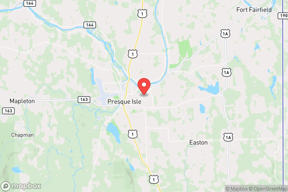
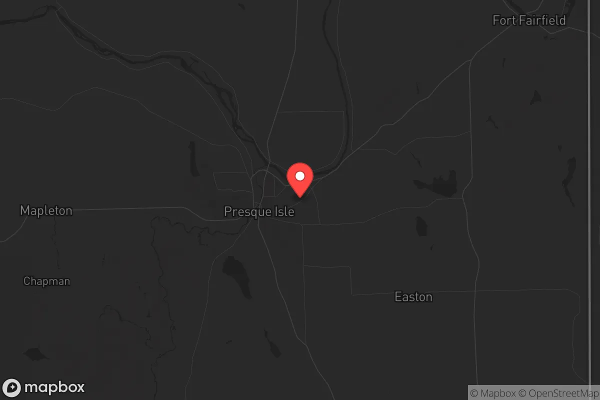
Presque Isle, Maine, offers a strategic relocation option for those prioritizing resilience and self-sufficiency, sitting at the northern terminus of Interstate 95 and within a 90-minute drive of the Canadian border. This Aroostook County hub, with a population of roughly 8,800, is insulated from the cascading failures of major metropolitan corridors by over 300 miles of sparsely populated terrain. Its location provides a natural buffer against the fallout of coastal population centers, while its agricultural base and access to freshwater resources make it a viable long-term holding ground for those preparing for civic unrest or systemic disruptions.
Geographic position and natural advantages for long-term security
Presque Isle’s primary strategic asset is its isolation. The city sits in the heart of Aroostook County, a region larger than Connecticut and Rhode Island combined but with fewer than 70,000 residents. This low population density means fewer vectors for disease transmission, less competition for resources during a crisis, and a reduced likelihood of being caught in mass evacuation routes. The surrounding landscape is dominated by potato fields, forests, and the Aroostook River, offering ample space for subsistence farming, hunting, and foraging. The proximity to the Canadian border—specifically the crossing at Fort Fairfield, 12 miles east—provides a potential secondary egress or supply route if domestic infrastructure falters. The area’s cold climate, with average winter lows near 0°F, acts as a natural deterrent to transient populations and limits the viability of many pests and pathogens. For a relocator, this means a built-in barrier to the chaos that often follows urban disasters.
Risks, exposures, and proximity to fallout-relevant landmarks
Presque Isle is not without vulnerabilities, but they are largely manageable compared to urban alternatives. The nearest major population center is Bangor, 150 miles south, which itself is a secondary target at best. The Loring Air Force Base, 15 miles north in Limestone, was decommissioned in 1994 and now operates as a commercial and industrial park; its former nuclear weapons storage igloos are sealed and monitored, posing no active threat. The closest active military installation is the Bangor Air National Guard Base, which is too distant to draw direct retaliation. The primary risk is economic isolation: Presque Isle’s economy relies heavily on agriculture (potatoes, broccoli) and healthcare (Northern Light AR Gould Hospital), meaning a prolonged supply chain disruption could strain local food availability if harvests fail. The region is also prone to severe winter storms that can knock out power for days, though most residents are accustomed to this and maintain backup systems. For a prepper, the lack of high-value infrastructure—no major ports, no nuclear plants, no data hubs—makes it a low-priority target in any conflict scenario.
Practical resilience for a relocator: food, water, energy, and defensibility
Presque Isle excels in the fundamentals of self-reliance. The surrounding Aroostook County produces roughly 90% of Maine’s potatoes, and local farms offer direct-to-consumer sales, seed potatoes, and livestock feed. The Aroostook River and numerous smaller streams provide reliable freshwater, though well-drilling is common for rural properties. The city’s municipal water supply draws from groundwater sources, reducing contamination risks from surface runoff. Energy resilience is moderate: the local grid is served by Versant Power, with frequent outages in winter, but many homes already have wood stoves or pellet boilers as primary heat sources. Solar potential is limited by latitude (46.7°N) and cloud cover, but small-scale wind turbines or propane generators are practical alternatives. Defensibility is strong due to the region’s geography—dense forests, limited road access, and a culture of firearms ownership (Maine has a shall-issue concealed carry law and no state-level assault weapon ban). The nearest National Guard armory is in Caribou, 10 miles north, but the local sheriff’s office and state police response times can exceed 30 minutes in rural areas, meaning personal security is a household responsibility. For a relocator, this means you can secure a property with a defensible perimeter, establish off-grid water and heat, and integrate into a community that values neighborly assistance without expecting government intervention.
The overall strategic picture for Presque Isle is one of calculated trade-offs. You gain extreme isolation, a robust agricultural base, and a low-threat environment, but you sacrifice access to specialized medical care, diverse employment, and the convenience of urban supply chains. For a conservative-leaning individual or family focused on weathering systemic collapse—whether from economic instability, civil unrest, or geopolitical conflict—this area offers a realistic foundation for long-term survival. The key is to arrive with a plan: secure a property with a well and wood heat, establish relationships with local farmers and tradespeople, and maintain a vehicle capable of handling unplowed roads. Presque Isle won’t shield you from every disaster, but it will give you the space and resources to ride out the worst of them without being swept up in the chaos of the crowd.
* Values derived from national, state, county, city and local statistics and may differ in a specific area. Last updated: 2026-05-01T04:37:23.000Z
Narrative content on this page is AI-generated and may contain mistakes. Verify any details that matter before acting on them.
ReloMaps may earn a commission from affiliate links at no extra cost to you.