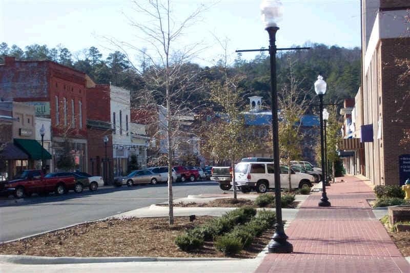

Photo: Wikipedia
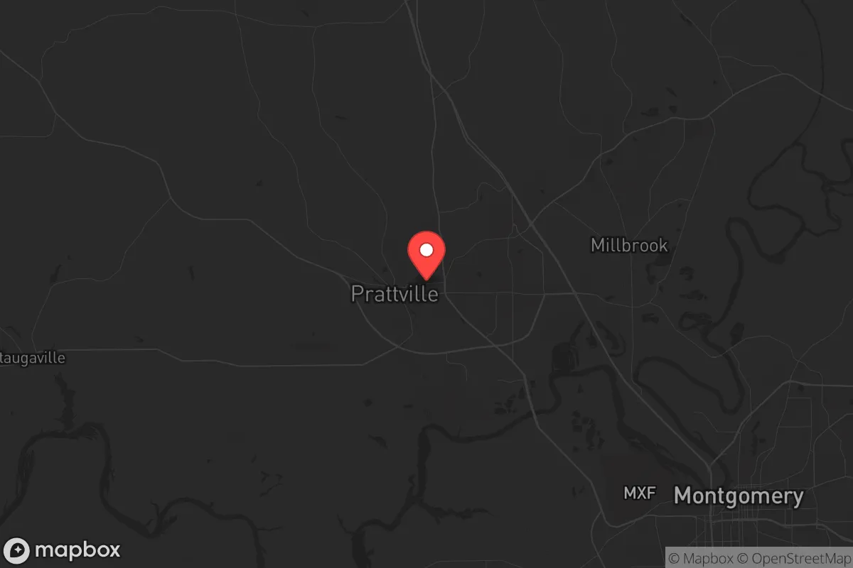
Strategic Assessment of Prattville, AL
Workable tactical position. Some exposure to population density or targets, but generally defensible in a crisis.
What does the Strategic Assessment tell us?
Our Strategic Assessment grades tactical survivability of an area. Major population centers, military targets, fallout zones, natural disasters, and border exposure all drive risk — lower exposure means a more defensible position in a crisis.
This is heavily inspired by Joel Skousen's Strategic Relocation book. Highly recommended you checkout the book ($)What does this tell us?
Our Strategic Assessment grades tactical survivability of an area. Major population centers, military targets, fallout zones, natural disasters, and border exposure all drive risk — lower exposure means a more defensible position in a crisis.
This is heavily inspired by Joel Skousen's Strategic Relocation book. Highly recommended you checkout the book ($)Strategic Pillars

Key Distances
Regional Safe Places
Below is our recommended "safe zones" in Alabama and the surrounding area based on our strategic heuristics. For most people, it's unrealistic to live in a “safe zone” full-time due to work, family or other personal reasons. They tend to be more rural. However, many of these areas are perfect for second homes and retreat properties that double as a vacation home or even a short-term rental.
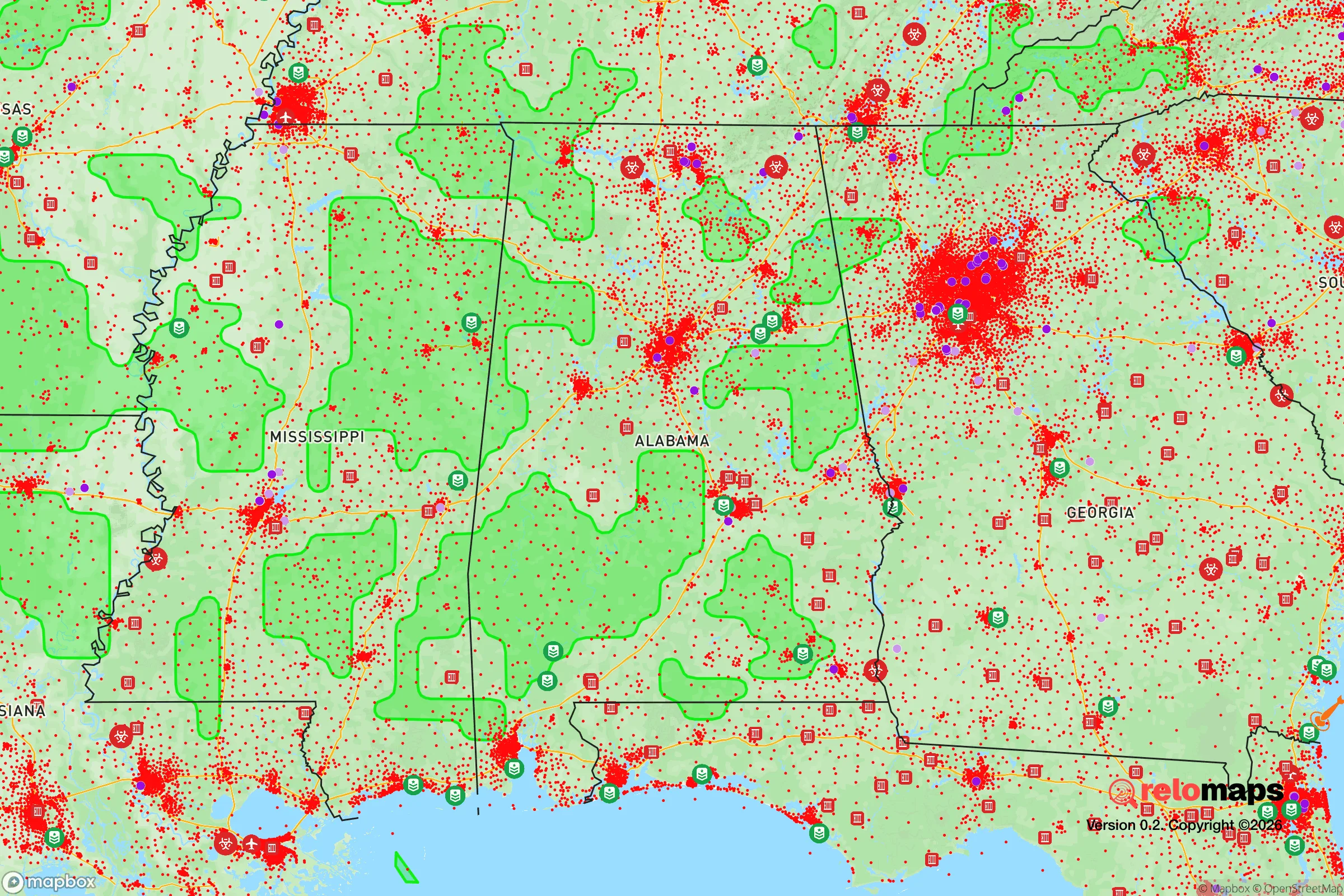
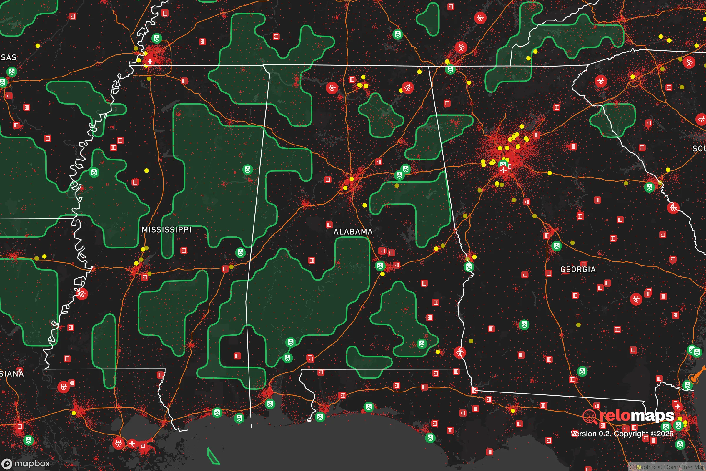
Important Note: For informational purposes only. This does not mean nothing bad ever happens in the green zones. Please use common sense. This is based on public data and modeled with AI. We tried to take a conservative approach but mistakes happen. We update this regularly as new information becomes available.
Solar Generator Recommendations
Backup power matters more here than in safer locations. We've picked three solar generators across budgets and capacity tiers — start with the budget unit if you only need a few essentials, or step up if you want to run a fridge and HVAC for days at a time.

Jackery Portable Power Station Explorer 300
Budget OptionPower on the Go: Weighing only 11 lbs, it's convenient to set up and store with book-sized foldable solar panels

BLUETTI Portable Power Station AC180
Designed for both indoor and outdoor scenarios, AC180 is highly capable as it has a robost capacity and continuous output power.

EF ECOFLOW DELTA Pro Ultra Power Station
Upgraded PickEcoFlow DELTA Pro Ultra is a whole-home energy system designed to grow with your family. Integrated with the Smart Home Panel 2, it scales to meet your evolving energy needs — keeping your home powered, intelligent, and secure through every stage of life.
We earn a commission, at no additional cost to you.
Strategic Assessment Analysis
Prattville, Alabama, offers a surprisingly resilient strategic position for those prioritizing preparedness, sitting at a deliberate distance from major metropolitan chaos while maintaining access to critical infrastructure. Its location along the Alabama River and just northwest of Montgomery provides a buffer from the immediate fallout of urban collapse, yet it remains close enough to leverage regional resources if the grid holds. For the prepper or survivalist assessing long-term viability, Prattville’s combination of geographic insulation, water access, and lower population density makes it a credible base of operations—provided you understand the specific risks baked into its surroundings.
Geographic position and natural advantages for long-term security
Prattville’s real strength is its position in the fall line zone, where the Piedmont plateau meets the coastal plain. This gives the area a mix of rolling hills and flatlands, offering defensible terrain without the isolation that makes resupply impossible. The Alabama River runs directly through the city’s eastern edge, providing a reliable surface water source that can be filtered or treated for drinking, irrigation, and sanitation—critical if municipal systems fail. The surrounding Autauga County is heavily forested with mixed pine and hardwoods, offering ample cover, firewood, and game for hunting or trapping. The climate is humid subtropical, meaning a year-round growing season for food production, though you’ll contend with heat and humidity that can stress both people and equipment. The area’s elevation, roughly 300 feet above sea level, keeps it above most flood risks from the river, though low-lying spots near the banks can flood during heavy rains. For a relocator, this means you can establish a self-sufficient homestead within a 15- to 30-minute drive of Prattville’s core, far enough from Montgomery’s sprawl to avoid the worst of civil unrest but close enough to trade or scavenge if needed.
Risks, exposures, and proximity to fallout-relevant landmarks
The biggest strategic liability is Prattville’s proximity to Montgomery, just 12 miles southeast. Montgomery is a state capital with a population over 200,000, a major transportation hub (I-65, I-85, and a regional airport), and a concentration of government buildings that could become targets during civil unrest or mass casualty events. In a grid-down scenario, expect refugees to flow northwest along Highway 31 and I-65, directly toward Prattville. The city itself has a population of about 37,000, which is manageable, but the surrounding Autauga County population density is roughly 60 people per square mile—low enough to avoid immediate crowding but high enough that you’ll have neighbors. There are no nuclear power plants within a 50-mile radius (the closest is the Joseph M. Farley Nuclear Plant near Dothan, about 100 miles southeast), but the Maxwell Air Force Base in Montgomery is a potential target for conventional or EMP strikes. The Alabama River also carries industrial traffic, including barges transporting chemicals and fuels, which could create secondary hazards if infrastructure fails. Tornadoes are a recurring natural threat—Prattville sits in Dixie Alley, with a higher frequency of violent, long-track tornadoes than the Great Plains. The 2011 Super Outbreak produced an EF-4 that hit nearby Tuscaloosa, and the 2019 Easter tornado outbreak caused damage in the region. For a prepper, this means you need a hardened shelter—a basement or reinforced safe room—since most homes here lack basements due to the high water table.
Practical resilience for a relocator: food, water, energy, and defensibility
Water is the strongest asset. The Alabama River provides a year-round, renewable source, but you’ll need a purification system—tablets, filters (like Berkey or Sawyer), or boiling capacity—since the river carries agricultural runoff and industrial residue from upstream. The average annual rainfall is about 54 inches, so rainwater catchment is viable with proper gutter systems and storage tanks. For food, the growing season runs from March to November, allowing two crop cycles for staples like corn, beans, and squash. Local soil is sandy loam in the river bottoms and clay-heavy on the hills, so raised beds or soil amendments are recommended. Hunting is legal with a license, and white-tailed deer, wild hogs, and turkey are abundant in the surrounding national forests (like the 25,000-acre Autauga National Wildlife Refuge, 20 minutes south). For energy, the grid is moderately reliable but vulnerable to storm outages; solar panels with battery storage are a smart investment, as the region gets about 215 sunny days per year. Natural gas is available in town, but rural properties rely on propane or wood. Defensibility is moderate: the terrain offers good natural cover, but the lack of natural chokepoints (mountains, rivers with steep banks) means you’ll need to harden your perimeter with fencing, lighting, and clear fields of fire if you’re serious about security. The local law enforcement presence is adequate for day-to-day, but in a SHTF scenario, you’re largely on your own—the Autauga County Sheriff’s Office has about 60 deputies for a 600-square-mile county.
Overall strategic picture for the conservative prepper
Prattville is not a bug-out location for the lone wolf—it’s a community-based resilience play for families and individuals who want to be part of a functioning social fabric while maintaining independence. The conservative lean of the area (Autauga County voted +36 points Republican in 2024) means you’ll find like-minded neighbors who value self-reliance, gun rights, and local governance. The local economy is anchored by manufacturing (including a large Hyundai plant in Montgomery) and agriculture, so there’s a baseline of practical skills in the population. The downsides are real: proximity to Montgomery’s potential chaos, tornado risk, and the need for significant upfront investment in water purification and shelter. But for a relocator who wants a defensible, resource-rich base within a day’s drive of the Gulf Coast and the Appalachian foothills, Prattville offers a solid middle ground. It’s not a fortress, but it’s a place where you can build one—if you’re willing to put in the work before the storm hits.
* Values derived from national, state, county, city and local statistics and may differ in a specific area. Last updated: 2026-04-19T19:06:40.000Z
Narrative content on this page is AI-generated and may contain mistakes. Verify any details that matter before acting on them.
ReloMaps may earn a commission from affiliate links at no extra cost to you.