
Photo: Wikipedia
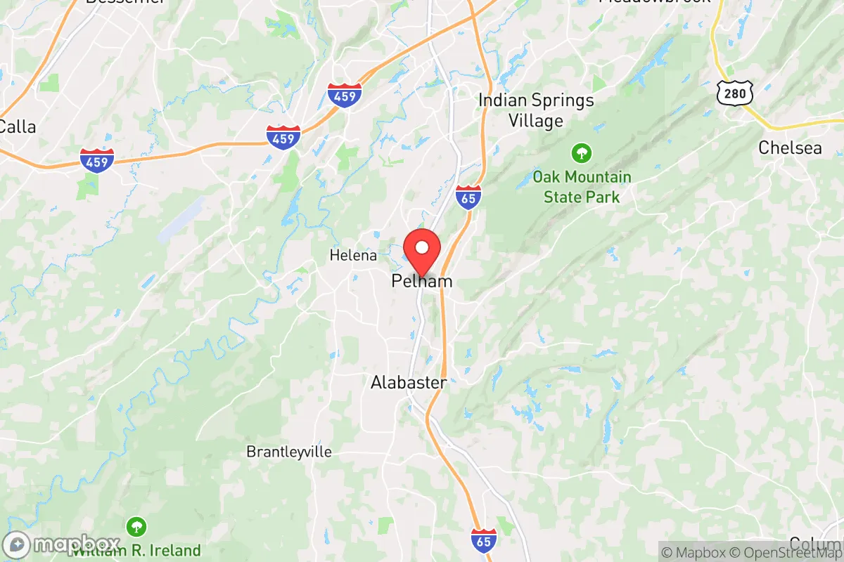
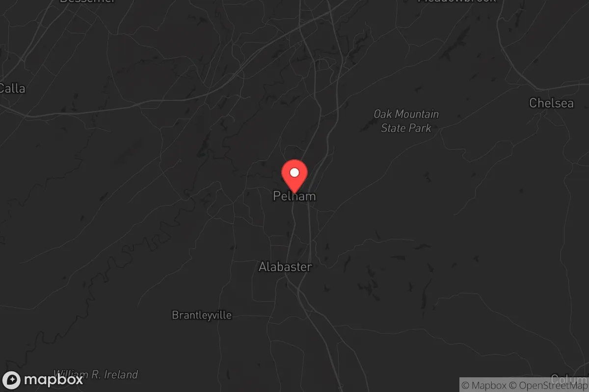
Strategic Assessment of Pelham, AL
Workable tactical position. Some exposure to population density or targets, but generally defensible in a crisis.
What does the Strategic Assessment tell us?
Our Strategic Assessment grades tactical survivability of an area. Major population centers, military targets, fallout zones, natural disasters, and border exposure all drive risk — lower exposure means a more defensible position in a crisis.
This is heavily inspired by Joel Skousen's Strategic Relocation book. Highly recommended you checkout the book ($)What does this tell us?
Our Strategic Assessment grades tactical survivability of an area. Major population centers, military targets, fallout zones, natural disasters, and border exposure all drive risk — lower exposure means a more defensible position in a crisis.
This is heavily inspired by Joel Skousen's Strategic Relocation book. Highly recommended you checkout the book ($)Strategic Pillars

Key Distances
Regional Safe Places
Below is our recommended "safe zones" in Alabama and the surrounding area based on our strategic heuristics. For most people, it's unrealistic to live in a “safe zone” full-time due to work, family or other personal reasons. They tend to be more rural. However, many of these areas are perfect for second homes and retreat properties that double as a vacation home or even a short-term rental.
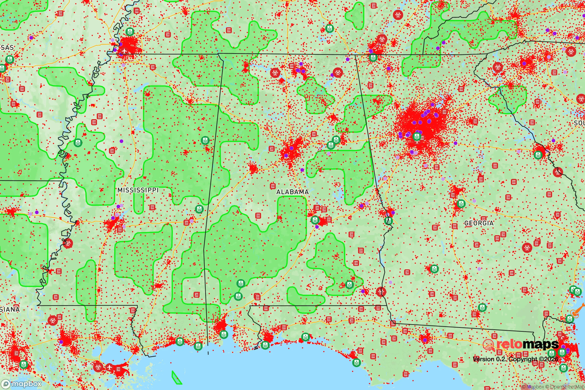
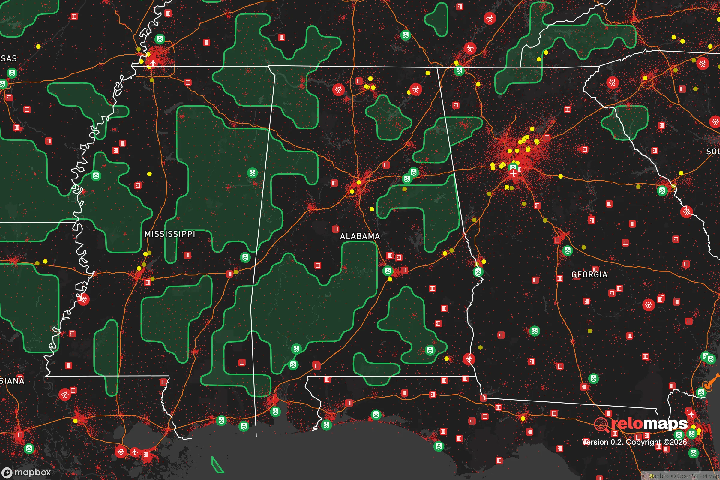
Important Note: For informational purposes only. This does not mean nothing bad ever happens in the green zones. Please use common sense. This is based on public data and modeled with AI. We tried to take a conservative approach but mistakes happen. We update this regularly as new information becomes available.
Solar Generator Recommendations
Backup power matters more here than in safer locations. We've picked three solar generators across budgets and capacity tiers — start with the budget unit if you only need a few essentials, or step up if you want to run a fridge and HVAC for days at a time.

Jackery Portable Power Station Explorer 300
Budget OptionPower on the Go: Weighing only 11 lbs, it's convenient to set up and store with book-sized foldable solar panels

BLUETTI Portable Power Station AC180
Designed for both indoor and outdoor scenarios, AC180 is highly capable as it has a robost capacity and continuous output power.

EF ECOFLOW DELTA Pro Ultra Power Station
Upgraded PickEcoFlow DELTA Pro Ultra is a whole-home energy system designed to grow with your family. Integrated with the Smart Home Panel 2, it scales to meet your evolving energy needs — keeping your home powered, intelligent, and secure through every stage of life.
We earn a commission, at no additional cost to you.
Strategic Assessment Analysis
Pelham, Alabama, sits in a sweet spot that few relocators fully appreciate: close enough to Birmingham’s economic engine to sustain a career and supply chain, yet far enough south and west to dodge the worst fallout corridors and urban chaos that could engulf a major metro during a crisis. This Shelby County town of roughly 24,000 offers a strategic buffer—roughly 20 miles south of Birmingham’s city center—that puts it outside the immediate blast radius of any high-value target in the metro, while still giving you access to the I-65 corridor for resupply or evacuation. For a prepper or survivalist weighing long-term stability, Pelham’s combination of suburban infrastructure, rural adjacency, and conservative governance makes it a credible base of operations, not just a place to ride out a storm.
Geographic position and natural advantages for long-term security
Pelham’s geography is its first line of defense. The city sits in the rolling foothills of the Appalachian range, with elevations around 500–600 feet that provide natural drainage and limited line-of-sight for any would-be threats. The surrounding Shelby County is heavily wooded with mixed pine and hardwood forests, offering both cover and a renewable source of building material and fuel. Water is the critical asset here: the Cahaba River runs just east of town, and the Coosa River system is within a 30-minute drive. Multiple smaller creeks and springs dot the area, meaning a relocator with basic mapping skills can secure a reliable water source without relying on municipal infrastructure. The local aquifer is robust, and private wells are common in the unincorporated areas just outside city limits. For a prepper, this means you’re not dependent on a single reservoir or treatment plant that could be compromised in a grid-down scenario. The climate is humid subtropical, with hot summers and mild winters—no deep freezes that would kill off food stores or freeze pipes for weeks on end. Growing seasons run from April to October, allowing for serious gardening and small-scale agriculture. The soil is clay-heavy but workable with raised beds or amendments, and local extension services are active for those wanting to go beyond hobby-level food production.
Risks, exposures, and proximity to fallout-relevant landmarks
No location is immune, and Pelham has its share of vulnerabilities that a strategic relocator must account for. The most obvious risk is Birmingham itself. While 20 miles provides a solid buffer against a conventional blast, a nuclear detonation at a major target—say, the Birmingham-Shuttlesworth International Airport, the University of Alabama at Birmingham medical complex, or the interstate interchange at I-65/I-20—would send fallout plumes that could reach Pelham depending on wind direction. The prevailing winds in north-central Alabama are from the west and southwest, which means a strike on Birmingham would likely push fallout east-northeast, away from Pelham. But that’s not guaranteed. A ground burst at the airport or the nearby Anniston Army Depot (roughly 60 miles east) could shift the calculus. The depot stores chemical weapons and conventional munitions, making it a high-value target in any conflict scenario. Pelham is far enough to avoid direct blast effects from Anniston, but fallout from a depot strike could drift west under certain conditions. Another exposure: the I-65 corridor itself. In a mass evacuation event, Pelham would become a choke point. The highway runs straight through town, and any panic exodus from Birmingham would clog the road within hours. Local roads like Highway 31 and County Road 52 offer alternative routes, but they’re not designed for mass throughput. For a prepper, this means having a secondary egress plan—preferably via back roads toward the rural areas of Chilton County or the Talladega National Forest—is non-negotiable. Natural disaster risks are moderate: tornadoes are the primary threat, with Shelby County averaging 1–2 significant tornado events per decade. Flooding is localized along the Cahaba River, but most of Pelham sits on higher ground. Earthquakes are negligible.
Practical resilience for a relocator: food, water, energy, and defensibility
Pelham’s practical resilience comes down to four pillars: food, water, energy, and defensibility. On food, the town has a solid agricultural periphery. The Shelby County Farmers Market in nearby Columbiana operates year-round, and local growers supply produce, meat, and eggs. For long-term storage, the area has multiple feed-and-seed stores and a Tractor Supply Co. that stocks seeds, tools, and animal feed. Hunting is legal in the surrounding national forest lands (Talladega National Forest is about 40 minutes east), with deer, turkey, and small game available. Fishing in the Coosa River system is productive. For water, as noted, private wells are the gold standard. If you’re buying property, prioritize a lot with an existing well or the geology to support one. Rainwater catchment is also viable given the 55+ inches of annual rainfall. Energy resilience is mixed. Pelham is served by Alabama Power, which has a relatively stable grid but is not immune to weather-related outages. Solar potential is moderate—the area gets about 4.5 peak sun hours per day, enough for a modest off-grid setup but not for heavy loads. Natural gas is available in most subdivisions, which is useful for backup heating and cooking. For defensibility, Pelham’s suburban layout is a double-edged sword. The town has a low crime rate (Shelby County consistently ranks among Alabama’s safest), but the density of subdivisions means you’re within earshot of neighbors. A rural property on the outskirts—say, near the community of Helena or toward the unincorporated areas of Vandiver—offers better standoff distance. The local law enforcement presence is professional and well-funded, but in a prolonged SHTF scenario, you cannot rely on a 911 call. The conservative culture of the area means a high percentage of residents are armed and familiar with firearms, which acts as a deterrent but also means you should expect your neighbors to be prepared. Community cohesion is strong; Shelby County has a robust church network and civic organizations that could serve as mutual-aid hubs in a crisis.
The overall strategic picture for Pelham is one of calculated viability. It’s not a remote bunker in the Rockies, and it’s not a self-sufficient homestead in the Dakotas. What it offers is a middle ground: proximity to medical resources, supply chains, and employment, combined with enough distance from the most likely targets to give you a fighting chance. The conservative governance of Alabama—low taxes, minimal regulation, strong Second Amendment protections—aligns with a prepper’s need for autonomy. The biggest trade-off is the Birmingham proximity. If you believe the risk of a major urban event is high, you’ll want to push farther south or east. But if you’re looking for a place where you can build a life now while maintaining the option to bug in or bug out, Pelham deserves a serious look. The key is to buy with an eye on water access, egress routes, and defensible space—and to treat the town as a base, not a fortress. With the right preparations, it can hold for the long haul.
* Values derived from national, state, county, city and local statistics and may differ in a specific area. Last updated: 2026-04-19T19:04:42.000Z
Narrative content on this page is AI-generated and may contain mistakes. Verify any details that matter before acting on them.
ReloMaps may earn a commission from affiliate links at no extra cost to you.