

Photo: Wikipedia
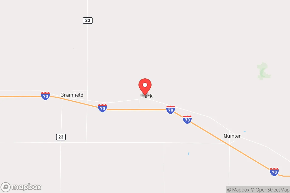
Strategic Assessment of Park City, KS
Strong survivability profile. Good buffer from population centers, with manageable environmental and tactical risks.
What does the Strategic Assessment tell us?
Our Strategic Assessment grades tactical survivability of an area. Major population centers, military targets, fallout zones, natural disasters, and border exposure all drive risk — lower exposure means a more defensible position in a crisis.
This is heavily inspired by Joel Skousen's Strategic Relocation book. Highly recommended you checkout the book ($)What does this tell us?
Our Strategic Assessment grades tactical survivability of an area. Major population centers, military targets, fallout zones, natural disasters, and border exposure all drive risk — lower exposure means a more defensible position in a crisis.
This is heavily inspired by Joel Skousen's Strategic Relocation book. Highly recommended you checkout the book ($)Strategic Pillars

Key Distances
Regional Safe Places
Below is our recommended "safe zones" in Kansas and the surrounding area based on our strategic heuristics. For most people, it's unrealistic to live in a “safe zone” full-time due to work, family or other personal reasons. They tend to be more rural. However, many of these areas are perfect for second homes and retreat properties that double as a vacation home or even a short-term rental.
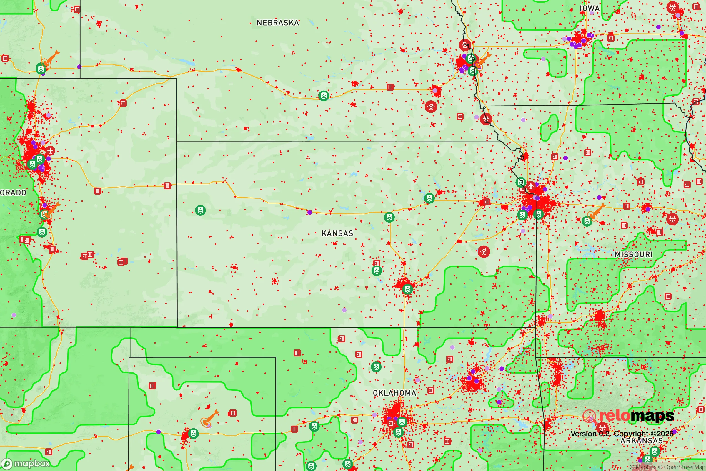
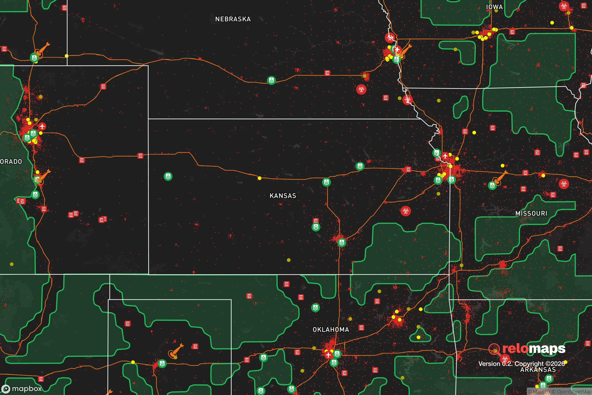
Important Note: For informational purposes only. This does not mean nothing bad ever happens in the green zones. Please use common sense. This is based on public data and modeled with AI. We tried to take a conservative approach but mistakes happen. We update this regularly as new information becomes available.
Solar Generator Recommendations
Backup power matters more here than in safer locations. We've picked three solar generators across budgets and capacity tiers — start with the budget unit if you only need a few essentials, or step up if you want to run a fridge and HVAC for days at a time.

Jackery Portable Power Station Explorer 300
Budget OptionPower on the Go: Weighing only 11 lbs, it's convenient to set up and store with book-sized foldable solar panels

BLUETTI Portable Power Station AC180
Designed for both indoor and outdoor scenarios, AC180 is highly capable as it has a robost capacity and continuous output power.

EF ECOFLOW DELTA Pro Ultra Power Station
Upgraded PickEcoFlow DELTA Pro Ultra is a whole-home energy system designed to grow with your family. Integrated with the Smart Home Panel 2, it scales to meet your evolving energy needs — keeping your home powered, intelligent, and secure through every stage of life.
We earn a commission, at no additional cost to you.
Strategic Assessment Analysis
Park City, Kansas offers a mixed strategic picture for the prepper-minded relocator: it sits close enough to Wichita to access resources, yet far enough to avoid the worst of urban collapse—but its proximity to McConnell Air Force Base and a major interstate corridor introduces real fallout risks. The area’s flat, agricultural landscape provides defensible sightlines and ample growing space, while the local water table and moderate climate support off-grid living. However, any serious assessment must weigh the convenience of suburban infrastructure against the heightened probability of being in a secondary target zone during a national crisis.
Geographic position and natural advantages for long-term survival
Park City lies in south-central Kansas, roughly 10 miles north of downtown Wichita, placing it on the edge of the Wichita metropolitan area. This location gives residents access to the Kansas Turnpike (I-35) and I-135, which connect to the broader interstate network—useful for evacuation or supply runs, but also a vector for refugee flow during unrest. The terrain is predominantly flat, open farmland, which offers excellent long-range visibility and makes ambush-style threats less likely. The Arkansas River runs just west of the city, providing a surface water source, though it’s heavily used and may carry agricultural runoff. The Ogallala Aquifer lies deeper beneath the region, but Park City’s municipal water comes from the Equus Beds aquifer, a reliable groundwater source that could be tapped with a private well. The climate is continental: hot summers, cold winters, and moderate precipitation (around 30 inches annually). Tornadoes are a real seasonal hazard, but the flat terrain also means you can dig a proper storm shelter or root cellar without hitting bedrock. For a relocator focused on self-sufficiency, the surrounding farmland offers opportunities for small-scale agriculture, livestock, and seed banking. The local soil is fertile loam, and the growing season runs roughly April through October.
Risks from proximity to Wichita and McConnell Air Force Base
The single biggest strategic liability for Park City is its location less than 5 miles from McConnell Air Force Base, home to KC-135 tankers and, increasingly, intelligence-gathering aircraft. In a major conflict or nuclear exchange, McConnell is a high-priority target. A ground burst at the base would produce fallout that could blanket Park City within hours, depending on wind direction. Even a conventional strike or sabotage event would draw immediate military and federal response, turning the surrounding area into a no-go zone for civilians. Additionally, Park City sits directly along I-135, a primary north-south corridor through Kansas. During a collapse scenario—whether economic, pandemic-related, or civil unrest—this highway will become a funnel for evacuees from Wichita (population ~390,000) heading north toward less populated areas. That means Park City could face waves of desperate people, looting, and resource competition. The city itself has a population around 8,000, so it lacks the critical mass to defend its perimeter without organized community effort. The Wichita metro area also contains several chemical plants, rail yards, and a major airport (ICT), all of which are potential secondary hazards from accidents or targeted attacks. For the prepper, the question isn’t if something happens near Wichita, but how quickly you can get clear of the blast and fallout zones.
Practical resilience: food, water, energy, and defensibility in Park City
On the positive side, Park City’s residential lots are generally larger than in dense suburbs—many homes sit on quarter-acre or half-acre plots, allowing room for gardens, chicken coops, and rainwater catchment. The city does not restrict backyard livestock in most zones, so you can keep chickens, goats, or rabbits without drawing attention. Local ordinances allow for private wells, though drilling costs run $5,000–$10,000 depending on depth. The Equus Beds aquifer sits about 100–200 feet down, and well water is generally potable with basic filtration. For energy, Kansas is a net exporter of wind power, but grid reliability during a crisis is questionable. Solar panels are a viable option—Park City averages 220 sunny days per year—and net metering is available through the local utility, Evergy. Battery storage is recommended to avoid grid dependence. Defensibility is a mixed bag: the flat terrain means you can see threats coming from a distance, but it also means your property is visible. A rural property on the outskirts of Park City (e.g., near 53rd Street North or along the river) offers better concealment with tree lines and agricultural buffers. The city itself has a small police force (about 15 officers), so during a breakdown, you cannot rely on rapid law enforcement response. Community networking is essential—several local church groups and farm co-ops already practice informal mutual aid, which can be leveraged for security and supply sharing. Food storage is straightforward: the area has multiple grain elevators, a local feed store, and a Costco in nearby Wichita for bulk purchasing. However, during a prolonged crisis, those supply chains will dry up quickly. A serious prepper should aim for at least a year’s worth of stored food, plus seeds and tools for gardening.
The overall strategic picture for Park City is one of calculated risk. It offers genuine advantages in water access, agricultural potential, and proximity to Wichita’s resources—but those same resources come with target liabilities and population pressure. For a relocator willing to invest in a well, solar, and a solid perimeter, and who has a plan to bug out north or west within the first 24 hours of a major event, Park City can serve as a viable base. It is not a remote retreat; it is a suburban outpost that requires active preparation and community engagement. If your priority is absolute isolation and zero fallout risk, look further west toward the High Plains. But if you want a balance of convenience and resilience, with the understanding that you’ll need to harden your property and build local alliances, Park City deserves a spot on your short list.
* Values derived from national, state, county, city and local statistics and may differ in a specific area. Last updated: 2026-05-14T18:57:16.000Z
Narrative content on this page is AI-generated and may contain mistakes. Verify any details that matter before acting on them.
ReloMaps may earn a commission from affiliate links at no extra cost to you.