
Photo: Wikipedia
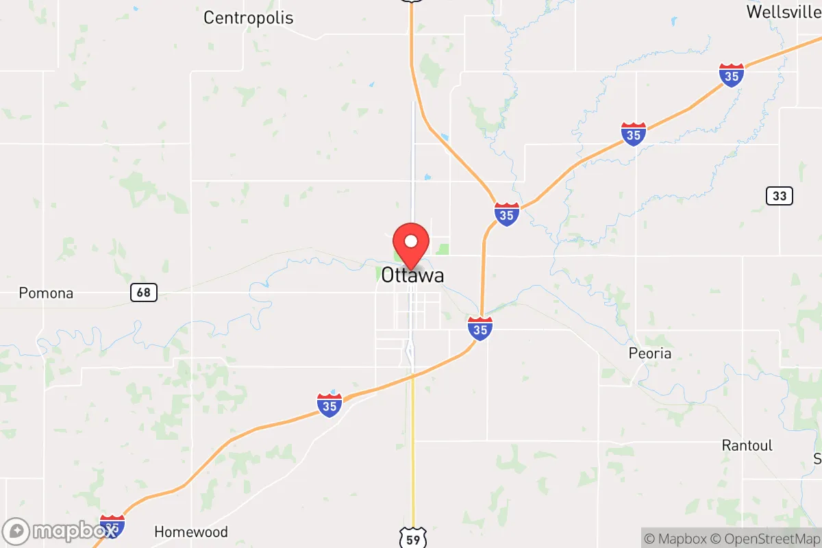
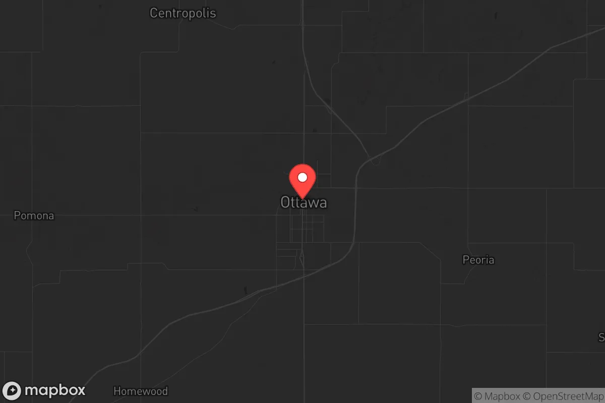
Strategic Assessment of Ottawa, KS
Workable tactical position. Some exposure to population density or targets, but generally defensible in a crisis.
What does the Strategic Assessment tell us?
Our Strategic Assessment grades tactical survivability of an area. Major population centers, military targets, fallout zones, natural disasters, and border exposure all drive risk — lower exposure means a more defensible position in a crisis.
This is heavily inspired by Joel Skousen's Strategic Relocation book. Highly recommended you checkout the book ($)What does this tell us?
Our Strategic Assessment grades tactical survivability of an area. Major population centers, military targets, fallout zones, natural disasters, and border exposure all drive risk — lower exposure means a more defensible position in a crisis.
This is heavily inspired by Joel Skousen's Strategic Relocation book. Highly recommended you checkout the book ($)Strategic Pillars

Key Distances
Regional Safe Places
Below is our recommended "safe zones" in Kansas and the surrounding area based on our strategic heuristics. For most people, it's unrealistic to live in a “safe zone” full-time due to work, family or other personal reasons. They tend to be more rural. However, many of these areas are perfect for second homes and retreat properties that double as a vacation home or even a short-term rental.
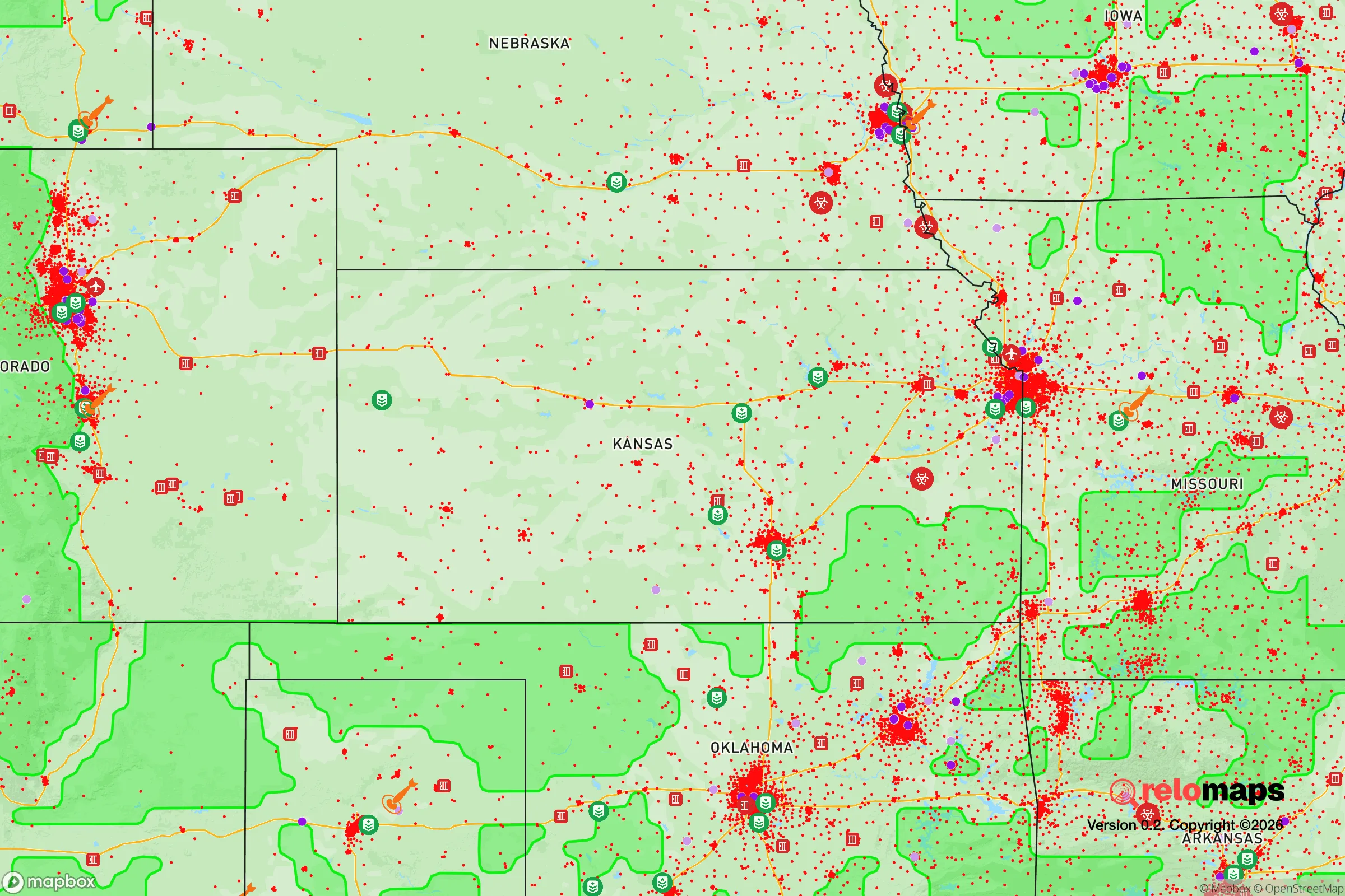
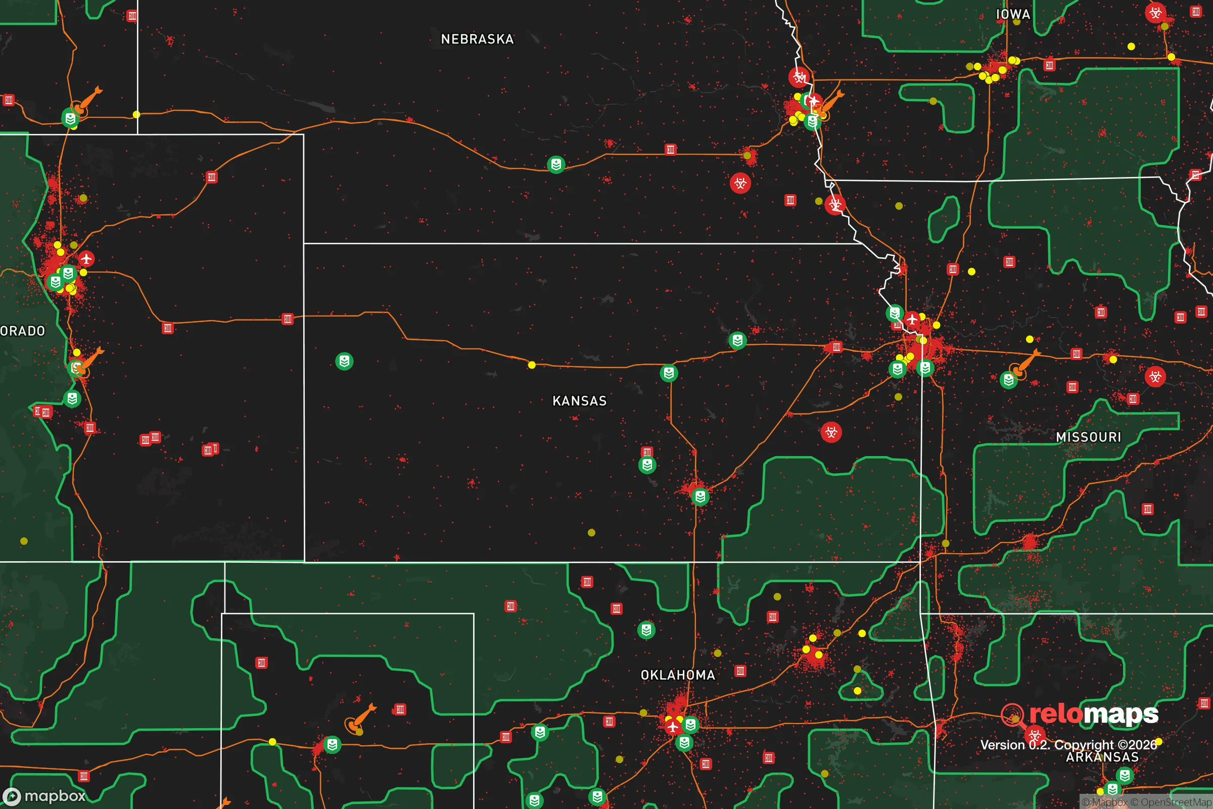
Important Note: For informational purposes only. This does not mean nothing bad ever happens in the green zones. Please use common sense. This is based on public data and modeled with AI. We tried to take a conservative approach but mistakes happen. We update this regularly as new information becomes available.
Solar Generator Recommendations
Backup power matters more here than in safer locations. We've picked three solar generators across budgets and capacity tiers — start with the budget unit if you only need a few essentials, or step up if you want to run a fridge and HVAC for days at a time.

Jackery Portable Power Station Explorer 300
Budget OptionPower on the Go: Weighing only 11 lbs, it's convenient to set up and store with book-sized foldable solar panels

BLUETTI Portable Power Station AC180
Designed for both indoor and outdoor scenarios, AC180 is highly capable as it has a robost capacity and continuous output power.

EF ECOFLOW DELTA Pro Ultra Power Station
Upgraded PickEcoFlow DELTA Pro Ultra is a whole-home energy system designed to grow with your family. Integrated with the Smart Home Panel 2, it scales to meet your evolving energy needs — keeping your home powered, intelligent, and secure through every stage of life.
We earn a commission, at no additional cost to you.
Strategic Assessment Analysis
Ottawa, Kansas, sits in a position that resilience-minded relocators should study closely: far enough from the major metro pressure zones to avoid the worst of civil unrest fallout, yet close enough to access critical supply chains when they function. This Franklin County seat of roughly 12,700 people offers a blend of agricultural self-sufficiency, modest industrial base, and geographic insulation that makes it a credible option for those prioritizing long-term preparedness over convenience. The town’s location along the Marais des Cygnes River and its historic rail infrastructure provide both assets and liabilities, depending on how you read the risk map.
Geographic position and natural advantages for long-term security
Ottawa’s primary strategic asset is its position roughly 50 miles southwest of the Kansas City metro area — close enough to monitor regional events, far enough to avoid the immediate blast radius of any major disruption. The town sits at the intersection of I-35 and US-50, giving it two solid evacuation corridors: north toward Topeka (30 miles) or south toward the Oklahoma border. The surrounding Franklin County is predominantly agricultural, with over 70% of land in row crops and pasture, meaning local food production capacity is high even if supply chains collapse. The Marais des Cygnes River provides a reliable freshwater source, though it’s not a major navigable waterway — more of a steady creek than a strategic water highway. The area’s rolling hills and scattered woodlots offer decent natural cover and defensible terrain for those with rural acreage, though the town itself is flat and exposed. Winters are cold but manageable, summers hot and humid; the climate supports year-round gardening with proper planning.
Risks, exposures, and proximity to fallout-relevant landmarks
No location is immune to risk, and Ottawa has specific vulnerabilities a prepper must weigh. The most obvious is proximity to the Kansas City metropolitan area — 50 miles is close enough that a major civil unrest event, EMP strike, or nuclear incident at the nearby Sunflower Army Ammunition Plant (30 miles northeast, in De Soto) could send refugees streaming down I-35 into Franklin County. The plant, though largely inactive, still stores munitions and poses a secondary hazard. Ottawa itself hosts a small rail yard and a few light industrial facilities, but nothing that qualifies as a high-value target. The town’s water treatment plant and electrical substations are vulnerable to sabotage or grid failure, as they are in any small city. Tornado risk is real — Franklin County sits in the heart of Tornado Alley, and the 2008 EF-4 that hit nearby Chapman is a reminder that natural disasters can compound man-made ones. Flooding along the Marais des Cygnes is a periodic concern, though the town’s levees have held since the 1990s. For the survivalist, the biggest risk is not direct attack but influx from a destabilized Kansas City — Ottawa would become a choke point on I-35, and the local police force of roughly 25 officers would be overwhelmed within hours.
Practical resilience for a relocator: food, water, energy, and defensibility
For a single individual or family looking to establish a resilient foothold, Ottawa offers a mixed bag. Food security is the strongest card: Franklin County has dozens of small farms, farmers’ markets, and a strong hunting culture (deer, turkey, small game). The local soil is fertile, and growing seasons run April through October. Water access is straightforward — the river is reliable, and most rural properties have wells. The city’s municipal water comes from the river and a series of wells, but a grid-down scenario would require private filtration or storage. Energy resilience is weaker: Ottawa’s grid is tied to the regional system, and while there are no major power plants nearby, the town does have a small natural gas peaker plant. Solar adoption is growing but still low; most preppers here rely on generators and propane. Defensibility depends on location. The town itself is open and hard to secure, but the surrounding rural areas offer excellent retreat properties — wooded hills, creek valleys, and limited road access. The local sheriff’s office is competent but small (about 30 deputies for the whole county), so self-reliance is the default. Medical care is limited to a 25-bed critical access hospital; major trauma means a 45-minute drive to Overland Park or Topeka. For the relocator, the play is to buy land outside town, establish a well and solar setup, and treat Ottawa as a resupply hub rather than a primary residence.
The overall strategic picture for Ottawa, Kansas, is one of moderate resilience with manageable exposure. It’s not a hardened bunker location like the Black Hills or the Idaho panhandle, but it offers a realistic balance for someone who wants to stay within striking distance of the Midwest’s economic core while maintaining a defensible rural base. The town’s agricultural capacity, water access, and evacuation routes are genuine assets. The liabilities — proximity to Kansas City, limited local law enforcement, tornado risk — are known and can be mitigated with proper planning. For the conservative-minded relocator who sees the current trajectory as unstable and wants a place that can absorb shocks without collapsing, Ottawa deserves a serious look. It’s not a fortress, but it’s a solid fallback position with room to grow your own food, store your own water, and keep your head down when the world gets loud.
* Values derived from national, state, county, city and local statistics and may differ in a specific area. Last updated: 2026-04-19T08:51:03.000Z
Narrative content on this page is AI-generated and may contain mistakes. Verify any details that matter before acting on them.
ReloMaps may earn a commission from affiliate links at no extra cost to you.