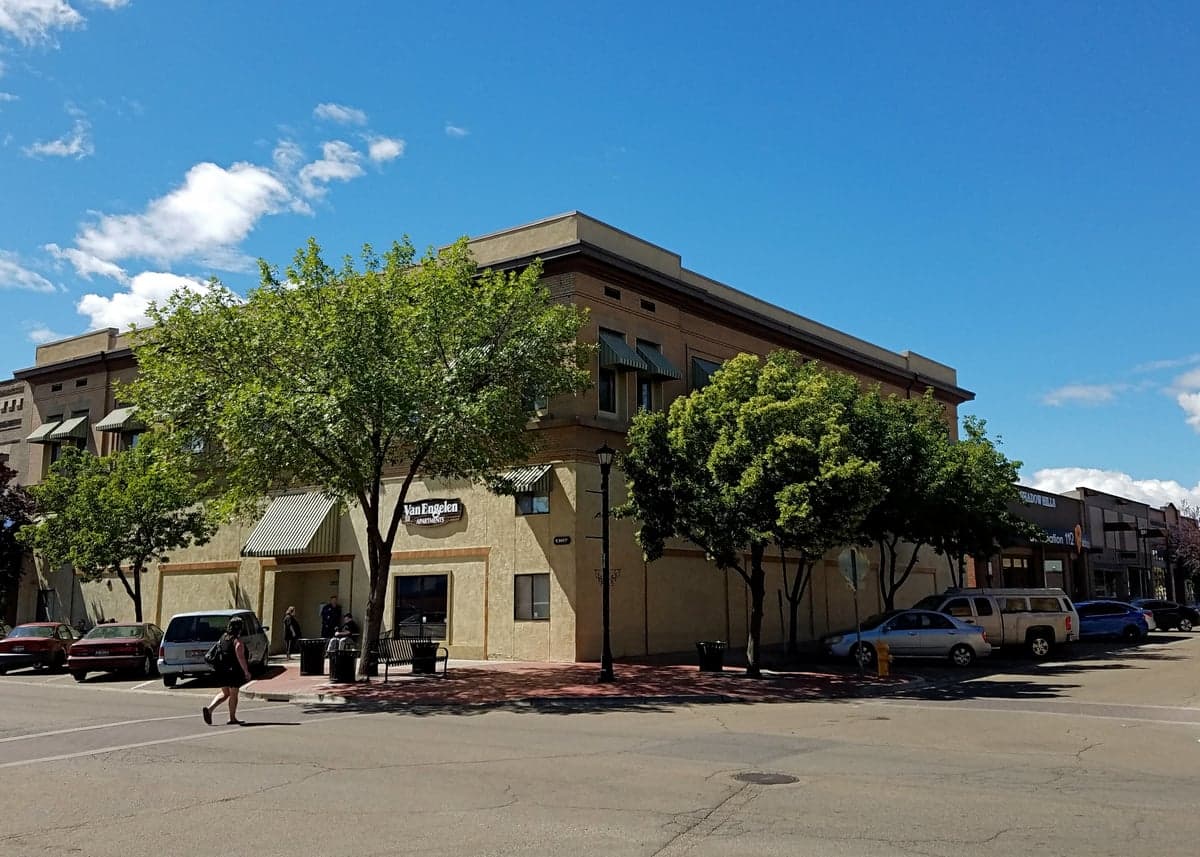
Photo: Wikipedia
Strategic Assessment of Nampa, ID
Strong survivability profile. Good buffer from population centers, with manageable environmental and tactical risks.
What does the Strategic Assessment tell us?
Our Strategic Assessment grades tactical survivability of an area. Major population centers, military targets, fallout zones, natural disasters, and border exposure all drive risk — lower exposure means a more defensible position in a crisis.
This is heavily inspired by Joel Skousen's Strategic Relocation book. Highly recommended you checkout the book ($)What does this tell us?
Our Strategic Assessment grades tactical survivability of an area. Major population centers, military targets, fallout zones, natural disasters, and border exposure all drive risk — lower exposure means a more defensible position in a crisis.
This is heavily inspired by Joel Skousen's Strategic Relocation book. Highly recommended you checkout the book ($)Strategic Pillars

Key Distances
Regional Safe Places
Below is our recommended "safe zones" in Idaho and the surrounding area based on our strategic heuristics. For most people, it's unrealistic to live in a “safe zone” full-time due to work, family or other personal reasons. They tend to be more rural. However, many of these areas are perfect for second homes and retreat properties that double as a vacation home or even a short-term rental.


Important Note: For informational purposes only. This does not mean nothing bad ever happens in the green zones. Please use common sense. This is based on public data and modeled with AI. We tried to take a conservative approach but mistakes happen. We update this regularly as new information becomes available.
Solar Generator Recommendations
Backup power matters more here than in safer locations. We've picked three solar generators across budgets and capacity tiers — start with the budget unit if you only need a few essentials, or step up if you want to run a fridge and HVAC for days at a time.

Jackery Portable Power Station Explorer 300
Budget OptionPower on the Go: Weighing only 11 lbs, it's convenient to set up and store with book-sized foldable solar panels

BLUETTI Portable Power Station AC180
Designed for both indoor and outdoor scenarios, AC180 is highly capable as it has a robost capacity and continuous output power.

EF ECOFLOW DELTA Pro Ultra Power Station
Upgraded PickEcoFlow DELTA Pro Ultra is a whole-home energy system designed to grow with your family. Integrated with the Smart Home Panel 2, it scales to meet your evolving energy needs — keeping your home powered, intelligent, and secure through every stage of life.
We earn a commission, at no additional cost to you.
Strategic Assessment Analysis
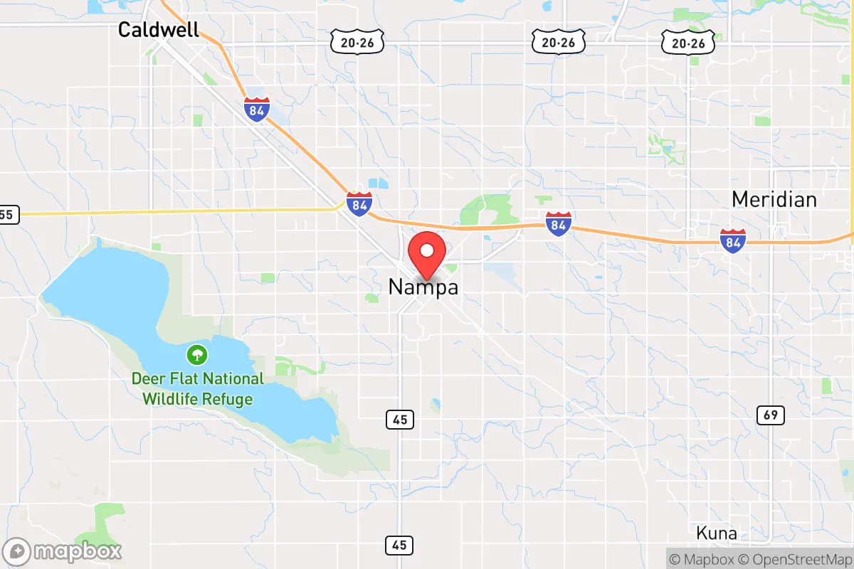
Nampa, Idaho, sits in a sweet spot that few relocation analysts fully appreciate: close enough to Boise’s economic engine to keep your career and supply lines intact, but far enough from the urban core to offer genuine strategic depth in a crisis. The city’s position along the Boise River and its access to the Snake River Plain give it a resilience profile that’s hard to beat in the Intermountain West, especially for someone thinking about long-term stability rather than just a pretty view. If you’re looking at Nampa through a prepper’s lens—factoring in food security, water access, and defensibility—the numbers and geography tell a story that deserves a hard look.
Geographic position and natural advantages for long-term stability
Nampa’s location at the western edge of the Treasure Valley places it roughly 20 miles west of Boise, which is far enough to avoid the worst of a metropolitan collapse but close enough to tap into regional resources. The city sits at an elevation of about 2,500 feet, giving it a moderate climate that avoids the brutal winters of eastern Idaho and the scorching summers of the southern desert. The Boise River runs just north of town, and the Snake River Aquifer—one of the largest groundwater systems in the country—lies beneath the entire region. That means Nampa has access to some of the most reliable freshwater in the western United States, a fact that becomes critical when municipal systems fail. The surrounding agricultural land is some of the most productive in Idaho, with sugar beets, onions, and wheat dominating the local farms. For a relocator thinking about food independence, the soil here is workable, the growing season runs about 150 days, and water rights are still obtainable if you know where to look. The topography is mostly flat to gently rolling, which makes it easy to set up a defensible perimeter without the visibility problems of a mountain hollow. You’re not hidden, but you’re not a target either—just another patch of farmland in a sea of green.
Risks, exposures, and proximity to fallout-relevant landmarks
No location is perfect, and Nampa has its share of vulnerabilities that a serious prepper needs to account for. The biggest risk is proximity to Boise, which is home to roughly 240,000 people and serves as the regional hub for government, healthcare, and transportation. In a major civil unrest scenario, Boise would be a flashpoint—and Nampa sits right on the edge of the fallout zone. Interstate 84 runs directly through Nampa, connecting it to Boise to the east and Ontario, Oregon, to the west. That highway is a double-edged sword: it’s your lifeline for trade and evacuation, but it’s also the most likely route for refugees fleeing the city. The Boise Airport, about 25 miles east, is a potential target for any coordinated attack on infrastructure, and the nearby Mountain Home Air Force Base (roughly 50 miles southeast) adds a military dimension that could attract attention in a conflict scenario. On the natural disaster front, the region is seismically active—the Wasatch Fault and the nearby Sawtooth Fault have produced quakes in the 6.0–7.0 range historically, and a major event could disrupt the water and power grid for weeks. Wildfire risk is moderate but growing, especially in dry summers when the surrounding sagebrush and grass become tinder. Flooding along the Boise River is a periodic concern, though Nampa’s elevation keeps most of the city out of the 100-year floodplain. The bottom line: Nampa is not a bunker, but it’s not a bullseye either. You need to plan for evacuation routes and have a bug-out location further east or north if things go sideways.
Practical resilience for a relocator: food, water, energy, and defensibility
For someone serious about self-sufficiency, Nampa offers a foundation that’s hard to replicate in most of the country. Water is the first concern, and the city’s municipal supply comes from the Boise River and deep wells tapping the Snake River Aquifer. But a prepper doesn’t rely on municipal lines. Drilling a private well in Nampa is feasible, with depths typically between 100 and 300 feet, and water quality is generally good with minimal treatment needed. The local soil is loamy and drains well, making it suitable for raised beds or traditional row gardening. You can grow potatoes, carrots, beans, and squash with relative ease, and the nearby farm supply stores carry everything from seed to irrigation pipe. For protein, the area supports chickens, goats, and even small-scale cattle operations on a few acres. Energy is a mixed bag: Idaho Power’s grid is mostly hydroelectric, which is reliable but vulnerable to drought and cyberattack. Solar is a solid bet here, with an average of 210 sunny days per year, and net metering policies are still favorable for grid-tied systems. Off-grid solar with battery storage is expensive but doable, and the local permitting process is straightforward compared to coastal states. Defensibility is where Nampa gets interesting. The city’s layout is mostly suburban sprawl, but the surrounding agricultural land offers natural buffer zones. If you buy property on the outskirts—say, south of Karcher Road or west toward the Oregon border—you get a clear line of sight in all directions and enough distance from neighbors to avoid unwanted attention. The local gun culture is strong, with multiple shooting ranges and a sheriff’s office that’s generally supportive of Second Amendment rights. Nampa’s crime rate is moderate, but property crime spikes during economic downturns, so a good security system and a well-stocked safe are non-negotiable. The community itself is a mixed bag: plenty of like-minded families and veterans, but also a growing population of transplants who don’t share the prepper mindset. Keep your circle small and your plans quiet.
The overall strategic picture for Nampa is one of cautious optimism. It’s not a remote survivalist retreat—you’re still within a day’s drive of Salt Lake City, Portland, and Seattle, which means you’re exposed to the chaos those cities generate. But for a relocator who wants a balance of economic opportunity, agricultural potential, and a community that still values independence, Nampa checks most of the boxes. The key is to buy land with water access, build a defensible home on the outskirts, and maintain a low profile. If the grid goes down, the Treasure Valley will become a contested zone, but Nampa’s agricultural base and groundwater give it a fighting chance that most suburbs simply don’t have. Plan for the worst, invest in your own infrastructure, and you’ll be in a position to ride out whatever comes—whether it’s a pandemic, a cyberattack, or a breakdown of civil order. Nampa isn’t a fortress, but it’s a damn good place to start building one.
* Values derived from national, state, county, city and local statistics and may differ in a specific area. Last updated: 2026-05-03T20:23:50.000Z
Narrative content on this page is AI-generated and may contain mistakes. Verify any details that matter before acting on them.
ReloMaps may earn a commission from affiliate links at no extra cost to you.