Photo: Wikipedia
Strategic Assessment of Mesquite, NV
Workable tactical position. Some exposure to population density or targets, but generally defensible in a crisis.
What does the Strategic Assessment tell us?
Our Strategic Assessment grades tactical survivability of an area. Major population centers, military targets, fallout zones, natural disasters, and border exposure all drive risk — lower exposure means a more defensible position in a crisis.
This is heavily inspired by Joel Skousen's Strategic Relocation book. Highly recommended you checkout the book ($)What does this tell us?
Our Strategic Assessment grades tactical survivability of an area. Major population centers, military targets, fallout zones, natural disasters, and border exposure all drive risk — lower exposure means a more defensible position in a crisis.
This is heavily inspired by Joel Skousen's Strategic Relocation book. Highly recommended you checkout the book ($)Strategic Pillars

Key Distances
Regional Safe Places
Below is our recommended "safe zones" in Nevada and the surrounding area based on our strategic heuristics. For most people, it's unrealistic to live in a “safe zone” full-time due to work, family or other personal reasons. They tend to be more rural. However, many of these areas are perfect for second homes and retreat properties that double as a vacation home or even a short-term rental.
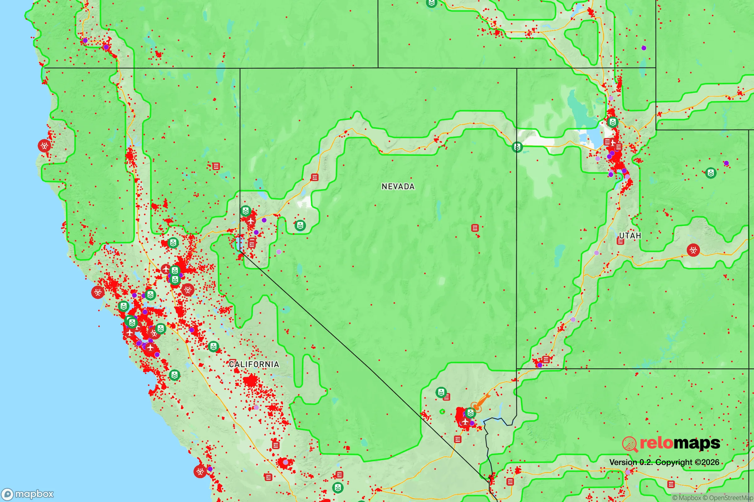
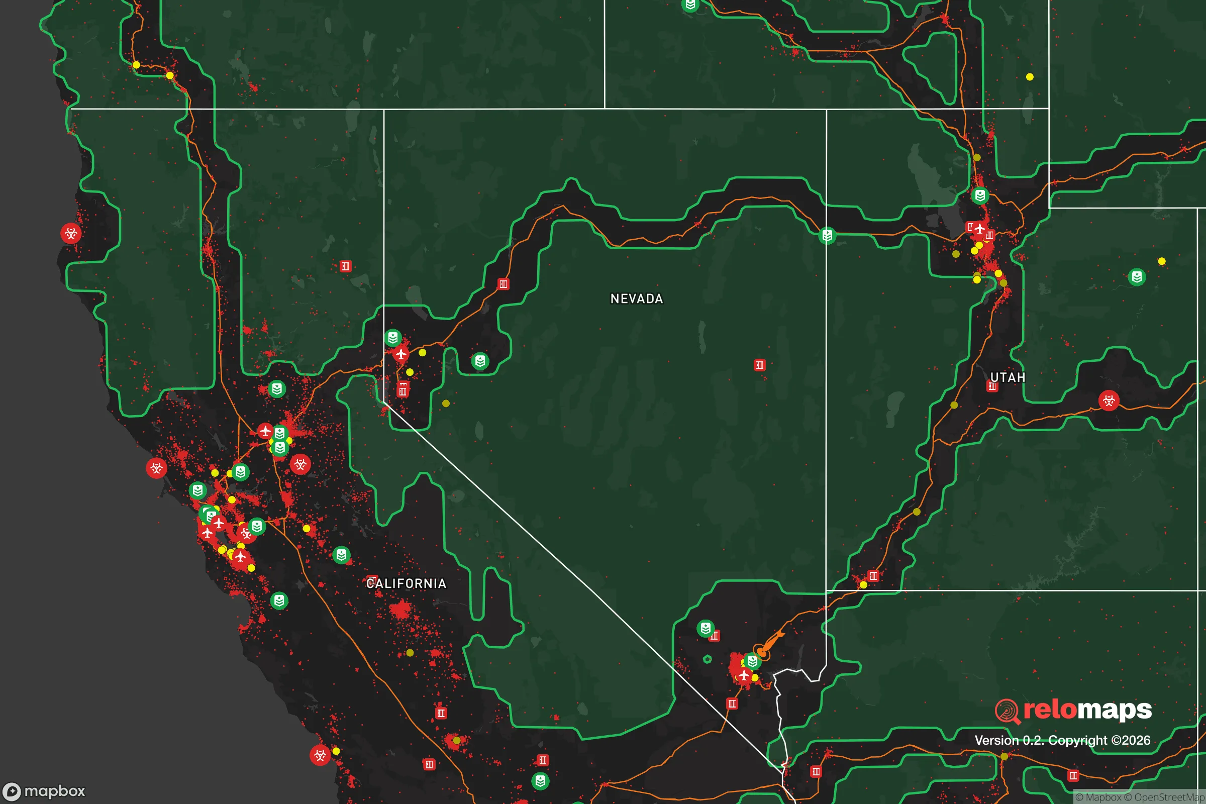
Important Note: For informational purposes only. This does not mean nothing bad ever happens in the green zones. Please use common sense. This is based on public data and modeled with AI. We tried to take a conservative approach but mistakes happen. We update this regularly as new information becomes available.
Solar Generator Recommendations
Backup power matters more here than in safer locations. We've picked three solar generators across budgets and capacity tiers — start with the budget unit if you only need a few essentials, or step up if you want to run a fridge and HVAC for days at a time.

Jackery Portable Power Station Explorer 300
Budget OptionPower on the Go: Weighing only 11 lbs, it's convenient to set up and store with book-sized foldable solar panels

BLUETTI Portable Power Station AC180
Designed for both indoor and outdoor scenarios, AC180 is highly capable as it has a robost capacity and continuous output power.

EF ECOFLOW DELTA Pro Ultra Power Station
Upgraded PickEcoFlow DELTA Pro Ultra is a whole-home energy system designed to grow with your family. Integrated with the Smart Home Panel 2, it scales to meet your evolving energy needs — keeping your home powered, intelligent, and secure through every stage of life.
We earn a commission, at no additional cost to you.
Strategic Assessment Analysis
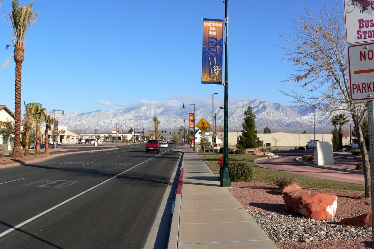
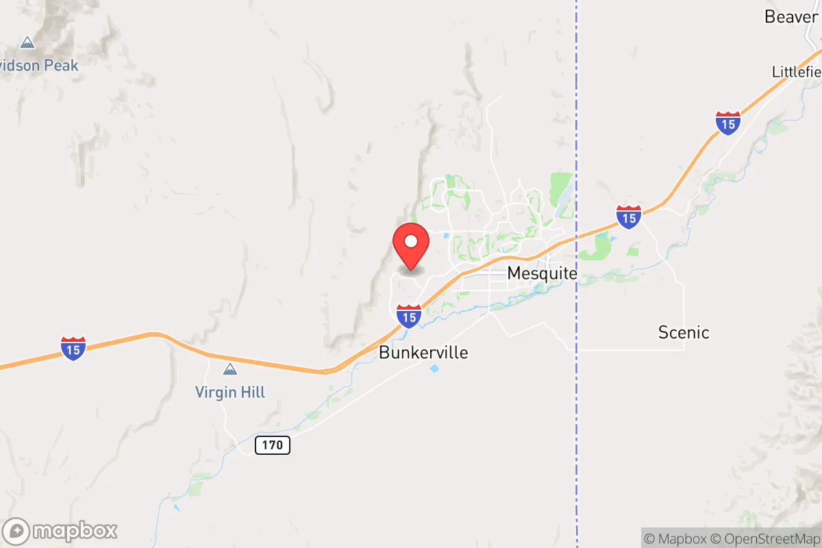
Mesquite, Nevada, sits as a surprisingly resilient outpost in the high desert, offering a strategic blend of isolation and accessibility that appeals to those planning for long-term stability. Its location on the far northeastern edge of Clark County, just 80 miles northeast of Las Vegas and a stone's throw from the Arizona and Utah borders, provides a buffer from the chaos of a major metropolitan area while still allowing for resupply and connectivity. For a relocator with a prepper mindset, Mesquite’s position along the Virgin River and its distance from the most obvious fallout targets make it a viable candidate for a base of operations, provided you understand its specific vulnerabilities and advantages.
Geographic position and natural advantages for long-term stability
Mesquite’s geography is its primary strategic asset. The city is nestled in the Virgin River Valley, surrounded by the rugged Virgin Mountains and the Beaver Dam Mountains, which create natural choke points and defensible terrain. This basin-and-range topography limits easy access from most directions, funneling traffic primarily along Interstate 15. For someone concerned with civic unrest or mass casualty events, this natural funneling is a double-edged sword: it makes the area easier to monitor and control, but also creates a single point of failure if the interstate is compromised. The elevation sits around 1,600 feet, offering a moderate climate that avoids the extreme heat of lower desert areas like Laughlin, while still providing a long growing season for hardy crops like beans, squash, and fruit trees if you have irrigation access. The Virgin River, though modest and heavily managed, provides a perennial water source that is rare in southern Nevada. This water, combined with the area’s low population density—roughly 10,000 permanent residents—means that in a crisis, competition for resources would be less intense than in St. George or Las Vegas. The nearby Bunkerville and Littlefield areas offer additional agricultural land and groundwater, making the broader region a potential breadbasket for a post-disruption scenario.
Risks, exposures, and proximity to fallout-relevant landmarks
No strategic analysis is complete without a hard look at the threats. Mesquite’s primary risk comes from its proximity to Las Vegas, a Tier-1 target for any large-scale conflict or terrorist event. The city is within the 80-mile radius that could see significant fallout from a ground-level nuclear detonation at Nellis Air Force Base, McCarran International Airport, or the Hoover Dam—all of which are plausible targets. The prevailing winds in the region blow from the southwest, meaning that a strike on Las Vegas could push fallout directly toward Mesquite within hours. This is not a theoretical concern; the area’s location in the downwind corridor from the Nevada Test Site (now the Nevada National Security Site) is a historical reminder of how airborne contamination can travel. Additionally, the I-15 corridor is a major evacuation route for Las Vegas, meaning that in a mass casualty event or civil unrest scenario, Mesquite could become a chokepoint for tens of thousands of panicked people fleeing north. The city’s small police force and limited hospital capacity (a single 25-bed facility) would be overwhelmed instantly. On the natural disaster front, the region faces flash flooding from the Virgin River during monsoon season, and the area sits in a moderate seismic zone—the nearby Hurricane Fault could produce a magnitude 6.5 earthquake, which would likely damage older infrastructure and disrupt water delivery systems.
Practical resilience for a relocator: food, water, energy, and defensibility
For the individual or family serious about self-sufficiency, Mesquite offers a mixed bag. Water is the most critical factor. The Virgin River is managed by the Virgin River Water Conservation District, and residential rights are tied to the municipal system, which draws from both the river and groundwater wells. In a prolonged grid-down scenario, those without private wells or river access would be dependent on stored water. The good news is that the shallow aquifer in the valley can be tapped with a hand pump or solar-powered well at depths of 100 to 300 feet, and many rural properties outside city limits already have private wells. For food, the growing season runs from March to November, and the local soil is alkaline but workable with amendments. The Mesquite Farmers Market and nearby Bunkerville’s agricultural co-ops provide a network for seed swapping and local knowledge, but you should plan to produce at least 50% of your own calories if you’re serious about resilience. Energy is a bright spot: the area averages over 300 days of sunshine per year, making solar a no-brainer. Net metering is available through NV Energy, but for true off-grid capability, a battery bank and a backup propane generator are essential—summer monsoons can knock out power for days. Defensibility is decent but not fortress-level. The city’s layout, with its golf course communities and suburban sprawl, is not designed for perimeter security. However, the surrounding BLM land and national forest areas offer remote retreat options for those willing to build a cabin or park an RV. The local gun culture is strong, with multiple shooting ranges and a sheriff’s office that is generally supportive of the Second Amendment, but note that Nevada is a shall-issue state for concealed carry, and there are no magazine capacity restrictions—a plus for preppers.
The overall strategic picture for Mesquite is one of cautious optimism for the prepared relocator. It is not a bug-out location in the strictest sense—its proximity to Las Vegas and the I-15 corridor introduces risks that cannot be ignored. But for someone who wants to live a semi-normal life while maintaining a high state of readiness, it offers a rare combination: a low-cost housing market (median home prices around $350,000 as of 2025), a conservative-leaning community with a strong sense of self-reliance, and access to water and land that is increasingly scarce in the Southwest. The key is to treat Mesquite as a base camp, not a final redoubt. Establish a secondary retreat in the nearby Pine Valley Mountains or the Great Basin region for worst-case scenarios, and build your primary residence with redundancy in mind—solar, well, food storage, and a solid plan for filtering fallout. If you can accept that you are living in the shadow of a major target, Mesquite gives you the tools to weather most storms short of a direct hit. For the conservative-minded individual who values freedom, space, and the ability to stand on their own two feet, it is one of the more rational choices in the Intermountain West.
* Values derived from national, state, county, city and local statistics and may differ in a specific area. Last updated: 2026-04-23T04:12:10.000Z
Narrative content on this page is AI-generated and may contain mistakes. Verify any details that matter before acting on them.
ReloMaps may earn a commission from affiliate links at no extra cost to you.