
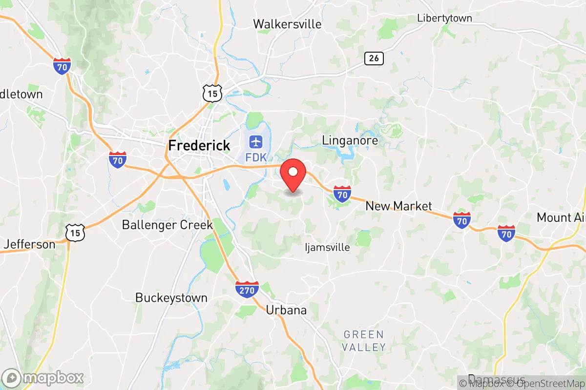
Strategic Assessment of Linganore-Bartonsville, MD
Meaningful friction. Expect exposure to either population pressure, blast zones, or natural disaster risk. Consider buying a retreat property.
What does the Strategic Assessment tell us?
Our Strategic Assessment grades tactical survivability of an area. Major population centers, military targets, fallout zones, natural disasters, and border exposure all drive risk — lower exposure means a more defensible position in a crisis.
This is heavily inspired by Joel Skousen's Strategic Relocation book. Highly recommended you checkout the book ($)What does this tell us?
Our Strategic Assessment grades tactical survivability of an area. Major population centers, military targets, fallout zones, natural disasters, and border exposure all drive risk — lower exposure means a more defensible position in a crisis.
This is heavily inspired by Joel Skousen's Strategic Relocation book. Highly recommended you checkout the book ($)Strategic Pillars

Key Distances
Regional Safe Places
Below is our recommended "safe zones" in Maryland and the surrounding area based on our strategic heuristics. For most people, it's unrealistic to live in a “safe zone” full-time due to work, family or other personal reasons. They tend to be more rural. However, many of these areas are perfect for second homes and retreat properties that double as a vacation home or even a short-term rental.




Important Note: For informational purposes only. This does not mean nothing bad ever happens in the green zones. Please use common sense. This is based on public data and modeled with AI. We tried to take a conservative approach but mistakes happen. We update this regularly as new information becomes available.
Solar Generator Recommendations
Backup power matters more here than in safer locations. We've picked three solar generators across budgets and capacity tiers — start with the budget unit if you only need a few essentials, or step up if you want to run a fridge and HVAC for days at a time.

Jackery Portable Power Station Explorer 300
Budget OptionPower on the Go: Weighing only 11 lbs, it's convenient to set up and store with book-sized foldable solar panels

BLUETTI Portable Power Station AC180
Designed for both indoor and outdoor scenarios, AC180 is highly capable as it has a robost capacity and continuous output power.

EF ECOFLOW DELTA Pro Ultra Power Station
Upgraded PickEcoFlow DELTA Pro Ultra is a whole-home energy system designed to grow with your family. Integrated with the Smart Home Panel 2, it scales to meet your evolving energy needs — keeping your home powered, intelligent, and secure through every stage of life.
We earn a commission, at no additional cost to you.
Strategic Assessment Analysis
Linganore-Bartonsville, Maryland, offers a strategic balance of rural self-sufficiency and proximity to critical infrastructure, making it a noteworthy option for relocators prioritizing disaster readiness. Situated in Frederick County, roughly 50 miles northwest of Washington, D.C., and 40 miles west of Baltimore, this unincorporated area sits outside the immediate blast and fallout zones of major metropolitan targets while retaining access to supply chains and medical centers. Its location along the eastern slope of the Blue Ridge Mountains provides natural terrain advantages, including elevation differentials and water resources, that enhance its resilience profile compared to flatter, more exposed regions of the Mid-Atlantic.
Geographic position and natural advantages for preparedness
Linganore-Bartonsville's position in the Piedmont region, where the rolling hills meet the Appalachian foothills, offers several inherent resilience benefits. The area sits at an elevation of roughly 400-600 feet above sea level, which reduces flood risk from the nearby Monocacy River and its tributaries, though low-lying properties near Linganore Creek warrant caution during heavy rain events. The underlying geology is primarily fractured bedrock (schist and gneiss) with moderate groundwater yields, meaning private wells are feasible but may require deeper drilling (typically 100-300 feet) compared to coastal plain aquifers. The local climate is humid continental, with average annual precipitation of about 40 inches, evenly distributed throughout the year, supporting rain-fed agriculture and reducing drought risk relative to the western U.S. The area's forest cover—roughly 40-50% of the census-designated place—provides natural windbreaks, wildlife habitat, and a source of biomass for heating, though it also elevates wildfire risk during dry spells, particularly in the wooded subdivisions near the Liberty Reservoir watershed. The proximity to the Catoctin Mountain range (about 10 miles west) offers a natural barrier against some weather systems and provides a potential retreat zone with higher elevation and lower population density.
Risks, exposures, and proximity to fallout-relevant landmarks
The primary man-made risk for Linganore-Bartonsville stems from its location within the Washington-Baltimore metropolitan corridor. While the area is roughly 50 miles from the White House and 40 miles from Fort Meade, it lies within the moderate fallout zone for a hypothetical ground-burst nuclear detonation at either target. Prevailing winds in the region are from the west-northwest, meaning fallout from a D.C. strike would likely drift east-northeast, away from Linganore-Bartonsville, but a Baltimore or Fort Detrick (Frederick) target could deposit fallout directly over the area. The nearby Fort Detrick (about 12 miles west in Frederick) is a U.S. Army biodefense and infectious disease research lab, which introduces a low-probability but high-consequence risk of accidental release or targeted attack. The area also sits within 20 miles of the Calvert Cliffs Nuclear Power Plant (about 60 miles southeast), though prevailing winds and distance reduce direct plume risk. Natural hazards are moderate: the region experiences occasional tornadoes (EF-0 to EF-2 historically), ice storms that can knock out power for days, and the remnants of hurricanes that dump heavy rain (e.g., Hurricane Agnes in 1972 caused significant flooding in the Monocacy basin). Earthquake risk is minimal, with the nearest significant fault being the Ramapo Fault in New Jersey. The area's proximity to major highways—I-70 (3 miles north) and I-270 (10 miles east)—is a double-edged sword: it provides evacuation routes but also channels traffic from population centers during a crisis, potentially creating gridlock.
Practical resilience for a relocator: food, water, energy, and defensibility
For a relocator focused on self-sufficiency, Linganore-Bartonsville offers a mix of advantages and limitations. Water security is achievable but requires upfront investment: most homes in the area rely on private wells, with yields typically ranging from 5 to 20 gallons per minute in the fractured bedrock aquifers. A hand-pump or solar-powered backup pump can provide off-grid water access, and the high water table in the valley bottoms means shallow wells are possible in some locations. Surface water from Linganore Creek and the Liberty Reservoir (a major Baltimore water supply) is accessible but requires treatment and legal permissions. Food production is viable: the growing season averages 170-180 days (mid-April to late October), and the loam and silt-loam soils in the valleys support vegetable gardens, orchards, and small livestock. The area is part of Frederick County's agricultural preservation zone, with numerous working farms and farmers' markets (e.g., the Linganore Winecellars farm market) providing local food sources even in normal times. However, the soil in the more wooded, hilly sections is thinner and rockier, requiring raised beds or imported topsoil for intensive gardening. Energy resilience is moderate: grid power is provided by Potomac Edison (FirstEnergy), with above-ground lines that are vulnerable to ice storms and wind. Solar potential is good, with an average of 4.5 peak sun hours per day, and net metering is available in Maryland. Wood heating is practical given the forest cover, but air quality regulations in Frederick County restrict outdoor wood boilers in some subdivisions. Defensibility is mixed: the area's rural character means homes are often spaced apart with natural sightlines, but the lack of a centralized community structure and the presence of multiple road access points (e.g., MD-75, MD-26, and MD-144) make it difficult to secure perimeter approaches. The nearest law enforcement is the Frederick County Sheriff's Office, with a substation in Mount Airy (about 8 miles east), but response times in the more remote parts of Linganore-Bartonsville can exceed 20 minutes. The local population is predominantly white (roughly 85%) and politically mixed (Frederick County voted +14 Democratic in 2024, but the rural precincts lean conservative), which may influence community cohesion during a crisis. The area's proximity to the Liberty Reservoir (a 3,100-acre water body) provides a potential fishing and water source, but it is a protected watershed with restricted access, limiting its utility for foraging.
The overall strategic picture for Linganore-Bartonsville is one of moderate resilience with specific trade-offs. Its distance from primary metropolitan targets reduces but does not eliminate fallout risk, and its natural resources—water, timber, and arable land—support a baseline level of self-sufficiency. However, the area's dependence on regional infrastructure (grid power, road networks, and supply chains) and its position within a corridor that could experience secondary effects (refugee movement, resource competition) means that true preparedness requires active investment in off-grid systems and community networking. For a relocator willing to drill a well, install solar panels, and build relationships with local farmers, Linganore-Bartonsville offers a defensible, resource-rich base that balances rural autonomy with access to the broader Mid-Atlantic economy. It is not a remote bunker location, but it is a practical choice for those who want to be near enough to civilization to thrive while far enough to survive a disruption.

* Values derived from national, state, county, city and local statistics and may differ in a specific area. Last updated: 2026-08-26T18:49:14.000Z
Narrative content on this page is AI-generated and may contain mistakes. Verify any details that matter before acting on them.
ReloMaps may earn a commission from affiliate links at no extra cost to you.

