Photo: Wikipedia
Strategic Assessment of Lexington, NE
Strong survivability profile. Good buffer from population centers, with manageable environmental and tactical risks.
What does the Strategic Assessment tell us?
Our Strategic Assessment grades tactical survivability of an area. Major population centers, military targets, fallout zones, natural disasters, and border exposure all drive risk — lower exposure means a more defensible position in a crisis.
This is heavily inspired by Joel Skousen's Strategic Relocation book. Highly recommended you checkout the book ($)What does this tell us?
Our Strategic Assessment grades tactical survivability of an area. Major population centers, military targets, fallout zones, natural disasters, and border exposure all drive risk — lower exposure means a more defensible position in a crisis.
This is heavily inspired by Joel Skousen's Strategic Relocation book. Highly recommended you checkout the book ($)Strategic Pillars

Key Distances
Regional Safe Places
Below is our recommended "safe zones" in Nebraska and the surrounding area based on our strategic heuristics. For most people, it's unrealistic to live in a “safe zone” full-time due to work, family or other personal reasons. They tend to be more rural. However, many of these areas are perfect for second homes and retreat properties that double as a vacation home or even a short-term rental.
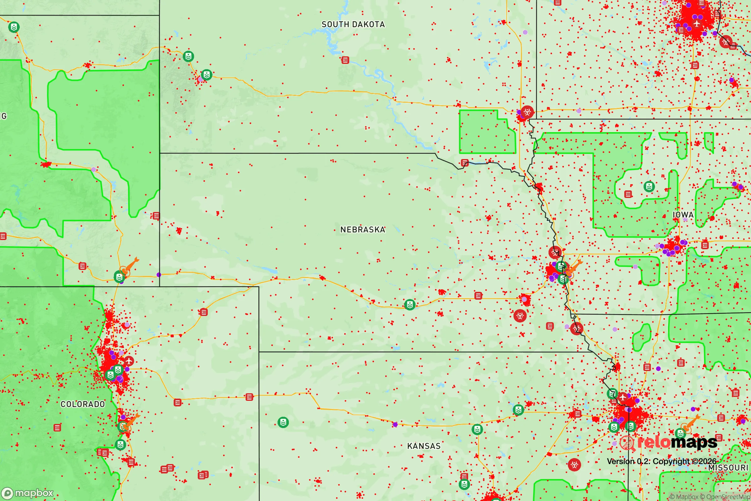
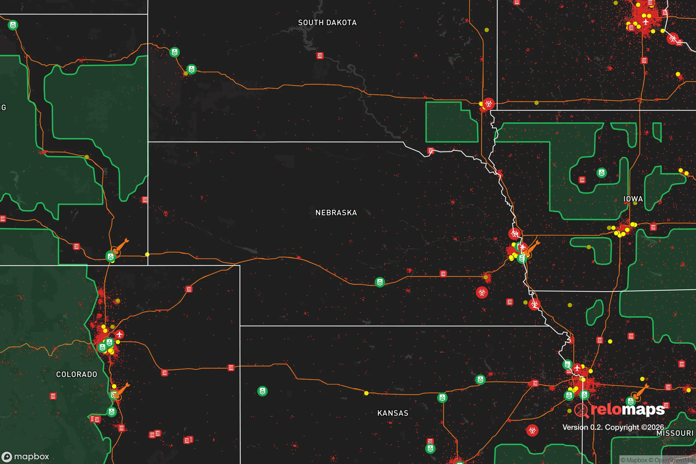
Important Note: For informational purposes only. This does not mean nothing bad ever happens in the green zones. Please use common sense. This is based on public data and modeled with AI. We tried to take a conservative approach but mistakes happen. We update this regularly as new information becomes available.
Solar Generator Recommendations
Backup power matters more here than in safer locations. We've picked three solar generators across budgets and capacity tiers — start with the budget unit if you only need a few essentials, or step up if you want to run a fridge and HVAC for days at a time.

Jackery Portable Power Station Explorer 300
Budget OptionPower on the Go: Weighing only 11 lbs, it's convenient to set up and store with book-sized foldable solar panels

BLUETTI Portable Power Station AC180
Designed for both indoor and outdoor scenarios, AC180 is highly capable as it has a robost capacity and continuous output power.

EF ECOFLOW DELTA Pro Ultra Power Station
Upgraded PickEcoFlow DELTA Pro Ultra is a whole-home energy system designed to grow with your family. Integrated with the Smart Home Panel 2, it scales to meet your evolving energy needs — keeping your home powered, intelligent, and secure through every stage of life.
We earn a commission, at no additional cost to you.
Strategic Assessment Analysis
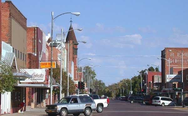
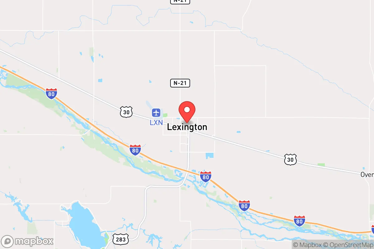
Lexington, Nebraska, sits at a strategic crossroads that offers a blend of agricultural self-sufficiency and logistical connectivity, making it a surprisingly resilient option for those prioritizing long-term preparedness. Located along Interstate 80 and the Platte River, this town of roughly 10,000 people provides a buffer from the chaos of larger metropolitan areas while still maintaining access to critical supply routes. For a relocator with a survivalist mindset, Lexington’s position in the central Great Plains—far from coastal threats and major population centers—offers a foundation for a more sustainable, defensible lifestyle in an increasingly uncertain national landscape.
Geographic position and natural advantages for long-term security
Lexington’s primary strategic asset is its location in the Platte River Valley, a corridor that has historically served as a transportation and agricultural hub. The town is roughly 200 miles west of Omaha and 150 miles east of Denver, placing it outside the immediate fallout zones of those major cities while still allowing for supply runs if necessary. The surrounding terrain is flat, open farmland, which provides clear lines of sight and reduces the risk of ambush or surprise during civil unrest. The Platte River itself is a reliable water source, though it requires filtration and treatment for safe consumption. The area’s aquifer is robust, and many rural properties have access to well water, a critical advantage for off-grid living. The climate is semi-arid, with hot summers and cold winters, but the growing season is long enough for staple crops like corn, soybeans, and wheat, which are already abundant in the region. This agricultural base means that food production is not just possible but deeply ingrained in the local economy, reducing reliance on fragile supply chains.
Risks, exposures, and proximity to fallout-relevant landmarks
While Lexington avoids the worst of urban collapse scenarios, it is not without vulnerabilities. The town lies within 100 miles of the Nebraska National Forest and the U.S. Strategic Command (STRATCOM) headquarters near Omaha, which could be a target in a major conflict. Interstate 80, while a lifeline, also serves as a potential evacuation route for millions of people fleeing the Front Range or the Midwest, meaning that a mass casualty event or civil unrest in Denver or Omaha could funnel desperate populations through Lexington. The town’s proximity to the Platte River also presents a flood risk, though the area has not seen catastrophic flooding in recent decades. Additionally, the local economy is heavily tied to agriculture and meatpacking—specifically the Tyson Foods plant—which could become a single point of failure during a pandemic or supply chain disruption. For the prepared relocator, these risks are manageable with proper planning: stockpiling supplies, establishing a rural retreat outside town limits, and maintaining situational awareness of regional events.
Practical resilience for a relocator: food, water, energy, and defensibility
For a single individual or family looking to establish a resilient base, Lexington offers several practical advantages. Food security is strong: the surrounding farmland produces millions of bushels of grain annually, and local farmers’ markets and co-ops provide direct access to fresh produce, meat, and dairy. The Platte River and nearby canals offer fishing opportunities, and the area’s game population—deer, turkey, and waterfowl—supports hunting. Water is accessible but requires treatment: municipal water comes from the Platte River, but a well on private property is a better long-term bet, with depths typically ranging from 50 to 200 feet. Energy infrastructure is moderately resilient: the grid is served by Dawson County Public Power District, which has a history of quick storm recovery, but solar panels and backup generators are advisable for off-grid capability. Natural gas is widely available, and wood-burning stoves are common in rural homes. Defensibility is mixed: the open terrain makes it hard to hide but easy to spot threats from a distance. A rural property with a good perimeter, reinforced doors, and a clear view of approach roads can be effectively secured. The local law enforcement presence is small—Dawson County has about 20 deputies—so community self-reliance is the norm. The town’s conservative culture, with a strong emphasis on hunting, firearms ownership, and neighborly mutual aid, aligns well with a prepper mindset.
Overall, Lexington presents a balanced strategic picture for the relocator focused on resilience. It avoids the high-risk zones of coastal cities and major military targets, while offering a solid agricultural base, reliable water, and a community that values self-sufficiency. The main trade-offs are the potential for regional migration during a crisis and the need to invest in water treatment and off-grid energy. For those willing to put in the work—establishing a rural property, building local networks, and maintaining a low profile—Lexington provides a viable long-term haven in an increasingly volatile world. The key is to act now, before the next wave of unrest or disaster makes such moves more difficult.
* Values derived from national, state, county, city and local statistics and may differ in a specific area. Last updated: 2026-05-03T20:30:32.000Z
Narrative content on this page is AI-generated and may contain mistakes. Verify any details that matter before acting on them.
ReloMaps may earn a commission from affiliate links at no extra cost to you.