Photo: Wikipedia
Strategic Assessment of Greer, SC
Meaningful friction. Expect exposure to either population pressure, blast zones, or natural disaster risk. Consider buying a retreat property.
What does the Strategic Assessment tell us?
Our Strategic Assessment grades tactical survivability of an area. Major population centers, military targets, fallout zones, natural disasters, and border exposure all drive risk — lower exposure means a more defensible position in a crisis.
This is heavily inspired by Joel Skousen's Strategic Relocation book. Highly recommended you checkout the book ($)What does this tell us?
Our Strategic Assessment grades tactical survivability of an area. Major population centers, military targets, fallout zones, natural disasters, and border exposure all drive risk — lower exposure means a more defensible position in a crisis.
This is heavily inspired by Joel Skousen's Strategic Relocation book. Highly recommended you checkout the book ($)Strategic Pillars

Key Distances
Regional Safe Places
Below is our recommended "safe zones" in South Carolina and the surrounding area based on our strategic heuristics. For most people, it's unrealistic to live in a “safe zone” full-time due to work, family or other personal reasons. They tend to be more rural. However, many of these areas are perfect for second homes and retreat properties that double as a vacation home or even a short-term rental.


Important Note: For informational purposes only. This does not mean nothing bad ever happens in the green zones. Please use common sense. This is based on public data and modeled with AI. We tried to take a conservative approach but mistakes happen. We update this regularly as new information becomes available.
Solar Generator Recommendations
Backup power matters more here than in safer locations. We've picked three solar generators across budgets and capacity tiers — start with the budget unit if you only need a few essentials, or step up if you want to run a fridge and HVAC for days at a time.

Jackery Portable Power Station Explorer 300
Budget OptionPower on the Go: Weighing only 11 lbs, it's convenient to set up and store with book-sized foldable solar panels

BLUETTI Portable Power Station AC180
Designed for both indoor and outdoor scenarios, AC180 is highly capable as it has a robost capacity and continuous output power.

EF ECOFLOW DELTA Pro Ultra Power Station
Upgraded PickEcoFlow DELTA Pro Ultra is a whole-home energy system designed to grow with your family. Integrated with the Smart Home Panel 2, it scales to meet your evolving energy needs — keeping your home powered, intelligent, and secure through every stage of life.
We earn a commission, at no additional cost to you.
Strategic Assessment Analysis
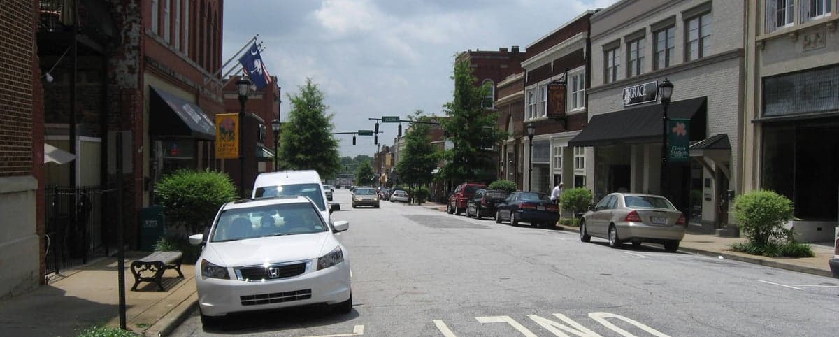
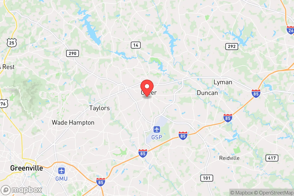
Greer, South Carolina, sits in a sweet spot that few relocation analysts fully appreciate: close enough to the economic engine of the Upstate to sustain a job and a tax base, but far enough from the immediate blast zones of Greenville and Spartanburg to offer a genuine buffer against the worst-case scenarios. Its position along I-85 and near the Greenville-Spartanburg International Airport (GSP) gives it logistical connectivity without the density that makes a city a target. For a relocator thinking in terms of decades, not just next year, Greer’s resilience comes down to geography, infrastructure, and a political culture that still values self-reliance over dependency.
Geographic position and natural advantages for long-term security
Greer sits on the Piedmont plateau, roughly 900 feet above sea level, which means it avoids the hurricane storm surge of the coast and the earthquake risks of the Charleston fault zone. The area’s topography is rolling hills with decent drainage—no floodplain issues like you’d find in the Lowcountry. The climate is humid subtropical, but with four distinct seasons and an average annual temperature around 60°F, it’s livable without extreme heat or cold that would strain off-grid systems. Water is the real asset here: the area sits atop the Piedmont aquifer system, and the nearby Enoree River and Tyger River provide surface water options. Greer gets roughly 50 inches of rain per year, which is more than enough for rainwater catchment and small-scale agriculture. The soil is clay-heavy but workable for gardens if amended. For a prepper, the key takeaway is that this region has no single catastrophic natural threat—no hurricanes, no wildfires, no tornado alley—just the slow, manageable risks of occasional ice storms and summer thunderstorms.
Risks, exposures, and proximity to fallout-relevant landmarks
Let’s be direct: Greer is not a fallout-free zone. The biggest liability is its proximity to the I-85 corridor, which runs from Charlotte to Atlanta. In a national emergency, that highway becomes a chokepoint for refugees and military movements. Greer is roughly 15 miles from the Greenville-Spartanburg International Airport (GSP), which is a dual-use facility with a 10,000-foot runway capable of handling C-5 Galaxies and other heavy military transports. That makes it a likely staging area in a crisis, which could draw unwanted attention. The BMW manufacturing plant in Spartanburg County is a major industrial asset, but also a potential target for sabotage or supply-chain disruption. The Savannah River Site (nuclear weapons facility) is about 120 miles south—outside the immediate fallout zone for a conventional attack, but close enough that prevailing winds from the south could carry particulate. The nearest nuclear power plant is the Oconee Nuclear Station, about 50 miles northwest, near Seneca. A catastrophic failure there would put Greer in a downwind risk zone, though prevailing winds are from the west-southwest, so the danger is moderate. The real risk is population density: Greenville’s metro area is pushing 1 million people. In a collapse scenario, that many people moving south on I-85 would overwhelm Greer’s resources within days.
Practical resilience for a relocator: food, water, energy, and defensibility
For a single individual or a family looking to hunker down, Greer offers a mix of suburban and rural options. The city itself is about 35,000 people, but the surrounding unincorporated areas in Spartanburg and Greenville counties have plenty of acreage for a homestead. Water is the first concern, and Greer’s municipal supply comes from the North Tyger River and Lake Robinson, both of which are surface sources vulnerable to contamination. A well is the better play—most properties outside city limits can drill a private well at 200-400 feet, with yields of 10-20 gallons per minute. That’s enough for a family and a garden. The electric grid is served by Duke Energy, which has a decent reliability record but is still vulnerable to cyberattack or EMP. Solar is viable here—the area gets about 200 sunny days per year, and net metering is available through Duke. A 10kW rooftop system with battery backup will cover a typical home’s needs for 8-10 hours of outage. For food, the growing season runs from April to October, and the local soil supports tomatoes, peppers, beans, squash, and leafy greens. The Upstate has a strong network of farmers’ markets and local meat producers, including pastured poultry and grass-fed beef operations within 20 miles. Defensibility is moderate: the terrain is rolling, not mountainous, so you don’t get natural chokepoints like you would in the Appalachians. But a rural property with a long driveway, a good fence, and a clear line of sight to the road gives you a tactical advantage. The local sheriff’s departments in both Spartanburg and Greenville counties are generally pro-Second Amendment and responsive, but in a prolonged crisis, you’re on your own after the first 72 hours.
The overall strategic picture for Greer is one of calculated trade-offs. It’s not a remote bunker location—you’re 20 minutes from a major airport and an hour from Charlotte. But that proximity also means you can stock up, network with like-minded people, and maintain a professional income while building your resilience. The political climate is favorable: Greenville and Spartanburg counties voted +18 and +22 Republican in the 2024 presidential election, respectively, and local governance is generally low-tax, low-regulation. The biggest vulnerability is the I-85 corridor and the population density of the Upstate. If you’re looking for a place that balances access to modern infrastructure with a realistic chance of riding out a crisis, Greer is a solid B+ pick. It’s not the Alamo, but it’s not a glass house either. For a conservative-leaning relocator who wants to be prepared without living in a cave, this area deserves a serious look.
* Values derived from national, state, county, city and local statistics and may differ in a specific area. Last updated: 2026-04-29T19:26:42.000Z
Narrative content on this page is AI-generated and may contain mistakes. Verify any details that matter before acting on them.
ReloMaps may earn a commission from affiliate links at no extra cost to you.