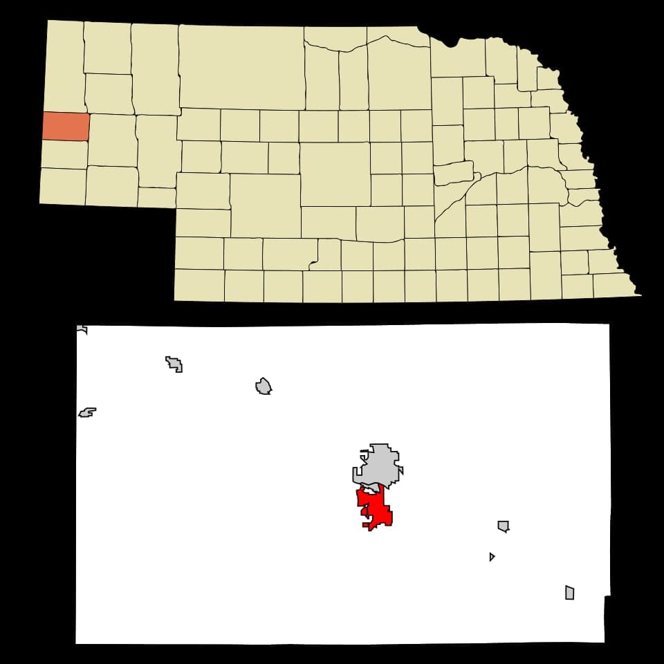
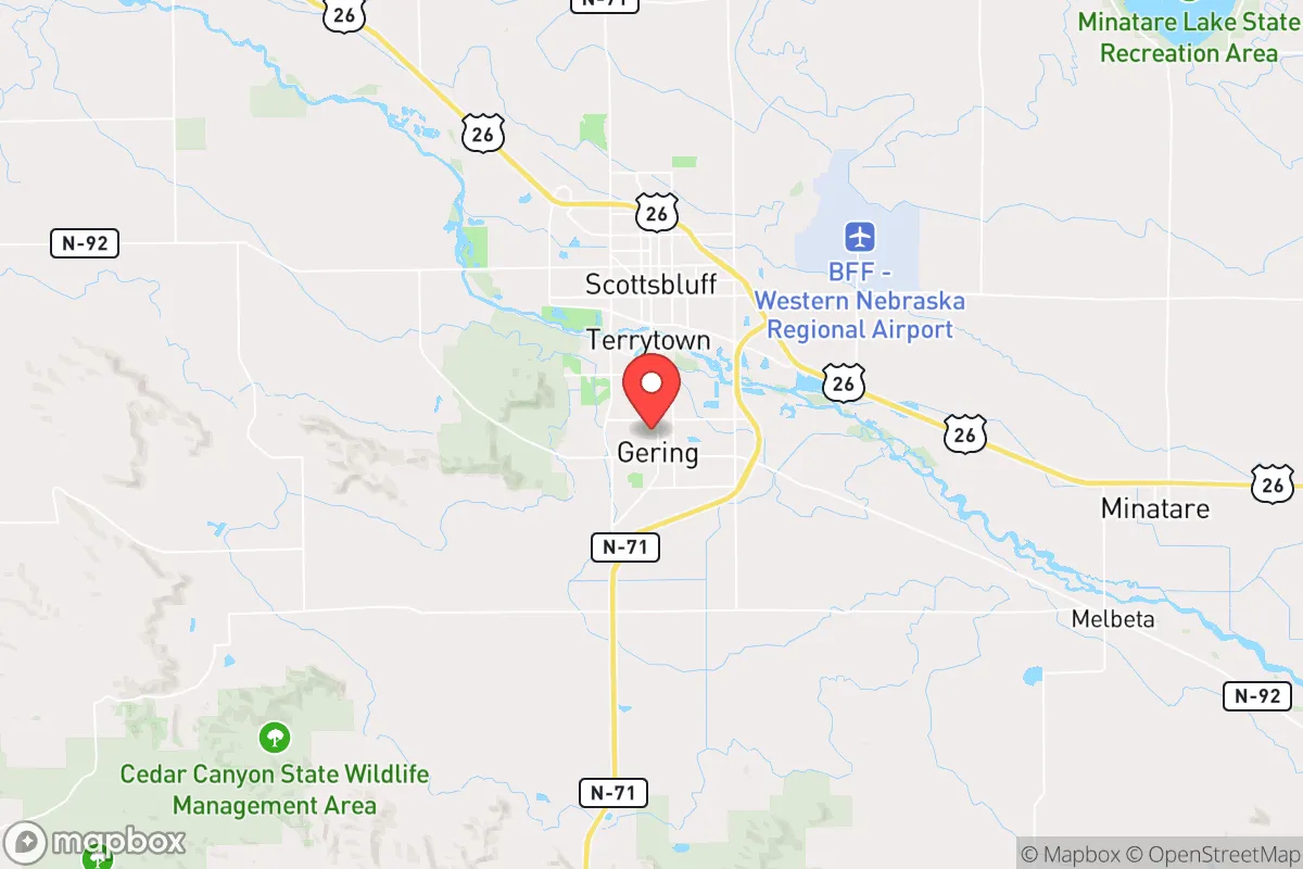
Photo: Wikipedia
Strategic Assessment of Gering, NE
Workable tactical position. Some exposure to population density or targets, but generally defensible in a crisis.
What does the Strategic Assessment tell us?
Our Strategic Assessment grades tactical survivability of an area. Major population centers, military targets, fallout zones, natural disasters, and border exposure all drive risk — lower exposure means a more defensible position in a crisis.
This is heavily inspired by Joel Skousen's Strategic Relocation book. Highly recommended you checkout the book ($)What does this tell us?
Our Strategic Assessment grades tactical survivability of an area. Major population centers, military targets, fallout zones, natural disasters, and border exposure all drive risk — lower exposure means a more defensible position in a crisis.
This is heavily inspired by Joel Skousen's Strategic Relocation book. Highly recommended you checkout the book ($)Strategic Pillars

Key Distances
Regional Safe Places
Below is our recommended "safe zones" in Nebraska and the surrounding area based on our strategic heuristics. For most people, it's unrealistic to live in a “safe zone” full-time due to work, family or other personal reasons. They tend to be more rural. However, many of these areas are perfect for second homes and retreat properties that double as a vacation home or even a short-term rental.
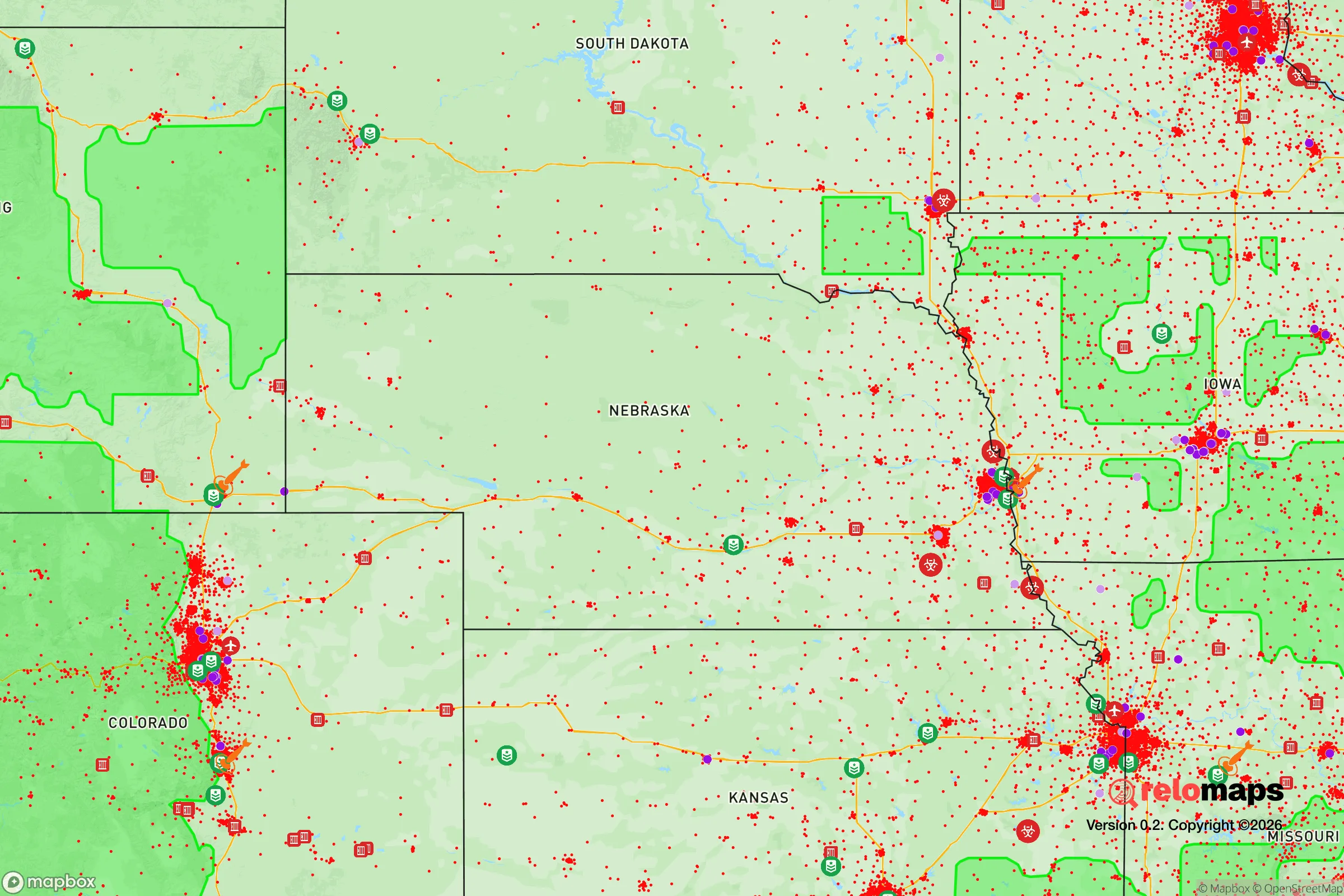
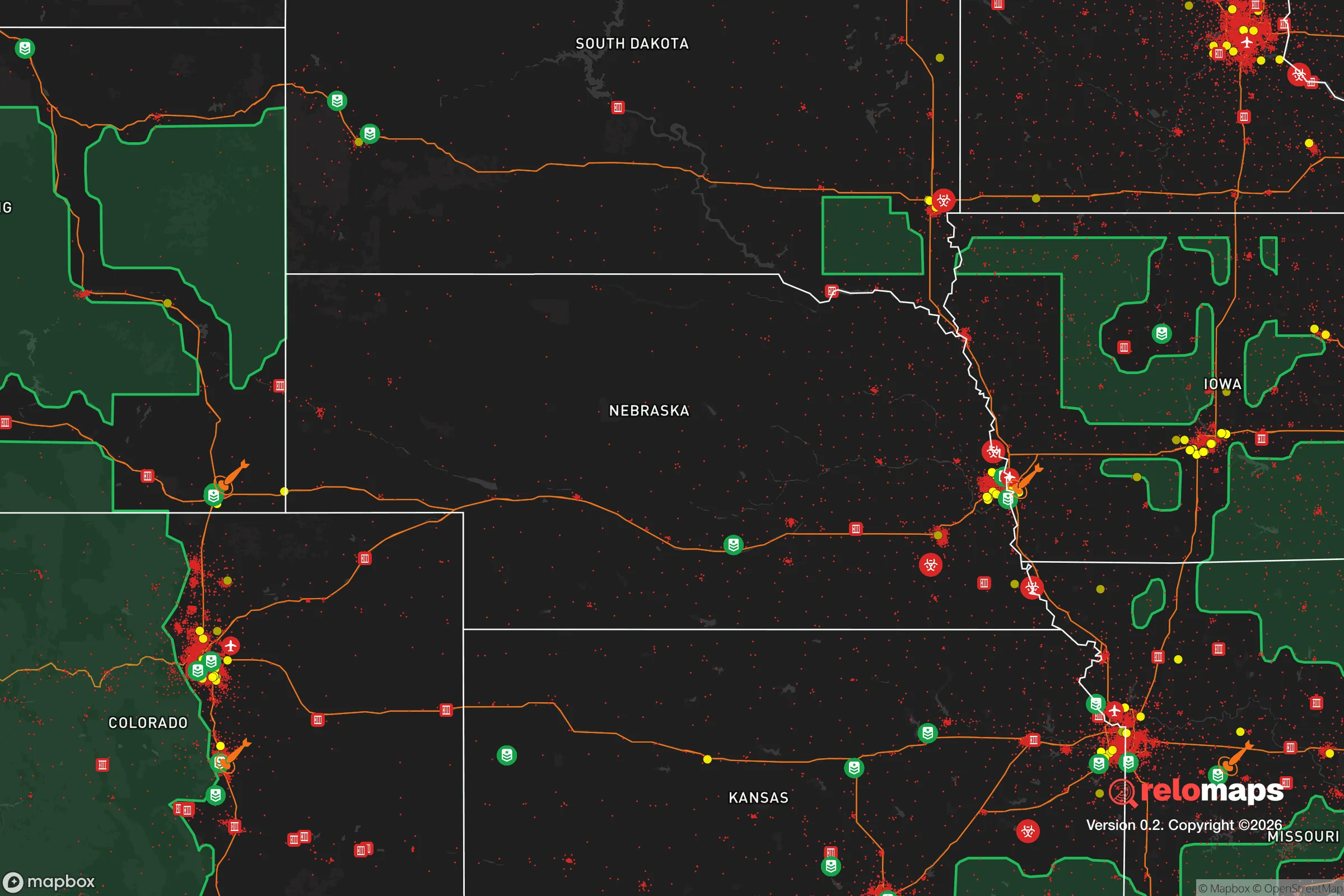


Important Note: For informational purposes only. This does not mean nothing bad ever happens in the green zones. Please use common sense. This is based on public data and modeled with AI. We tried to take a conservative approach but mistakes happen. We update this regularly as new information becomes available.
Solar Generator Recommendations
Backup power matters more here than in safer locations. We've picked three solar generators across budgets and capacity tiers — start with the budget unit if you only need a few essentials, or step up if you want to run a fridge and HVAC for days at a time.

Jackery Portable Power Station Explorer 300
Budget OptionPower on the Go: Weighing only 11 lbs, it's convenient to set up and store with book-sized foldable solar panels

BLUETTI Portable Power Station AC180
Designed for both indoor and outdoor scenarios, AC180 is highly capable as it has a robost capacity and continuous output power.

EF ECOFLOW DELTA Pro Ultra Power Station
Upgraded PickEcoFlow DELTA Pro Ultra is a whole-home energy system designed to grow with your family. Integrated with the Smart Home Panel 2, it scales to meet your evolving energy needs — keeping your home powered, intelligent, and secure through every stage of life.
We earn a commission, at no additional cost to you.
Strategic Assessment Analysis
Gering, Nebraska, presents a compelling case for the strategic relocator, not because it offers flashy amenities, but because it sits at a geographic and logistical pivot point that few other small towns can match. Nestled against the base of Scotts Bluff National Monument in the western Panhandle, this community of roughly 8,500 people functions as a quiet hub for regional agriculture, transportation, and light industry. Its resilience stems from a combination of low population density, a strong local work ethic, and a position along the Union Pacific mainline and Highway 26, which ties it directly to the broader national food and fuel supply chains. For someone thinking in terms of decades, not election cycles, Gering offers a foundation that is both defensible and economically viable.
Geographic position and natural advantages for long-term security
Gering’s primary strategic asset is its location in the North Platte River Valley, a corridor that has historically been a lifeline for westward expansion and remains a critical agricultural artery. The city sits at the edge of the Nebraska Panhandle, roughly 20 miles from the Wyoming border, placing it far from the major population corridors of the Front Range (Denver is about 190 miles south) and the I-80 crush of central Nebraska. This distance from large metro areas—Denver, Cheyenne, and even Rapid City—is a deliberate advantage. In a scenario of civic unrest or supply chain disruption, being outside the 100-mile radius of a major city significantly reduces the risk of refugee flow, resource competition, and secondary fallout from urban collapse. The surrounding landscape is a mix of irrigated cropland (corn, sugar beets, dry beans) and shortgrass prairie, offering a natural buffer of open space. The North Platte River itself provides a reliable surface water source, and the region sits atop the High Plains Aquifer, though groundwater depth varies. The local topography, dominated by the Scotts Bluff landform, offers natural observation points and defensible terrain, a detail not lost on those who study the area’s history as a waypoint on the Oregon Trail.
Risks, exposures, and proximity to fallout-relevant landmarks
No location is without vulnerabilities, and Gering’s are worth a sober assessment. The most immediate risk is its proximity to the Union Pacific rail line and the adjacent Highway 26 corridor. While these are economic assets, they also represent potential chokepoints and targets in a national disruption scenario. A derailment or deliberate blockage could sever the town’s primary supply line for fuel, fertilizer, and manufactured goods. Additionally, the city lies about 90 miles from the U.S. Strategic Command (STRATCOM) headquarters at Offutt Air Force Base near Omaha, and while that is a significant distance, the Panhandle is not far from the ballistic missile fields of western Nebraska and eastern Wyoming. The presence of Minuteman III silos scattered across the region—many within a 50-mile radius—is a double-edged sword. On one hand, it places Gering within a zone of potential military interest; on the other, the area’s low population density and lack of high-value industrial targets make it a less likely primary strike location compared to Denver or Cheyenne. The real exposure is more mundane: the town is heavily dependent on a single major employer, the Western Sugar Cooperative processing plant, and the broader agricultural economy. A multi-year drought or a collapse in commodity prices would hit harder here than in a more diversified economy. Flooding along the North Platte is a periodic concern, though the river is well-managed by upstream dams. Wildfire risk in the surrounding grasslands is moderate but real, especially during dry, windy summers.
Practical resilience for a relocator: food, water, energy, and defensibility
For the individual or family looking to establish a resilient homestead, Gering offers several concrete advantages. Food security is the standout feature. The surrounding valley is some of the most productive irrigated farmland in the state, with local producers growing sugar beets, corn, dry beans, and alfalfa. The Western Sugar plant processes beets from a 200-mile radius, meaning raw sugar is available locally. The region also supports cattle ranching, and the nearby town of Scottsbluff (directly across the river) has a USDA-inspected meat processing facility. A relocator with land could realistically achieve a high degree of food self-sufficiency within a few growing seasons. Water is the second pillar. The North Platte River flows year-round, and while municipal water rights are allocated, a private well on agricultural land is a viable option for those with the capital to drill. The aquifer is deep in some areas (200-400 feet), but yields are generally good. Energy is a mixed picture. The grid is served by the Nebraska Public Power District, which relies heavily on coal and nuclear generation (the nearby Gerald Gentleman Station is a major coal plant). Natural gas is available in town, but rural properties may need propane. Solar potential is excellent—the region averages over 220 sunny days per year—and wind is a constant resource, though small-scale wind turbines require careful siting. Defensibility is inherent in the layout. The city is compact, with a single main thoroughfare (10th Street) and limited entry points from the surrounding farmland. The Scotts Bluff landform provides a natural high ground for observation. The local law enforcement presence is small but professional, and the community culture is one of self-reliance and neighborly mutual aid—a stark contrast to the anonymity of a suburb. The biggest practical challenge for a relocator is the housing stock: older homes in town are affordable but may require significant upgrades to insulation, plumbing, and electrical systems. Building new on rural land is possible but requires navigating county zoning and well permits.
The overall strategic picture for Gering is one of quiet, unglamorous viability. It is not a prepper fantasyland of bunkers and militia compounds; it is a working agricultural town where the skills of gardening, mechanical repair, and community cooperation are still alive. The trade-offs are clear: you trade the convenience of urban amenities and high-paying remote work for a lower cost of living, a slower pace, and a genuine buffer from the chaos of the coasts. The proximity to the rail line and missile fields is a risk, but it is a calculated one—far less acute than living within the blast radius of a major city or near a chemical refinery. For the conservative relocator who values self-sufficiency, community cohesion, and a defensible position, Gering deserves a serious look. It is a place where you can buy a modest house on a quarter-acre lot for under $200,000, drill a well, plant a garden, and be within a day’s drive of the Rockies for a true retreat if needed. It is not a perfect refuge, but it is a solid, rational choice for those who understand that resilience is built, not bought.

* Values derived from national, state, county, city and local statistics and may differ in a specific area. Last updated: 2026-05-01T05:51:39.000Z
Narrative content on this page is AI-generated and may contain mistakes. Verify any details that matter before acting on them.
ReloMaps may earn a commission from affiliate links at no extra cost to you.

