
Photo: Wikipedia
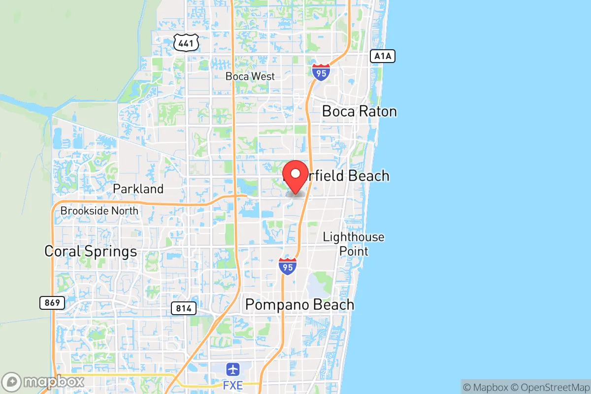
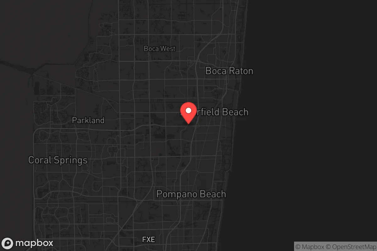
Strategic Assessment of Deerfield Beach, FL
Multiple tactical vulnerabilities. Population density, target proximity, or disaster risk are likely compounding. A retreat property and exit planning is required.
What does the Strategic Assessment tell us?
Our Strategic Assessment grades tactical survivability of an area. Major population centers, military targets, fallout zones, natural disasters, and border exposure all drive risk — lower exposure means a more defensible position in a crisis.
This is heavily inspired by Joel Skousen's Strategic Relocation book. Highly recommended you checkout the book ($)What does this tell us?
Our Strategic Assessment grades tactical survivability of an area. Major population centers, military targets, fallout zones, natural disasters, and border exposure all drive risk — lower exposure means a more defensible position in a crisis.
This is heavily inspired by Joel Skousen's Strategic Relocation book. Highly recommended you checkout the book ($)Strategic Pillars

Key Distances
Regional Safe Places
Below is our recommended "safe zones" in Florida and the surrounding area based on our strategic heuristics. For most people, it's unrealistic to live in a “safe zone” full-time due to work, family or other personal reasons. They tend to be more rural. However, many of these areas are perfect for second homes and retreat properties that double as a vacation home or even a short-term rental.

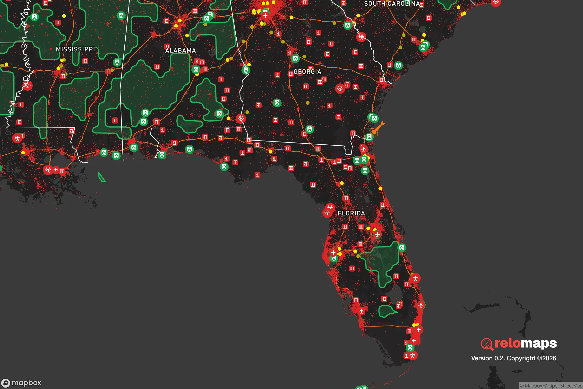
Important Note: For informational purposes only. This does not mean nothing bad ever happens in the green zones. Please use common sense. This is based on public data and modeled with AI. We tried to take a conservative approach but mistakes happen. We update this regularly as new information becomes available.
Solar Generator Recommendations
Backup power matters more here than in safer locations. We've picked three solar generators across budgets and capacity tiers — start with the budget unit if you only need a few essentials, or step up if you want to run a fridge and HVAC for days at a time.

Jackery Portable Power Station Explorer 300
Budget OptionPower on the Go: Weighing only 11 lbs, it's convenient to set up and store with book-sized foldable solar panels

BLUETTI Portable Power Station AC180
Designed for both indoor and outdoor scenarios, AC180 is highly capable as it has a robost capacity and continuous output power.

EF ECOFLOW DELTA Pro Ultra Power Station
Upgraded PickEcoFlow DELTA Pro Ultra is a whole-home energy system designed to grow with your family. Integrated with the Smart Home Panel 2, it scales to meet your evolving energy needs — keeping your home powered, intelligent, and secure through every stage of life.
We earn a commission, at no additional cost to you.
Strategic Assessment Analysis
Deerfield Beach, Florida, sits in a precarious strategic position that demands a clear-eyed assessment from anyone prioritizing resilience over convenience. While its coastal location offers immediate access to marine resources and a temperate climate that reduces heating fuel dependence, the city’s proximity to the sprawling Miami-Fort Lauderdale metropolitan corridor introduces significant vulnerabilities for those planning for civic unrest, mass casualty events, or large-scale disasters. The area’s flat topography, dense population, and reliance on a single major evacuation route (I-95) create a scenario where the very advantages that attract retirees and tourists become liabilities when the grid goes down or social order frays. For a conservative-leaning relocator focused on self-sufficiency and security, Deerfield Beach demands a sober evaluation of trade-offs rather than a simple thumbs-up or thumbs-down.
Geographic position and natural advantages for long-term survival
Deerfield Beach’s coastal position along the Atlantic provides a reliable source of seafood and a potential maritime escape route if inland roads become impassable. The city sits on a barrier island and adjacent mainland, with the Intracoastal Waterway offering protected navigation north to Palm Beach or south to Fort Lauderdale. The subtropical climate means freeze events are virtually nonexistent, reducing the risk of crop failure for anyone maintaining a garden or small livestock operation. The Biscayne Aquifer beneath South Florida supplies freshwater, though it is shallow and vulnerable to saltwater intrusion during storm surges. The area’s flat terrain makes it easy to traverse by bicycle or on foot, but it also offers zero natural defensive high ground—a critical weakness if you need to observe approaching threats or establish a secure perimeter. The proximity to the Everglades to the west provides a vast, sparsely populated wilderness for retreat, but accessing it requires crossing the congested I-95 and Florida’s Turnpike corridors, which would likely become choke points during an evacuation.
Risks, exposures, and proximity to fallout-relevant landmarks
The single greatest strategic liability of Deerfield Beach is its location within the Miami-Fort Lauderdale-Pompano Beach metropolitan statistical area, home to over 6 million people. In a cascading failure scenario—whether from a hurricane, grid collapse, or civil unrest—this population density creates a humanitarian disaster zone. The city is less than 10 miles from Fort Lauderdale-Hollywood International Airport and within 30 miles of Port Everglades, one of the busiest cargo and cruise ports in the United States. Both are high-value targets for any adversary or could become focal points for mass evacuation efforts that overwhelm local infrastructure. The nearby Turkey Point Nuclear Generating Station, located about 40 miles south in Homestead, presents a low-probability but high-consequence risk: a catastrophic failure or sabotage event could render large portions of coastal South Florida uninhabitable for decades. Deerfield Beach also sits in a FEMA-designated high-risk flood zone, with storm surge from a Category 3 hurricane potentially reaching 6 to 10 feet above ground level in low-lying neighborhoods. The city’s evacuation zone covers most of the barrier island and parts of the mainland, meaning residents would be ordered to leave during any major storm—a scenario that pits them against millions of others competing for the same limited road space.
Practical resilience for a relocator: food, water, energy, and defensibility
For a single individual or family willing to invest in preparation, Deerfield Beach offers some workable but limited options. Municipal water comes from the Biscayne Aquifer, treated by the city’s water plant, but a prolonged power outage would halt pumping. Installing a rainwater catchment system is feasible given the region’s average 60 inches of annual rainfall, though local HOA restrictions may apply. Solar panels are viable year-round due to high insolation, but the flat terrain and dense tree canopy in older neighborhoods can limit roof exposure. Natural gas is available in many areas for cooking and heating, but the distribution network is vulnerable to storm damage. Defensibility is the weakest link: the city’s grid-like street layout, lack of natural chokepoints, and high density of single-family homes on small lots make it difficult to secure a property against a determined group. Neighborhoods west of I-95, such as the Deerfield Beach Highlands area, offer slightly larger lots and more tree cover, but still lack the rural buffer that provides standoff distance. The city’s police department has about 100 sworn officers for a population of 85,000, meaning response times would stretch dramatically during a widespread event. For food storage, the humid subtropical climate makes long-term dry goods storage challenging without climate-controlled space; a basement is nonexistent in Florida, so all supplies must be kept above ground in a garage or interior room. The Pompano Beach Farmers Market, located just south, provides a local source for bulk produce and goods, but it operates on a normal schedule and would cease during a crisis.
Overall strategic picture for the conservative prepper
Deerfield Beach is a location that works best as a temporary base or a “bug-out” starting point rather than a long-term survival homestead. Its coastal access and mild climate are genuine assets, but they are outweighed by the density of population, vulnerability to storm surge, and proximity to high-value infrastructure that would attract chaos in a national emergency. For a relocator with a conservative mindset who values community ties and is willing to invest in hardening a single-family home with solar, water storage, and a well-stocked pantry, the city could function as a defensible outpost—provided you have a pre-planned inland retreat within a few hours’ drive. The real strategic value of Deerfield Beach is as a coastal observation point and resource hub during the early stages of a crisis, before the evacuation orders come. Once the roads clog and the power goes out, the smart move is to leave. If you are looking for a place to ride out the storm long-term, look farther north or west, where population density drops and natural defensive features exist. Deerfield Beach is a place to pass through, not to dig in.
* Values derived from national, state, county, city and local statistics and may differ in a specific area. Last updated: 2026-04-24T12:47:41.000Z
Narrative content on this page is AI-generated and may contain mistakes. Verify any details that matter before acting on them.
ReloMaps may earn a commission from affiliate links at no extra cost to you.