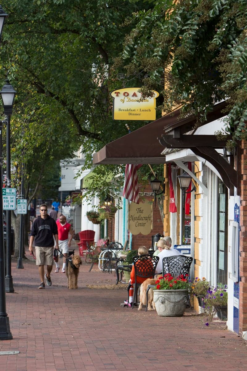
Photo: Wikipedia
Strategic Assessment of Davidson, NC
Multiple tactical vulnerabilities. Population density, target proximity, or disaster risk are likely compounding. A retreat property and exit planning is required.
What does the Strategic Assessment tell us?
Our Strategic Assessment grades tactical survivability of an area. Major population centers, military targets, fallout zones, natural disasters, and border exposure all drive risk — lower exposure means a more defensible position in a crisis.
This is heavily inspired by Joel Skousen's Strategic Relocation book. Highly recommended you checkout the book ($)What does this tell us?
Our Strategic Assessment grades tactical survivability of an area. Major population centers, military targets, fallout zones, natural disasters, and border exposure all drive risk — lower exposure means a more defensible position in a crisis.
This is heavily inspired by Joel Skousen's Strategic Relocation book. Highly recommended you checkout the book ($)Strategic Pillars

Key Distances
Regional Safe Places
Below is our recommended "safe zones" in North Carolina and the surrounding area based on our strategic heuristics. For most people, it's unrealistic to live in a “safe zone” full-time due to work, family or other personal reasons. They tend to be more rural. However, many of these areas are perfect for second homes and retreat properties that double as a vacation home or even a short-term rental.

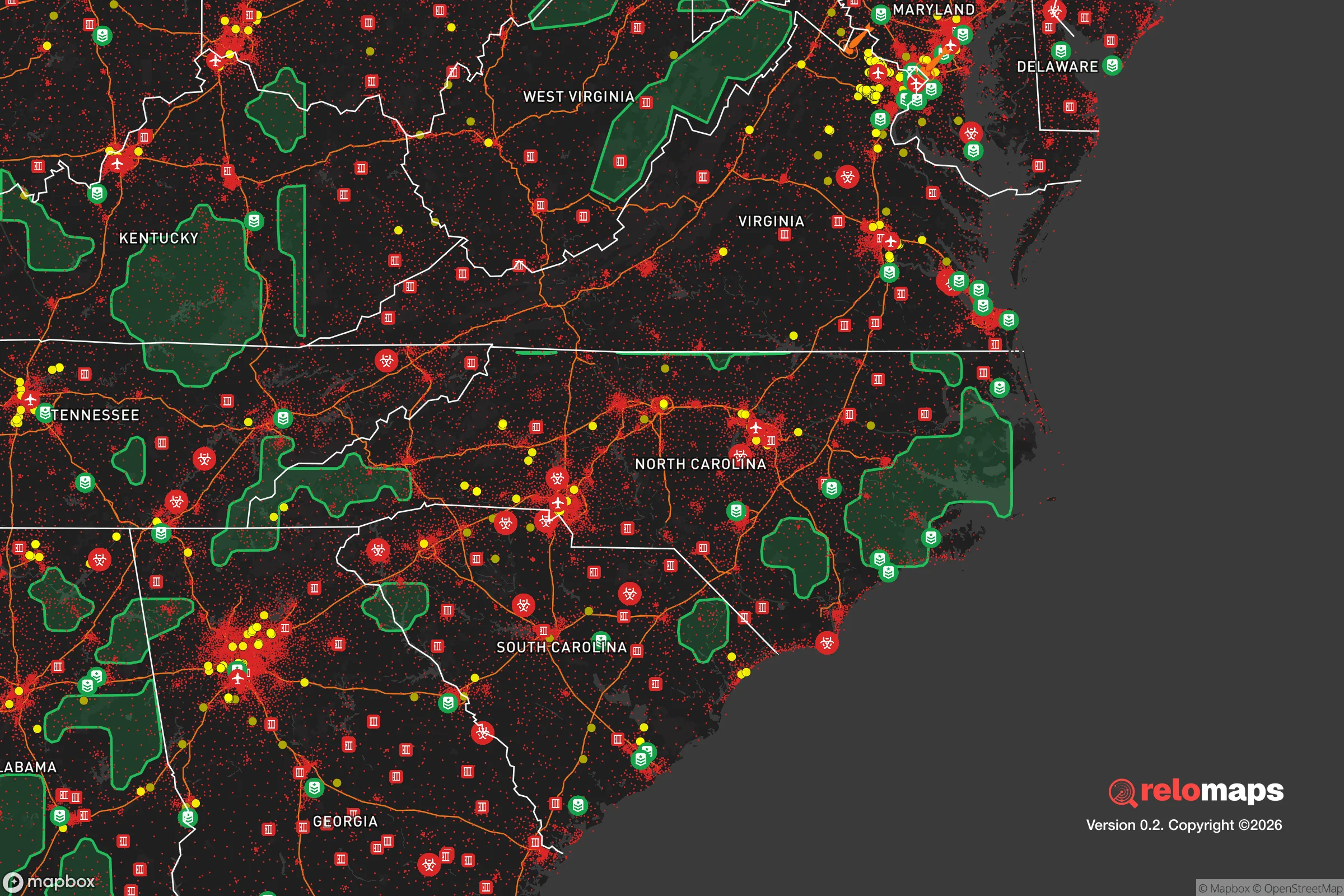


Important Note: For informational purposes only. This does not mean nothing bad ever happens in the green zones. Please use common sense. This is based on public data and modeled with AI. We tried to take a conservative approach but mistakes happen. We update this regularly as new information becomes available.
Solar Generator Recommendations
Backup power matters more here than in safer locations. We've picked three solar generators across budgets and capacity tiers — start with the budget unit if you only need a few essentials, or step up if you want to run a fridge and HVAC for days at a time.

Jackery Portable Power Station Explorer 300
Budget OptionPower on the Go: Weighing only 11 lbs, it's convenient to set up and store with book-sized foldable solar panels

BLUETTI Portable Power Station AC180
Designed for both indoor and outdoor scenarios, AC180 is highly capable as it has a robost capacity and continuous output power.

EF ECOFLOW DELTA Pro Ultra Power Station
Upgraded PickEcoFlow DELTA Pro Ultra is a whole-home energy system designed to grow with your family. Integrated with the Smart Home Panel 2, it scales to meet your evolving energy needs — keeping your home powered, intelligent, and secure through every stage of life.
We earn a commission, at no additional cost to you.
Strategic Assessment Analysis
Davidson, North Carolina, presents a mixed strategic picture for the relocation-minded reader focused on resilience and self-sufficiency. Its primary advantage is a strong, walkable town core and a tight-knit community ethos, but its position within the rapidly urbanizing Charlotte metro area introduces significant vulnerabilities that a serious preparedness-minded individual must weigh. The town’s resilience is less about geographic isolation and more about social cohesion and local governance, which can be a double-edged sword when considering long-term disaster readiness and fallout scenarios.
Geographic position and natural advantages for long-term stability
Davidson sits on the western shore of Lake Norman, a massive 32,500-acre reservoir created by Duke Energy in the 1960s. This location provides a substantial freshwater resource, which is a genuine strategic asset for water security in a prolonged emergency. The town itself is situated in the Piedmont region, characterized by rolling hills rather than steep mountains, which offers moderate defensibility and good drainage. The local climate is temperate, with four distinct seasons, reducing the risk of extreme weather events like the hurricanes that plague the coast or the wildfires common in the arid West. The area is not seismically active, and the primary natural threats are occasional severe thunderstorms, tornadoes (typically EF-0 to EF-2), and winter ice storms that can knock out power for days. The presence of Davidson College, a liberal arts institution with a 665-acre campus, provides a stable institutional anchor and a pool of educated, community-minded residents. However, the town’s location in Mecklenburg County places it squarely within the Charlotte metropolitan statistical area, which had a population of over 2.8 million as of 2025. This proximity to a major urban center is a double-edged sword: it offers economic opportunity but also means that Davidson is not a remote or easily defensible location in a crisis. The town’s growth has been significant, with a population increase from around 12,000 in 2010 to over 15,000 by 2025, driven largely by Charlotte’s expansion. This growth has brought new infrastructure but also increased density and reliance on regional supply chains.
Risks, exposures, and proximity to fallout-relevant landmarks
The most significant strategic vulnerability for Davidson is its location within the Charlotte metro area, which includes several high-value targets in a major conflict or terrorist scenario. Charlotte Douglas International Airport (CLT) is a major hub for the US military and civilian aviation, and the city is a major financial center, home to Bank of America’s headquarters and a large Wells Fargo presence. These are plausible targets for a kinetic or cyber attack. Additionally, the McGuire Nuclear Station, located roughly 20 miles north of Davidson near Huntersville, is a dual-reactor facility that generates power for the region. While nuclear power plants are robustly built, they remain a potential target or source of concern in a major disaster. The proximity to I-77, a major north-south artery, means that any evacuation or disruption in Charlotte will directly impact Davidson’s roads and resources. The town’s main evacuation routes are limited: I-77 to the south or north, or NC-73 east toward Mooresville. In a mass evacuation scenario, these roads would quickly become gridlocked. The Lake Norman dam, while well-maintained, is another infrastructure point of failure; a catastrophic breach would flood downstream areas including parts of Davidson. The area is also within the fallout zone of a hypothetical nuclear detonation in Charlotte, though the prevailing winds would likely carry fallout eastward. For the serious preparedness reader, the concentration of strategic targets within a 30-mile radius is a significant negative factor that outweighs many of the town’s natural advantages.
Practical resilience for a relocator: food, water, energy, and defensibility
For a relocator focused on practical self-sufficiency, Davidson offers a mixed bag. The town’s water supply comes from Lake Norman, which is managed by Duke Energy and treated by the local water authority. In a prolonged power outage, the pumps that move water to homes would fail, making stored water or a private well essential. Homes on the town water system are vulnerable; those with private wells on the outskirts have a distinct advantage. The local food system is decent but not exceptional. Davidson has a small farmers market (seasonal, Saturdays) and is within driving distance of several farms in Iredell and Cabarrus counties. However, the town itself is not a food-producing hub; most groceries come via truck from regional distribution centers. For long-term food security, a relocator would need to establish a garden or secure relationships with local growers. The energy grid is typical for the region: Duke Energy provides electricity, and outages from ice storms or summer thunderstorms are common, lasting anywhere from a few hours to several days. Solar panels with battery storage are a viable option, though homeowners’ associations (HOAs) in some Davidson neighborhoods may restrict their installation. Natural gas is available in many parts of town, providing a backup cooking and heating option. Defensibility is a major concern. Davidson is a compact, walkable town with a dense core and suburban sprawl on its edges. The town is not easily defensible due to multiple road access points and a lack of natural barriers. The Lake Norman shoreline provides a water boundary on the west, but the east and south are open to suburban development. The town’s police force is small (around 30 officers), and in a crisis, they would be stretched thin. The community’s strength is its social fabric: neighborhood watch programs, a strong civic association, and the college’s resources could be leveraged for mutual aid. However, for a relocator seeking a truly defensible, off-grid property, Davidson is not the right fit. It is better suited for someone who values community resilience and preparedness within a suburban context, rather than hardcore self-sufficiency.
Overall, Davidson’s strategic picture is one of moderate resilience with significant urban exposure. The town’s greatest assets are its freshwater access, strong community institutions, and temperate climate. Its greatest liabilities are its location within the Charlotte metro area, proximity to high-value targets like the airport and nuclear plant, and limited evacuation routes. For the relocator who is serious about disaster readiness and self-sufficiency, Davidson is a compromise: it offers a high quality of life and a prepared community, but it is not a remote or easily defensible location. The prudent relocator would need to invest in backup power, water storage, and food supplies, and develop a robust evacuation plan. For those willing to accept the risks of being near a major city in exchange for a strong local community and access to Lake Norman, Davidson can be a viable option. But for the individual or family seeking a truly resilient, low-risk location, the Charlotte metro area’s shadow looms large, and the search should continue further afield.

* Values derived from national, state, county, city and local statistics and may differ in a specific area. Last updated: 2026-08-16T20:32:44.000Z
Narrative content on this page is AI-generated and may contain mistakes. Verify any details that matter before acting on them.
ReloMaps may earn a commission from affiliate links at no extra cost to you.

