Photo: Wikipedia
Strategic Assessment of Dalton, GA
Meaningful friction. Expect exposure to either population pressure, blast zones, or natural disaster risk. Consider buying a retreat property.
What does the Strategic Assessment tell us?
Our Strategic Assessment grades tactical survivability of an area. Major population centers, military targets, fallout zones, natural disasters, and border exposure all drive risk — lower exposure means a more defensible position in a crisis.
This is heavily inspired by Joel Skousen's Strategic Relocation book. Highly recommended you checkout the book ($)What does this tell us?
Our Strategic Assessment grades tactical survivability of an area. Major population centers, military targets, fallout zones, natural disasters, and border exposure all drive risk — lower exposure means a more defensible position in a crisis.
This is heavily inspired by Joel Skousen's Strategic Relocation book. Highly recommended you checkout the book ($)Strategic Pillars

Key Distances
Regional Safe Places
Below is our recommended "safe zones" in Georgia and the surrounding area based on our strategic heuristics. For most people, it's unrealistic to live in a “safe zone” full-time due to work, family or other personal reasons. They tend to be more rural. However, many of these areas are perfect for second homes and retreat properties that double as a vacation home or even a short-term rental.


Important Note: For informational purposes only. This does not mean nothing bad ever happens in the green zones. Please use common sense. This is based on public data and modeled with AI. We tried to take a conservative approach but mistakes happen. We update this regularly as new information becomes available.
Solar Generator Recommendations
Backup power matters more here than in safer locations. We've picked three solar generators across budgets and capacity tiers — start with the budget unit if you only need a few essentials, or step up if you want to run a fridge and HVAC for days at a time.

Jackery Portable Power Station Explorer 300
Budget OptionPower on the Go: Weighing only 11 lbs, it's convenient to set up and store with book-sized foldable solar panels

BLUETTI Portable Power Station AC180
Designed for both indoor and outdoor scenarios, AC180 is highly capable as it has a robost capacity and continuous output power.

EF ECOFLOW DELTA Pro Ultra Power Station
Upgraded PickEcoFlow DELTA Pro Ultra is a whole-home energy system designed to grow with your family. Integrated with the Smart Home Panel 2, it scales to meet your evolving energy needs — keeping your home powered, intelligent, and secure through every stage of life.
We earn a commission, at no additional cost to you.
Strategic Assessment Analysis
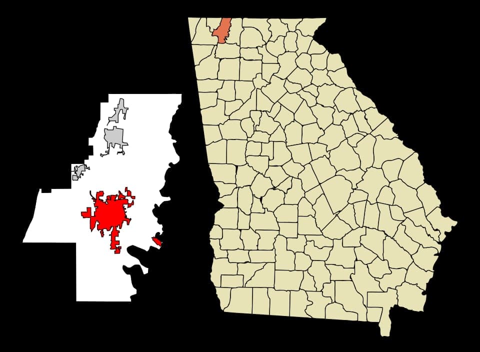
Dalton, Georgia, often called the "Carpet Capital of the World," offers a surprisingly resilient strategic position for those prioritizing self-reliance and distance from major metropolitan collapse zones. Its location in the foothills of the Appalachian Mountains provides natural terrain advantages, while its industrial base—centered on flooring and textiles—means a local economy less dependent on the volatile service and tech sectors that dominate coastal cities. For a relocator with a prepper mindset, Dalton represents a middle-ground option: far enough from Atlanta (about 90 miles north) to avoid the immediate fallout of a major urban crisis, yet close enough to a regional hub (Chattanooga, TN, just 30 miles north) for specialized supplies or medical care if the grid holds. The area’s historical resilience, rooted in its role as a Civil War supply depot and later a manufacturing powerhouse, suggests a community accustomed to pulling together when external systems falter.
Geographic position and natural defensive advantages
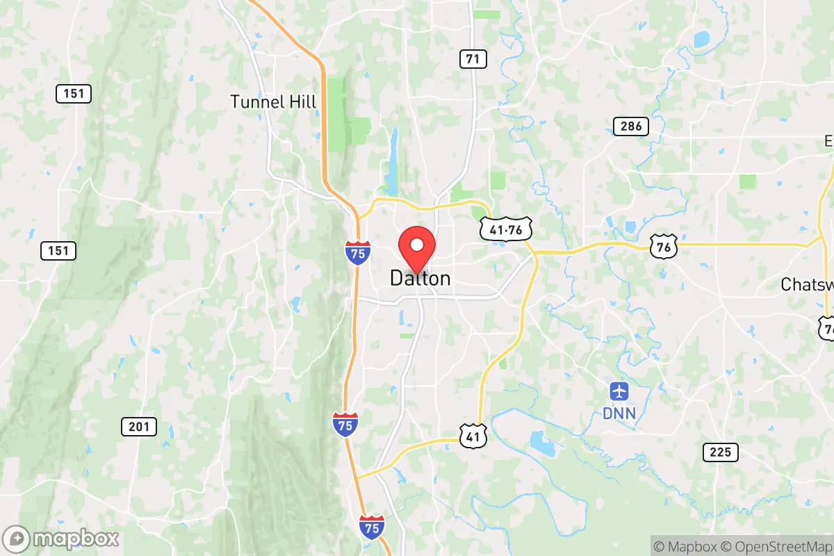
Dalton sits in the Ridge-and-Valley region of northwest Georgia, a landscape that offers natural chokepoints and elevated terrain for observation and defense. The city itself lies in a valley, but the surrounding ridges—including Rocky Face Mountain and the Cohutta Wilderness to the east—provide excellent fallback positions or bug-out locations. The proximity to the Chattahoochee National Forest (about 20 miles east) means access to hundreds of thousands of acres of public land for hunting, foraging, and long-term retreat if urban areas become untenable. The Conasauga River and the Coahulla Creek watershed run through the area, offering reliable surface water sources that are less likely to be contaminated by industrial runoff compared to more developed regions. The terrain also naturally funnels traffic along I-75, the main north-south artery, which is both a vulnerability (easy access for looters or refugees from Atlanta) and an advantage (you can monitor movement from high ground). For a conservative prepper, the ability to control access points—like the narrow passes through the ridges—is a significant tactical plus.
Risks, exposures, and proximity to fallout-relevant landmarks
The most glaring risk for Dalton is its position along I-75, a major evacuation route from Atlanta and Florida. In a mass casualty event or civic unrest scenario, this highway could become a clogged, dangerous corridor filled with desperate people fleeing the cities. The city’s industrial base, while economically stabilizing, also presents a hazard: the carpet and textile plants use chemicals like latex, dyes, and adhesives, and a major fire or spill at one of these facilities could contaminate local water or air. Additionally, Dalton is about 90 miles from the Sequoyah Nuclear Plant near Chattanooga, which is a significant fallout risk if that facility suffers a catastrophic failure or is targeted during a conflict. The plant’s proximity means that a worst-case release could affect wind patterns carrying radioactive material into the Dalton area, especially during prevailing westerly winds. On the positive side, Dalton is far from major military targets like the Pentagon, Norfolk Naval Base, or the nuclear silos in the Great Plains, reducing the likelihood of a direct strike in a conventional war scenario. The city’s location in a valley also means that fallout from a distant detonation might settle on the ridges rather than the valley floor, but this is a double-edged sword—valleys can trap contaminated air during inversions.
Practical resilience for a relocator: food, water, energy, and defensibility
For a relocator focused on practical self-sufficiency, Dalton offers a mixed but workable picture. Water is the strongest asset: the Conasauga River and numerous springs in the surrounding mountains provide reliable sources, and the area’s average rainfall of 55 inches per year means rainwater catchment is highly viable. The local water table is generally shallow in the valleys, making well drilling feasible for those on rural parcels. Food production is moderate: the surrounding farmland grows corn, soybeans, and hay, but the region is not a major grain producer like the Midwest. However, the long growing season (about 210 frost-free days) allows for robust home gardening, and the nearby national forests offer deer, turkey, and small game for protein. Local farmers’ markets and the Dalton Farmers Market provide some redundancy for fresh produce, but a relocator should plan to establish a substantial garden and possibly raise chickens or rabbits for meat and eggs. Energy is a vulnerability: Dalton relies on the regional grid, which is fed by coal, natural gas, and the Sequoyah nuclear plant. Solar potential is decent but not optimal—the area gets about 210 sunny days per year, which is below the national average, and the valley’s cloud cover can reduce generation in winter. A backup generator with stored fuel is essential, as is a wood stove for heating, given the local abundance of hardwood forests. Defensibility is the area’s standout feature: the terrain allows for a layered defense strategy. A rural property on a ridge with a single access road can be easily monitored and secured. The local population is predominantly conservative, with a strong hunting and firearms culture—the Dalton Gun Club and numerous outdoor retailers indicate a community that values self-defense. The Whitfield County Sheriff’s Office and local law enforcement are generally well-regarded, but in a prolonged grid-down scenario, you’ll need to rely on your own capabilities and a trusted network of neighbors. The city’s relatively low population density (about 34,000 in the city proper, 100,000 in the county) means fewer people to compete with for resources compared to Atlanta suburbs, but also fewer organized mutual aid groups.
The overall strategic picture for Dalton is one of cautious viability for a conservative prepper. It avoids the worst of urban collapse zones while offering natural resources and terrain that favor a prepared individual or family. The primary concerns are the I-75 corridor as a vector for unrest and the nuclear plant risk to the north. A relocator should prioritize securing a property with a private water source, defensible access, and sufficient land for food production, while also establishing a network with like-minded locals through churches, gun clubs, or prepper groups. Dalton is not a fortress, but it is a place where a serious, well-stocked individual can carve out a sustainable existence if the country faces prolonged instability. The key is to be proactive: stockpile supplies, learn the local terrain, and build relationships before the crisis hits. In a world where coastal cities are increasingly fragile, Dalton offers a solid, if not perfect, foundation for long-term resilience.
* Values derived from national, state, county, city and local statistics and may differ in a specific area. Last updated: 2026-04-29T19:07:30.000Z
Narrative content on this page is AI-generated and may contain mistakes. Verify any details that matter before acting on them.
ReloMaps may earn a commission from affiliate links at no extra cost to you.