Photo: Wikipedia
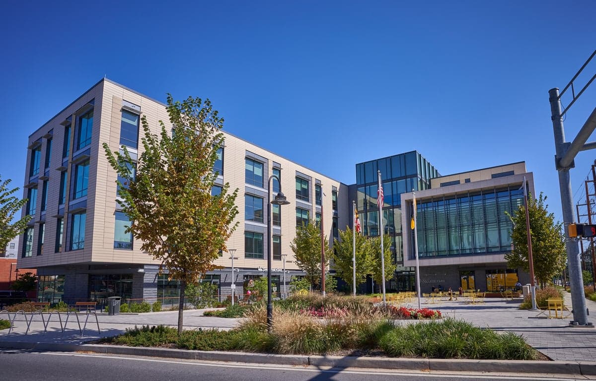
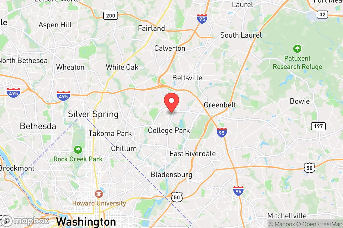
Strategic Assessment of College Park, MD
Multiple tactical vulnerabilities. Population density, target proximity, or disaster risk are likely compounding. A retreat property and exit planning is required.
What does the Strategic Assessment tell us?
Our Strategic Assessment grades tactical survivability of an area. Major population centers, military targets, fallout zones, natural disasters, and border exposure all drive risk — lower exposure means a more defensible position in a crisis.
This is heavily inspired by Joel Skousen's Strategic Relocation book. Highly recommended you checkout the book ($)What does this tell us?
Our Strategic Assessment grades tactical survivability of an area. Major population centers, military targets, fallout zones, natural disasters, and border exposure all drive risk — lower exposure means a more defensible position in a crisis.
This is heavily inspired by Joel Skousen's Strategic Relocation book. Highly recommended you checkout the book ($)Strategic Pillars

Key Distances
Regional Safe Places
Below is our recommended "safe zones" in Maryland and the surrounding area based on our strategic heuristics. For most people, it's unrealistic to live in a “safe zone” full-time due to work, family or other personal reasons. They tend to be more rural. However, many of these areas are perfect for second homes and retreat properties that double as a vacation home or even a short-term rental.


Important Note: For informational purposes only. This does not mean nothing bad ever happens in the green zones. Please use common sense. This is based on public data and modeled with AI. We tried to take a conservative approach but mistakes happen. We update this regularly as new information becomes available.
Solar Generator Recommendations
Backup power matters more here than in safer locations. We've picked three solar generators across budgets and capacity tiers — start with the budget unit if you only need a few essentials, or step up if you want to run a fridge and HVAC for days at a time.

Jackery Portable Power Station Explorer 300
Budget OptionPower on the Go: Weighing only 11 lbs, it's convenient to set up and store with book-sized foldable solar panels

BLUETTI Portable Power Station AC180
Designed for both indoor and outdoor scenarios, AC180 is highly capable as it has a robost capacity and continuous output power.

EF ECOFLOW DELTA Pro Ultra Power Station
Upgraded PickEcoFlow DELTA Pro Ultra is a whole-home energy system designed to grow with your family. Integrated with the Smart Home Panel 2, it scales to meet your evolving energy needs — keeping your home powered, intelligent, and secure through every stage of life.
We earn a commission, at no additional cost to you.
Strategic Assessment Analysis
College Park, Maryland, presents a complex strategic picture for the conservative prepper. Its primary resilience advantage—proximity to the federal government and major infrastructure—is also its greatest liability. While the University of Maryland and the surrounding tech corridor offer economic stability and a dense network of resources, the city sits squarely in the crosshairs of any major disruption targeting the Washington, D.C. metro area. For a relocator prioritizing self-sufficiency and low-profile survivability, College Park is a high-risk, high-reward proposition that demands a clear-eyed assessment of its geographic and logistical realities.
Geographic position and natural advantages for long-term survival
College Park occupies a strategic spot in the Washington-Baltimore corridor, roughly 8 miles northeast of the U.S. Capitol and 25 miles southwest of Baltimore’s Inner Harbor. This places it within the I-95 and I-495 (Capital Beltway) nexus, a double-edged sword for anyone thinking about bug-out routes. On the plus side, the area is flat to gently rolling, with the Anacostia River and its tributaries—like the Northeast Branch and Paint Branch—running through or near the city. These waterways provide a natural water source, though they are heavily urbanized and likely contaminated in a crisis. The region’s temperate climate and 44 inches of annual rainfall mean that, with proper filtration, water is not a scarcity issue. The soil is decent for small-scale gardening, but the surrounding land is almost entirely developed or suburban, leaving little room for off-grid homesteading. The University of Maryland’s 1,250-acre campus does include agricultural research fields and the Arboretum, which could be a source of seeds and botanical knowledge in a prolonged emergency, but that’s a thin reed for a prepper counting on self-reliance.
Risks, exposures, and proximity to fallout-relevant landmarks
This is where the analysis gets sobering. College Park is within the blast radius of any major attack on Washington, D.C.—whether nuclear, chemical, or conventional. The city is directly under the flight path for Reagan National Airport and Andrews Air Force Base, both high-value targets. The Beltsville Agricultural Research Center (just west of the city) and the NASA Goddard Space Flight Center (in nearby Greenbelt) are potential secondary targets for a sophisticated adversary. For a prepper, the biggest concern is the human tide. In a mass evacuation of D.C., College Park would be choked by gridlocked traffic on the Beltway and Route 1. The city’s population of roughly 35,000 swells to over 50,000 during the academic year, and the University of Maryland’s 40,000 students would be a massive, panicked population to contend with. Civil unrest is a real risk here—the area has a history of protests and riots (e.g., the 2020 George Floyd protests that shut down Route 1). The Prince George’s County police presence is robust, but in a widespread breakdown, the sheer density of people (over 4,000 per square mile) makes defensibility a nightmare. Any prepper plan must account for the fact that you are living in a potential kill box for the first 72 hours of a major event.
Practical resilience for a relocator: food, water, energy, and defensibility
Let’s break down the nuts and bolts for someone looking to set up shop here. Water: The city’s water comes from the Washington Aqueduct (Potomac River) and local reservoirs. In a grid-down scenario, the Anacostia and its tributaries are your backup, but you’ll need heavy-duty filtration (e.g., Berkey or RO systems) because of agricultural runoff and urban pollution. Food: College Park has a decent number of grocery stores (Shoppers, Giant, Lidl) and a strong farmers’ market (College Park Farmers Market, Saturdays at the City Hall). But supply chains here are fragile—the area is a food desert for anything beyond 3 days of shelf-stable goods. Energy: The grid is reliable day-to-day, but it’s part of the PJM Interconnection, which has faced strain in recent winters. Solar is viable (Maryland has net metering), but most homes are older (1940s-1960s) with limited roof space for panels. Defensibility: This is the weak link. College Park is a dense, walkable suburb with no natural chokepoints—it’s a grid of streets and cul-de-sacs. The best defensive posture is a hardened home with reinforced doors, window bars, and a secure perimeter, but that’s expensive and draws attention. The University of Maryland Police Department and Prince George’s County PD are well-funded, but in a SHTF scenario, they’ll be overwhelmed. Your best bet is to form a neighborhood watch or prepper group with like-minded individuals, ideally in the quieter, less dense areas like Berwyn or Lakeland. Avoid the high-traffic zones near the Metro stations (College Park-U of MD on the Green Line) and the Route 1 corridor—those will be the first to flood with refugees.
The overall strategic picture for College Park is one of calculated risk. For a conservative prepper who values access to federal resources, a strong job market (especially in tech and defense contracting), and a relatively liberal local government, it’s a place to build a career and a network, not a bug-out location. The city’s proximity to D.C. makes it a prime target, but its infrastructure (hospitals, police, universities) also means you have a higher baseline of support than a rural outpost. The key is to treat College Park as a base of operations, not a final redoubt. Have a bug-out vehicle prepped (preferably a 4x4 with off-road capability) and a secondary location at least 50 miles away—say, in the Appalachian foothills of western Maryland or northern Virginia. Stockpile for 90 days, not 30, because the supply chain here will be the first to break. And above all, keep a low profile. In a crisis, the guy with the visible prepper setup in a dense suburb is a target. College Park can work, but only if you’re willing to play the long game—and have a plan to get out when the game changes.
* Values derived from national, state, county, city and local statistics and may differ in a specific area. Last updated: 2026-04-22T03:18:32.000Z
Narrative content on this page is AI-generated and may contain mistakes. Verify any details that matter before acting on them.
ReloMaps may earn a commission from affiliate links at no extra cost to you.