Photo: Wikipedia
Strategic Assessment of Clemson, SC
Meaningful friction. Expect exposure to either population pressure, blast zones, or natural disaster risk. Consider buying a retreat property.
What does the Strategic Assessment tell us?
Our Strategic Assessment grades tactical survivability of an area. Major population centers, military targets, fallout zones, natural disasters, and border exposure all drive risk — lower exposure means a more defensible position in a crisis.
This is heavily inspired by Joel Skousen's Strategic Relocation book. Highly recommended you checkout the book ($)What does this tell us?
Our Strategic Assessment grades tactical survivability of an area. Major population centers, military targets, fallout zones, natural disasters, and border exposure all drive risk — lower exposure means a more defensible position in a crisis.
This is heavily inspired by Joel Skousen's Strategic Relocation book. Highly recommended you checkout the book ($)Strategic Pillars

Key Distances
Regional Safe Places
Below is our recommended "safe zones" in South Carolina and the surrounding area based on our strategic heuristics. For most people, it's unrealistic to live in a “safe zone” full-time due to work, family or other personal reasons. They tend to be more rural. However, many of these areas are perfect for second homes and retreat properties that double as a vacation home or even a short-term rental.


Important Note: For informational purposes only. This does not mean nothing bad ever happens in the green zones. Please use common sense. This is based on public data and modeled with AI. We tried to take a conservative approach but mistakes happen. We update this regularly as new information becomes available.
Solar Generator Recommendations
Backup power matters more here than in safer locations. We've picked three solar generators across budgets and capacity tiers — start with the budget unit if you only need a few essentials, or step up if you want to run a fridge and HVAC for days at a time.

Jackery Portable Power Station Explorer 300
Budget OptionPower on the Go: Weighing only 11 lbs, it's convenient to set up and store with book-sized foldable solar panels

BLUETTI Portable Power Station AC180
Designed for both indoor and outdoor scenarios, AC180 is highly capable as it has a robost capacity and continuous output power.

EF ECOFLOW DELTA Pro Ultra Power Station
Upgraded PickEcoFlow DELTA Pro Ultra is a whole-home energy system designed to grow with your family. Integrated with the Smart Home Panel 2, it scales to meet your evolving energy needs — keeping your home powered, intelligent, and secure through every stage of life.
We earn a commission, at no additional cost to you.
Strategic Assessment Analysis
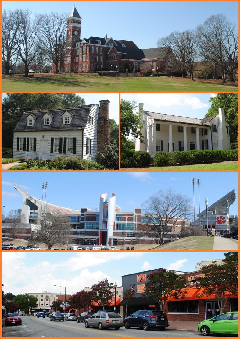
Clemson, South Carolina, offers a surprisingly strong strategic position for those prioritizing resilience and preparedness, largely due to its location in the foothills of the Blue Ridge Mountains and its distance from major metropolitan targets. While not a remote bunker, the area provides a defensible geography with access to fresh water, arable land, and a community that, while influenced by the university, retains a deep-rooted conservative and self-sufficient culture. For a relocator concerned with civic unrest, supply chain disruptions, or mass casualty events, Clemson presents a viable balance of accessibility and buffer—provided you understand its specific vulnerabilities and plan accordingly.
Geographic position and natural advantages for long-term security
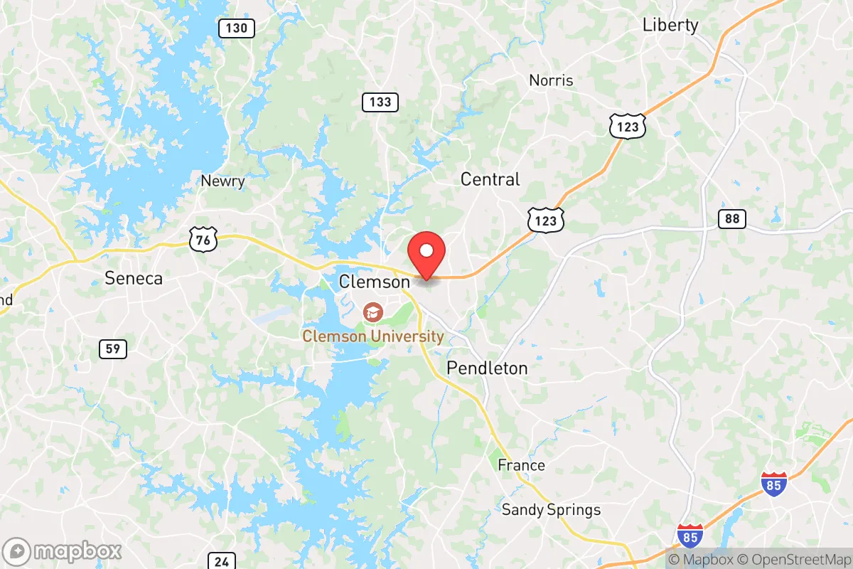
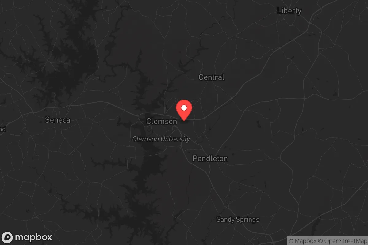
Clemson sits in Pickens County, roughly 30 miles from the Georgia border and 40 miles from the North Carolina line, placing it in a strategic corridor that avoids the direct fallout zones of major cities like Atlanta (120 miles southwest), Charlotte (100 miles east), and Greenville (30 miles north). The area’s elevation—averaging around 800 feet—and its position along the Seneca River and Lake Hartwell provide natural defensive terrain and a reliable water source. The surrounding Blue Ridge Escarpment creates a natural barrier that would slow movement from the coastal plain, a critical factor if population displacement occurs. The region’s moderate climate supports year-round gardening and livestock, with a growing season of roughly 200 days, and the nearby Sumter National Forest and Jocassee Gorges offer extensive wilderness for foraging, hunting, and off-grid retreat. Lake Hartwell alone holds over 56,000 acres of water, making it a strategic asset for both drinking water and food supply via fishing, though you’ll need to account for potential contamination from upstream industrial sites.
Risks, exposures, and proximity to fallout-relevant landmarks
No location is without risk, and Clemson’s proximity to several high-value targets demands attention. The most immediate concern is the Oconee Nuclear Station, located just 12 miles west of Clemson in Seneca. This single-unit pressurized water reactor is a potential target for sabotage or a catastrophic failure scenario, and while the plant has robust security, a worst-case release could render large portions of Pickens and Oconee counties uninhabitable for years. Clemson sits within the 10-mile emergency planning zone (EPZ) of Oconee, meaning you’d need a pre-planned evacuation route west toward the mountains or east toward Greenville. Additionally, the Clemson University campus itself—with its 25,000 students and research facilities—could become a focal point for civil unrest or resource competition during a crisis, especially given its liberal-leaning administrative culture. The nearby Greenville-Spartanburg International Airport (GSP) and the I-85 corridor are both chokepoints that could see military or refugee traffic. On the natural disaster front, the area is in a moderate seismic zone (the 1886 Charleston earthquake was felt here), and tornadoes are a seasonal risk, though the hilly terrain reduces their frequency compared to the plains.
Practical resilience for a relocator: food, water, energy, and defensibility
For a relocator serious about self-sufficiency, Clemson’s practical assets are mixed but workable. Water is abundant: Lake Hartwell, the Seneca River, and numerous creeks and springs provide surface water, but you’ll need filtration systems (Berkey or Sawyer) and a plan for catchment, as municipal water treatment could fail during a prolonged grid outage. The local water table is high in many areas, making well drilling a viable option for rural properties. Food resilience is strong due to the agricultural base in Pickens and Anderson counties—there are dozens of small farms, farmers’ markets, and a strong hunting culture for deer and turkey. The Clemson University Cooperative Extension offers excellent resources for gardening, livestock, and food preservation, which is a unique advantage for newcomers. Energy is a vulnerability: Duke Energy provides the grid, which is reliable day-to-day but vulnerable to cyberattacks or EMP events. Solar is feasible (the area averages 215 sunny days per year), but you’ll need battery storage and a backup generator for winter storms. Defensibility is moderate—the terrain offers natural chokepoints on rural roads, but the town itself is spread out and hard to secure. Rural properties north of Clemson toward Six Mile or west toward the Jocassee Gorges offer better defensibility with limited access points and dense forest cover. The local gun culture is strong, with several ranges and gun shops, and South Carolina’s constitutional carry law (effective 2024) means you can carry without a permit—a practical advantage for personal security.
The overall strategic picture for Clemson is one of calculated trade-offs. It’s not a remote survivalist retreat—you’re still within 30 minutes of a major interstate and an hour from a nuclear plant—but it offers a rare combination of natural resources, a conservative-leaning community, and a geography that buffers against the worst of urban collapse. The key is to treat Clemson as a base of operations rather than a final redoubt: secure a rural property with well water, solar, and a defensible perimeter, build relationships with local farmers and prepper groups (the Upstate has an active network), and have a bug-out plan for the Oconee scenario. If you can manage those risks, Clemson provides a solid foundation for weathering the coming storms—economic, political, or otherwise.
* Values derived from national, state, county, city and local statistics and may differ in a specific area. Last updated: 2026-04-30T01:18:24.000Z
Narrative content on this page is AI-generated and may contain mistakes. Verify any details that matter before acting on them.
ReloMaps may earn a commission from affiliate links at no extra cost to you.