
Photo: Wikipedia
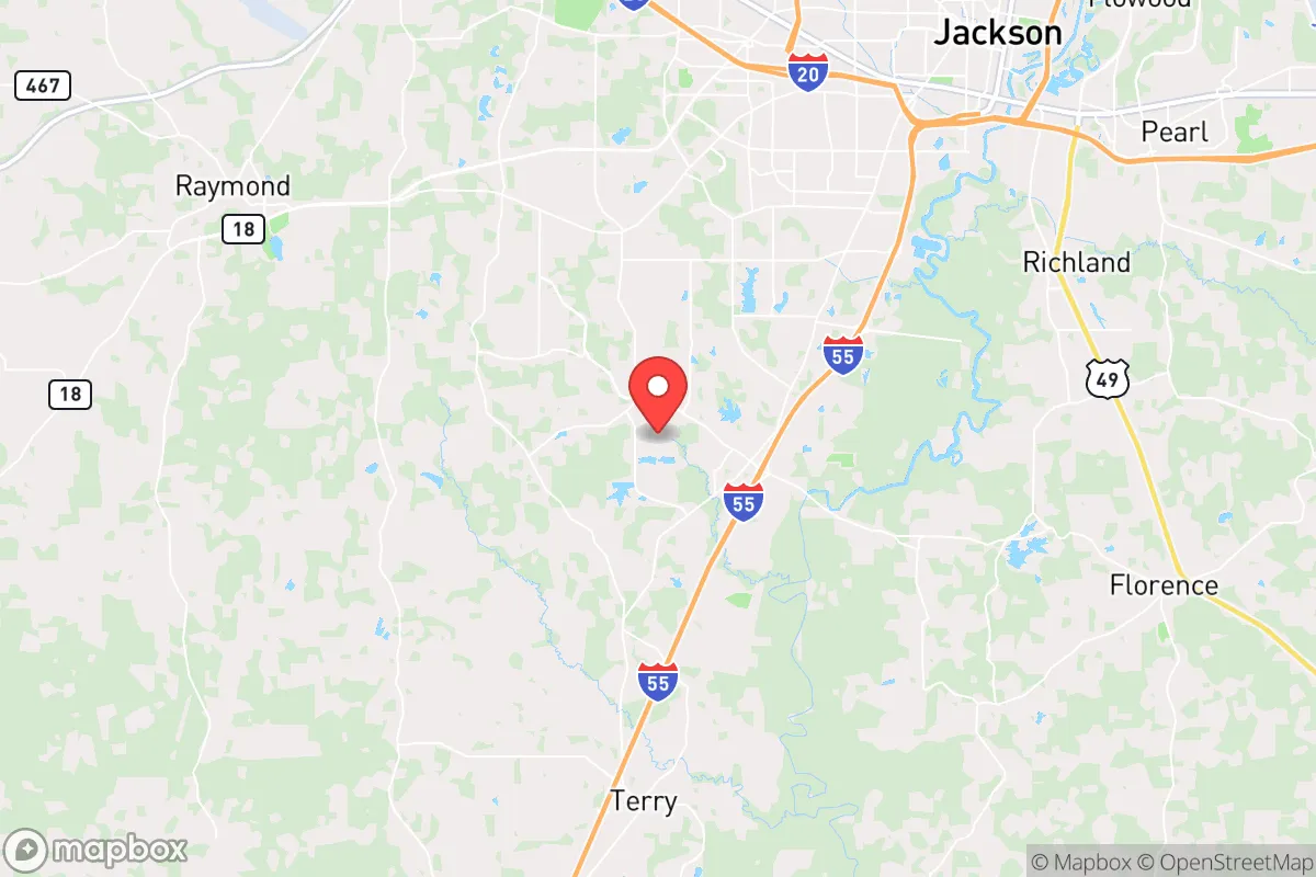
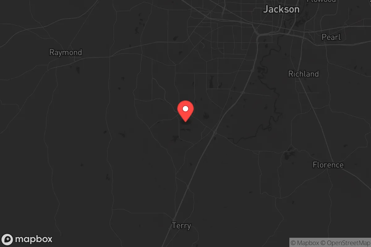
Strategic Assessment of Byram, MS
Workable tactical position. Some exposure to population density or targets, but generally defensible in a crisis.
What does the Strategic Assessment tell us?
Our Strategic Assessment grades tactical survivability of an area. Major population centers, military targets, fallout zones, natural disasters, and border exposure all drive risk — lower exposure means a more defensible position in a crisis.
This is heavily inspired by Joel Skousen's Strategic Relocation book. Highly recommended you checkout the book ($)What does this tell us?
Our Strategic Assessment grades tactical survivability of an area. Major population centers, military targets, fallout zones, natural disasters, and border exposure all drive risk — lower exposure means a more defensible position in a crisis.
This is heavily inspired by Joel Skousen's Strategic Relocation book. Highly recommended you checkout the book ($)Strategic Pillars

Key Distances
Regional Safe Places
Below is our recommended "safe zones" in Mississippi and the surrounding area based on our strategic heuristics. For most people, it's unrealistic to live in a “safe zone” full-time due to work, family or other personal reasons. They tend to be more rural. However, many of these areas are perfect for second homes and retreat properties that double as a vacation home or even a short-term rental.
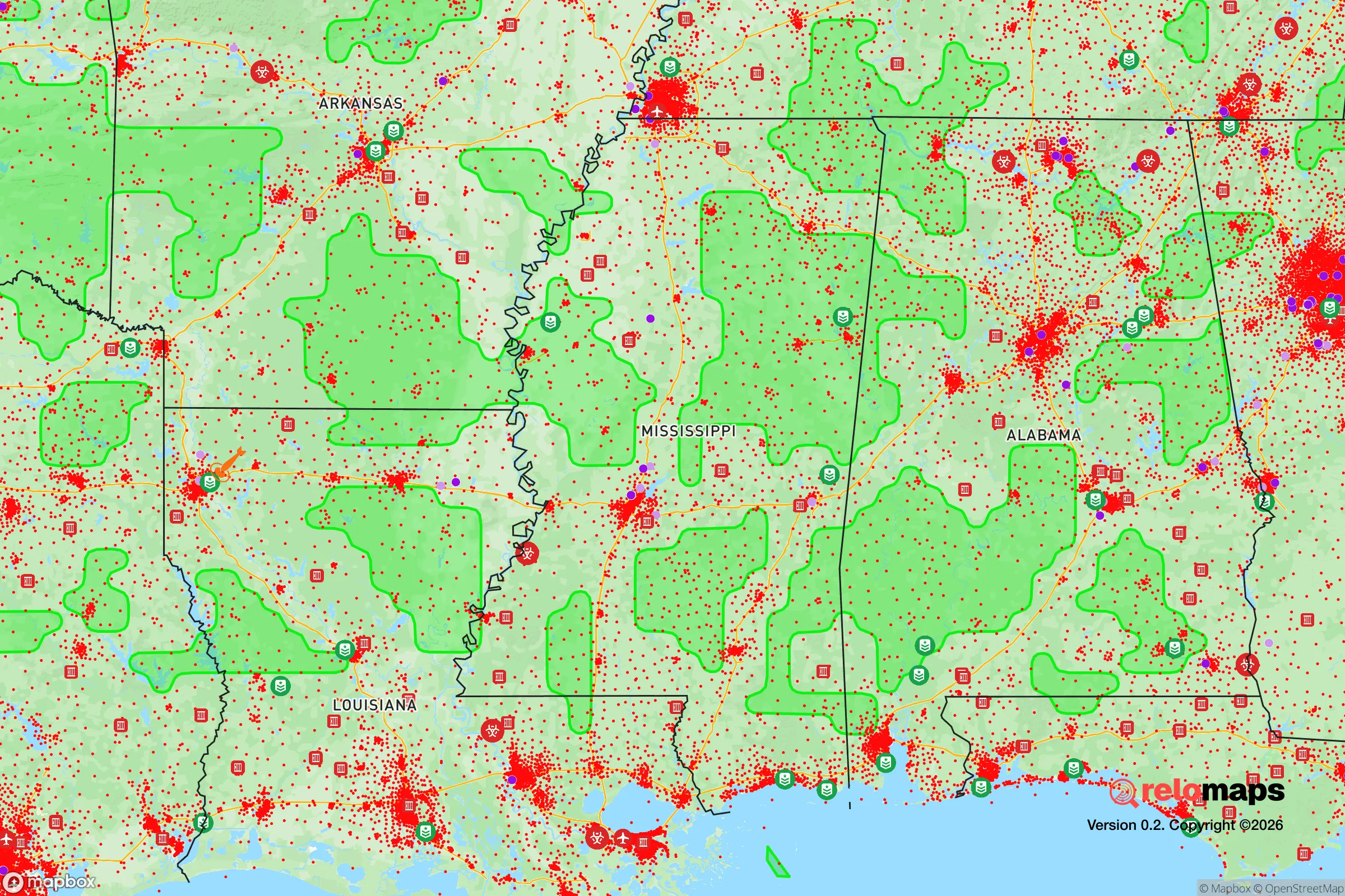
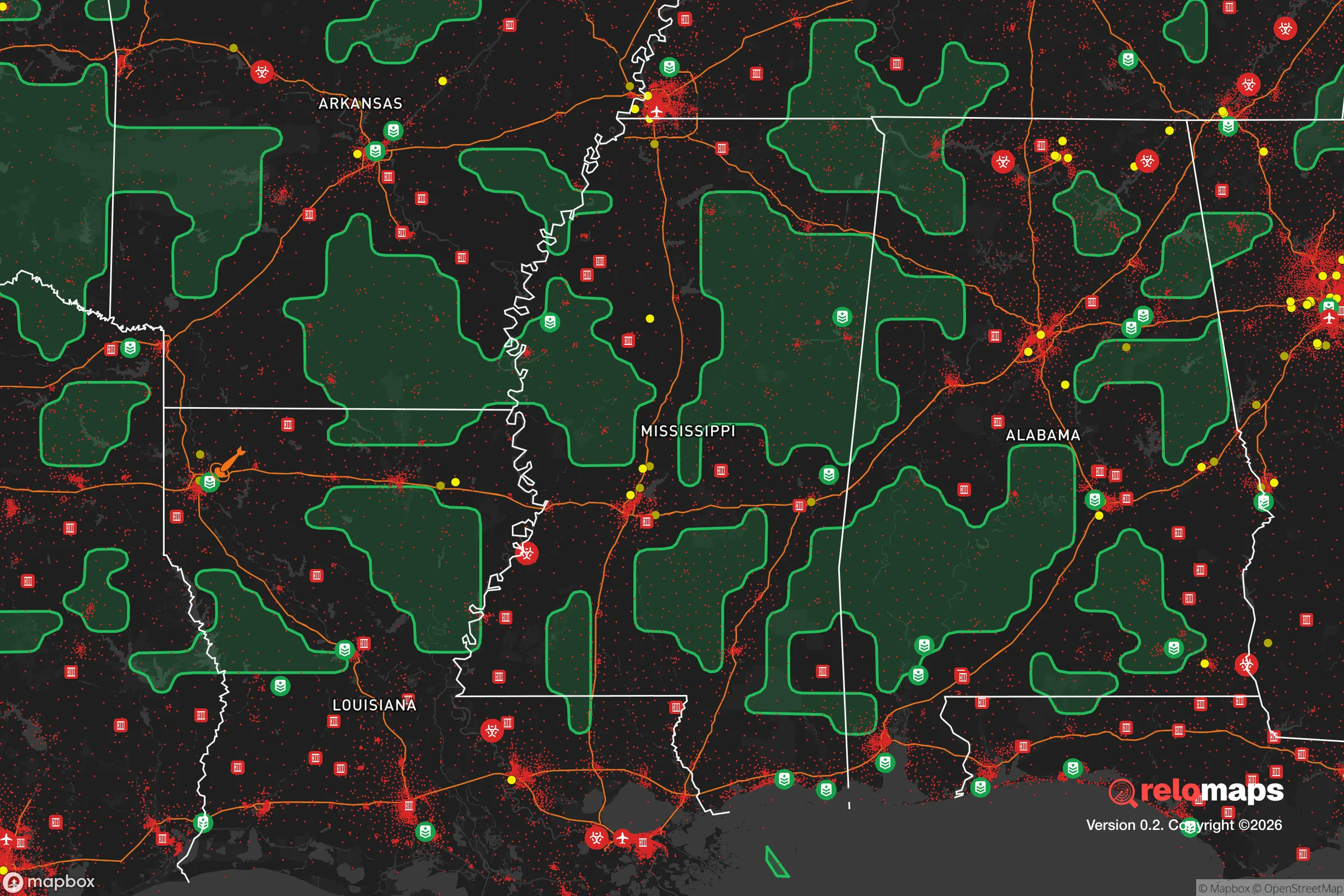
Important Note: For informational purposes only. This does not mean nothing bad ever happens in the green zones. Please use common sense. This is based on public data and modeled with AI. We tried to take a conservative approach but mistakes happen. We update this regularly as new information becomes available.
Solar Generator Recommendations
Backup power matters more here than in safer locations. We've picked three solar generators across budgets and capacity tiers — start with the budget unit if you only need a few essentials, or step up if you want to run a fridge and HVAC for days at a time.

Jackery Portable Power Station Explorer 300
Budget OptionPower on the Go: Weighing only 11 lbs, it's convenient to set up and store with book-sized foldable solar panels

BLUETTI Portable Power Station AC180
Designed for both indoor and outdoor scenarios, AC180 is highly capable as it has a robost capacity and continuous output power.

EF ECOFLOW DELTA Pro Ultra Power Station
Upgraded PickEcoFlow DELTA Pro Ultra is a whole-home energy system designed to grow with your family. Integrated with the Smart Home Panel 2, it scales to meet your evolving energy needs — keeping your home powered, intelligent, and secure through every stage of life.
We earn a commission, at no additional cost to you.
Strategic Assessment Analysis
Byram, Mississippi, sits in a precarious but potentially advantageous position for those prioritizing resilience and strategic relocation. Located just southwest of Jackson along Interstate 55, this small city of roughly 8,000 offers a blend of rural buffer and logistical access that can be leveraged for self-sufficiency. However, its proximity to a major state capital and key infrastructure corridors introduces significant vulnerabilities that any serious prepper must weigh. The area’s flat, forested terrain and access to the Pearl River system provide natural resources, but the same geography that makes it defensible also channels risk from nearby population centers and industrial targets.
Geographic position and natural advantages for long-term survival
Byram’s location at the intersection of I-55 and the Pearl River gives it a dual advantage: quick evacuation routes north to Tennessee or south to the Gulf Coast, and a reliable freshwater source. The surrounding landscape is predominantly piney woods and low-lying wetlands, which offer natural cover and limited road access for anyone seeking to avoid mass movement corridors. The city itself is far enough from Jackson’s urban core—roughly 12 miles—to avoid the worst of any civil unrest or gridlock, yet close enough to monitor regional developments. The Pearl River floodplain provides fertile soil for small-scale agriculture, and the area’s moderate climate allows for year-round growing seasons. For a relocator, this means the potential for food independence, especially if you secure land with well water access, as municipal supplies could be compromised during a crisis. The lack of major military installations or nuclear facilities within a 50-mile radius reduces the risk of direct fallout, though Jackson’s industrial zones and the nearby University of Mississippi Medical Center could become secondary targets in a widespread event.
Risks, exposures, and proximity to fallout-relevant landmarks
The most glaring vulnerability is Byram’s position along I-55, a primary north-south evacuation route that would likely become a chokepoint during any regional disaster. In a scenario involving civil unrest or mass casualty events, this highway could funnel desperate populations from Jackson southward, potentially overwhelming local resources. Jackson itself, with its population of roughly 150,000 and its role as a state government and healthcare hub, is a high-probability target for any coordinated attack or systemic collapse. The city’s water crisis in 2022—when the main treatment plant failed, leaving residents without potable water for weeks—demonstrates how fragile urban infrastructure can be. Byram’s proximity to the Jackson-Medgar Wiley Evers International Airport (about 15 miles north) and the rail lines running through the area also introduces risks of supply chain disruptions or secondary attacks. Additionally, the Mississippi River’s industrial corridor, including chemical plants and refineries near Baton Rouge and New Orleans, is within a 150-mile radius, meaning fallout from a major event there could drift northward. For a prepper, the key takeaway is that Byram’s buffer zone is thin—you’re not remote enough to ignore Jackson’s problems, but you’re close enough to be affected by them.
Practical resilience for a relocator: food, water, energy, and defensibility
Water security is the first priority in Byram. While the Pearl River is a reliable surface source, it’s also a vector for contamination during floods or industrial spills. Drilling a private well is feasible in the area’s alluvial aquifers, but you’ll need to test for agricultural runoff and heavy metals. Rainwater catchment is a solid backup, given the region’s average 55 inches of annual rainfall. For food, the growing season runs from March to November, allowing for two crop cycles of staples like corn, beans, and squash. Local soil is sandy loam, which drains well but requires amendment for sustained fertility. Hunting and fishing are viable—white-tailed deer, turkey, and catfish are abundant in the surrounding national forests and the Pearl River. Energy independence is more challenging. Byram is served by Entergy Mississippi, whose grid has shown vulnerability to storms and cyberattacks. Solar panels with battery storage are a strong option, as the area gets about 215 sunny days per year, but you’ll need to account for hurricane-related cloud cover. Defensibility is mixed: the flat terrain offers limited natural chokepoints, but the dense pine forests can be used for concealment and perimeter security. The city’s low population density (roughly 200 people per square mile) means fewer neighbors to worry about, but also fewer mutual aid opportunities. A rural property with a gravel driveway and a clear line of sight to the main road would be ideal.
The overall strategic picture for Byram is one of calculated risk. It’s not a bug-out location for those seeking total isolation—you’re too close to Jackson and its associated vulnerabilities for that. But for a relocator who wants to maintain a semblance of normal life while building layered resilience, it offers a workable middle ground. The key is to treat Byram as a base of operations, not a fortress. Stockpile supplies for at least 90 days, establish off-grid water and power, and develop a network of trusted contacts in the surrounding rural areas. Monitor the I-55 corridor as a tripwire for regional instability. If you can manage the proximity to Jackson’s risks—and the inevitable traffic and noise that come with it—Byram provides the resources and access needed to weather a slow-burn collapse or a sudden crisis. Just don’t mistake its convenience for safety. The real value here is in the land and water, not the town itself.
* Values derived from national, state, county, city and local statistics and may differ in a specific area. Last updated: 2026-04-21T11:47:23.000Z
Narrative content on this page is AI-generated and may contain mistakes. Verify any details that matter before acting on them.
ReloMaps may earn a commission from affiliate links at no extra cost to you.