Photo: Wikipedia
Strategic Assessment of Bossier City, LA
Meaningful friction. Expect exposure to either population pressure, blast zones, or natural disaster risk. Consider buying a retreat property.
What does the Strategic Assessment tell us?
Our Strategic Assessment grades tactical survivability of an area. Major population centers, military targets, fallout zones, natural disasters, and border exposure all drive risk — lower exposure means a more defensible position in a crisis.
This is heavily inspired by Joel Skousen's Strategic Relocation book. Highly recommended you checkout the book ($)What does this tell us?
Our Strategic Assessment grades tactical survivability of an area. Major population centers, military targets, fallout zones, natural disasters, and border exposure all drive risk — lower exposure means a more defensible position in a crisis.
This is heavily inspired by Joel Skousen's Strategic Relocation book. Highly recommended you checkout the book ($)Strategic Pillars

Key Distances
Regional Safe Places
Below is our recommended "safe zones" in Louisiana and the surrounding area based on our strategic heuristics. For most people, it's unrealistic to live in a “safe zone” full-time due to work, family or other personal reasons. They tend to be more rural. However, many of these areas are perfect for second homes and retreat properties that double as a vacation home or even a short-term rental.

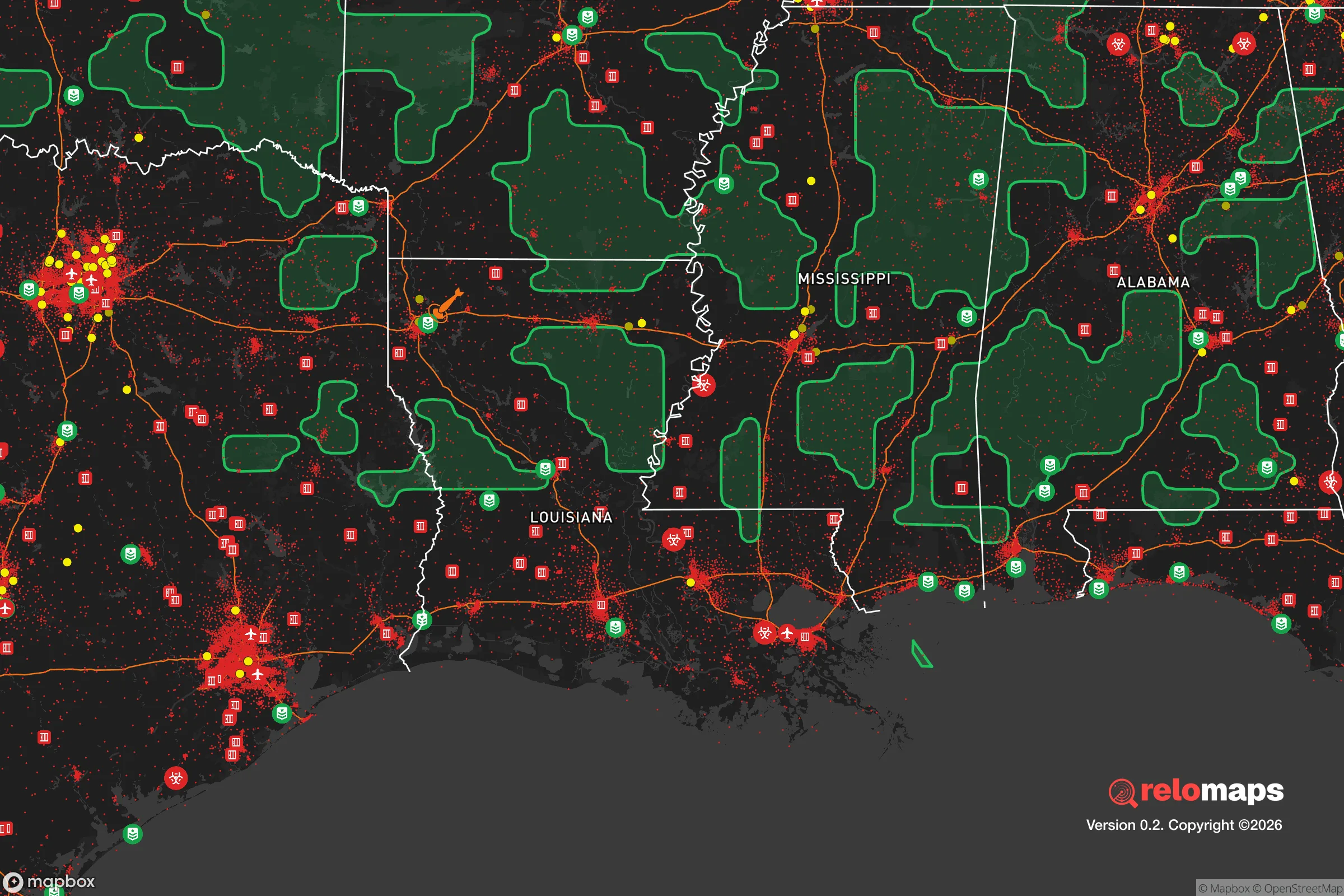
Important Note: For informational purposes only. This does not mean nothing bad ever happens in the green zones. Please use common sense. This is based on public data and modeled with AI. We tried to take a conservative approach but mistakes happen. We update this regularly as new information becomes available.
Solar Generator Recommendations
Backup power matters more here than in safer locations. We've picked three solar generators across budgets and capacity tiers — start with the budget unit if you only need a few essentials, or step up if you want to run a fridge and HVAC for days at a time.

Jackery Portable Power Station Explorer 300
Budget OptionPower on the Go: Weighing only 11 lbs, it's convenient to set up and store with book-sized foldable solar panels

BLUETTI Portable Power Station AC180
Designed for both indoor and outdoor scenarios, AC180 is highly capable as it has a robost capacity and continuous output power.

EF ECOFLOW DELTA Pro Ultra Power Station
Upgraded PickEcoFlow DELTA Pro Ultra is a whole-home energy system designed to grow with your family. Integrated with the Smart Home Panel 2, it scales to meet your evolving energy needs — keeping your home powered, intelligent, and secure through every stage of life.
We earn a commission, at no additional cost to you.
Strategic Assessment Analysis
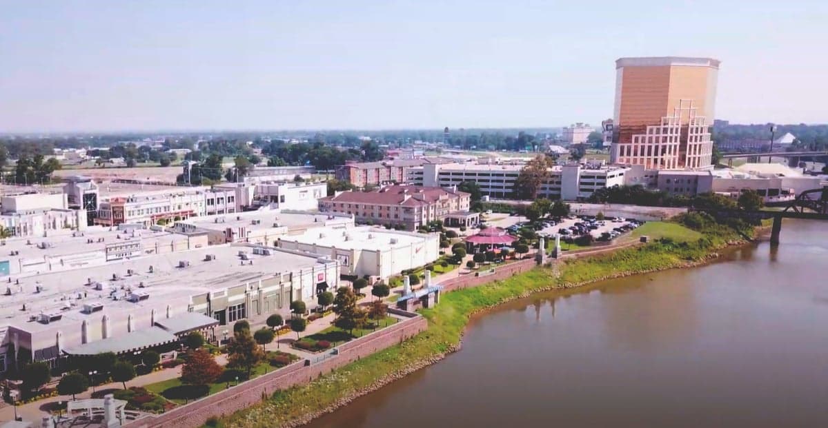
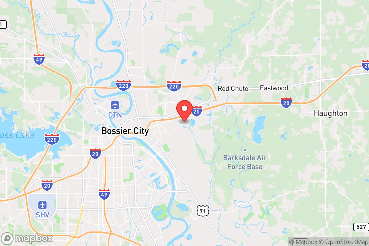
Bossier City, Louisiana, sits in a precarious but potentially advantageous position for those prioritizing resilience and strategic relocation. Its location across the Red River from Shreveport offers a buffer from immediate urban chaos while still providing access to regional infrastructure, but the area’s proximity to a major metropolitan hub, a major interstate corridor, and the Louisiana-Texas border introduces significant exposure risks that a prepper must weigh carefully. For a conservative-leaning individual or family seeking a place to weather civic unrest, natural disasters, or supply chain disruptions, Bossier City presents a mixed bag: decent natural resources and a relatively low population density by metro standards, but with vulnerabilities that demand a clear-eyed assessment of fallout zones and escape routes.
Geographic position and natural advantages for long-term survival
Bossier City’s location on the eastern bank of the Red River provides a natural defensive barrier against any unrest originating in Shreveport, but this same river can become a liability during floods. The area sits within the Red River Valley, a fertile floodplain that historically supported agriculture, meaning soil quality is decent for small-scale food production if you secure land outside the flood zone. The region’s climate is humid subtropical, with hot summers and mild winters—good for year-round gardening but also for mosquito-borne diseases and mold issues in stored supplies. The nearby Kisatchie National Forest, about 30 miles southeast, offers a potential bug-out location with dense cover and water sources, though it’s not a true wilderness and is crisscrossed by logging roads. Bossier City’s elevation averages around 170 feet, with no significant hills or mountains to provide tactical advantage, but the flat terrain makes overland travel and vehicle-based evacuation straightforward. The area’s position near the intersection of I-20 and I-49 gives quick access to Texas, Arkansas, and the Gulf Coast, but those same highways are choke points during any mass evacuation event—something to plan around, not rely on.
Risks, exposures, and proximity to fallout-relevant landmarks
The biggest strategic weakness of Bossier City is its proximity to Shreveport, a city of roughly 190,000 people that is a regional hub for healthcare, energy, and transportation. During a major disaster—whether a hurricane, a pandemic, or civil unrest—Shreveport’s population will likely surge as people flee the Gulf Coast or Texas, turning Bossier City into a pressure cooker. The Barksdale Air Force Base, located just south of Bossier City, is a double-edged sword: it’s a major employer and a potential source of security, but it’s also a high-value target in any conflict scenario, drawing attention from adversaries or looters. The base houses the 2nd Bomb Wing and B-52s, making it a nuclear-capable asset that could be a fallout magnet. Additionally, the Red River itself is a flood risk; the 2015 and 2016 floods inundated parts of Bossier City, and climate models suggest heavier rainfall events are becoming more common. The area is also in Tornado Alley’s southern fringe, with a moderate risk of tornadoes—nothing like Oklahoma, but enough to warrant a storm shelter. For a prepper, the biggest concern is the lack of natural barriers: the flat, open terrain means any civil unrest in Shreveport can spill across the bridges (I-20, I-220, and the Texas Street Bridge) with little warning. The I-20 bridge is a notorious bottleneck; if it’s blocked, you’re looking at a long detour through rural Caddo Parish or a risky river crossing.
Practical resilience for a relocator: food, water, energy, and defensibility
Bossier City’s water supply comes from the Red River, treated by the city’s water plant, which is vulnerable to both contamination and power outages. A prepper should plan for a well or a reliable rainwater catchment system—the area gets about 50 inches of rain annually, so collection is feasible. The local soil is clay-heavy, which means poor drainage but decent for raised beds if amended. For food, the region has a strong hunting culture—deer, wild hog, and waterfowl are abundant in the surrounding rural areas—but you’ll need to secure land outside city limits, as Bossier City itself is suburban and lacks acreage for self-sufficiency. Energy-wise, the grid is served by SWEPCO, which has a mixed reliability record; ice storms in 2021 caused widespread outages, and the area is prone to summer thunderstorms that knock out power. Solar is viable (about 215 sunny days per year), but you’ll need battery storage to handle the cloudy stretches. Defensibility is the weak point: Bossier City is a typical suburban sprawl with cul-de-sacs and strip malls, offering little natural cover or chokepoints. A better bet is to look at the rural areas north of town, near the Red River National Wildlife Refuge or further out toward the town of Benton, where you can get acreage with tree lines and distance from the main roads. The local law enforcement presence is decent—Bossier City has its own police department, and the sheriff’s office covers the parish—but during a SHTF scenario, they’ll be overwhelmed by the sheer volume of people fleeing Shreveport. Stockpile ammunition and medical supplies, because the nearest trauma center is in Shreveport, and it will be a magnet for the wounded.
Overall, Bossier City is a strategic compromise: it offers proximity to resources (hospitals, airports, supply routes) and a relatively conservative population (the area leans red, with Bossier Parish voting heavily Republican), but it lacks the isolation and natural defenses that a serious prepper would want. If you’re looking for a place to ride out a short-term crisis—say, a week-long power outage or a localized riot—it’s workable, especially if you have a well-stocked suburban home with a generator. But for a long-term collapse scenario, the risks from Shreveport’s population, the Barksdale target, and the flood-prone geography make it a poor choice for a primary retreat. The smart play is to use Bossier City as a staging area—a place to build relationships, store supplies, and monitor the situation—while securing a more defensible property further north or east, in the piney woods of north Louisiana or across the border in Arkansas. The area’s real value is as a hub for networking with like-minded individuals and accessing the region’s hunting and farming potential, not as a final destination. If you’re set on the area, focus on buying land with water access and elevation, and keep a low profile—Bossier City’s suburban comfort can lull you into complacency, but the strategic picture demands constant vigilance.
* Values derived from national, state, county, city and local statistics and may differ in a specific area. Last updated: 2026-04-23T05:00:50.000Z
Narrative content on this page is AI-generated and may contain mistakes. Verify any details that matter before acting on them.
ReloMaps may earn a commission from affiliate links at no extra cost to you.