7 Dangerous Neighborhoods in Washington, DC
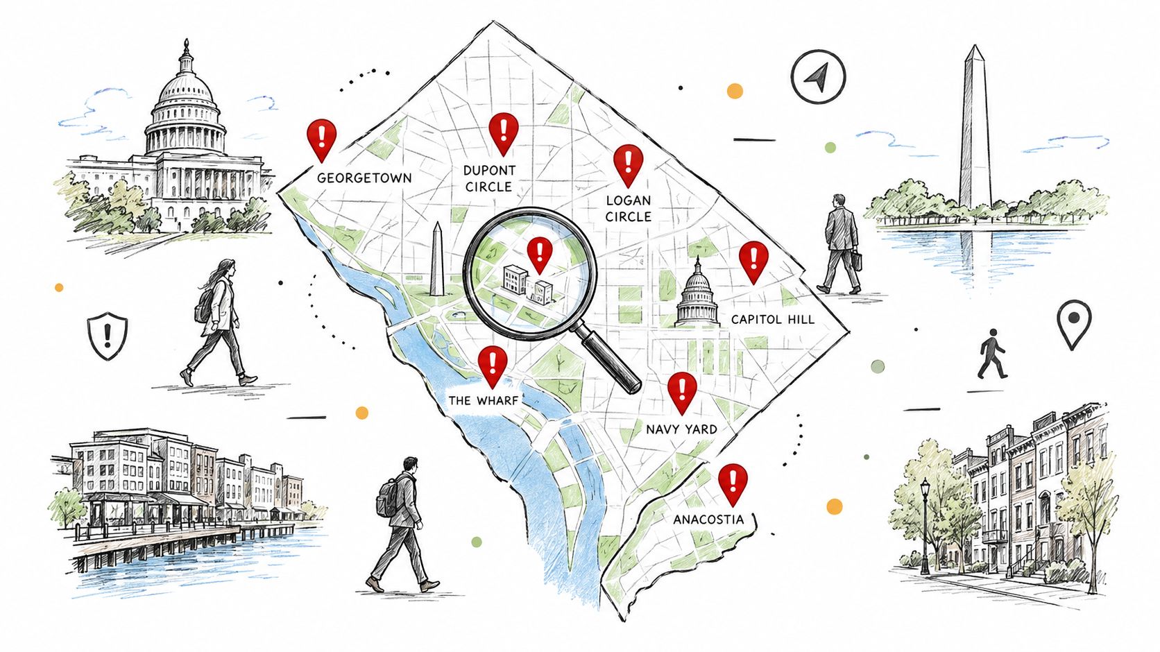
Anacostia, Ward 7's East End, Petworth, Shaw and Howard University, Woodland Heights near the Takoma Park border, Bloomingdale and LeDroit Park, and Garfield Heights and Kenilworth are the seven areas that most warrant a close safety review in Washington, DC. That said, risk changes sharply by block, crime type, and time of day, so a neighborhood-wide label can hide safer pockets and hotter corridors.
Table of Contents
- Which DC Areas Require the Closest Safety Review
- 1. Anacostia High Violent Crime and Property Theft Corridor
- 2. Ward 7's East End Concentrated Homicide Clusters and Limited Economic Mobility
- 3. Petworth Robbery Pressure Near the Metro Corridor
- 4. Shaw and Howard University Mixed Crime Patterns with Robbery Concentration
- 5. Woodland Heights and the Takoma Park Border Property Crime and Limited Visibility
- 6. Bloomingdale and LeDroit Park Transitional Safety with Gentrification-Related Volatility
- 7. Garfield Heights and Kenilworth Persistent Gang Activity and Violence Concentration
- 7-Area Crime & Safety Comparison, Washington, DC
- How to Turn a Crime List Into a Safer Move
- Frequently Asked Questions
- Can a high property-crime area still work for a remote worker?
- How do I judge a block when neighborhood crime rates vary sharply?
- Does a late-night hybrid commute change the safety assessment?
- What security costs should I budget before leasing in a risky area?
- What crime-data threshold should make me remove a property from my shortlist?
Which DC Areas Require the Closest Safety Review
The best way to judge the dangerous neighborhoods in Washington DC is to separate violent crime from property crime, then look at the exact block, recent trend, and likely commute pattern. A neighborhood can have a mixed profile, where one corridor draws robberies and another mainly sees car break-ins or theft from autos. For a move, that difference matters as much as the neighborhood name itself.
A quick note before the list, check whether the crime data is recent and whether it uses ward, PSA, or address-level geography. DC's Crime Cards lets you filter by location and offense type, which is more useful than a broad reputation alone. If you're comparing shortlists, tools like ReloMaps can add city and neighborhood context on safety, affordability, commute, and quality of life, which helps you weigh trade-offs instead of chasing a single “safe or unsafe” label. For readers comparing other metro areas too, where to live safely in Boston is a useful contrast point.
Crime in DC is concentrated enough that the right question is rarely, “Is this whole area dangerous?” It's more often, “Which block, which hour, and which offense type?”
Contents
- Anacostia
- Ward 7's East End
- Petworth
- Shaw and Howard University
- Woodland Heights and the Takoma Park border
- Bloomingdale and LeDroit Park
- Garfield Heights and Kenilworth
1. Anacostia High Violent Crime and Property Theft Corridor
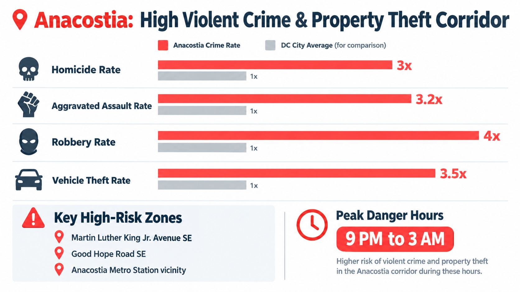
Anacostia stays on almost every serious relocation watchlist because it combines high violent crime with persistent property crime. Historical FBI-based context places the District's long-run crime burden in perspective, and Anacostia has repeatedly sat above city norms in that broader pattern, which is why it keeps surfacing in relocation searches. The core issue for renters and buyers is not just the neighborhood name, it's the corridor effect, where commercial strips, transit access, and parking conditions can change the risk from one block to the next.
The practical question is where crime clusters, and the answer is usually around activity nodes rather than evenly across the whole area. A resident commuting home after dark, for example, may face a very different risk profile on a well-traveled commercial block than on a quieter side street with good lighting and consistent foot traffic. That's why a lease review should include the immediate block, the nearest intersection, and the route from transit or parking to the front door.
Practical rule: If you'd need to rely on a car every evening, don't assume a safer experience just because the apartment itself looks fine in daylight.
- Night travel: Avoid solo walks after sunset, especially near active commercial corridors.
- Vehicle security: Park only in well-lit, monitored lots, and keep the cabin empty of visible valuables.
- Home hardening: Use motion lighting, sturdy locks, and, if possible, a camera at the entry.
- Transit use: If you depend on Metro, check whether the walking segment from the station feels active at the actual times you'd use it.
For relocation screening, this is a place where the exact address matters more than the zip code. If you're comparing options, use DC neighborhood and city context on ReloMaps to compare nearby alternatives before you make a deposit.
2. Ward 7's East End Concentrated Homicide Clusters and Limited Economic Mobility
Ward 7's East End deserves close scrutiny because the risk profile centers on concentrated homicide risk and long-running household trade-offs, not visible disorder alone. East of the Anacostia River, residents often face limited economic mobility, fewer nearby services, and more planning around how to move through the day safely. That combination makes broad neighborhood labels less useful than block-level conditions.
A relocation decision here usually depends on routine. If your schedule includes late shifts, school pickups, or regular evening trips, the questions are practical: how often would you be outside after dark, how many parking handoffs would you make, and does the immediate block offer enough natural surveillance to feel workable on foot? A place can look acceptable on a map and still be awkward for the way you live.
The citywide picture also matters, but only as context. MPD reported total violent crime falling from 3,475 incidents to 2,475 in 2025, while total reported crime fell from 29,332 to 24,177. That improvement does not erase local variation. Ward 7 can still present a sharper day-to-day safety problem for commuters and families who need predictable access after work, especially where the walk from parking or transit feels isolated.
- Home security: Use reinforced locks, cameras, and an alarm system.
- Public visibility: Keep jewelry, laptops, and other valuables out of sight.
- Evening movement: Use rideshare or transit with a clear plan rather than improvising.
- Family routines: Choose supervised activities for children so they are not spending long unsupervised hours outside.
If Ward 7 is on your shortlist, use ReloMaps Washington, DC context to compare nearby blocks before you commit.
3. Petworth Robbery Pressure Near the Metro Corridor
Petworth's defining risk is robbery pressure around the Metro corridor, the commercial strips, and the routes people walk at night. Exposure changes block by block. A quiet residential street can feel very different from a busier edge where foot traffic continues after dark.
For renters, the practical questions are simple. Can you reach the front door without crossing a dim lot or side alley? Is the walk from transit visible from surrounding homes and businesses? Would carrying a laptop or shopping bag after dark make you stand out? Robbery risk often tracks visibility, predictable routines, and places where people are moving with little natural surveillance.
That makes Petworth workable for some households and awkward for others. People who choose quieter blocks away from the busiest commercial edges may find the area acceptable. The trade-off grows sharper for anyone who relies on late returns, solo walks, or street parking. In those cases, the safety plan has to compensate for the block's layout and nighttime activity.
Practical rule: A block that feels calm at 2 p.m. can still be a poor fit if you usually get home by Metro after 9 p.m.
- Street behavior: Keep phones and laptops out of sight while walking.
- Route choice: Use well-lit streets and avoid shortcut alleys.
- Packages: Use signature delivery or secure pickup to limit theft exposure.
- Parking: Choose monitored parking over street parking when you can.
If you are comparing nearby options, use how Petworth compares on safety, commute, and housing type to judge whether a specific block fits your routine before you commit.
4. Shaw and Howard University Mixed Crime Patterns with Robbery Concentration
Shaw and the Howard University area show why broad neighborhood labels can mislead. Some blocks benefit from revitalization, active nightlife, and steady foot traffic, while specific commercial zones and transit-adjacent stretches still draw robbery concerns. The result is a place where one street can feel active and another can feel unsuitable for solo movement after dark.
Students, staff, and nearby residents often have to judge whether they are comfortable with late classes, social events, and walking home after dark. For anyone returning around 10 p.m., the deciding factor is whether the route from the station to the door is predictable and well lit. That is the practical test, not the neighborhood name on its own.
The same logic applies to apartment selection. A unit one block from a busy strip can feel very different from a similar unit deeper in the residential grid. The stronger move is to compare specific addresses, building entrances, and the walk from transit before you sign anything.
Practical rule: If your safest path home requires crossing the same busy corner every night, choose a different building or a different block.
- Night transit: Avoid solo travel on the busiest corridors after dark.
- Visibility: Keep headphones low and your phone put away while walking.
- Nightlife: Use a buddy system if your routine includes bars or late events.
- Residence: Choose buildings with quality locks and controlled entry.
Shaw is also a useful reminder that city-wide context matters. Before you sign a lease, compare nearby options with Washington, DC on ReloMaps so you can see whether a slightly different block changes the safety, commute, or affordability picture enough to matter.
5. Woodland Heights and the Takoma Park Border Property Crime and Limited Visibility
Woodland Heights near the Takoma Park border stands out more for property crime than for headline violent crime. That matters because many households think about safety only through the lens of assault or robbery, then underestimate the day-to-day cost of theft from cars, packages, and entry points. A place can feel quiet and still be frustrating if you're constantly replacing stolen items or dealing with avoidable break-ins.
The visibility issue is central here. Lower lighting, thinner police presence relative to demand, and inconsistent block conditions can turn ordinary routines into weak points, especially if you leave packages outside or park on the street overnight. Remote workers and hybrid commuters often feel this most acutely, because they're home long enough to notice patterns but may still leave the property unattended during the workday.
A household evaluating this area should think less about drama and more about friction. Are packages exposed? Is the driveway visible? Can you secure the porch, the entry, and the vehicle without overhauling the whole property? Those practical questions often determine whether the area is livable in practice, even if the violent-crime profile is less alarming than in other parts of the city.
- Entry points: Use reinforced locks and deadbolts on every exterior door.
- Package control: Bring deliveries inside immediately, don't let them sit outside.
- Cars: Avoid visible valuables and, when possible, skip overnight street parking.
- Lighting: Add motion-sensor lights and porch cameras with secure mounting.
For a broader comparison of lower-risk alternatives, ReloMaps' Mid-Atlantic safety context is useful when you want to compare DC-adjacent choices without relying on reputation alone.
6. Bloomingdale and LeDroit Park Transitional Safety with Gentrification-Related Volatility
Bloomingdale and LeDroit Park sit in a transitional zone that can mislead buyers who rely on neighborhood labels alone. Renovated homes and stronger street activity sit beside blocks where theft, nuisance calls, or other minor problems still show up unevenly. The result is not a single safety profile, but a set of block-level differences that can change the relocation calculation.
The common mistake is treating redevelopment as proof of stability. In these areas, better housing stock can coexist with heavier cut-through traffic, parking stress, and pockets where opportunistic crime remains more likely than the block a few streets away. That means a renter, a family, and a remote worker may all judge the same address differently depending on how often they are outside, where they park, and how visible their routines are.
Repeat visits matter here. Check the street in daylight, then after dark, then on a weekend. Pay attention to whether the block feels residential or more like a route between destinations, whether street parking looks exposed, and whether the path to the front door feels comfortable when fewer people are around.
Practical rule: A renovated building does not erase the conditions around it.
- Research: Review recent theft patterns at the block level, not just the neighborhood label.
- Visits: Compare the same address at different times of day before you commit.
- Security: Match locks, lighting, and car storage to the street's exposure.
- Fit: Ask long-term residents and neighborhood groups how the block behaves at night.
Because volatility here is block-level, sort candidate addresses by recent theft trends rather than the neighborhood average, then compare your final options on commute, parking, and everyday convenience before you make an offer.
7. Garfield Heights and Kenilworth Persistent Gang Activity and Violence Concentration
Garfield Heights and Kenilworth are the kind of places where caution needs to be explicit, not implied. Their risk profile is shaped by persistent violence concentration, gang territory patterns, and lower day-to-day visibility from outsiders who don't already know the area. For most households, that combination makes them poor fits unless there's a strong reason to be there.
The safety challenge isn't just what happens, it's where and when it happens. Territorial lines can cut across multiple blocks, which means one street can feel manageable while the next one over can be a very different environment. That makes casual assumptions risky for buyers, renters, and even drivers who only pass through without local familiarity.
If someone is considering housing here anyway, the decision should come with a high level of home hardening, personal discretion, and an exit plan if conditions worsen. Families with children, older adults, and anyone with late-night work routines should be especially careful about whether the location matches their daily reality. A place with limited economic activity and reduced police presence can be difficult to make comfortable even when the building itself looks decent.
- Low profile: Don't attract attention with valuables or visible routine patterns.
- Time outdoors: Keep outdoor time short after sunset.
- Youth safety: Use supervised programs so children aren't exposed to street risk.
- Relocation readiness: Keep savings and a backup plan if you need to move quickly.
This is the clearest reminder that a dangerous neighborhood label is a screening tool, not a permanent identity. A single address can still surprise you, but in areas like these, the burden of proof should be on the property, not the buyer.
7-Area Crime & Safety Comparison, Washington, DC
| Neighborhood | Crime intensity | Implementation complexity (safety measures) | Resources required & expected outcomes | Ideal use cases | Key advantages |
|---|---|---|---|---|---|
| Anacostia: High Violent Crime & Property Theft Corridor | Very high violent crime (≈3–4× DC avg); concentrated hotspots; elevated property crime | High, comprehensive security, route variation, avoid late-night travel | Moderate–High resources (security systems, rideshare, time for block-level research). Outcome: reduced theft/targeting but residual violent risk | Cost-sensitive renters, community organizers willing to accept/manage risk | Lower housing costs; riverfront parks; revitalization initiatives |
| Ward 7 (East End): Elevated Homicide Clusters & Limited Economic Mobility | Extremely high homicide/violent crime (≈5–6× national avg in clusters) | Very high, strict avoidance of evenings, full home security, behavioral precautions | High resources (extensive security investment, reliable transport, time). Outcome: mitigation possible but baseline risk remains high | Residents prioritizing affordability with strong safety planning; community program workers (families face significant tradeoffs) | Lowest housing costs, transit links, nonprofit/youth program investment |
| Petworth: Gang Activity & Robbery Hotspot Near Metro Corridor | High robbery/aggravated assault (≈2–3× DC avg), Metro corridor hotspot | Moderate, corridor avoidance at night, secure belongings, vigilant commuting | Moderate resources (secure parking, modest home security, rideshare). Outcome: meaningful reduction in pedestrian-targeted crime with precautions | Transit-dependent renters, young professionals who avoid risky corridors after dark | Good transit access, moderate costs, active community and parks |
| Shaw/Howard University Area: Mixed Crime Patterns with Robbery Concentration | Moderate–High overall (1.5–2.5× DC avg depending on block); robbery concentrated in nightlife/commercial zones | Moderate, nightlife precautions, buddy systems, device security | Low–Moderate resources (behavioral changes, selective home security). Outcome: manageable risk for students/young professionals with precautions | Students, young professionals, nightlife patrons who use safety practices; families should choose quieter blocks | Vibrant culture, proximity to Howard U, strong transit and amenities |
| Woodland Heights & Takoma Park Border: Property Crime & Limited Visibility | High property crime (≈2–3× DC avg); lower violent crime but frequent thefts/burglaries | Moderate, focus on property defenses: locks, cameras, lighting | Moderate resources (home-security installations, lighting, neighbor coordination). Outcome: substantial reduction in property losses; limited change to violent-crime exposure | Remote workers, residents valuing quiet who can invest in property security | Affordable, residential character, green spaces, growing community investment |
| Bloomingdale & LeDroit Park: Transitional Safety with Gentrification-Related Volatility | Moderate (≈1–2× DC avg); high block-to-block variability during gentrification | Variable, block-level assessment; standard security recommended | Low–Moderate resources (time for research, basic security). Outcome: potential safety improvement over time; results depend on specific block trends | Buyers/investors seeking upside; residents tolerant of transitional conditions | Historic character, rising investment, proximity to downtown and transit |
| Garfield Heights & Kenilworth: Persistent Gang Activity & Violence Concentration | Extreme violent crime and gang activity (hotspots 5–8× national avg) | Maximum, avoidance recommended; if present, top-tier security and strict behavioral limits | Very high resources (extensive security, limited services, relocation planning). Outcome: limited mitigation; high residual danger, relocation advised | Generally not recommended; only those with strong local ties or constrained options | Lowest housing costs, larger lots, access to Kenilworth natural areas |
How to Turn a Crime List Into a Safer Move
Treat this list as a first-pass filter, not a final verdict. The right sequence is simple, check the date of the data, confirm whether it's ward-level, PSA-level, or address-level, and separate violent crime from property crime before you compare neighborhoods. A place with more theft than violence can still be a poor fit if you park on the street every night, while a place with lower overall volume can still feel risky if the incidents cluster on your block.
Next, inspect the exact route you'd use every day. That means the walk from the door to the car, the trip from the station to the apartment, and the last few blocks you'd cover after dark. Visit during daytime, evening, and weekend conditions, because a neighborhood that feels calm at brunch may feel different after the bars empty out or after office traffic disappears.
Then price the trade-offs carefully. Security upgrades, gated parking, package handling, rideshare use, and insurance can change the true cost of living in a place that looks affordable on paper. If two neighborhoods are similar on rent, a block with better lighting, easier access, and a calmer nighttime pattern can be the better deal even if the headline crime reputation is lower elsewhere.
ReloMaps fits into that process because it helps compare safety alongside affordability, commute, and quality of life instead of isolating one metric. That's especially useful in DC, where reputation, redevelopment, and block-level variation can point in different directions at the same time. For anyone narrowing a shortlist, the best move is to compare alternatives side by side, then revisit the exact property with location context before you commit.
Frequently Asked Questions
Can a high property-crime area still work for a remote worker?
Yes, if the property risk is manageable and the block feels stable during the hours you'd use it. Remote workers should focus on package theft, car break-ins, lighting, and whether they'll still be outside for groceries, gym visits, and evening walks, because those exposures matter even without a commute.
How do I judge a block when neighborhood crime rates vary sharply?
Use the immediate block, the adjacent blocks, and the route to transit or parking, not just the neighborhood name. If the building sits near a corridor with heavier foot traffic, look at recent incidents in the exact walk you'd take after dark, since a nearby street can be materially safer or worse than the one you first searched.
Does a late-night hybrid commute change the safety assessment?
Yes, because the risk window moves from daytime errands to the exact time you return home. A block that feels acceptable at 5 p.m. can be a bad fit if you regularly arrive after 9 p.m., especially if the route includes isolated parking, transit transfers, or long walks with little foot traffic.
What security costs should I budget before leasing in a risky area?
Budget for lighting, stronger locks, window or door sensors, and secure parking before you move in. If the building doesn't already handle package security and controlled access well, the actual cost can be the monthly expense of delivery pickup, rideshare use, or parking in a monitored lot.
What crime-data threshold should make me remove a property from my shortlist?
Remove it if the exact block shows repeated incidents in the offense type that matches your daily routine, especially near the front door, parking area, or commute route. A short list should also come off the table if you can't make the walk safely at the hours you'd realistically use it, even when the broader neighborhood looks acceptable on paper.
ReloMaps helps you compare DC neighborhoods with city context on safety, commute, affordability, and quality of life in one place. If you're weighing Anacostia, Ward 7, Petworth, Shaw, or any other shortlist against safer alternatives, visit ReloMaps and use the location context to check whether the property, block, and daily routine fit your move.
Enjoying the blog? Subscribe to ReloMaps+ for premium area intelligence — and to keep us independent.
Subscribe today