

Photo: Wikipedia
Strategic Assessment of Weber County
Workable tactical position. Some exposure to population density or targets, but generally defensible in a crisis.
What does the Strategic Assessment tell us?
Our Strategic Assessment grades tactical survivability of an area. Major population centers, military targets, fallout zones, natural disasters, and border exposure all drive risk — lower exposure means a more defensible position in a crisis.
This is heavily inspired by Joel Skousen's Strategic Relocation book. Highly recommended you checkout the book ($)What does this tell us?
Our Strategic Assessment grades tactical survivability of an area. Major population centers, military targets, fallout zones, natural disasters, and border exposure all drive risk — lower exposure means a more defensible position in a crisis.
This is heavily inspired by Joel Skousen's Strategic Relocation book. Highly recommended you checkout the book ($)Strategic Pillars

Key Distances
Strategic Assessment Analysis
Weber County, Utah, anchored by Ogden and stretching from the Wasatch Front into the eastern mountains, offers a strategic balance of access and isolation that appeals to relocation-minded readers focused on resilience and self-sufficiency. Its position at the crossroads of major transportation corridors and its proximity to both the Great Salt Lake and the Uinta-Wasatch-Cache National Forest provide a unique mix of urban infrastructure and rural buffer. For those assessing long-term preparedness, Weber County presents a defensible geography with notable natural advantages, though it is not without exposure to risks tied to its regional role and proximity to critical infrastructure.
Geographic position and natural advantages for long-term security
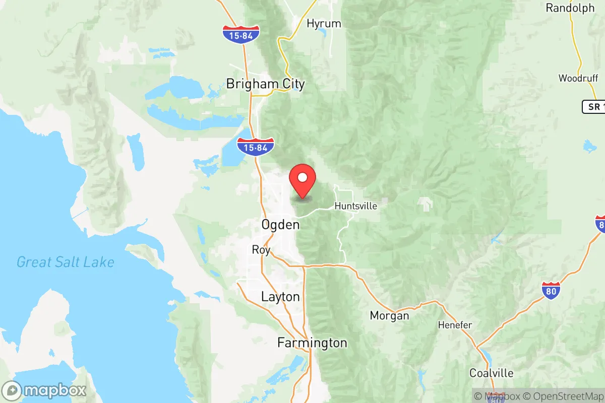
Weber County's geography is defined by the transition from the flat, arid lakebed of the Great Salt Lake in the west to the steep, forested slopes of the Wasatch Range in the east. This elevation gradient creates a natural defensive barrier: the eastern communities of Eden, Huntsville, and Liberty sit in mountain valleys with limited access points, offering a degree of physical isolation that is rare along the Wasatch Front. The Ogden River and the Weber River, both fed by mountain snowpack, provide reliable surface water sources that are less vulnerable to drought than groundwater-dependent areas. The county's position at the northern end of the Wasatch Front also places it roughly 35 miles north of Salt Lake City's urban core, far enough to avoid the immediate fallout zone of a major metropolitan target but close enough to access regional medical and logistical resources if needed. The presence of Hill Air Force Base, located just south of the county line in Davis County, is a double-edged asset: it brings economic stability and emergency response capability, but also marks the area as a potential secondary target in a conflict scenario.
Risks, exposures, and proximity to fallout-relevant landmarks
Weber County's strategic value is also its vulnerability. The county sits within the Wasatch Front, a densely populated corridor that includes critical infrastructure such as the Chevron refinery in North Salt Lake, the Salt Lake City International Airport, and the Union Pacific rail yards in Ogden. These are plausible targets for both conventional and asymmetric threats, and prevailing wind patterns from the west could carry fallout across the county's lower elevations, particularly the western bench areas near Roy, West Haven, and Hooper. The county itself hosts the Browning Arms Company headquarters in Morgan (adjacent to Weber County) and the Defense Depot Ogden, a major military logistics hub. For a relocator, the safest residential zones are the eastern mountain valleys—Eden, Huntsville, and the upper Ogden Valley—where terrain and distance from the valley floor reduce exposure to blast and fallout. However, these areas are not immune to natural hazards: the Wasatch fault line runs through the county, and a major earthquake could disrupt road access through Ogden Canyon and Trappers Loop, effectively isolating the eastern valleys from emergency services. Wildfire risk is moderate in the wildland-urban interface, particularly in the summer months, though the county's fire departments have strong mutual aid agreements with neighboring jurisdictions.
Practical resilience for a relocator: food, water, energy, and defensibility
For a household focused on self-sufficiency, Weber County offers a mix of favorable conditions and logistical challenges. Water availability is the strongest asset: the Weber River and Ogden River systems are managed by the Weber Basin Water Conservancy District, which maintains reservoirs like Pineview, Causey, and Lost Creek that store significant snowmelt. Groundwater in the eastern valleys is generally potable, though well drilling is regulated and costs vary by elevation. Agricultural land is concentrated in the western part of the county, around Hooper and West Haven, where irrigation from the Weber River supports hay, alfalfa, and some vegetable production. Local food production is viable but limited by the short growing season (roughly 120-150 frost-free days) and alkaline soils. The county's energy grid is connected to the broader Western Interconnection, with natural gas and electricity supplied by Dominion Energy and Rocky Mountain Power. Solar potential is excellent, especially on south-facing slopes in the Ogden Valley, where winter inversions are less severe than in the valley floor. Defensibility is strongest in the eastern valleys, where choke points like Ogden Canyon and Trappers Loop can be monitored and controlled with minimal effort. The county's population density is low enough in these areas that a small, prepared group could maintain a secure perimeter, but the proximity to Ogden's urban population (roughly 87,000) means that a collapse scenario could bring pressure from the valley floor. The local culture, shaped by a strong LDS (Mormon) presence, emphasizes community preparedness and food storage, which translates into a social infrastructure of mutual aid and resource sharing that a relocator can tap into by building relationships early.
The overall strategic picture for Weber County is one of calculated trade-offs. Its eastern valleys offer some of the best natural defensive positions along the Wasatch Front, with reliable water, good solar exposure, and limited access points that can be secured. The county's proximity to Hill Air Force Base and the Ogden defense depot provides economic stability and emergency response capability, but also elevates its risk profile in a national security crisis. For a relocator who values preparedness and is willing to invest in off-grid infrastructure—well water, solar panels, and food storage—the Ogden Valley and its surrounding communities represent a viable long-term base. The key is to choose a location east of the fault line and above the inversion layer, where the risks from industrial targets and urban fallout are minimized, and where the natural geography can be leveraged for security. Weber County is not a remote bunker; it is a strategically positioned community that rewards preparation and local knowledge.

* Values derived from national, state, county, city and local statistics and may differ in a specific area. Last updated: 2026-06-28T11:00:28.000Z
Narrative content on this page is AI-generated and may contain mistakes. Verify any details that matter before acting on them.
ReloMaps may earn a commission from affiliate links at no extra cost to you.

