
Photo: Wikipedia
Strategic Assessment of St Louis County
Workable tactical position. Some exposure to population density or targets, but generally defensible in a crisis.
What does the Strategic Assessment tell us?
Our Strategic Assessment grades tactical survivability of an area. Major population centers, military targets, fallout zones, natural disasters, and border exposure all drive risk — lower exposure means a more defensible position in a crisis.
This is heavily inspired by Joel Skousen's Strategic Relocation book. Highly recommended you checkout the book ($)What does this tell us?
Our Strategic Assessment grades tactical survivability of an area. Major population centers, military targets, fallout zones, natural disasters, and border exposure all drive risk — lower exposure means a more defensible position in a crisis.
This is heavily inspired by Joel Skousen's Strategic Relocation book. Highly recommended you checkout the book ($)Strategic Pillars

Key Distances
Strategic Assessment Analysis
St. Louis County, Minnesota, offers a compelling strategic position for relocation-minded readers prioritizing resilience and self-sufficiency, blending vast natural resources with a low population density that buffers against many cascading risks. Anchored by the regional hub of Duluth and stretching north to the Canadian border, the county provides a rare combination of freshwater access, forested terrain, and distance from major metropolitan targets. For a conservative-leaning audience weighing disaster readiness, this area presents a defensible, resource-rich environment that balances isolation with practical access to essential services.
Geographic position and natural advantages for long-term stability
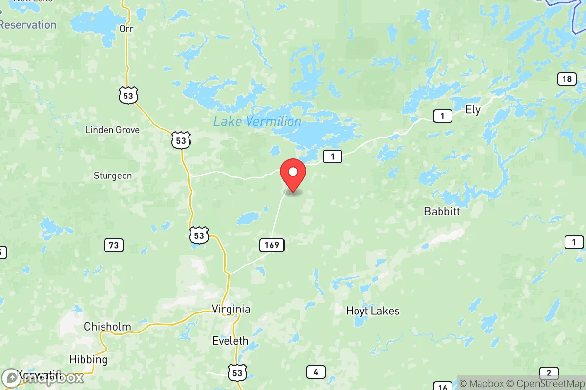
St. Louis County’s geography is its strongest asset. Covering over 6,800 square miles—larger than the state of Connecticut—it is Minnesota’s largest county by land area, with a population density of roughly 10 people per square mile outside Duluth. The county sits along the western shore of Lake Superior, the world’s largest freshwater lake by surface area, providing an immense, reliable water source that is unlikely to be contaminated by upstream industrial accidents. The Mesabi Iron Range runs through the county’s central corridor, with towns like Virginia, Hibbing, and Eveleth sitting atop one of the nation’s most significant iron ore deposits—a resource that could be critical for post-disaster reconstruction. The county’s northern reaches, including the Boundary Waters Canoe Area Wilderness near Ely, offer thousands of square miles of roadless, trackless forest that serve as a natural buffer against population movement or fallout drift. Elevation varies from 600 feet along Lake Superior to over 2,000 feet in the interior highlands, providing defensible terrain and natural drainage away from major population centers. The region’s cold climate—average January lows around -5°F in Duluth, colder inland—acts as a natural deterrent to many biological and insect-borne threats, while also reducing the evaporation rate of surface water supplies.
Risks, exposures, and proximity to fallout-relevant landmarks
While St. Louis County is far from the highest-risk zones, it is not immune to threats. The most significant man-made risk is the county’s own industrial infrastructure: the Duluth-Superior port is a major shipping hub for taconite, coal, and grain, and the Hibbing Taconite plant and other mining operations are potential targets for sabotage or collateral damage in a conflict scenario. However, these are low-yield industrial targets compared to major military bases or nuclear facilities. The nearest major military installation is Camp Ripley, about 130 miles south near Little Falls, which is a training center but not a primary strategic target. The closest nuclear power plant is the Prairie Island facility near Red Wing, roughly 200 miles south—far enough that a worst-case release would likely dissipate before reaching the county. Duluth itself, with a population of about 86,000, is the largest city in the region and could face secondary effects from a national crisis, such as refugee flow or supply chain disruption. The county’s position along the Canadian border (at International Falls, just west of the county line) provides an additional buffer: Canada’s sparsely populated Ontario wilderness lies to the north, reducing the likelihood of cross-border fallout or military activity. Natural risks include severe winter storms, which can isolate communities for days, and occasional wildfires in dry summers—though the region’s boreal forest is less fire-prone than western U.S. forests. Tornadoes are rare but possible; the county averages fewer than one per year.
Practical resilience for a relocator: food, water, energy, and defensibility
For a household focused on self-sufficiency, St. Louis County offers strong fundamentals. Water is abundant: Lake Superior provides an essentially unlimited supply for Duluth-area residents, while inland properties often have access to lakes, rivers, or groundwater. The county contains over 1,000 lakes and thousands of miles of streams, making water sourcing straightforward for those with proper filtration or well systems. Food production is limited by a short growing season (roughly 90–120 frost-free days) and acidic, rocky soils typical of the Iron Range. However, cold-hardy crops like potatoes, root vegetables, and certain grains can be grown, and the region’s forests support wild game—deer, moose, grouse, and small game—as well as extensive berry and mushroom harvests. Commercial agriculture is minimal; most food is imported from southern Minnesota or Wisconsin, meaning a relocator should plan for significant food storage or greenhouse investment. Energy resilience is mixed: the county is served by Minnesota Power, which relies on a mix of coal, natural gas, hydroelectric, and wind. The Thomson Dam near Carlton and several smaller hydro plants on the St. Louis River provide local renewable generation, but the grid is vulnerable to winter storms. Off-grid solar is viable in summer but challenging in winter due to low sun angle and snow cover; wood heating is the most practical backup, with abundant timber available on private and public land. Defensibility is excellent: the county’s vast size, low population density, and dense forest cover make it easy to select a property with natural chokepoints—lakes, rivers, ridges—that limit approach routes. The Superior National Forest and state forests cover much of the county, providing public land for hunting, foraging, and retreat if needed. Communities like Aurora, Babbitt, and Tower are small (under 2,000 people) and tight-knit, with a culture of mutual aid and self-reliance that aligns well with preparedness-minded newcomers.
Overall, St. Louis County presents a strong strategic picture for a relocator who values isolation, natural resources, and a low-risk profile relative to national targets. Its weaknesses—short growing season, reliance on imported food, and harsh winters—are manageable with planning and investment, while its strengths—abundant water, defensible terrain, low population density, and distance from major military or industrial targets—are difficult to replicate elsewhere in the continental U.S. For a family or individual serious about long-term resilience, this county offers a realistic, grounded option that avoids the alarmism of many “prepper” destinations while still providing genuine strategic advantages.

* Values derived from national, state, county, city and local statistics and may differ in a specific area. Last updated: 2026-07-17T02:17:40.000Z
Narrative content on this page is AI-generated and may contain mistakes. Verify any details that matter before acting on them.
ReloMaps may earn a commission from affiliate links at no extra cost to you.

