
Photo: Wikipedia
Strategic Assessment of Terrebonne County
Workable tactical position. Some exposure to population density or targets, but generally defensible in a crisis.
What does the Strategic Assessment tell us?
Our Strategic Assessment grades tactical survivability of an area. Major population centers, military targets, fallout zones, natural disasters, and border exposure all drive risk — lower exposure means a more defensible position in a crisis.
This is heavily inspired by Joel Skousen's Strategic Relocation book. Highly recommended you checkout the book ($)What does this tell us?
Our Strategic Assessment grades tactical survivability of an area. Major population centers, military targets, fallout zones, natural disasters, and border exposure all drive risk — lower exposure means a more defensible position in a crisis.
This is heavily inspired by Joel Skousen's Strategic Relocation book. Highly recommended you checkout the book ($)Strategic Pillars

Key Distances
Strategic Assessment Analysis
Terrebonne County, Louisiana, presents a complex strategic picture for the relocation-minded reader focused on resilience and self-sufficiency. Its primary advantage is a degree of geographic isolation from major population centers and the most concentrated industrial targets, while its most significant vulnerability is its exposure to Gulf hurricanes and the slow, corrosive threat of coastal subsidence. For a family or individual weighing disaster readiness, this parish offers a unique blend of natural resource abundance and logistical challenges that demand careful, sober assessment.
Geographic position and natural advantages for a strategic relocation
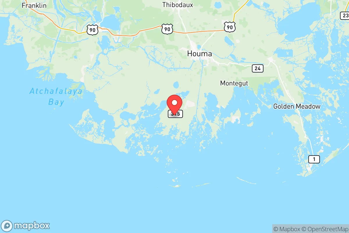
Terrebonne County sits roughly 50 miles southwest of New Orleans and 60 miles south of Baton Rouge, placing it outside the immediate blast or fallout zones of those major metropolitan areas. The parish seat, Houma, is the population and commercial hub, while smaller communities like Chauvin, Montegut, and Bourg offer more rural, low-density living. The area's defining feature is its position within the Mississippi River Delta — a vast, flat, water-rich landscape interlaced with bayous, marshes, and swamps. This geography provides a natural buffer against large-scale ground invasion or civil unrest, as the road network is limited and easily controlled. The primary arterial routes, US Highway 90 and Louisiana Highway 24, are the only practical ways in and out, which is a double-edged sword: they offer a chokepoint for defense but also a single point of failure for evacuation. The region's proximity to the Gulf of Mexico means abundant seafood and a mild climate that allows for year-round food production, a significant plus for long-term self-sufficiency. The Port of Terrebonne in Houma is a working waterfront, not a major container port, which reduces its value as a strategic target compared to the Port of New Orleans or the Louisiana Offshore Oil Port (LOOP).
Risks, exposures, and proximity to fallout-relevant landmarks
The most immediate and recurring risk is hurricane storm surge. Terrebonne is one of the most hurricane-exposed parishes in the state, with much of its land area at or below sea level. The Morganza-to-the-Gulf hurricane protection system is partially complete but not fully closed, leaving large sections of the parish — including much of Houma — vulnerable to a Category 2 or higher storm. This is not a theoretical risk; Hurricane Ida (2021) and Hurricane Zeta (2020) both caused widespread, prolonged power outages and flooding. For a relocator, this means any resilience plan must include a robust, elevated home, a reliable generator or solar-plus-battery system, and a pre-planned evacuation route. Beyond weather, the parish sits within the broader Louisiana chemical corridor. While not as dense as the "Cancer Alley" stretch between Baton Rouge and New Orleans, Terrebonne is home to numerous oil-and-gas support facilities, pipelines, and processing plants. The Houma Navigation Canal is a major artery for barge traffic carrying crude and refined products. A worst-case industrial accident — a refinery fire, a pipeline rupture, or a chemical release — could contaminate local water and air, especially given the slow-moving, flood-prone drainage patterns. The Louisiana Offshore Oil Port (LOOP), the nation's only deepwater port capable of offloading supertankers, is located roughly 30 miles offshore in the Gulf. While not in the parish, its destruction or compromise in a major conflict could trigger a cascading energy crisis that would directly impact Terrebonne's economy and fuel supply. The nearest major military installation is Naval Air Station Joint Reserve Base New Orleans (about 50 miles northeast), which is a moderate-value target but not a primary strategic asset like Fort Hood or a nuclear submarine base.
Practical resilience for a relocator: food, water, energy, and defensibility
For a family serious about self-sufficiency, Terrebonne offers genuine strengths. Food is abundant: the bayous and marshes provide year-round fishing, crabbing, and shrimping, and the long growing season allows for multiple vegetable harvests. Local farmers' markets and roadside stands are common, and the area's strong Cajun culture means many residents already practice home canning, hunting, and small-scale livestock raising. Water is a more complex issue. The parish sits atop the Southern Hills Aquifer, a deep, high-quality groundwater source that supplies most of the region's drinking water. However, saltwater intrusion from coastal erosion and canal dredging is a growing threat to shallow wells. A relocator should plan for a deep well (200+ feet) and a robust rainwater catchment system as a backup. Energy is a mixed bag. The parish is a hub for oil and gas extraction, so fuel is generally available, but the grid is notoriously unreliable during storms. Solar is viable, but the flat, tree-covered terrain means panels must be carefully sited to avoid shading from the ubiquitous live oaks. Natural gas is widely available in suburban areas, which can power whole-house generators. Defensibility is the parish's strongest card. The limited road network — essentially a few two-lane highways — makes it easy to monitor and control access. The surrounding marsh and swamp create a natural moat that is impassable to vehicles and difficult to traverse on foot. For a group or family with a prepared homestead, Terrebonne offers a high degree of physical security against large-scale threats. The local population is generally self-reliant, armed, and community-oriented, with a strong tradition of mutual aid during disasters. The Terrebonne Parish Sheriff's Office and local volunteer fire departments are well-regarded, but response times in rural areas can be long, reinforcing the need for personal preparedness.
The overall strategic picture for Terrebonne County is one of high reward paired with high, specific risk. It is not a place for someone seeking a low-maintenance, low-effort relocation. The hurricane threat is real and recurring, and the long-term viability of the coastal landscape is uncertain due to subsidence and sea-level rise. However, for a prepared individual or family willing to invest in a resilient home — elevated, storm-hardened, with independent water and power — the parish offers a level of natural resource abundance and geographic defensibility that is rare in the continental United States. It is a location that rewards competence and punishes complacency, which is precisely the calculus a serious strategic relocator should be making.

* Values derived from national, state, county, city and local statistics and may differ in a specific area. Last updated: 2026-07-24T07:26:18.000Z
Narrative content on this page is AI-generated and may contain mistakes. Verify any details that matter before acting on them.
ReloMaps may earn a commission from affiliate links at no extra cost to you.

